
REPORT
on the ascent of Pik Chetyrekh.
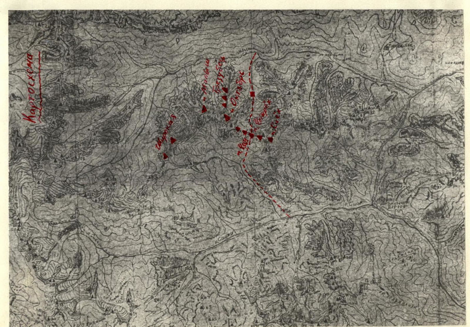
Pik Chetyrekh is located in the area of Tajikskiye Igizaki. The height of the summit, which stands out from the ridge between Pik Oktyabr and Pik Sieh, is 4200 m. To the north, towards the Maykhura River, the entire ridge drops off with a wall having a height difference of 400 (near Pik Oktyabr) to 700–800 m (near Pik Sieh). To the south, the slopes are more gentle and fragmented, and the length of rock routes does not exceed 300 m.
The area began to be explored by climbers from DCCO "Khosilot" in 1962. From the north, under the wall, climbers were present in 1965–1966. In 1969, during the ascent of Pik Oktyabr on November 7, the route for the ascent was planned.
On October 1, 1971, the sports group along with observers left the city and spent the night on the bank of the Maykhura River at the entrance to the gorge.
On October 2, they made their way under the glacier, where the observation group remained. The approach to this place—a large green meadow—takes 1.5 hours, following the right side of the stream (there is a trail).
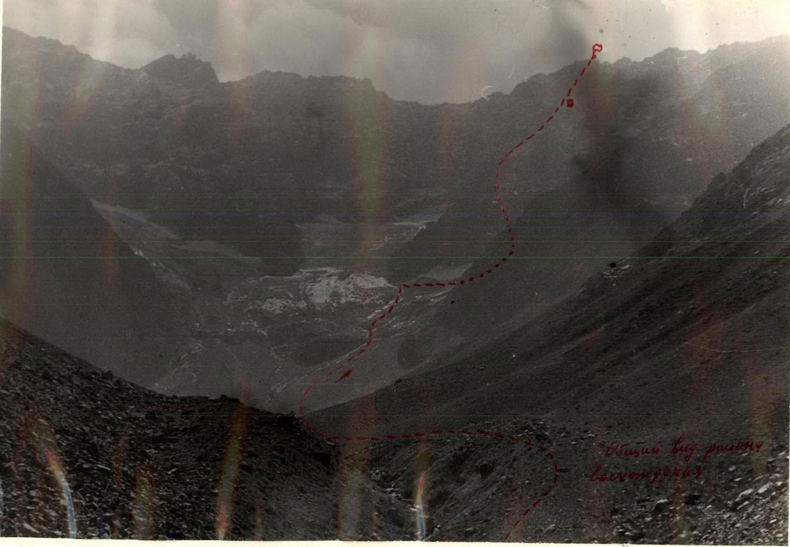
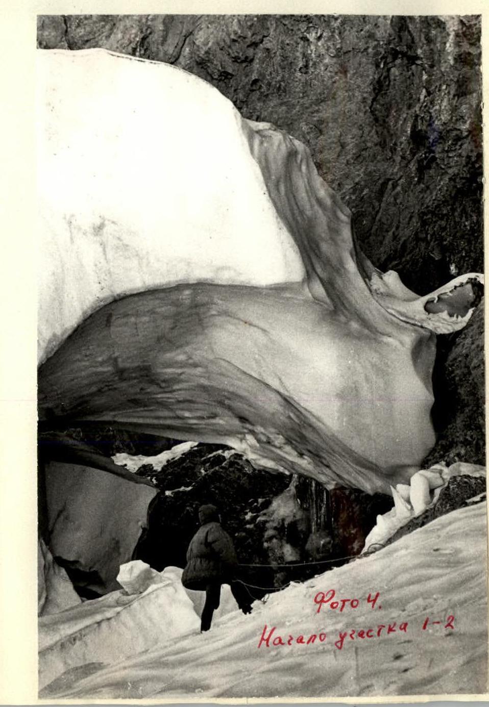
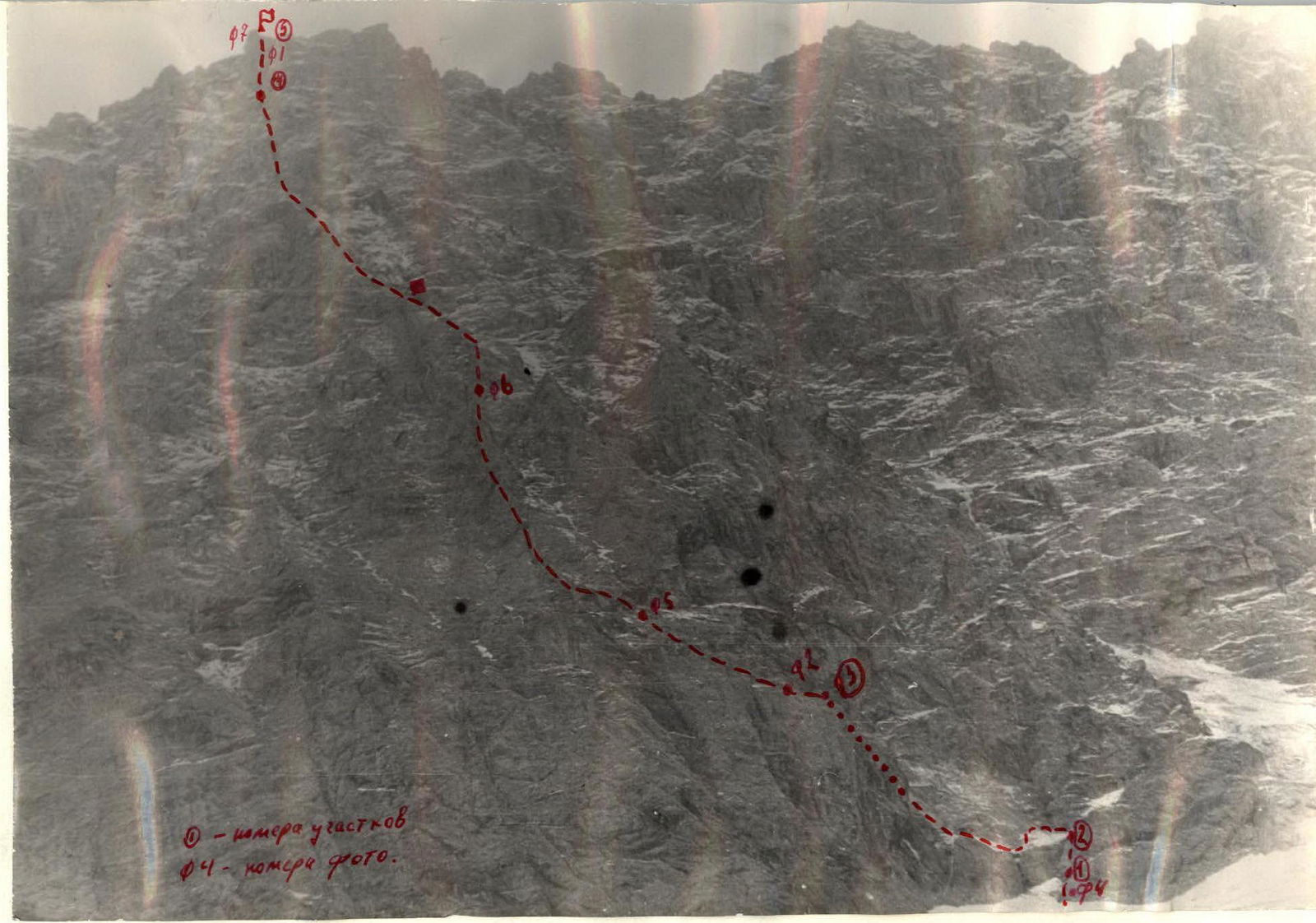
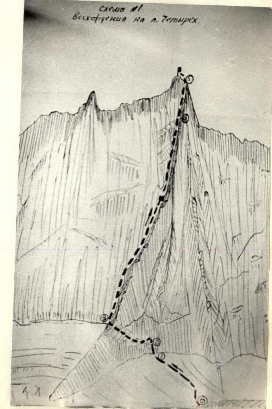
The planned ascent route went along the main counterfort of the northern wall of Pik Chetyrekh, bordering on the right a bowl-shaped glacier and the glacier fall under the wall (see photo).
The approaches to the start of the counterfort were made:
- initially across the "sheep's foreheads",
- then down to the counterfort via moraine and a gentle glacier,
- took 2 hours.
Along the counterfort, 3 ropes of 60 m were passed. The route went through the wall and was supposed to lead to the counterfort. However, upon reaching the top, it was discovered that it was blocked by overhanging massive blocks from the glacier fall, presenting a significant potential danger for this and any subsequent groups.
The climbers were forced to descend and spend the night on the moraine under the wall.
On October 3, at 7:00, the group moved along the glacier fall under the wall on the right (in the direction of travel) side to search for a new path to the counterfort. Such a path was found, and after crossing the glacier fall, the group approached the wall at 11:00. Passing the first 60 m of the wall took 3 hours due to traversing an ice shelf.
At 14:00, the group reached the main counterfort and began ascending towards the summit. At 20:00, the group was forced to stop for the night due to darkness and continued the ascent on October 4, 1971, at 8:00. At 16:30, the four climbers reached the summit.
The descent into the Tajikskiye Igizaki valley took 2 hours, descending from the summit via a route of 1B–2A category of difficulty.
Despite the warm, low-snow autumn, snow lay on the route due to its orientation—the northern, concave part of the wall. At night, the temperature dropped significantly below zero and remained so on the wall for a long time. The route (eastern side of the counterfort) is sunlit until 11:00 and then remains in shadow.
On the route, the leaders were alternately the republic's rock climbing champions, O. Karaselnilova and S. Suzdalev. On easier sections where hook protection was not required and there were opportunities to accelerate the pace, the teams worked in parallel. The group had two backpacks containing sleeping bags and food. The backpacks were only pulled out on the last steep section leading to the summit (see description).
Bivouac sites are available throughout the route. The weather during the ascent days was mostly clear, without precipitation.
Comparing the route taken on the northern wall of Pik Chetyrekh
 www.alpfederation.ru ↗
with routes of 5A category of difficulty (Mechta, Sakharnaya Golova) and 4B category of difficulty (Shlem, Festivalny), the group evaluates it as 5A category of difficulty.
www.alpfederation.ru ↗
with routes of 5A category of difficulty (Mechta, Sakharnaya Golova) and 4B category of difficulty (Shlem, Festivalny), the group evaluates it as 5A category of difficulty.
The route taken is the easiest path to Pik Chetyrekh from the north.
The ascent was observed by climbers Starshikh N and Starshikh V. Communication with the observation group was maintained using a flashlight.
Description of the ascent of Pik Chetyrekh via the northern wall
The route goes along the northern wall via the Main Counterfort (see diagram) of Pik Chetyrekh. The approach to the route from the Maykhura River takes 4.5 hours.
Section O–R1. Glacier fall. Movement towards the wall in the direction of a clearly visible snow-ice shelf, crossing the glacier fall with almost no gain in height. The difficulty of passage depends on the amount of snow on it and the degree of ice movement. The group passed under the most favorable conditions—bare ice—and spent 2 hours. Step-cutting was used. The length of the section is 300 m, difficulty is 2.
Section R1–R2. Wall with a steepness of 65°, length 60 m. Passed on the right part of the concavity, exiting to the start of the snow-ice shelf. Difficulty is 4, 6 hooks were hammered. Time taken to pass—1 hour.
Section R2–R3. Shelf, rock-ice-snow, with a steepness of up to 50° and a width of up to 40 m. Passed in an arc, exiting under the rocks. The detour is due to the presence on the shelf of a deep (3–4 m) and wide (8–10 m) ice trough with sheer edges.
Passage of the section includes:
- step-cutting,
- use of rock outcrops.
Hook protection, movement is alternating, 10 hooks were hammered. The length of the section is 350 m, including:
- 4B category of difficulty—180 m,
- 2B category of difficulty—170 m.
Time taken to pass—4 hours.
Section R3–R4. Counterfort. The main part of the route—the counterfort. It has a stepped structure, alternating steep (up to 80°) walls up to 80 m in length with more gentle (up to 40°) sections of significant length (up to 80–100 m). In width, it varies from 10–15 m to 1–1.5 m. The rocks are monolithic, with cracks for hooks.
On the counterfort are located:
- 5 high walls (from 40 to 80 m)
- about 6 small walls (from 10 to 20 m), which constitute the main difficulty of the ascent.
The category of difficulty of the walls ranges from 3 to 4, including two 10 m walls of 5A category of difficulty.
Passed alternately, with hook protection (40 hooks). On one 10 m wall, two artificial points of support (hook with carabiner) were used.
The total length of the section is 800 m, steepness is 60°, difficulty is 4. Time taken to pass—10 hours, including up to the bivouac—5 hours. The overall steepness of the counterfort increases with ascent.
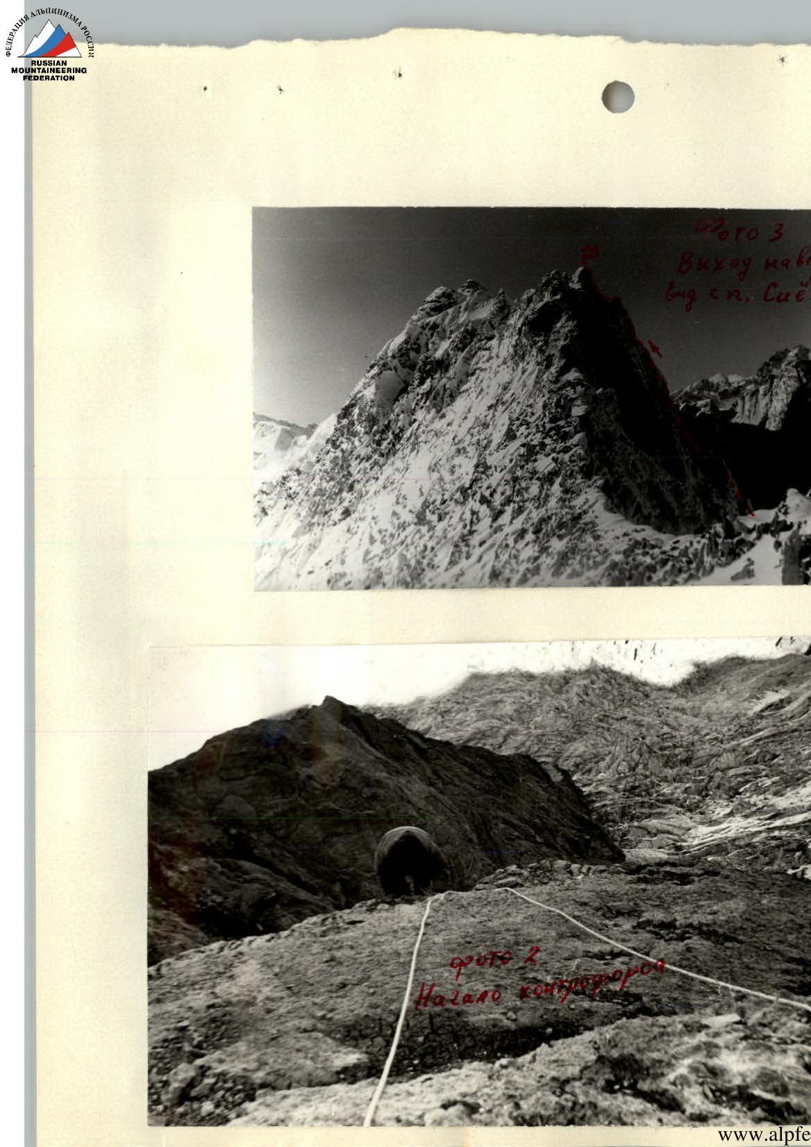
Section R4–R5. Bypass of the summit tower. The counterfort leads to the start of the summit tower. The tower is initially bypassed on the left (in the direction of travel) with an exit to its pre-summit rise. The length of the section is 110 m (1x60, 1x50), steepness is 65°, difficulty is 4, time taken to pass—2 hours. Movement is alternating, hook protection, 10 hooks were hammered.
Section R5–R6. Tower. The exit to the summit is via the wall of the tower. The steepness of the section is 85°, length is 40 m, difficulty is 5, time taken to pass—1.5 hours, 6 hooks were hammered. Backpacks are pulled out.
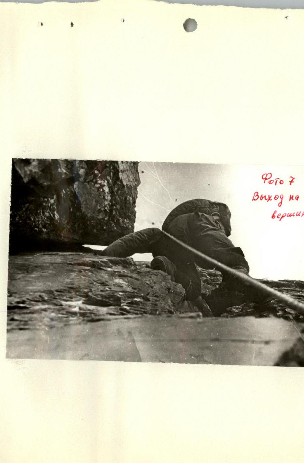
Photo 7. Exit to the summit.
The descent to the south into the Tajikskiye Igizaki valley via a route of 1B–2A category of difficulty is not complicated and takes 1.5 hours.
The total time spent on the ascent is 20 hours.
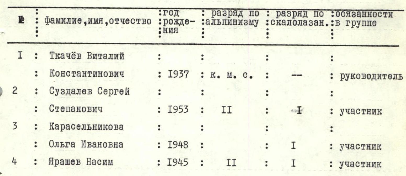
Composition of the ascent and observation group
List of equipment used by the group and recommended for subsequent ascents by groups of 4 people
- Main rope—2x60
- Rock hooks—10
- Ice hooks and wedges—5
- Hammers—2
- Ice axes—2
- "Pamirka" tents—1
- Carabiners—10
Compiled by /Tkachev/ /Yarashev/
Comments
Sign in to leave a comment