Description
of the 3B category difficulty route to the summit "KHARKOV" via the NW edge. From the bivouac organized on the moraine of the western slopes of the summit "PESHIN", the group heads to the cairn of the "SNEZHNY" pass (the transition takes 30–40 minutes), from where the route to the summit "KHARKOV" via the NW edge is clearly visible.
The route begins from the "SNEZHNY" pass, going vertically up the snow with initially gentle slopes, and then the steepness reaches 50–55°.
Bypassing the lower rock outcrop:
- Bypassed on the left.
Characteristics of the snow route:
- The length from the rock outcrop to the upper edge is 120 m.
Overcoming sections:
- From snow with piton protection.
- Across rocks of medium difficulty (10 m).
Completing the section:
- The group reaches a ledge where they can change, remove crampons.
- The first control cairn is located here.
After the control cairn, we move up the rocks of medium difficulty, quite steep, but with many holds. Piton protection. After 60 m of rock climbing, crossing an inclined snow ledge, we approach the summit bastion, more precisely, to the northern face of the "KHARKOV" summit bastion. Approaching a vertical crack, we move left to a destroyed tooth near the wall, from there 5–7 m up to a horizontal ledge. The ledge is quite narrow, gradually widening to the right, but handholds disappear. Movement along the ledge is with careful piton protection. After 7–8 m, the ledge leads to a vertical narrow chimney (8 m) narrowing at the top:
- The lower part of the chimney can fit one person.
- The chimney is traversed using friction and jamming of hands and feet.
The exit from the chimney ends at the destroyed rocks located on the ridge of the bastion. The second control cairn is located here.
From here, the movement continues along the ridge of the bastion, rocks of medium difficulty, piton protection. From control cairn No. 2 to the summit is 50–60 m.
The descent from the summit is carried out via a steep couloir (40 m) to the Southeast towards the summit "PIRAMIDY" to a connecting ridge.
From the connecting ridge:
- To the left, we descend into the couloir, where 2–3 rappels are organized with rope retrieval.
- After that, the group reaches the snow and, bypassing the rocks of "KHARKOV", exits to the "PYATI" pass, then descends to the bivouac site.
On the route, 10 rock pitons were hammered, and two loops were left on the descent.
Recommendations
- By the beginning of July, the ice on the northern slopes of "KHARKOV" may be exposed, so crampons are necessary for each participant during the ascent at this time.
- Footwear for a group of four can be as follows: 2 pairs of tricouni boots, 2 pairs of Vibram boots.
June 6, 1971 Description compiled by: I. GETMAN V. GALAKTIONOV
The first ascent to the summit "KHARKOV" via the NW edge was made by climbers from the "Tadzhikistan" society on June 6, 1971, by a group consisting of:
- I. Getman I.S., MS — leader
- Galaktionov V.P. — participant
- Shatkovsky A. — CMS
- Mukhamedova E. — CMS
The group's passage of the route with descent took 9 hours
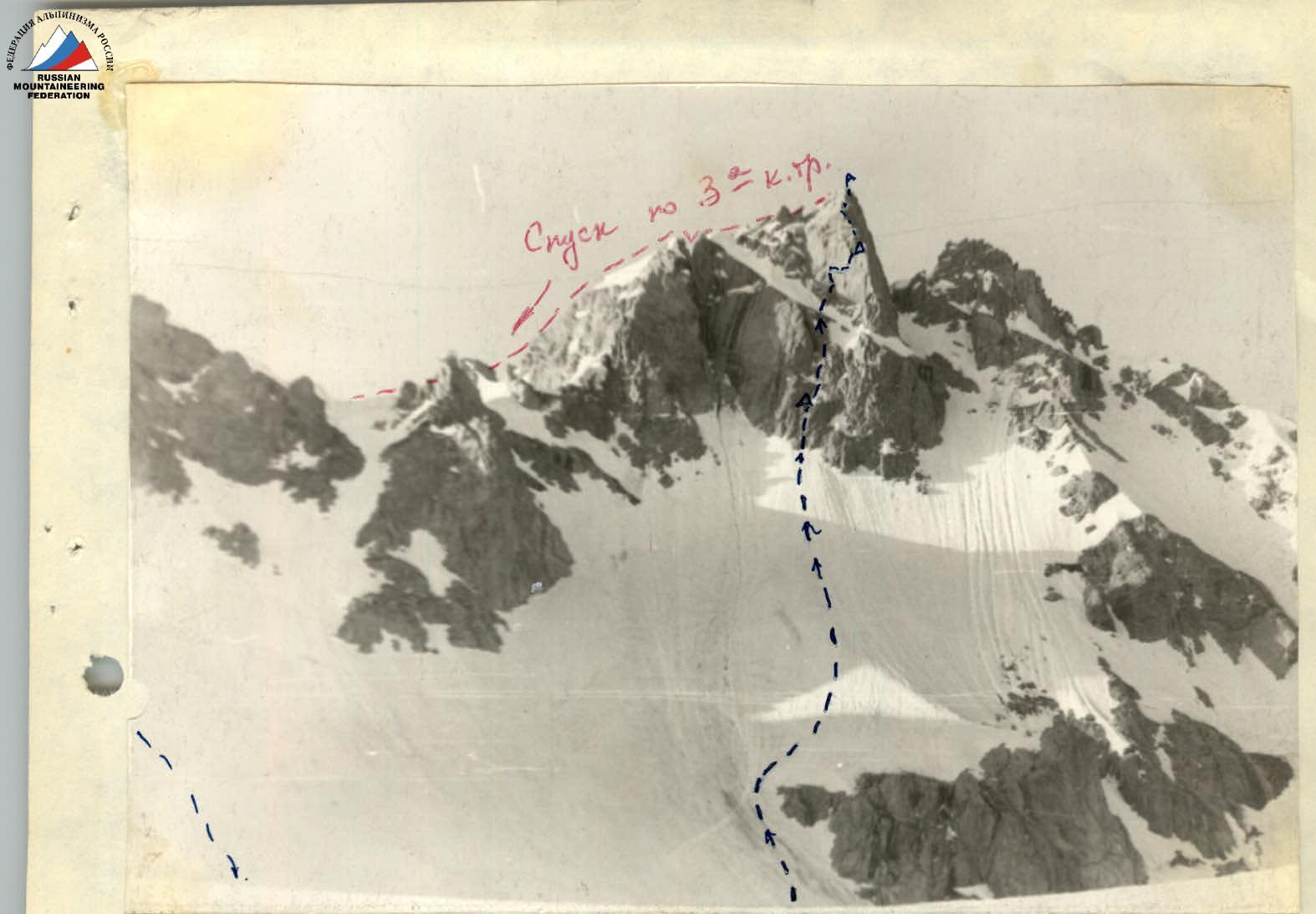
The summit "KHARKOV" from the Northwest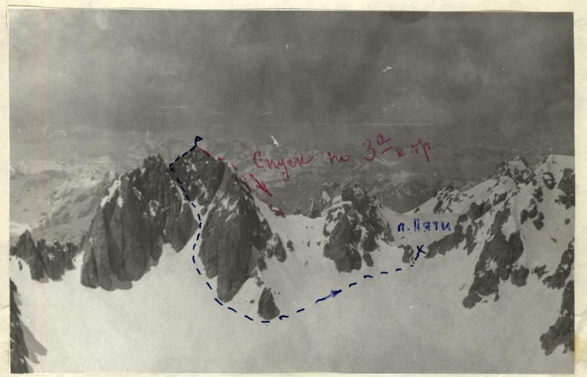
The summit "KHARKOV" from the East.