Climbing Passport. 5.2.110
Climbing Class: Rock (Combined) Climbing Area: Igizakov area (5.2.) Peak, its height, and climbing route: "Ular", 3900 m via the Northwest Ridge, cat. dif. "Ular" Estimated Difficulty Category: 3A
Route Characteristics: Height difference: 300 m Average steepness: 50° Section lengths: 2–150 m; II–100 m; III–240 m;
Pitons driven:
| For belay | For creating belay anchors | |
|---|---|---|
| Rock | 20 | – |
| Ice | – | – |
| Bolt | – | – |
Duration: 9 hours Number of nights and their characteristics: on the route — none
Surname, first initial of the leader and participants, their sports qualification:
- Lavruhin V.I. Master of Sports
- Krainov V. 1st sports category
- Bragin V. 3rd sports category
- Solovyov M. 2nd sports category
Team coach: Lavruhin V. Date of departure and return: May 6, 1977
Published by Sovikupit
Dushanbe 1981 p. 93
P52

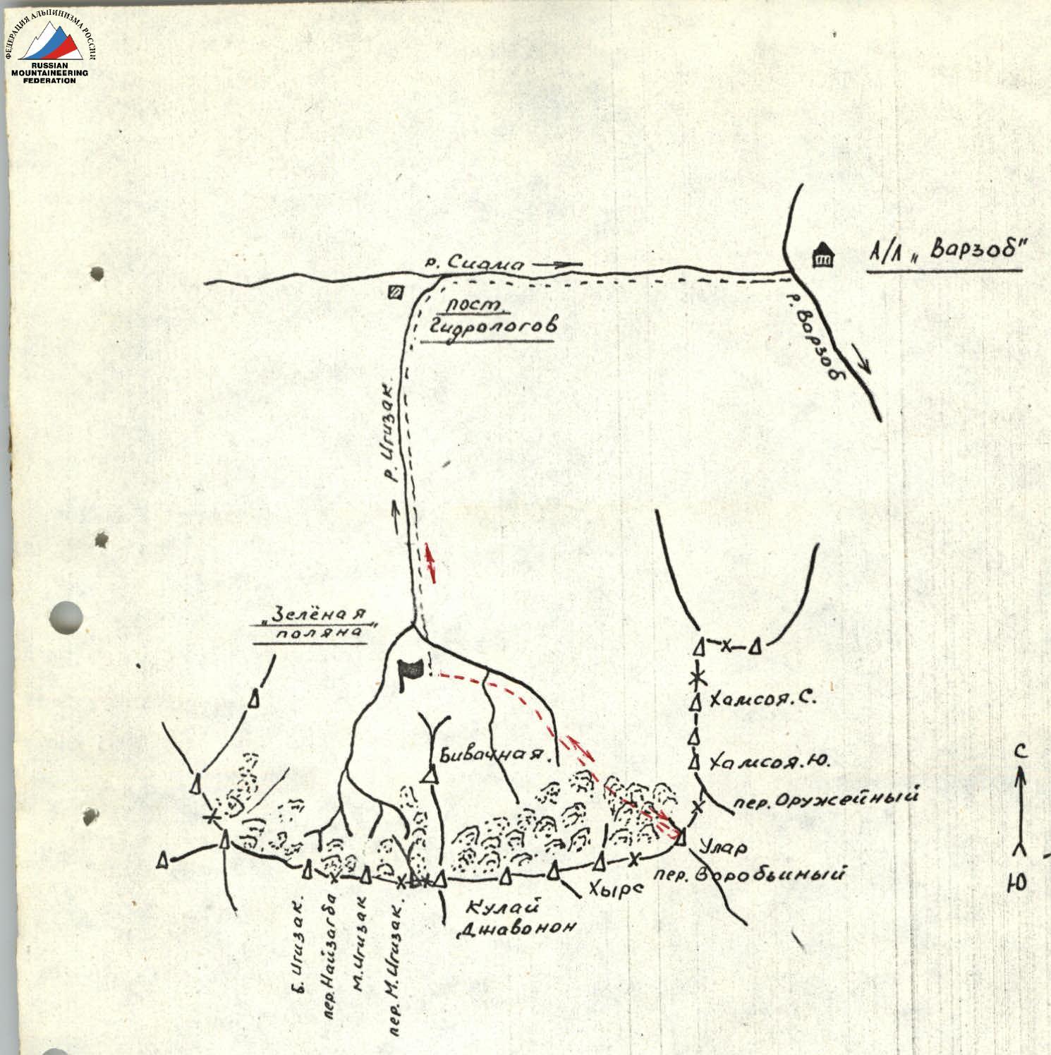
Igizak Area Diagram
- Ular 3A from "Zelyonaya Polyana" bivouac – Base camp
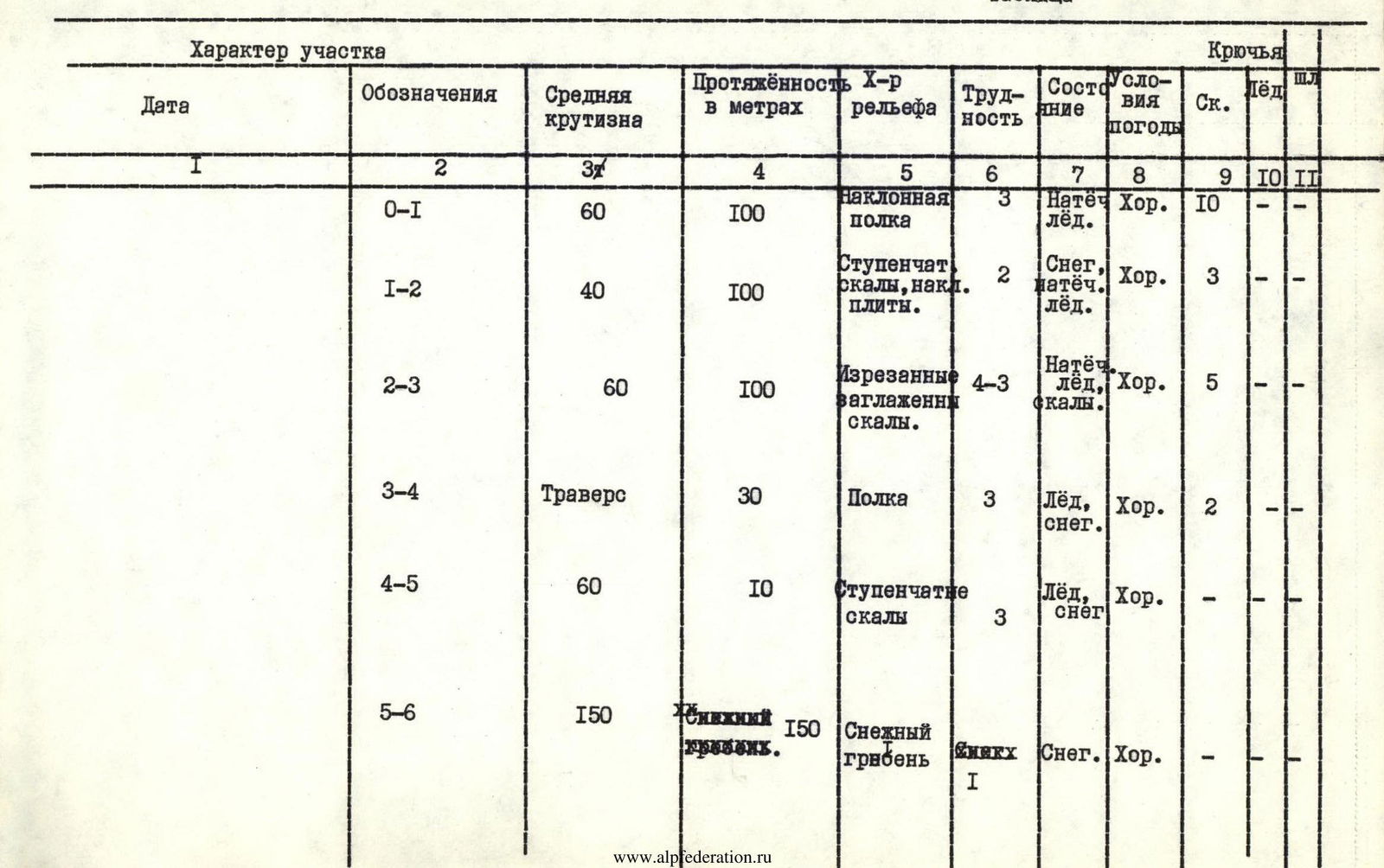
Table
| Designation | Average steepness | Length in meters | Terrain character | Difficulty | Condition | Weather conditions | Rock Pitons | Ice Pitons | Bolt Pitons |
|---|---|---|---|---|---|---|---|---|---|
| R0–R1 | 60° | 100 | Inclined shelf | 3 | Rime ice | Good | 10 | – | – |
| R1–R2 | 40° | 100 | Stepped rocks, inclined slabs | 2 | Snow, rime ice | Good | 3 | – | – |
| R2–R3 | 60° | 100 | Jagged, smoothed rocks | 4–3 | Rime ice, rocks | Good | 5 | – | – |
| R3–R4 | Traverse | 30 | Shelf | 3 | Ice, snow | Good | 2 | – | – |
| R4–R5 | 60° | 10 | Stepped rocks | 3 | Ice, snow | Good | – | – | – |
| R5–R6 | 150 | 150 | Snow ridge | 1 | Snow | Good | – | – | – |
 |
Ular 3A cat. dif. (November 1 – May 10)
Brief description of the approach to the route. From "Zelyonaya Polyana" bivouac, go upstream along the stream flowing from the left cirque: – In autumn — through fresh loose snow, sometimes waist-deep. – In spring, the approach may be possible on firn until 10:00, but it's also possible that the firn doesn't hold, and you have to make a path knee-deep or deeper to the start of the route.
Brief explanation of the table: The ascent route to the summit is mostly the same as the summer variant, except for a large amount of rime ice on the shelf from the start of the route to the 1st control tower. This part of the route is climbed along the left edge (in the direction of travel) of the shelf, clearing handholds and piton placements (100 m). The turn towards the control tower is to the right (30 m).
This section features stepped rocks filled with snow. In spring, just before reaching the control tower (5 m), you typically have to overcome a steep snowy overhang with ice axes.
From the control tower: – Up 50 m on snow, exiting onto rocks (steepness 25–30°). – Then — into the gap between the rock pinnacle and the ridge's edge, through a chimney filled with snow (ice).
The section from the rock pinnacle to the start of the traverse of the gendarme is similar to the summer variant, as the rocks are steep and don't hold snow, and only occasionally are the cracks filled, which doesn't hinder rock climbing. The 30 m traverse to the rock wall leading to the main ridge is done on narrow snow-filled ledges. In uncomfortable areas, the snow has to be cleared.
The 10 m rock wall leading to the ridge is heavily jagged and filled with snow (steepness up to 70°). Climbing due to the snow and exiting onto the ridge is done with the help of ice axes (3 m).
Along the snowy ridge — to the summit, then descent via the 1B cat. dif. route.
In spring, when the snow becomes very soggy after 12:00: – It's recommended to follow the 2A cat. dif. ridge to the main rock massif. – Then — straight down on the shortest section of the snowy slope (relatively safe), and further along the known route.
The route is climbed using standard equipment. The time required for the route itself is up to 10 hours. The approach time greatly depends on the snow conditions and should be planned by the group.
Route remark
In poor conditions on the section up to the 1st control tower, an alternative ascent is possible via the bastion of the wall (50 m to the right) from the standard start.
The rocks are complex (4A cat. dif.), requiring careful belaying during climbing, but due to their steepness (up to 80°), they are almost always snow-free, allowing climbing in rubber boots.
The path continues as described.
The route description is made with knowledge of the summer route description.
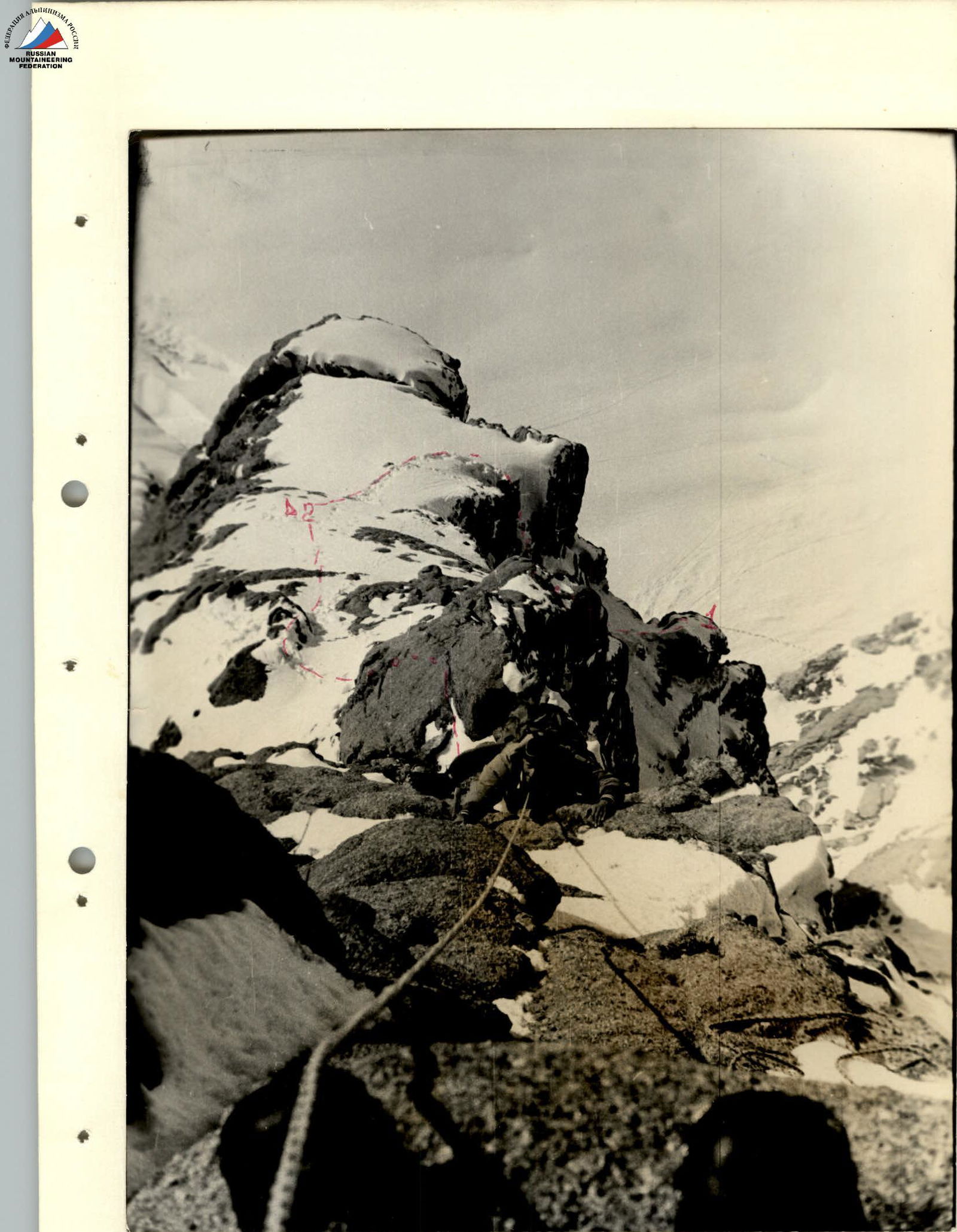
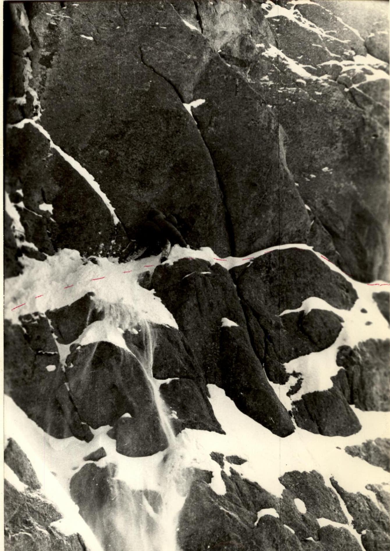
On section R2–R3
On section R3–R4

Descent via 1B route