ASCENT DOCUMENT
- Ascent class — winter ascents.
- Ascent area — Gissar Ridge, Surkh-Kuh spur.
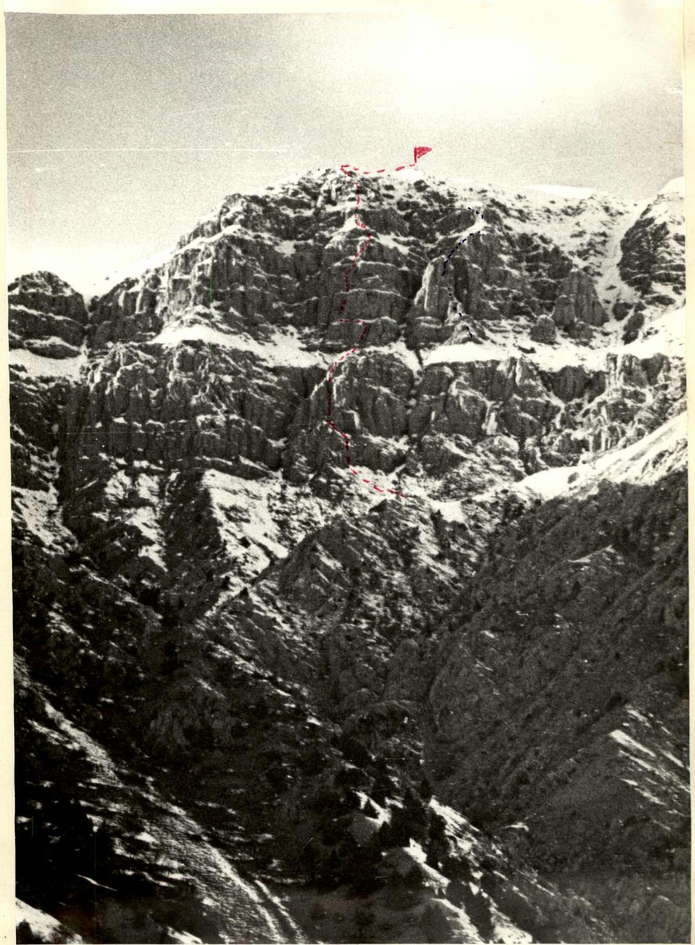
- Peak, its height and ascent route — p. Surkh-Nu (2980) via the central counterfort of the left part of the SE wall.
- Presumed difficulty category — 4A
- Route characteristics: height difference –880 m average steepness: wall section –50° ridge –20° section lengths: I diff. category – 400 m, II – 185 m, III – 280 m, IV – 10 m, V – 100 m, VI – —
- Pitons hammered in: rock – 17/3 ice – 0 placed elements – 19/1 drill-in – 0
- Total climbing hours – 6 hrs (excluding 4 hrs approach and 3 hrs descent from the summit)
- Number of bivouacs, their characteristics – one, in the base camp.
- Full name of the leader and participants, their sports qualification:
- Tyulenev I.V. Candidate for Master of Sports
- Skachkov A.S. Master of Sports
- Lorenz E.O. Candidate for Master of Sports
- Kharlamov A.S. 1st sports category
- Coach: Leonov K.N. Candidate for Master of Sports
- Date of departure and return from the route – February 1–2, 1986
Panorama of p. Surkh-Nu, South-Eastern wall. “Zenit” camera with “Helios-44” lens, shooting point #1, time – 9:30.
- Proposed route via Central counterfort, 4A diff. category.
- E. Lorenz's route, 1B diff. category.
- Descent route, 1B diff. category.
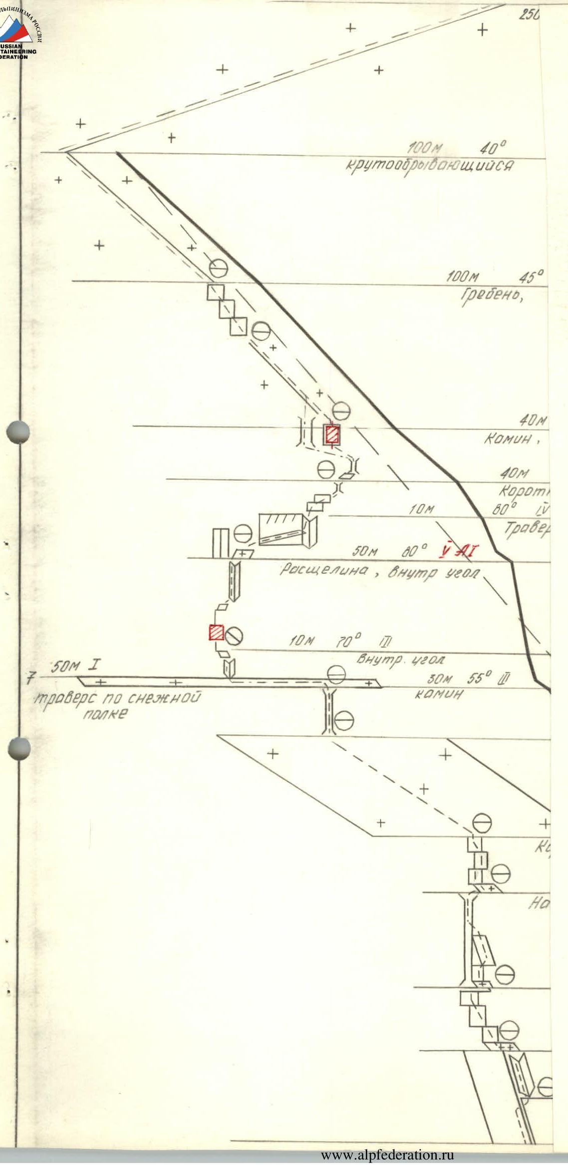
ROUTE DESCRIPTION BY SECTIONS
Section R0–R1. Inclined rock slabs, ending in an internal angle (pitons, placements) with 50° steepness, 60 m long, 3rd diff. category, lead to a snow ledge.
Section R1–R2. Short walls alternating with snow ledges, 45° steepness, 45 m long, 2nd diff. category, lead to a large chimney.
Section R2–R3. Inclined smooth slabs — chimney (pitons, placements, additional handholds at the top, beware of loose rocks) with 80° steepness, 50 m long, 5th diff. category.
Section R3–R4. Short walls with 40–45° steepness, 40 m total length, 2nd diff. category (pitons), complete the first rock belt of the route, lead to a large snow ridge — ledge.
Section R4–R5. Large snow ledge with 30° steepness, 100 m long, 1st diff. category.
Section R5–R6. Large chimney (pitons at the top), 55° steepness, 30 m long, 3rd diff. category.
Section R6–R7. Traverse along a snow ledge 50 m long, 1st diff. category.
Section R7–R8. Internal angle with 70° steepness, 10 m long, 3rd diff. category (pitons).
Section R8–R9. Move somewhat left-up towards a cleft, internal angle with 80° steepness, 50 m long section, 5th diff. category (pitons, placements, artificial handholds).
Section R9–R10. Right-up along a narrow ledge — flake, 80° steepness, 10 m long, 4th diff. category.
Section R10–R11. Short walls alternating with snow ledges, “red” chimney. 55° steepness, 40 m long, 3rd diff. category.
Section R11–R12. “Red” chimney, ridge, wall with a cleft. 40–45° steepness, 40 m long, 3rd diff. category (cleft is passed with an artificial handhold). Completes the second rock belt of the route.
Section R12–R13. Snow ridge with alternating rock walls, 45° steepness, 100 m long, 3rd diff. category.
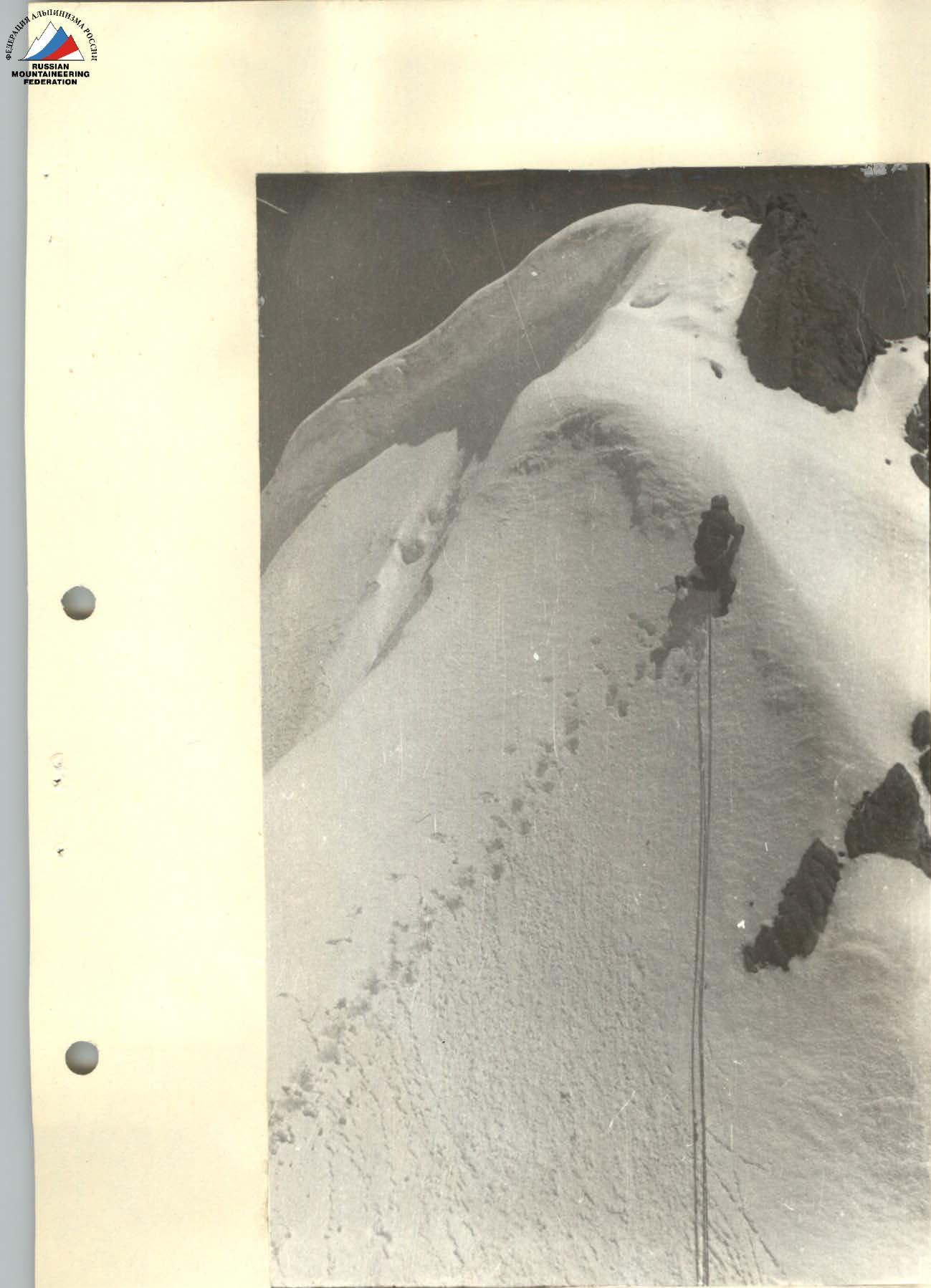
Section R13–R14. Steeply sloping snow ridge, 40° steepness, 100 m long. Exit to the pre-summit ridge.
Section R14–R15. Pre-summit ridge with 20° steepness, 250 m long, 1st diff. category. Reach the summit.
Descent from the summit via the south-western ridge, 1B diff. category.
The ascent takes 13–14 hrs (including approach to the wall and descent from the summit to the base camp).
Route via Central counterfort of the left part of the SE wall
Section R12–R13