
ASCENT DOCUMENT
-
Ascent class — winter ascents
-
Ascent area: Gissarsky ridge, Surkh-Kukh spur
-
Peak, its height and ascent route: p. Surkh-Nu (2980) via South-West ridge
-
Estimated difficulty category — 1B
-
Route characteristics: height difference 1380 m, average slope 30–35°
-
Length of sections: I — 960 m, II — 80 m, III — m, IV — m, V — m, VI — m.
-
Pitons driven:
rock — 0 ice — 0 bolt — 0
-
Number of travel hours — 5–6 h
-
Number of nights and their characteristics: one, convenient
-
Full name of team leader and participants, their sports qualification:
- Leonov K.N. CMS
- Kashina O.G. CMS
- Doktorov A.A. CMS
- Gaponenko V.A. 1st sports category
- Porotnikov V.L. 1st sports category
- Shkurko S.D. 1st sports category Team coach Leonov K.N.
-
Date of departure and return: 9–10/II–1965
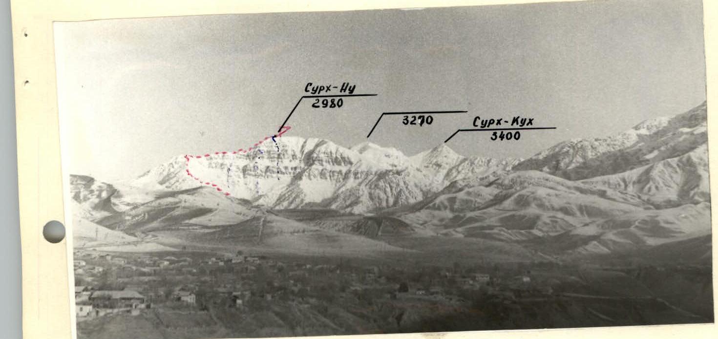
Panorama of Surkh-Nu peak. Camera "Zenit", lens "Helios-44".
Recommended route 1B difficulty category, 1B ridge.

Route description
The ascent to Surkh-Nu peak via 1B ridge is done from the Surkh-Nu river cirque. The approach from Lyuchob village along an old dirt road takes 1.5 h to the mouth of the Surkh-Nu river.
200 m before reaching the Surkh-Nu river (base camp location) turn left-up:
- Along the slope, 1 h, to reach the ridge.
- Then along the ridge. A small shoulder-saddle, 15 min walk.
- From here along the ridge (alternating simple rocks and snowfields) — exit to a small angular peak, 1.5–2 h walk, after which the ridge turns sharply to the right.
- Along the ridge 200 m to a steep snowy ascent with rare rocky outcrops.
- Steep section, 200 m, to be overcome in teams (belay!) with exit to a gentle summit ridge.
- Along it 150 m to the summit.
Descent from the summit via the ascent route. The ascent takes 5–6 h.