Description
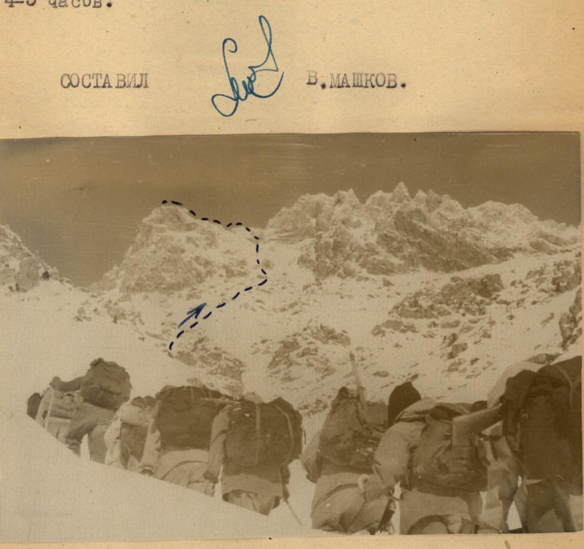
Ascent to the Western peak of Varzob Saw from the east via route 2A cat. difficulty
The Western peak of Varzob Saw (3830 m above sea level) is climbed by mountaineers during the traverse of the entire Varzob Saw via route 4B cat. difficulty. At the same time, climbers ascend to the peak via the western wall and descend to the east, continuing the traverse.
Until now, the ascent route to the peak from the east has not been classified, although it corresponds to 2A cat. difficulty and can be recommended for badge holders and athletes.
Approaches for the described ascent are made via the same paths as for the traverse of Varzob Saw from W to E via route 3B cat. difficulty, i.e., via the stream and then to the saddle between the Western peak and the main ridge.
The exit to the saddle is made in its right part (not directly under the wall of the main ridge) via rough rocks with pronounced ledges, gutters, etc.
On the saddle:
- There are areas for setting up two tents.
- Snow is present almost all year round - on the northern side.
Movement along the saddle to the Western peak:
- Initially occurs along ledges along the northern side of the ridge.
- Then, closer to the Western peak, - along the southern side (belaying is mandatory).
Exit to the peak:
- Made via short (1-1.5 m) walls alternating with ledges.
- The route here is easily chosen and initially passes to the left, then to the right of the ridge line.
On the peak:
- A large cairn, installed by topographers.
- An alpinist cairn - 1-1.5 meters at 10° E from it.
Descent - via the ascent route.
Time calculation:
- Highway, bridge - stream source: 3.5-4.5 hours.
- Stream source - saddle: 1.5-2 hours.
- Saddle - peak: 1-1.5 hours.
- Peak - highway: 4-5 hours.
COMPILED BY V. MASHKOV.