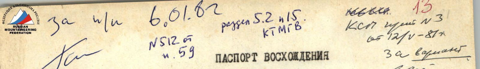
ASCENT DOCUMENT
- Ascent category — rock.
- Ascent region — Pamir-Alay, southern spurs of the Hissar Range, upper reaches of the Igizak River.
- Peak, its height and ascent route — p. Yuzhnaya Bivachnaya, 3950 m, via the right part of the Western wall.
- Estimated category of difficulty — 3B.
- Route characteristics: height difference — 310 m, average steepness — 60°, total length of sections — 350 m: 2nd cat. difficulty — 120 m, 3rd cat. difficulty — 170 m, 4th cat. difficulty — 60 m.
- Number of rock pitons for belaying — 16, number of chocks for creating artificial support — 5.
- Number of travel hours — 7.
- Surname, name, patronymic of the leader and participants, their sports qualification:
- Arakcheev P. P. — leader, 1st sports category.
- Chernov A. I. — participant, 1st sports category.
- Zemlyanov M. E. — participant, 1st sports category.
- Khakimullin Yu. N. — participant, 1st sports category.
- Team coach — Kudryashov V. S., Candidate Master of Sports (Kazan).
- Date of departure and return — June 28, 1980.
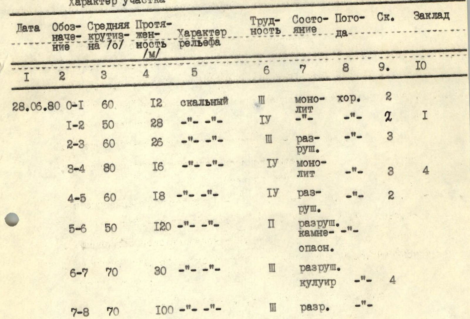
Section Characteristics
| Date | Designation | Average steepness, ° | Length, m | Terrain characteristics | Difficulty | Condition | Weather | Rock pitons | Chocks |
|---|---|---|---|---|---|---|---|---|---|
| 28.06.1980 | R0–R1 | 60 | 12 | rocky | III | monolithic | good | 2 | |
| R1–R2 | 50 | 28 | —"—"— | IV | —"—"— | —"—"— | 2 | 1 | |
| R2–R3 | 60 | 26 | —"—"— | III | fractured | —"—"— | 3 | ||
| R3–R4 | 80 | 16 | —"—"— | IV | monolithic | —"—"— | 3 | 4 | |
| R4–R5 | 60 | 18 | —"—"— | IV | fractured | —"—"— | 2 | ||
| R5–R6 | 50 | 120 | —"—"— | II | fractured, rockfall prone | —"—"— | |||
| R6–R7 | 70 | 30 | —"—"— | III | fractured, couloir | —"—"— | 4 | ||
| R7–R8 | 70 | 100 | —"—"— | III | fractured | —"—"— |
1st bivouac after section R1–R2 2nd bivouac after section R4–R5 Summit after section R7–R8 Descent via route 1B category of difficulty.
APPROACH DESCRIPTION
Follow the left bank of the Igizak River to the "Zelyonaya Polyana" bivouac — uphill along the trail. Up the scree and left-upwards, then across the snow, passing p. Bivachnaya Srednyaya, approach p. Bivachnaya Yuzhnaya. From the bivouac — 1.5–2 hours.
Ascend the steep snow slope, with a steepness of 35°, to the middle of the Western wall of p. Yuzhnaya Bivachnaya. The wall is dissected in its middle part by a black trough-shaped couloir. The start of the route is 15 m to the right of the couloir and to the left of a black wide vein running from the top.

Map of the ascent region. — Group's route — Base camp