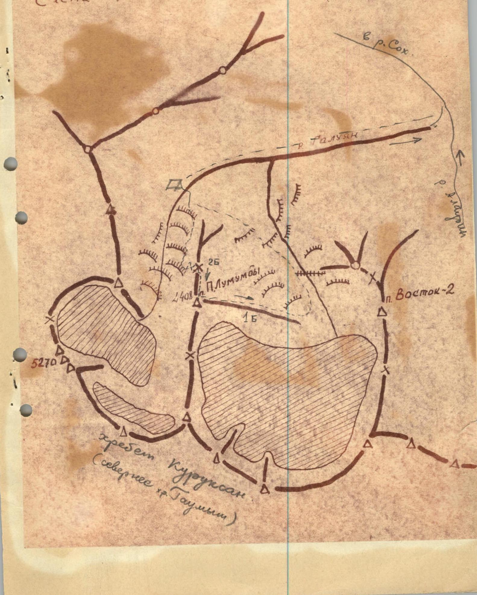
LOCATION
Peak P.Lumumba is located in the northern spur of the Alay Range (South Tian Shan or Pamir-Alay) in the upper reaches of the Gavmen (Galyuan) River. Its height is 4405 m. The attached diagram clearly defines its location.
APPROACHES
From the town of Haydarkan, located in the western part of the Frunze district of Osh region within the basin of the Sokh River, a small but powerful vehicle (e.g., GAZ-69) can drive up the Gavian (Golyuan) River valley for about 14 km.
Further:
- The road turns into a trail.
- We ascend along the trail on the right or left orographic bank of the Gavman River to the moraine, where we set up the base camp.
Around the campsite, there is a juniper forest on the slopes.
ASCENT ROUTE
From the base camp, we cross to the right bank of the river, walk 50 m along the river, and turn left upwards along the ancient moraine. Then we move to the young moraine, heading towards Peak Patrice Lumumba. We approach the couloir descending from the northern ridge along the middle talus and ascend to the saddle. The elevation gain from the foot of the couloir to the saddle is 450-500 m. The average steepness of the couloir is 30-35°. We move all the time along the right-hand side of the couloir. We reach the saddle to the right of the gendarme. The detour on the right side, as well as the direct ascent to the gendarme, is difficult. Therefore, we descend to the left and traverse the gendarme (from the east) along the broken rocks and steep talus. This section is very prone to rockfall. The use of circular belay is impossible. Having reached the saddle behind the gendarme, we traverse the slope to the right to the beginning of the couloir. We ascend up the couloir. The ascent passes through very broken rocks. The use of belay is difficult. Having ascended 150 m up the couloir, we turn to the right and traverse the slope along the pitons. After 100 m, we approach the overhanging tower and detour it on the left. After 50 m, we ascend to the ridge and approach the gendarme. We ascend the gendarme on the right.
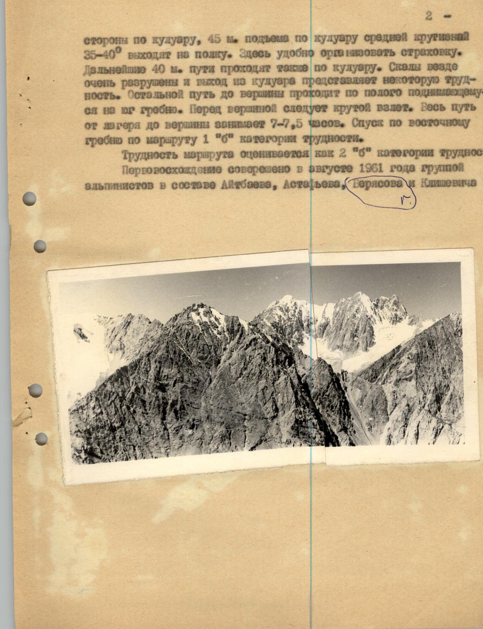
- The sides of the couloir, 45 m of ascent up the couloir with an average steepness of 35-40° lead to a ledge. Here it is convenient to organize a belay. The next 40 m of the route also pass through the couloir. The rocks are everywhere very broken, and exiting the couloir presents some difficulty. The remaining path to the summit passes along the gently ascending southern ridge. Before the summit, there is a steep ascent. The entire path from the camp to the summit takes 7-7.5 hours. The descent is along the eastern ridge via route 1B cat. difficulty. The difficulty of the route is estimated as 2B cat. difficulty. The first ascent was made in August 1961 by a group of climbers consisting of Aitbaev, Astafyev, Beryasov, and Klishevich.