Brief Description of the Route Approach
The path from the base camp at the confluence of the Kurgan and Suichikty rivers follows the road down to the lower bridge. After crossing the bridge over the Kyrgyz-Ata river, follow the trail leading into the Beketty gorge. Continue along the trail that runs along the bottom of the gorge until a steep ascent to the moraine. Then proceed along the moraine to a scree slope, orienting towards the "finger" gendarme.
It takes 3.5 hours to walk from the base camp to the start of the route.
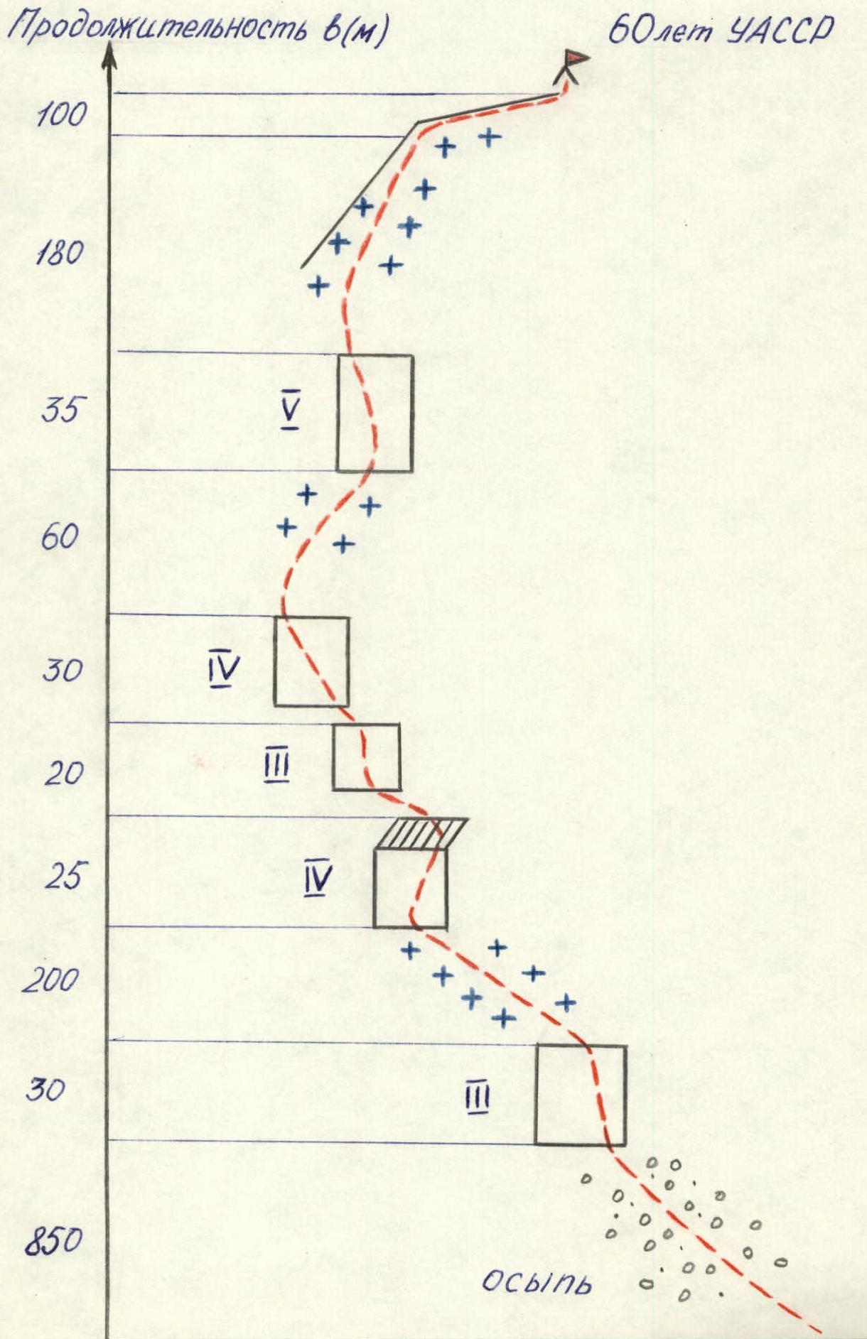
4150 m (60th anniversary of the UASSR) via the E ridge. Category 3B difficulty, 700 m, 45°, 21 pitches, 12 hours. 6/XI-80. R. Galeev, S. Bochenkov, S. Suntsov, V. Teletsyn.
Map of the ascent area
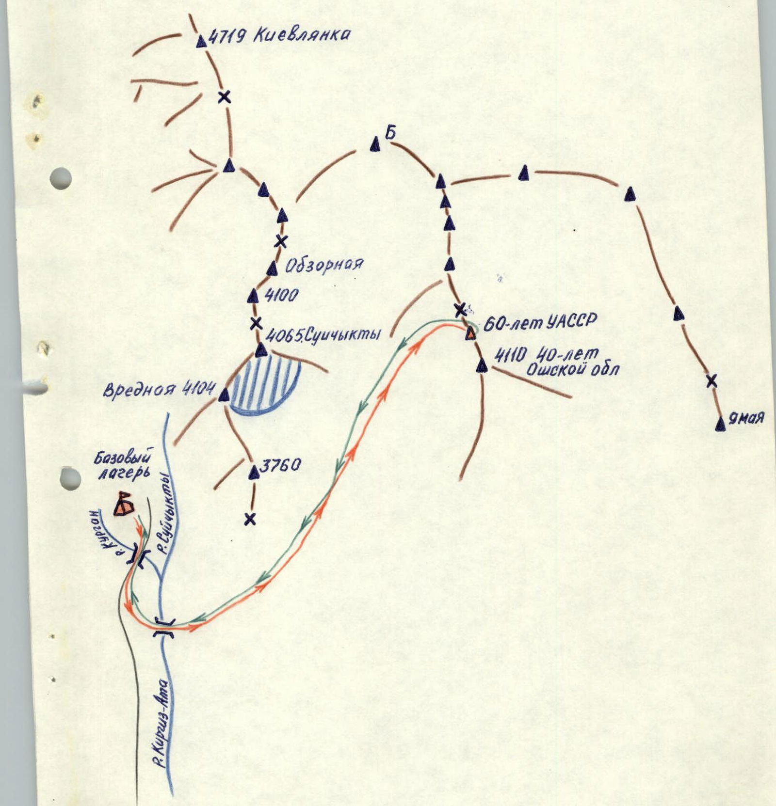
Table of main characteristics of the ascent route
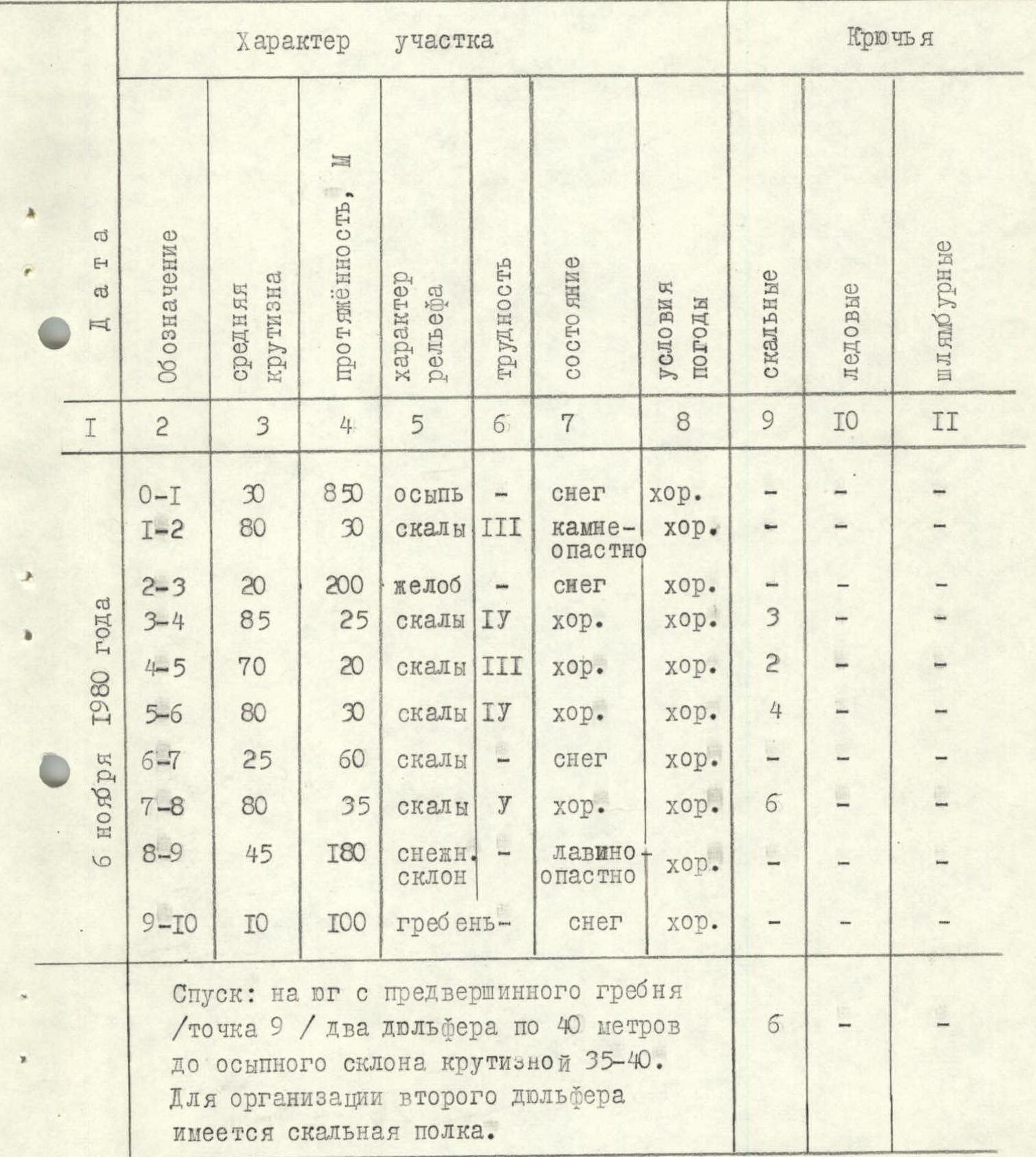
| Date | Designation | Average steepness | Length, m | Terrain character | Difficulty | Condition | Weather conditions | Rock | Ice | Bolts |
|---|---|---|---|---|---|---|---|---|---|---|
| R0–R1 | 30 | 850 | scree | snow | good | - | - | - | ||
| November 6, 1980 | R1–R2 | 80 | 30 | rocks | III | rockfall hazard | good | - | - | - |
| R2–R3 | 20 | 200 | gully | snow | good | - | - | - | ||
| R3–R4 | 85 | 25 | rocks | IV | good | good | 3 | - | - | |
| R4–R5 | 70 | 20 | rocks | III | good | good | 2 | - | - | |
| R5–R6 | 80 | 30 | rocks | IV | good | good | 4 | - | - | |
| R6–R7 | 25 | 60 | rocks | snow | good | - | - | - | ||
| R7–R8 | 80 | 35 | rocks | V | good | good | 6 | - | - | |
| R8–R9 | 45 | 180 | snow slope | avalanche hazard | good | - | - | - | ||
| R9–R10 | 10 | 100 | ridge | snow | good | - | - | - |
Descent: from the south of the pre-summit ridge (point R9), two 40 m rappels down to a scree slope with a steepness of 35–40. A rock ledge is available for the second rappel.
Route diagram according to UIAA symbolism
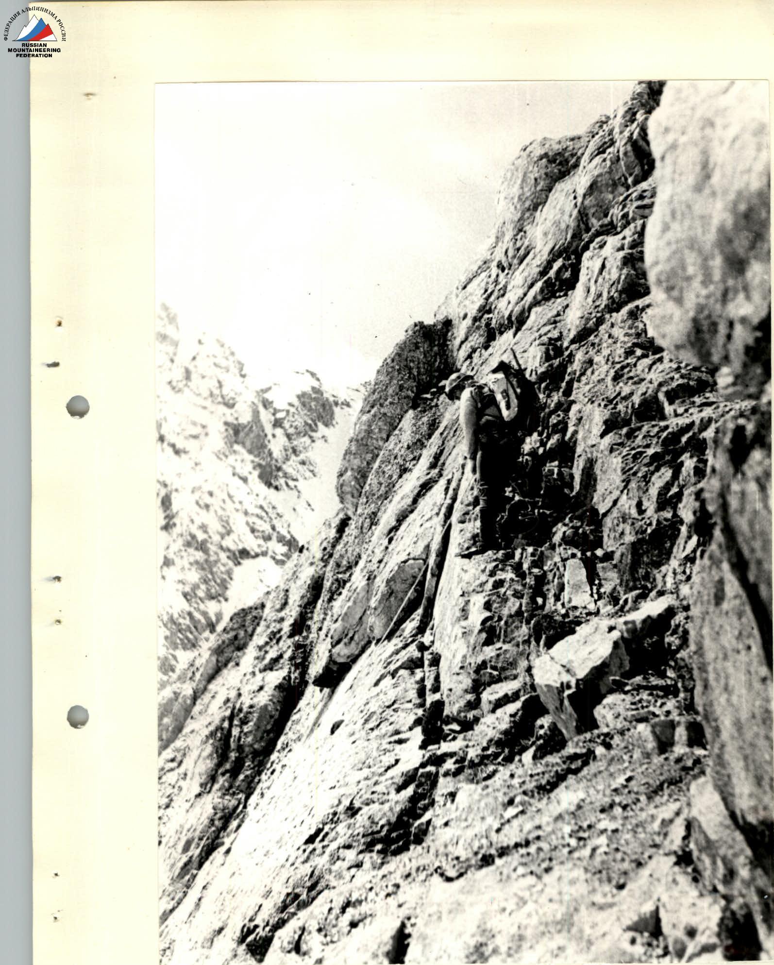
Section R1–R2


