Group Equipment
I. Main rope 40 m - 3 pcs. 2. Rock pitons - 10 pcs. 3. Carabiners - 10 pcs. 4. Hammers - 2 pcs. 5. Ladders - 4 pcs.
III. Peak Sur-ToO
Ascent via the south-eastern ridge, route 1A cat. difficulty (see diagram in Fig. 2). The route was traversed on October 31, 1972 by a group consisting of Inozemtsev Yu.P. (leader), Telbuh P.A., Nehaenko A.A.
Location of the summit and ascent routes
The summit is located in the ridge on the right bank of the Kuragan River and has an elevation of 4197 m. (Fig. 14). To the north-north-east of the summit in the main ridge is the Kumbel pass, and further the ridge goes in the direction of peak "Builder of the Toktogul HPP". In addition, the south-eastern ridge leads to the summit. From the Kuragan River valley, one can ascend to the Sur-ToO summit:
- along the main ridge (from the Kumbel pass or the saddle between Sur-ToO and peak "Builder of the Toktogul HPP"),
- along the south-eastern ridge.
Approaches. (see p. 3)
Route. Initially, the trail goes along the snow in the ridge part of the edge. After 1.5 hours of movement on snow, rocks begin. Further, the ridge is represented by three counterforts going in the direction of the summit.
Movement:
- on the rocks of the right counterfort - simultaneous and alternating,
- having passed two ropes on the rocks, it is necessary to traverse the couloir to the left and exit onto the rocks of the middle counterfort,
- one rope is traversed with alternate belay,
- further, moving simultaneously, exit to the sub-summit located on the side of peak "Builder of the Toktogul HPP".
From the sub-summit to the summit, one rope is traversed on snow and rocks with alternate belay. The section from the beginning of the rocks to the summit is traversed in 2 hours. At the summit, there is a triangulation marker, and a note is left in the upper tube.
Descent along the rocks and snow of the main ridge towards the saddle between v. Sur-ToO and p. "Builder of the Toktogul HPP". Movement is simultaneous or alternating (30 min.). From the saddle, descend along the snow to the beginning of the rocks of the south-eastern ridge, from where they moved to the summit, and then down along the ascent route. The section from the saddle to the base camp is traversed in 2 hours 30 minutes.
Route timing:
- Base camp - start of the ridge: 3 hours 30 minutes
- Ascent to the summit: 1 hour 30 minutes
- Descent to the base camp: 3 hours Total: 8 hours
It is recommended to classify the route as 1A cat. difficulty.

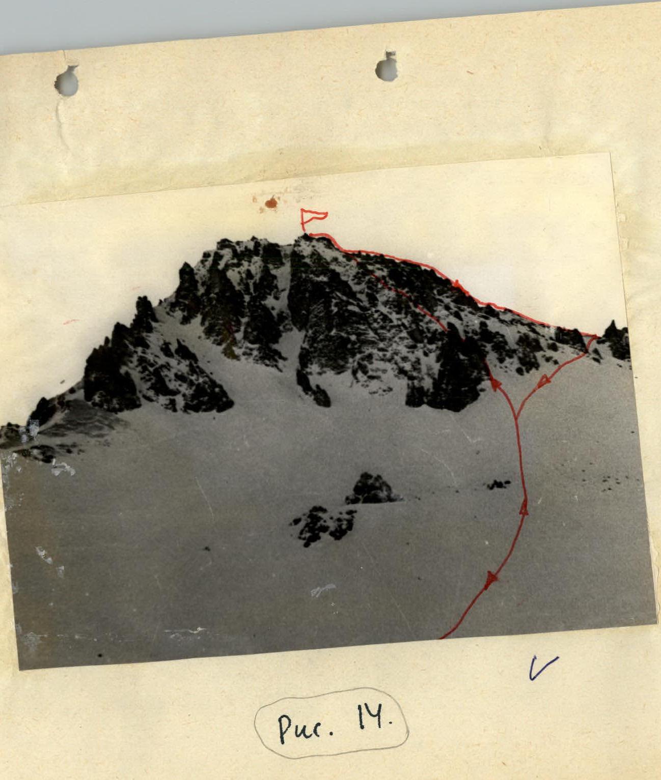 Fig. 14.


