Ascents to the summit of Pervomayskaya (4064 m). 15. From the south via the Kurgan pass
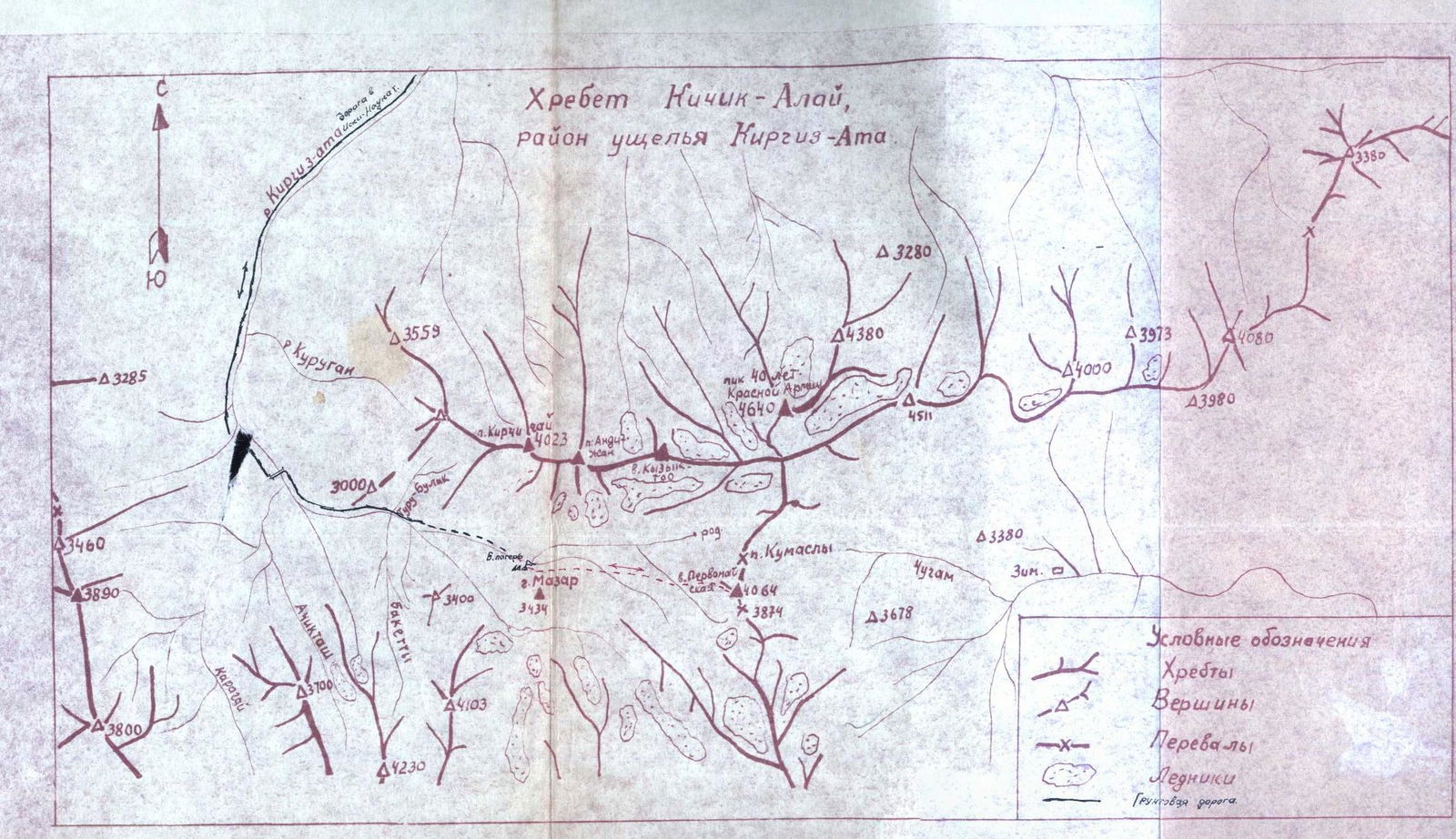
The summit is located in the Kyzylkiya ridge in the Mazarsay tract approximately 65–70 km from the city of Osh. It is convenient to set up a base camp under the Mazar mountain. The location is suitable for camping, with available firewood and water.
The Pervomayskaya summit is located east of the base camp. The summit is composed of loose, heavily weathered rocks.
The first ascent to the Pervomayskaya summit was made on April 29, 1959, by a group of climbers from Osh consisting of NAUMENKO I.M. — leader, 1st sports category, BURYAK V.A. — 1st sports category, and holders of the "Alpinist of the USSR" badge: MAMATOV G., MADRAKHIMOV T., YUDINA V., SOKOLOVA S., YAROSHENKO V.
The movement goes in the direction of the Kok-Bel pass. We crossed a number of spurs covered with deep snow and gullies.
The slope gradually becomes steeper and avalanche-prone. We move up with variable insurance via ice axes to the pass. Here we build a cairn.
Further, we head west, traversing the slope of the Pervomayskaya summit. We reach a steep, wide snow couloir with rocky outcrops. Here we insure via ledges and ice axes. Before the summit:
- we reach rocks of moderate difficulty, which we traverse to the right with a gradual gain in height;
- we overcome a small wall 3–3.5 m high.
On the summit, we build a cairn. Descent is made via the ascent route.
The group assessed the route as Category 1B difficulty in winter conditions.
Group leader: NAUMENKO I.M.

