Climbing Passport
-
Climbing category: Technical
-
Climbing region, range: Pamir-Alay, Kikik-Alay range
-
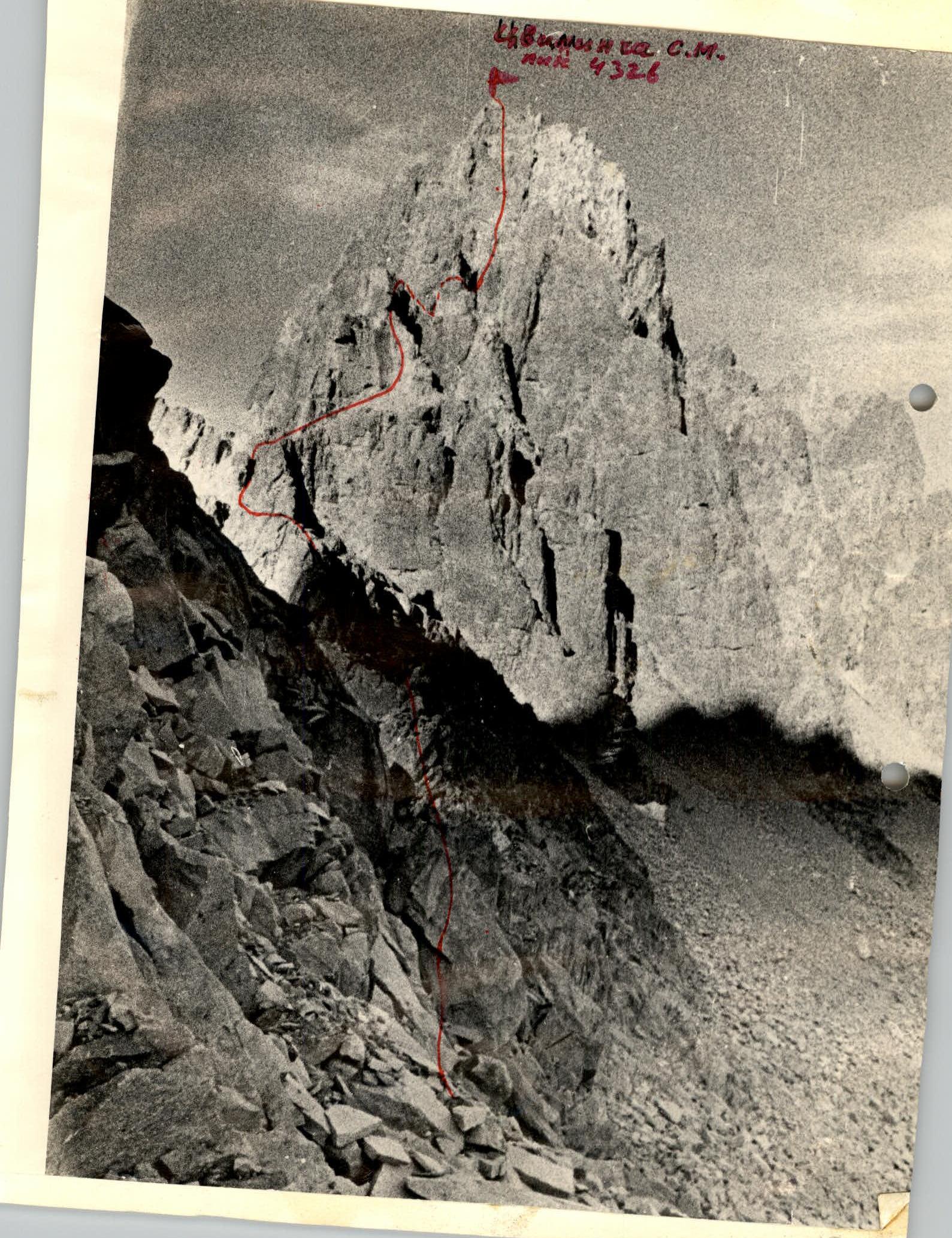
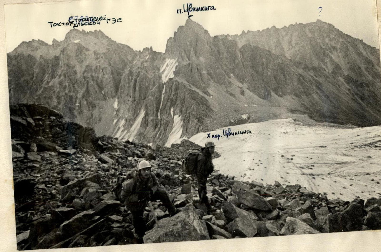
Peak: Tsvilling S.M. peak Height: 4326 m Ascent route: from Tsvilling pass
-
Proposed difficulty category: 4–5
-
Route characteristics: Elevation gain: ~850 m Length of sections: 5–6 with 3rd category difficulty, 30 m Average steepness: 50°
-
Pitons hammered:
- FOR PROTECTION:
- Rock: 58
- Ice: 12
- Bolted: —
- FOR CREATING INTERMEDIATE PROTECTION: 4
- FOR PROTECTION:
-
Number of climbing hours: 14.2
-
Number of bivouacs and their characteristics: One — moraine of the glacier behind the pass, close to the beginning of the ridge and safe.
-
Leader's full name, participants, and their qualifications:
- Semenyuta G.K. — leader — II sports category
- Glyadelov V.S. — II sports category
- Kozlov B.N. — II sports category
- Lensky S.V. — I sports category
- Rokhalskaya G.K. — Master of Sports of the USSR International Class
Team coach: Master of Sports Levin M.S.
-
Date of departure and return: August 28, 1977 – August 30, 1977

Explanations for the table
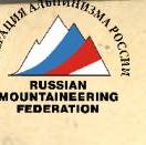
- Descent via the ascent route: 6×40 rappels with rope retrieval from 16:30 to the bivouac on the moraine at 20:05; on August 30, 1977, sport climbing using the left ice pitons 3×40. Descent from the pass to the moraine from 7:30 to 10:00.
- When processing the ice section of the ascent to Tsvilling pass, fixed ropes were installed 2×40 + 1×60 m. The group had THREE ropes!
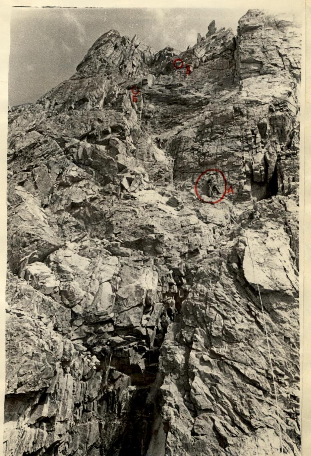
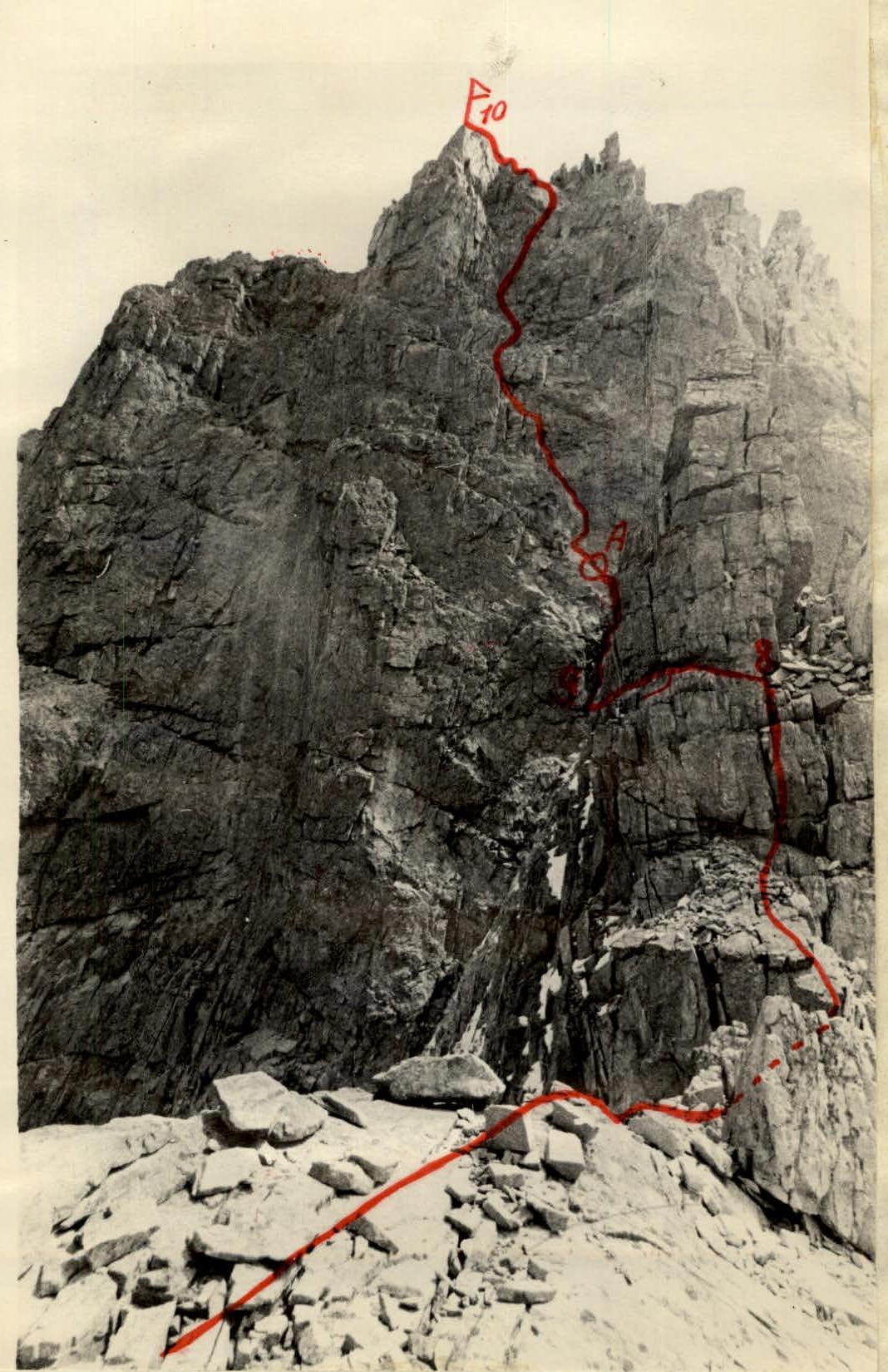
- «R1–R2»: do not go left — SERACS!
- «R2–R3»: stay on the ridge — detours complicate the route.
- «R3–R4»: do not go left — steep ice.
- On tower «R6» a bivouac is possible (there is water).
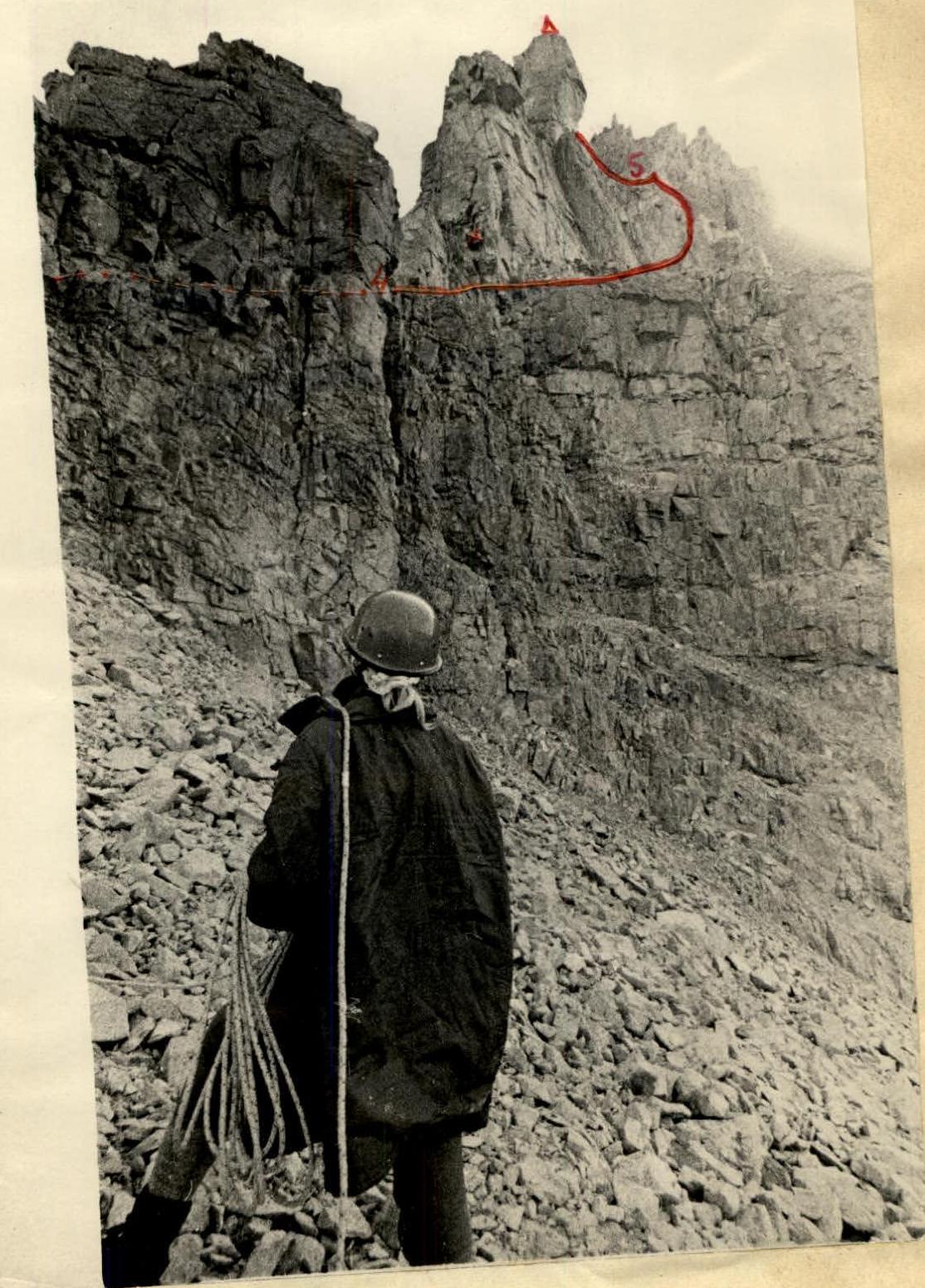
- «R8–R9»: do not ascend to the summit of the gendarme «Palets», pass on the left along the ledge — the one where in 1972 the Karakul alpinist Ivan Morozov fell and died. Channel pitons are required.
Description of the approach: Osh — Iskinukkat — Karakoy forestry — bridge over the Kurgan river behind the forestry using any type of vehicle. Up the Kurgan river 3.5–4 hours to the white moraine blocking the Kurgan gorge and further under the ascent to Tsvilling pass.
Proposals for classification: The group assumed that the planned route to peak «4326» would be no easier than category 5A. However, the route overall turned out to be simpler — there are rational detour options, as shown in the description. However, in the group's opinion, the route, even for four people, will be more difficult than such category 4B routes as «Metallurg», «Kara-Tau», «Litva». Therefore, the group proposes to include the route they completed in the Classification table of routes to mountain peaks of the USSR as:
Tsvilling S.M. peak 4326 4B combined from Tsvilling pass
www.alp-federation.ru