28
30
- Class — rock
- Area — Kiçik-Alay ridge
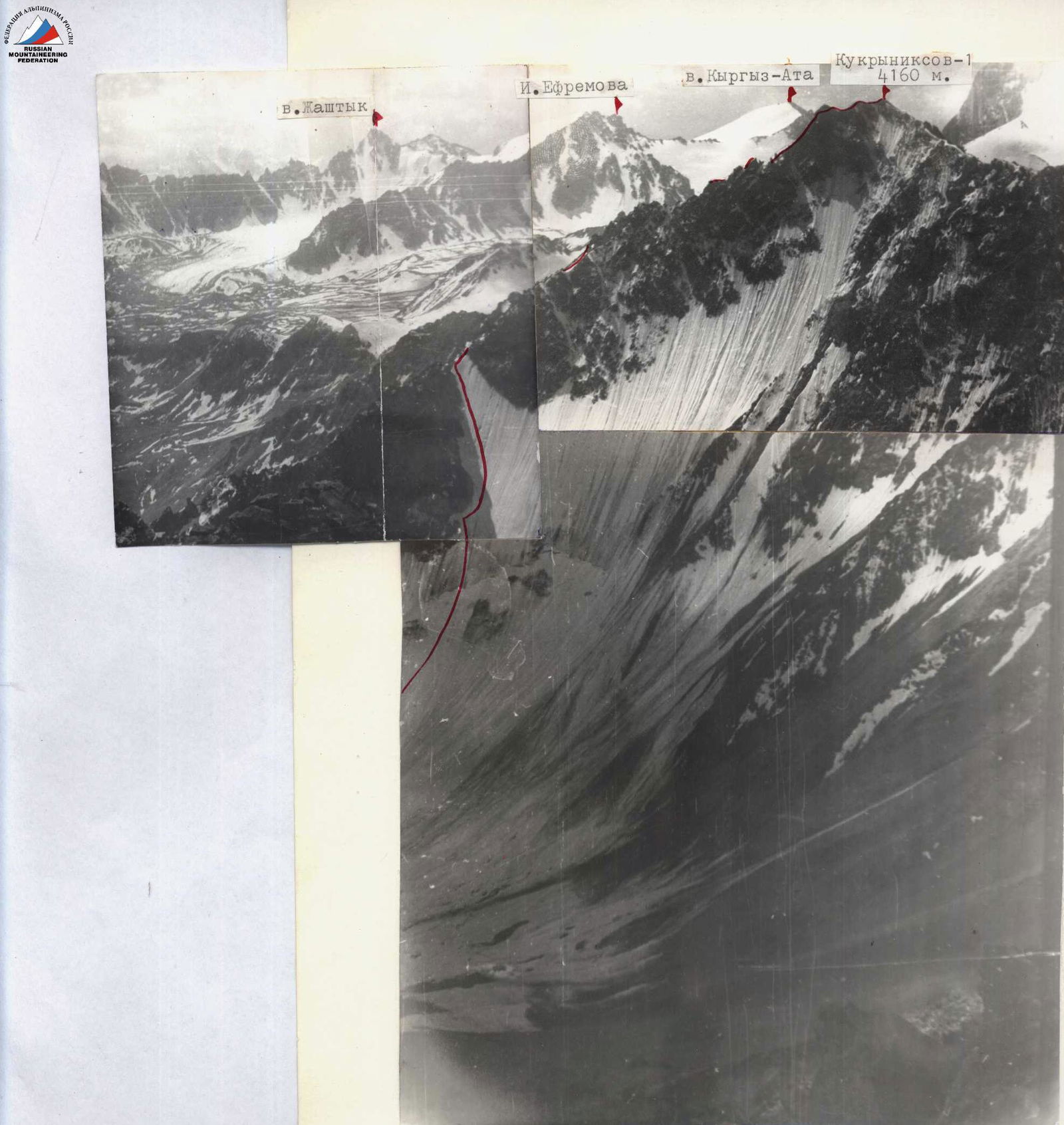
- Peak — Kukrniksov (4160 m)
First ascent via the north wall of the eastern ridge (combined)
- Proposed category of difficulty — 3B
- Height difference — 630 m
Length of sections R0–R1 cat. diff. — NONE, average steepness — 43°
- Hammered in pitons:
For belay: for creating ITO: ice — 10, rock — 4
- Number of travel hours (on the ascent) — 6.5 h
- Overnights on the route — NONE
- Participants: 1. Bochkov Vladimir Viktorovich — 2nd sports category
- Samokotin Yuri Timofeevich — 2nd sports category. Coach: Master of Sports MS Levin
- Date of departure and return from the route: July 28, 1981
Chelyabinsk Region Alpine Federation
- Route scheme in UIAA symbols

| Date / time | Section No. | Average steepness | Length (m) | Terrain characteristics | Category of difficulty (section) | State of terrain | Weather conditions | Rock pitons | Ice pitons |
|---|---|---|---|---|---|---|---|---|---|
| July 28 7:30–14:00 | R0–R1 | 45° | 220 | Slope with bergschrund | 3 | Firn, ice; pass at +8° early in the morning in crampons | — | — | 1 |
| — | R1–R2 | 50° | 140 | Couloir | 3+ | Ice, many frozen stones | Calm, clear | — | 3 |
| — | R2–R3 | 35° | 520 | Ridge | 3 | Destroyed, loose rocks with snow and ice accretions | «—» | — | — |
| — | R3–R4 | 50° | 40 | Wall | 3+ | Very destroyed rock | «—» | 3 | — |
| — | R4–R5 | 60° | 100 | Wall | 4+ | Rocks are fragile. Hard to find a place for belay | +14° | 7 | — |
| — | R5–R6 | 35° | 80 | Summit | 2+ | Brittle rocks, covered in ice | «—» | — | — |
| Total: | 10 | 4 |
Descent: along the southern ridge, then left — down to the Suychikty gorge and along the moraine and glacier to the left of Kievyanka peak.
Proposals for classification: the described route is undoubtedly more complex than the first 3B in this area — N. ridge of Kievyanka. It is also more complex than the first 4A in this area — 4A N. ridge of Peak 40 Years of Soviet Army. The snow and ice slope is comparable to a similar key section on Peak Boris Ruchyev, but the rocky ridge is an order of magnitude more complex. Overall, the route is quite comparable to the 4A category route on Peak Kirov via the saddle with Peak Smena (Kyrgyz Ala-Too) — it is just as beautiful, logical, and varied.
We request to be included in the KTMGV USSR: Kukrniksov-1 4160 3B comb. via N. wall of E. ridge (V. Bochkov, 1981)
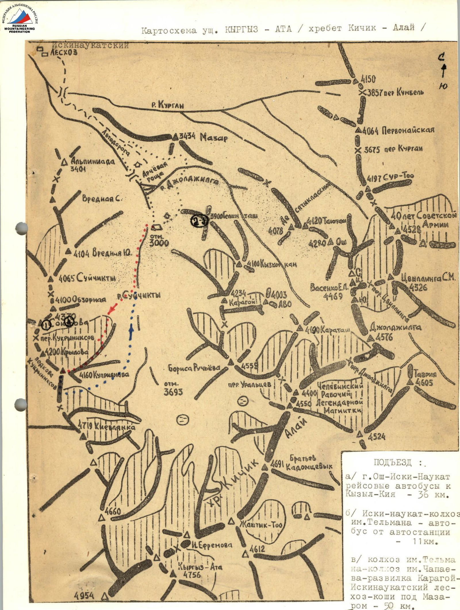
Approach:
- a) Osh city — Iski-Naukat — scheduled buses to Kyzyl-Kiya — 36 km.
- b) Iski-Naukat — Tельман collective farm — bus from the bus station — 11 km.
- c) Tельман collective farm — Чапаев collective farm — Karagoy junction — Iskinaucat forest district — winter camp near Mazar — 50 km. (1) photo 1 shooting point, etc.
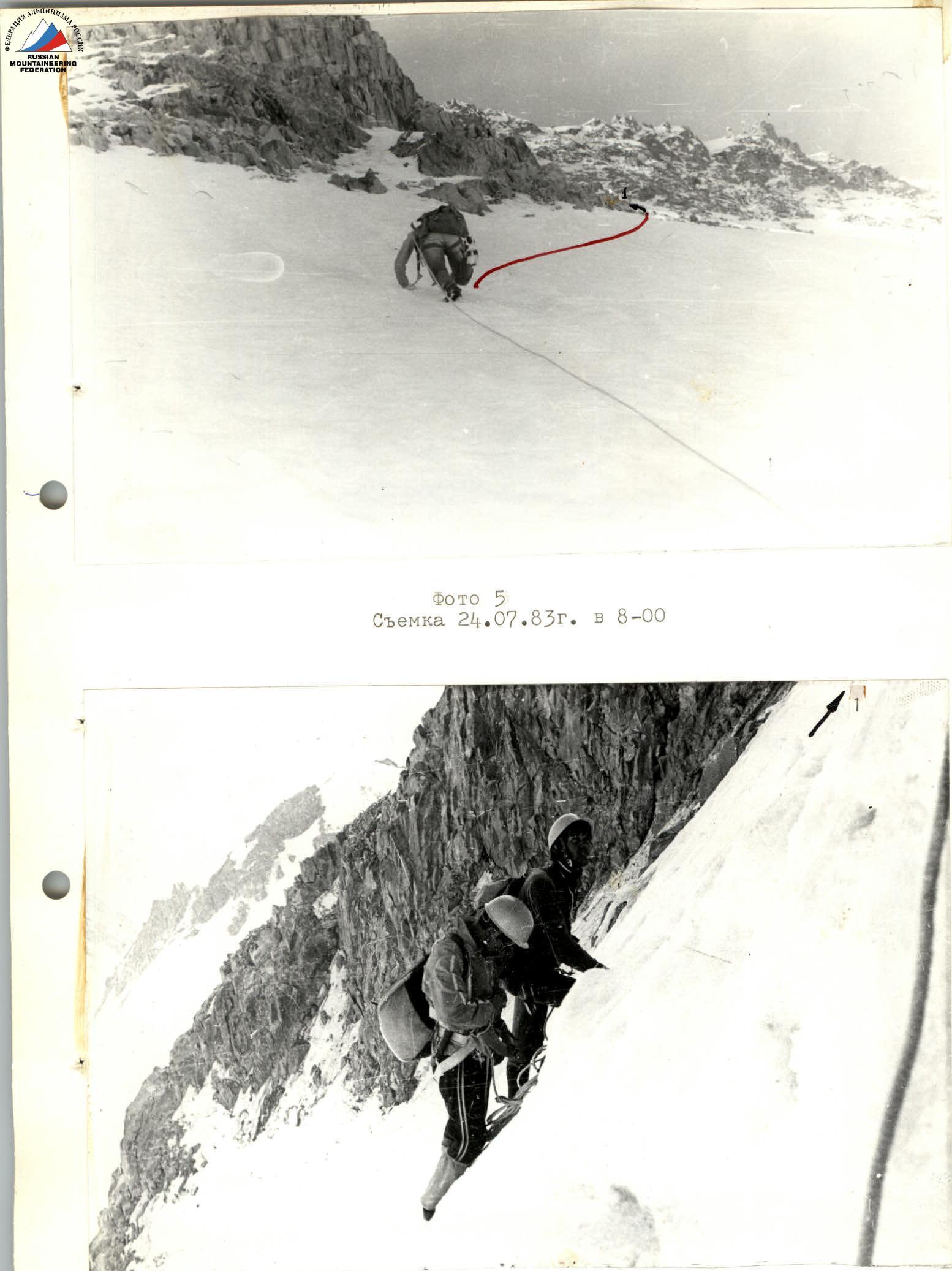
Photo 6. Section R0–R1 (shot on July 24, 1983 at 8:30)
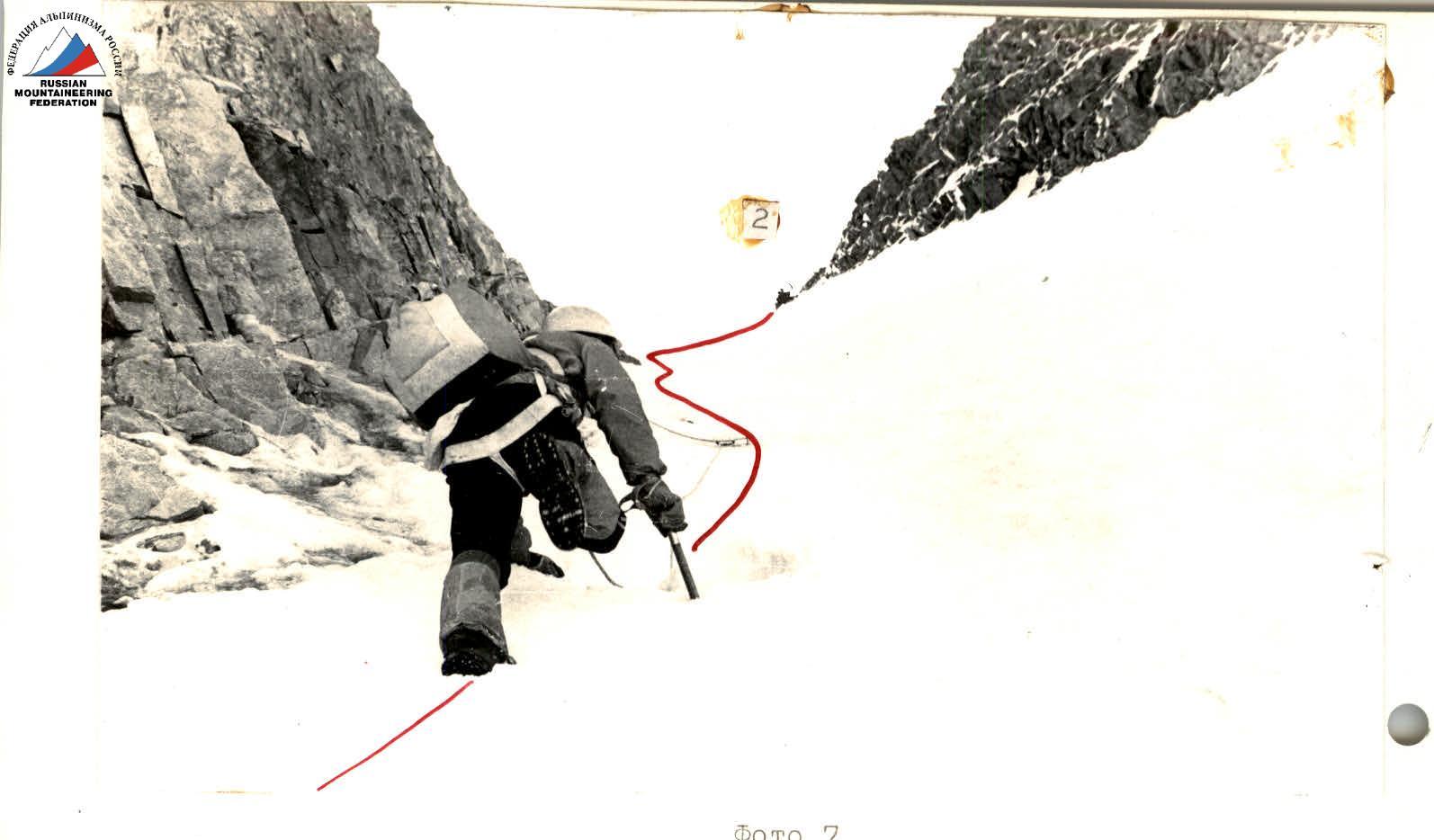
Photo 7. Shot on July 24, 1983 at 9:30
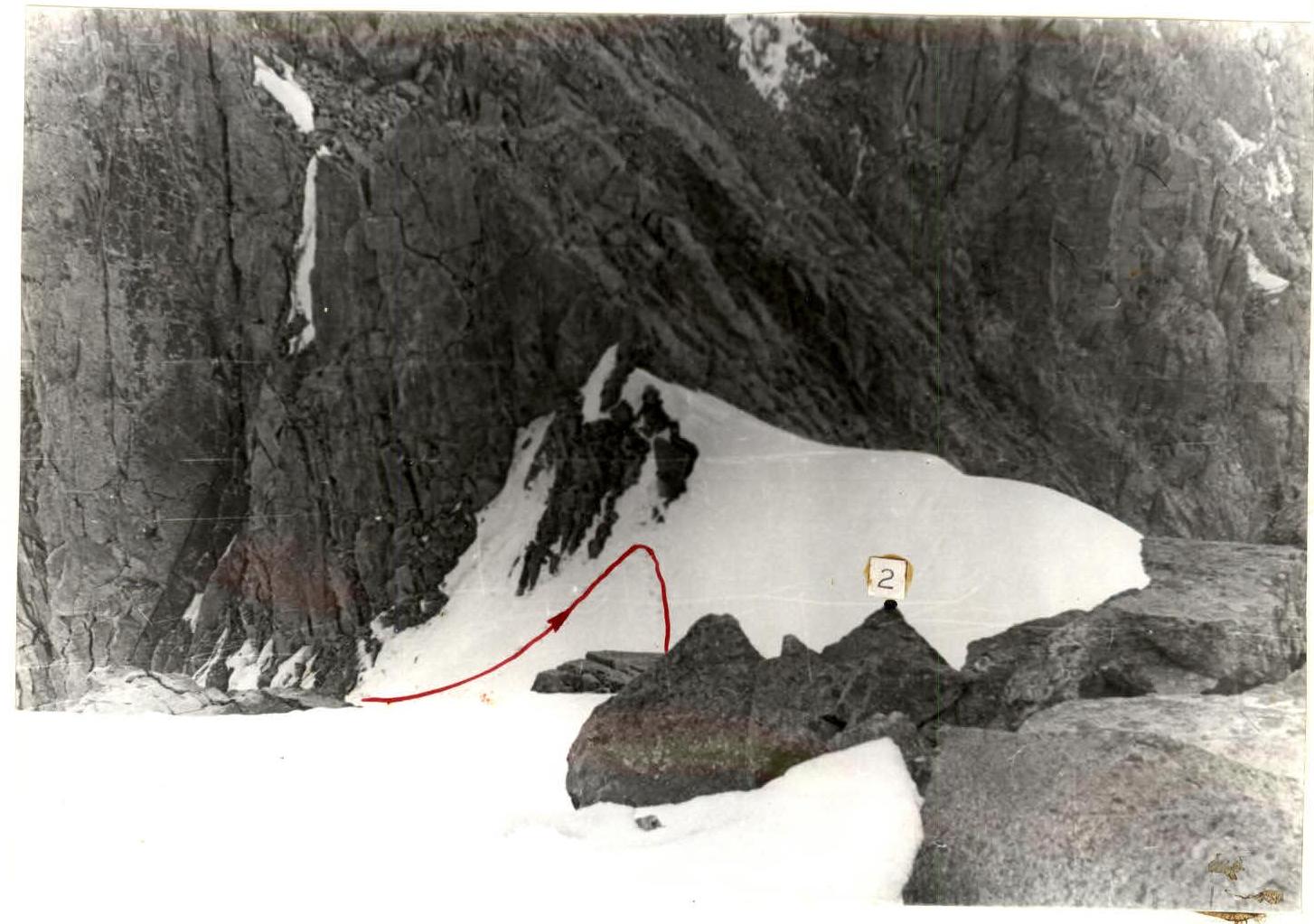
Photo 8. Shot on July 24, 1983 at 10:30
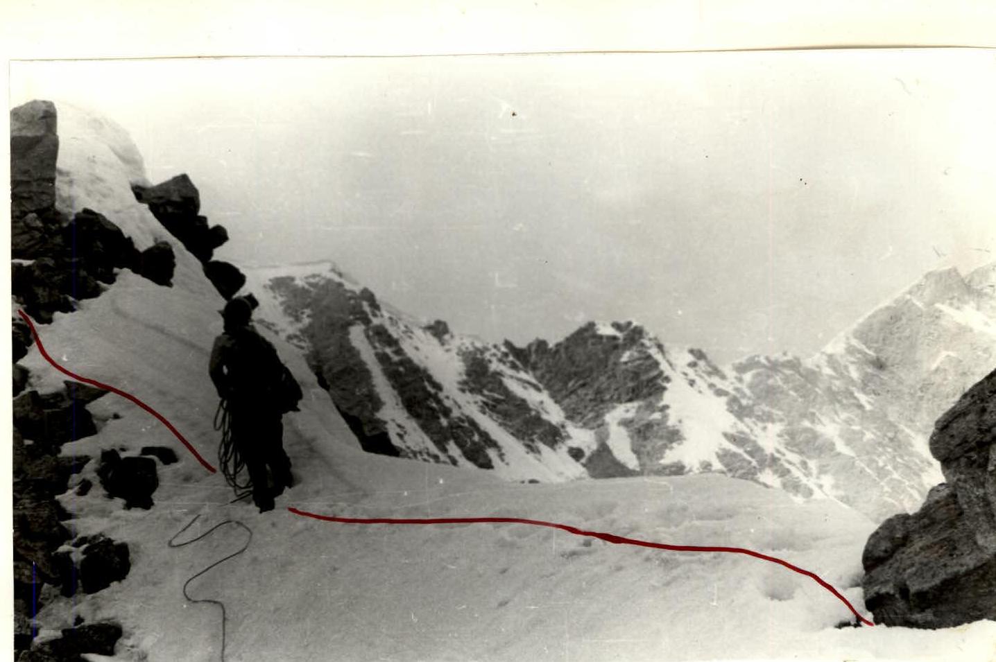
Photo 9. Section R2–R3 (shot on July 24, 1983 at 11:00)
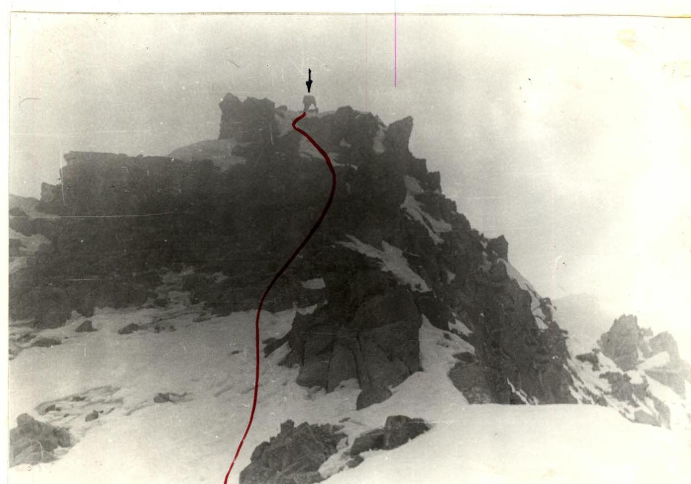
Photo 10. Section R2–R3 (shot on July 24, 1983 at 11:30)
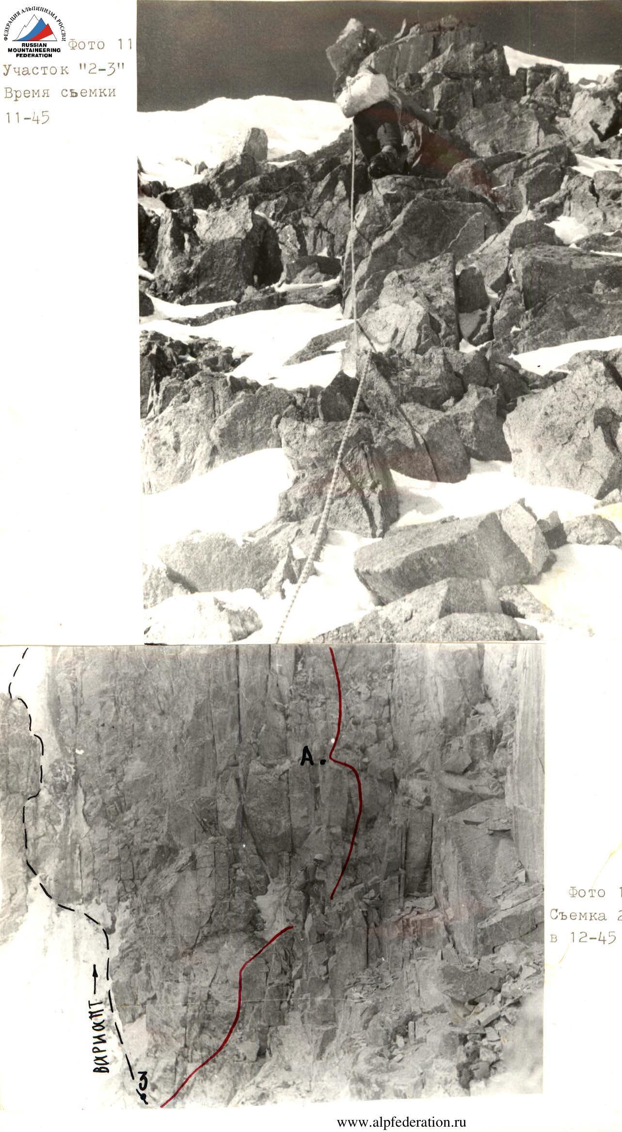
Photo 12. Shot on July 24, 1983 at 12:45
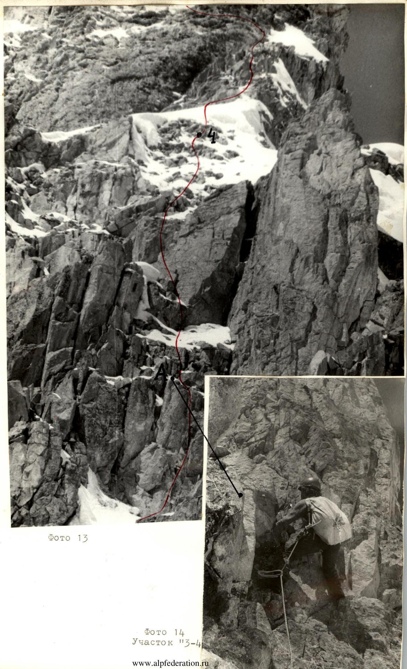
Photo 14. Section R3–R4
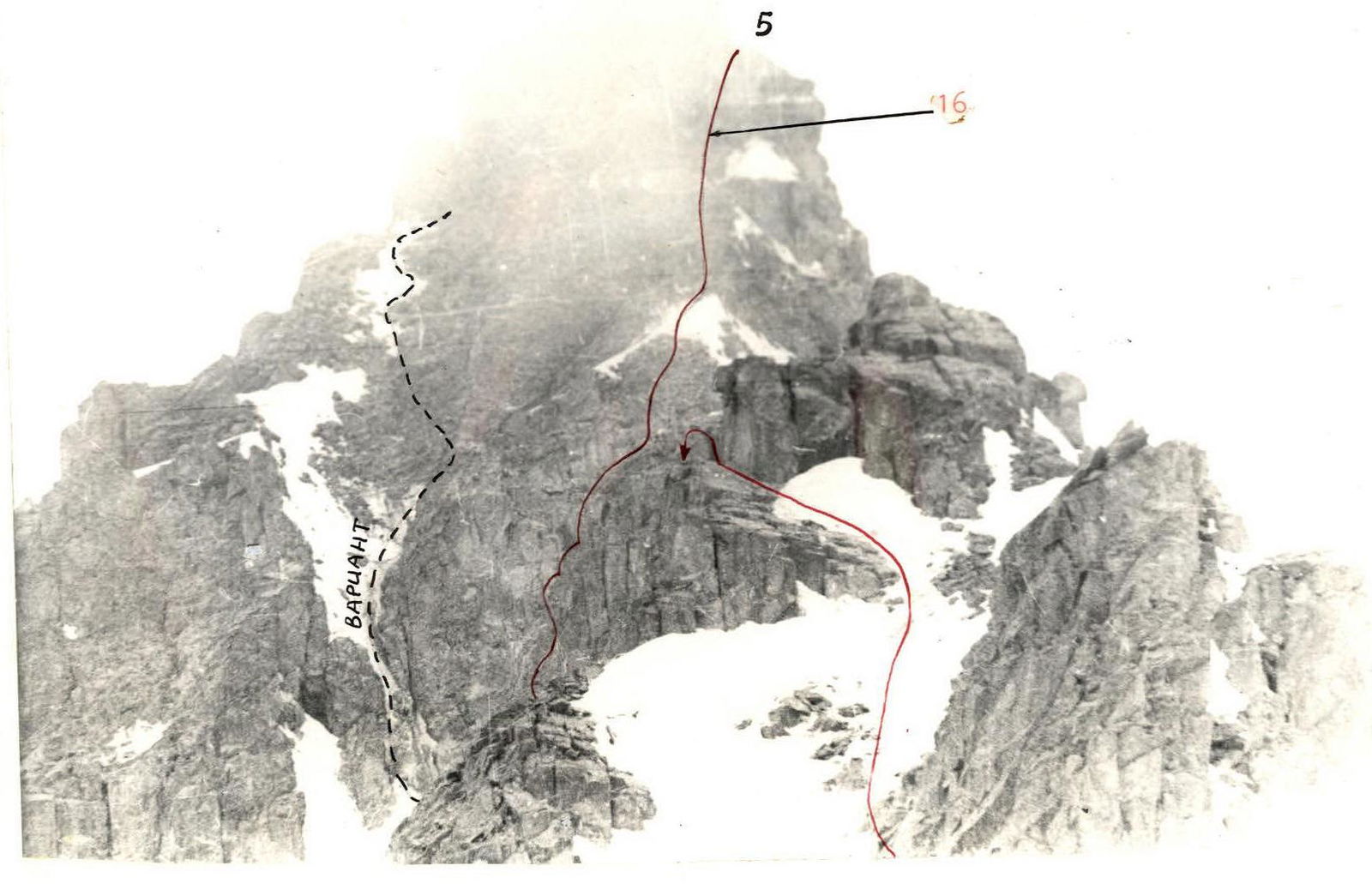
Photo 15. Shot from section R2–R3
Photo 16. Section R3–R4, see reference on photo 15
Photo 17. Shot from section R2–R3


