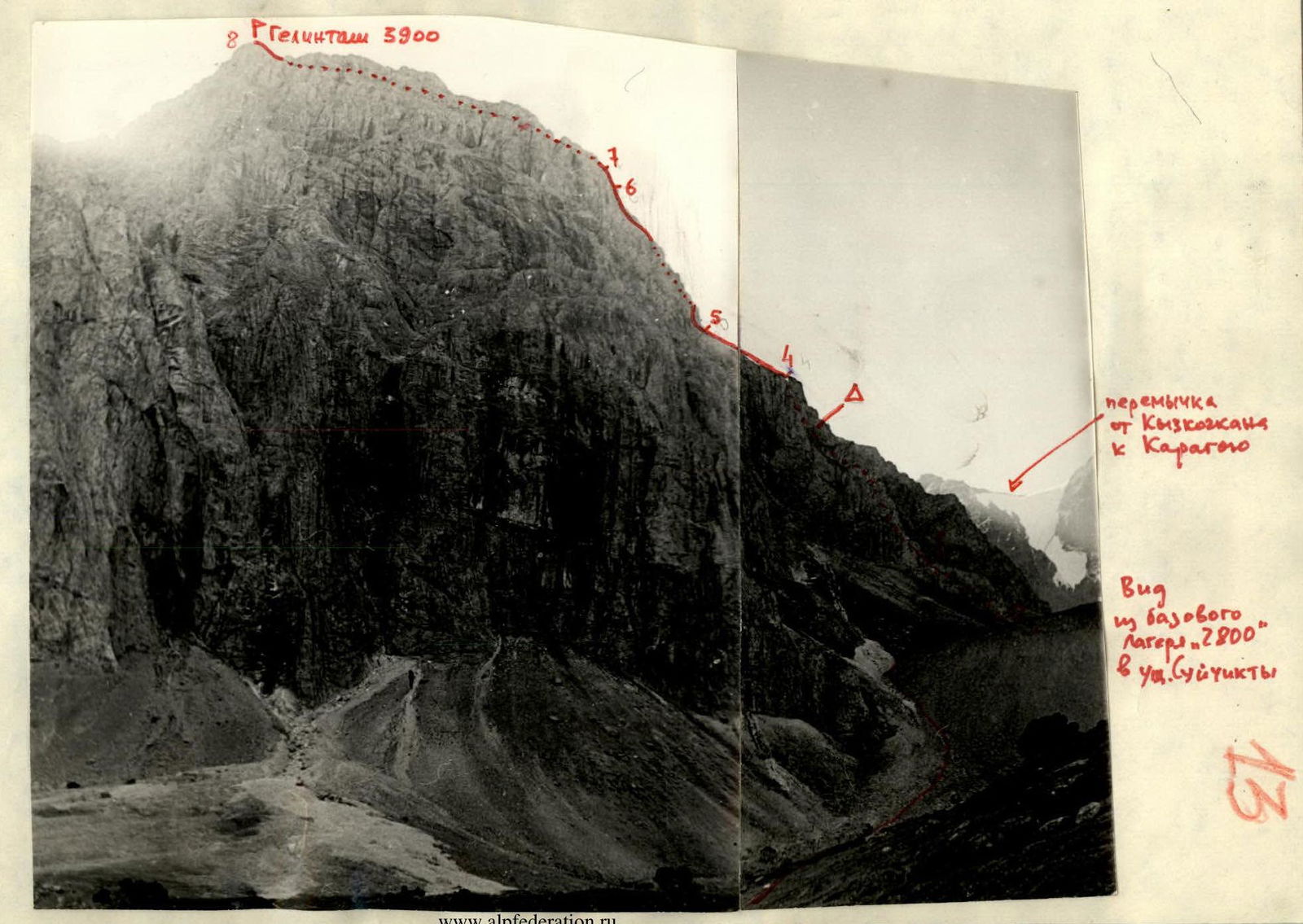
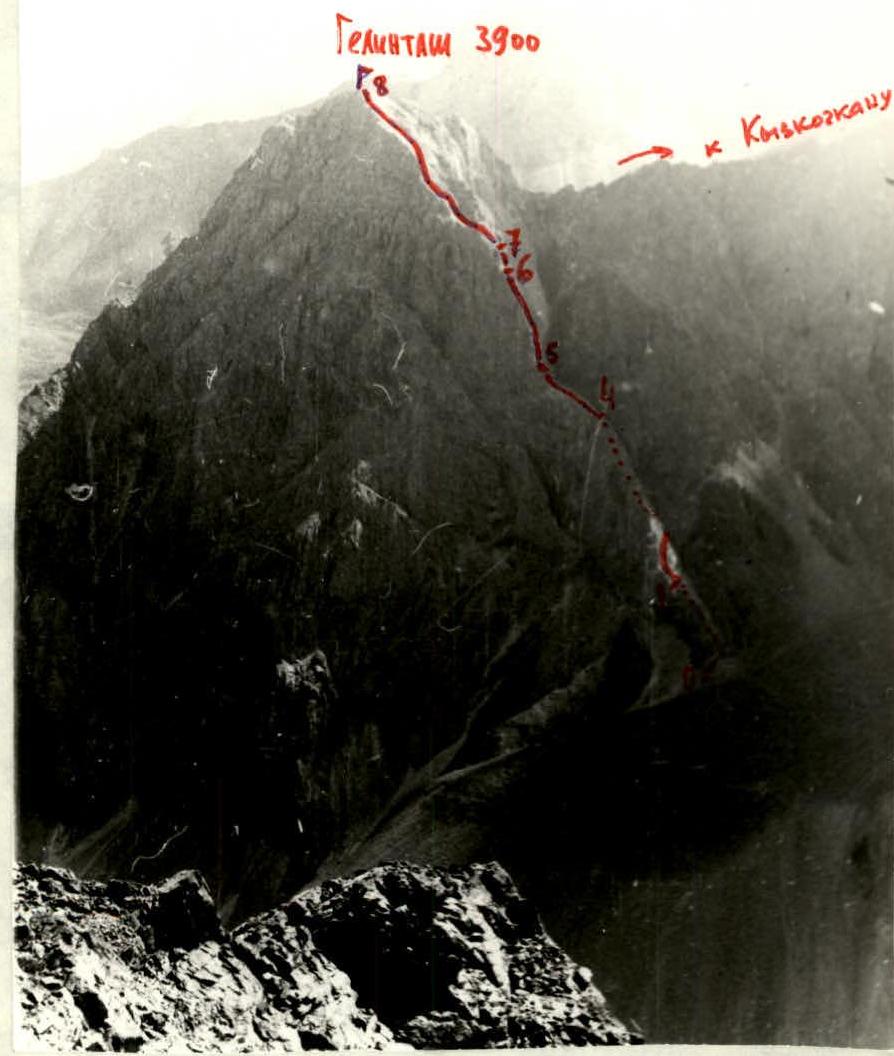
Gelintas 3900
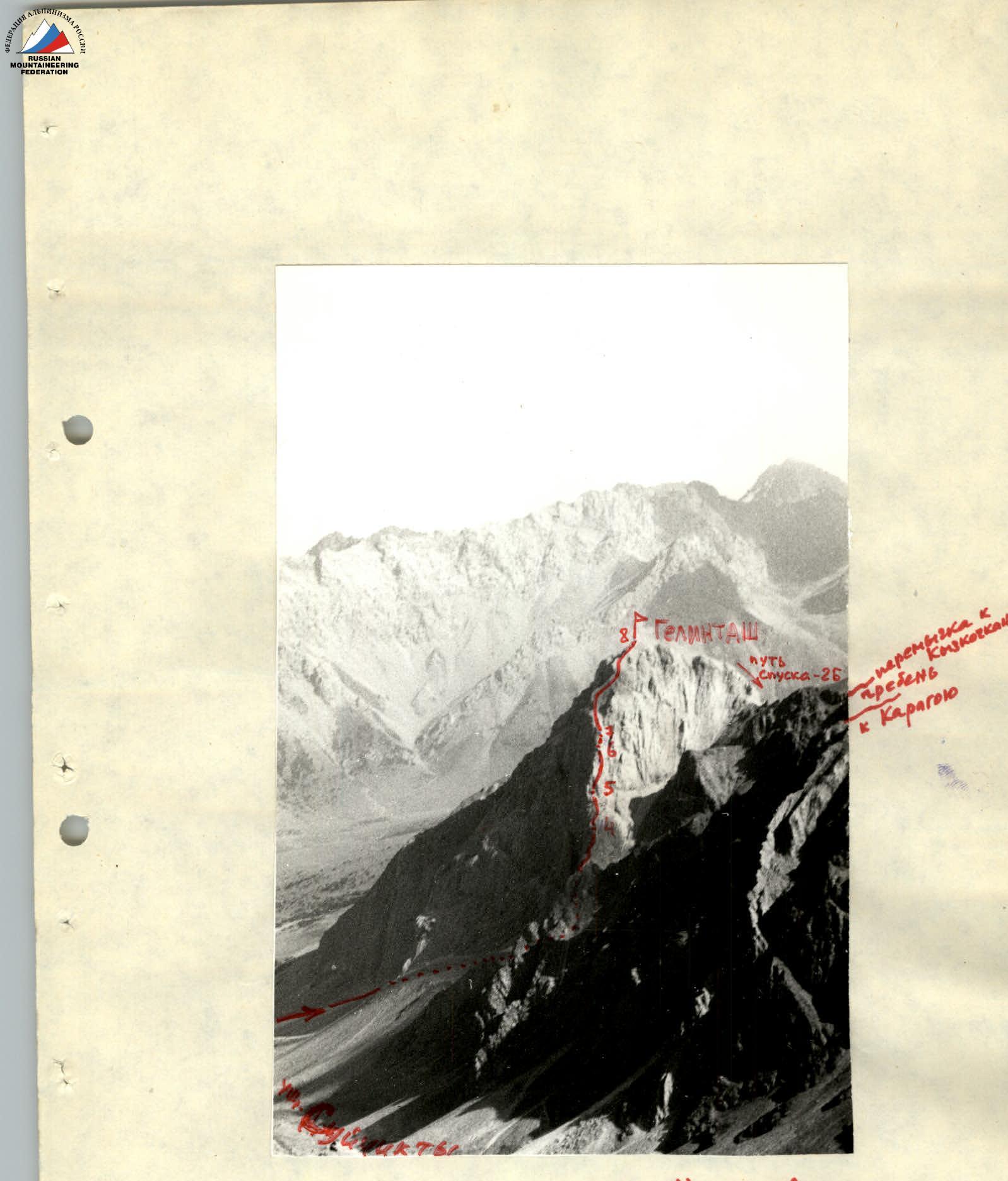
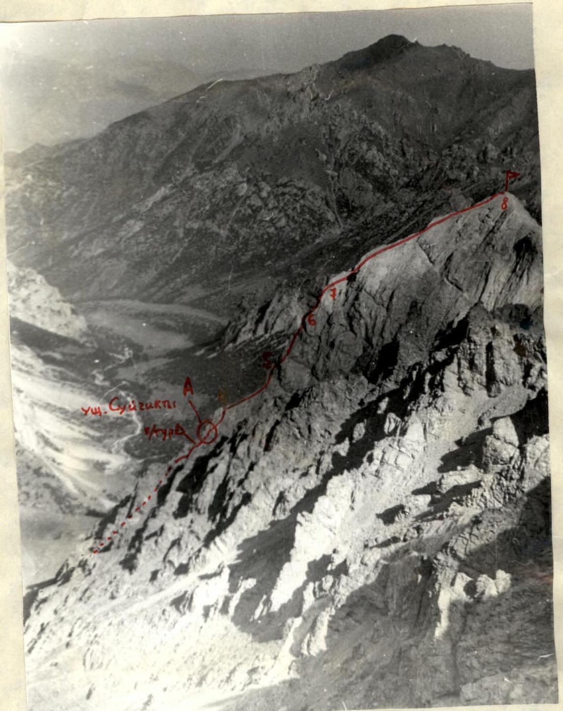
View from NW ridge of p. Kupriyanova
Gelintas 3900
www.alpfederation.ru
September 2, 1977 - Approach from base camp "2800" in Suichikty gorge to the start of the route: 1.2 hours.
| Date, Time | Section | Avg. Slope | Length | Terrain Description | Difficulty | Conditions, Weather | Belay | Ascent |
|---|---|---|---|---|---|---|---|---|
| 8:15–8:25 | R0–R1 | 30° | 150 m | Slope of a rocky ridge | 1–2 | Clear, calm. Medium scree, rocky outcrops. | Walking | |
| 8:25–10:00 | R1–R2 | 60° | 70 m | Rocky wall | 4 | To the right - dissected, loose rocks on monolith. | Twelve rock pitons, protrusions - alternately | Free climbing |
| 9:30–11:40 | R2–R3 | 80° | 30 m | Pinching ledge and a wall behind it, 20 m | 4–5 | Few handholds, monolith. | Six rock pitons - alternately | One rock piton, ITO-ladder, 20 m of rope, pulling a backpack |
| 11:20–13:30 | R3–R4 | 50° | 90 m | Rocky wall | 3–4 | Dissected, slanting handholds. Loose rocks on monolith. | Fifteen rock pitons, protrusions - alternately | Free climbing |
| 13:00–13:40 | R4–R5 | 10° | 80 m | Slope of a rocky ridge | 1–2 | Small loose rocks on monolith | Simultaneously | Walking |
| 13:10–17:00 | R5–R6 | 60° | 120 m | Dissected rocky wall | 3–4 | Cloudy. Only to the right. Destroyed ridges, inner corners, slanting ledge. Handholds are slanting. | Twenty rock pitons, protrusions - alternately | Free climbing |
| 16:10–17:20 | R6–R7 | 80° | 10 m | Rocky wall | 4–5 | Few handholds, unreliable - destroyed rocks | Five rock pitons - alternately | 10 m of rope, pulling a backpack |
| 17:10–18:00 | R7–R8 | 30° | 70 m | Slopes of rocky ridge leading to the summit of Gelintas | 2Б | Destroyed rocks, loose rocks, walls up to 50°. Low clouds, damp. | Eight rock pitons, protrusions, bends simultaneously | Free climbing |
From 18:10 to 20:30 descent via a known route - along the southern ridge to the saddle with Kyzkochan and from it RIGHT along the scree couloir to the moraines under Karagoy, from where along the ascent path to base camp "2800".
Approach:
- Osh — juniper grove under v. Mazar (through Iskinaukat, Karakol forestry, Suichikty gorge) - by car.
- Cross the juniper grove and turn left from r. Suichikty to the morainic step between Gelintas and Karagoy.
- Ascend the left side of the step to the cirque and through it to the base of the right western ridge of Gelintas (far ridge).
Classification Proposals
The group had not undertaken climbs of such complexity before: a constant sense of exposure and complex, often extreme climbing. The rope teams worked independently, the first team started the next section without waiting for the 2nd team to complete the previous one (see "TIME" in Table № 1); the group was well-coordinated; the lead climbers constantly changed (1st rope team), and both had a high level of rock climbing training (1st category in rock climbing), and still the route was not conquered without a fight.
Comparing with "3"s and "4"s climbed by group members is pointless, but the group had not yet climbed "4Б"s - so we request to include the route we completed in the Classification table of routes to mountain peaks of the USSR as:
Gelintas 3900 m 4A category of difficulty via the right 3rd ridge