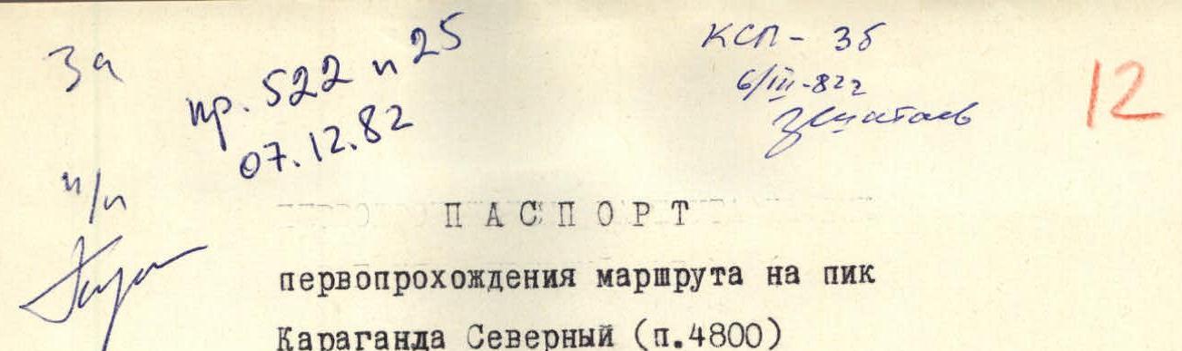
First ascent of the route to Peak Karaganda Northern (elevation 4800)
- Climbing category — technical
- Spur of the Guamysh ridge Alaysky district
- Peak Karaganda Northern, W. slope
- Estimated difficulty category — 3B
The route is snow-ice
- Height difference — 780 m, length of sections: 4th category — 100 m, 3rd category — 700 m, 2nd category — 380 m. Average steepness of the route — 40°
- Driven insurance hooks: Rock — 1, Ice — 7
- Number of travel hours — 6–7
- Participants: Evgeny Adolfovich Vinogradov — 1st sports category (leader) Viktor Nikolaevich Boboshin — 2nd sports category Igor Vladimirovich Benkin — 2nd sports category Vadim Georgievich Antipov — 2nd sports category Kerim Keshafovich Ashirov — 2nd sports category Alexander Yuryevich Sokolov — 2nd sports category Vladimir Nikolaevich Koshelev — 2nd sports category
- Team coach: Vladimir Samuilovich Benkin — Master of Sports, USSR
- Date of ascent — July 12, 1981
Table of characteristics of sections of the route to Peak Karaganda Northern (elevation 4800) on the W. slope 3B category of difficulty approximately (first ascent)
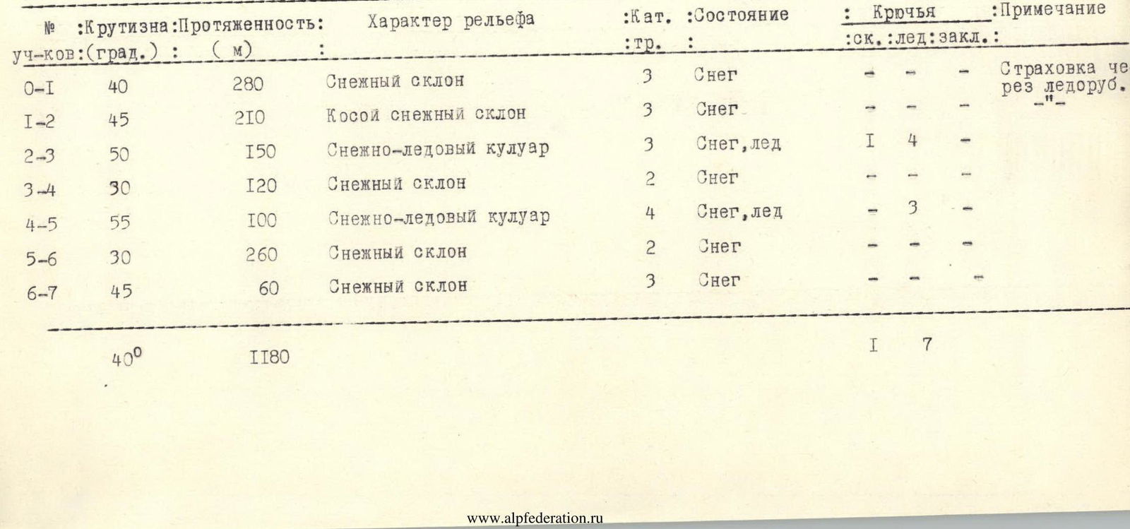
| Section № | Steepness (degrees) | Length (m) | Character of terrain | Cat. diff. | Condition | Hooks (rock/ice/cam) | Note |
|---|---|---|---|---|---|---|---|
| R0–R1 | 40° | 280 m | Snow slope | 3 | Snow | – / – / – | Insurance via ice axe. |
| R1–R2 | 45° | 210 m | Diagonal snow slope | 3 | Snow | – / – / – | – |
| R2–R3 | 50° | 150 m | Snow-ice couloir | 3 | Snow, ice | 1 / 4 / – | – |
| R3–R4 | 30° | 120 m | Snow slope | 2 | Snow | – / – / – | – |
| R4–R5 | 55° | 100 m | Snow-ice couloir | 4 | Snow, ice | – / 3 / – | – |
| R5–R6 | 30° | 260 m | Snow slope | 2 | Snow | – / – / – | – |
| R6–R7 | 45° | 60 m | Snow slope | 3 | Snow | – / – / – | – |
| Total | 40° | 1180 m | 1 / 7 / – |
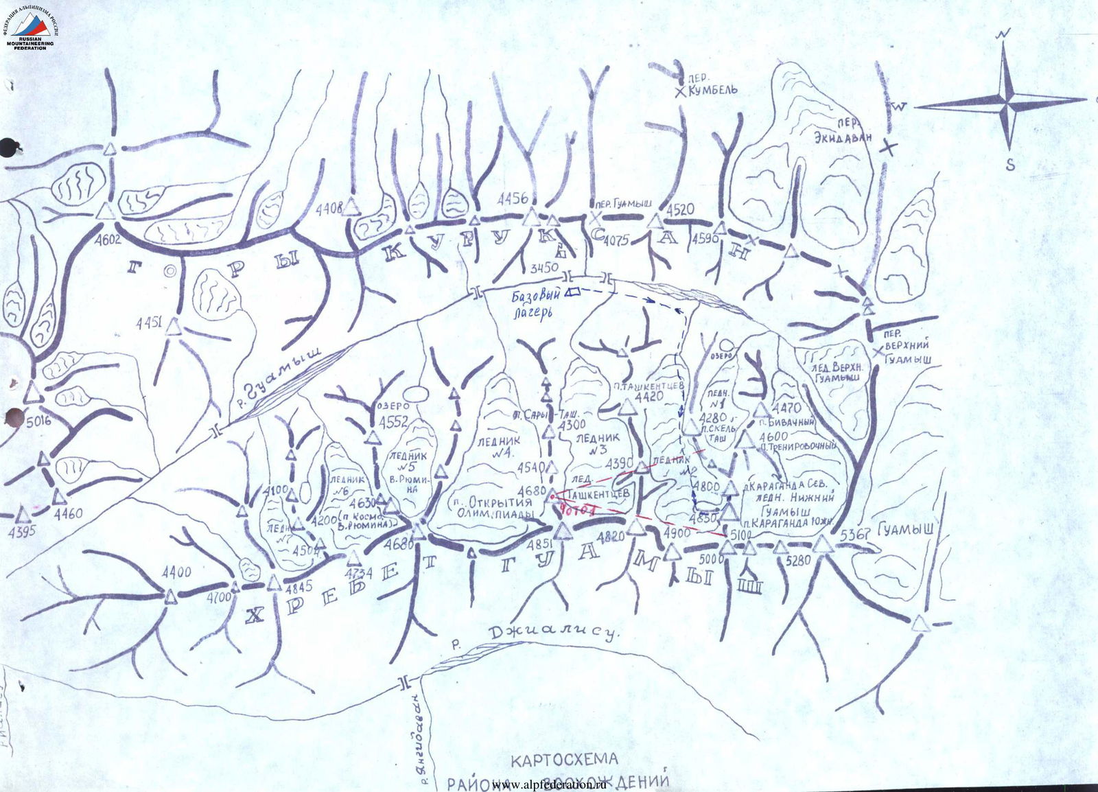
Map of Deniy area
Description of the ascent route to Peak Karaganda Northern on the W. slope (first ascent)
From the base camp in the Guamysh river gorge — to the cirque of glacier №2, in the direction of the end of the W. counterfort of p. Karaganda Northern — 1.5 hours. The counterfort separates large snow-ice slopes descending west from the peaks of Karaganda Northern and Southern. These slopes are impassable due to ice falls crossing them entirely. Only a narrow passage remains to the right of the counterfort. The route begins from glacier №2 by ascending a snow slope (280 m, 40°) to the lower rocky end of the counterfort (section R0). Movement in rope teams — there are closed crevices. Further, bypassing the counterfort to the right, ascent along an oblique snow slope (210 m, 45°, section R1–R2) to a snow-ice couloir. Through the couloir (150 m, 50°, section R2–R3) exit to a snow slope of medium steepness, along it (120 m, 30°, section R3–R4) approach the second snow-ice couloir (100 m, 55°, section R4–R5). Above the couloir, a snow slope (260 m, 30°, section R5–R6) leads to a snow platform near the upper end of the counterfort, which rises above the glacier by only 5–10 meters. There is a gap in the rocks of the counterfort. Through it, along a snow slope (60 m, 45°, section R6–R7) exit to the summit. The ascent takes 6–7 hours. Descent via the ascent route — 3 hours. Group leader: Yeryk Vinogradov A.