Ascent Passport
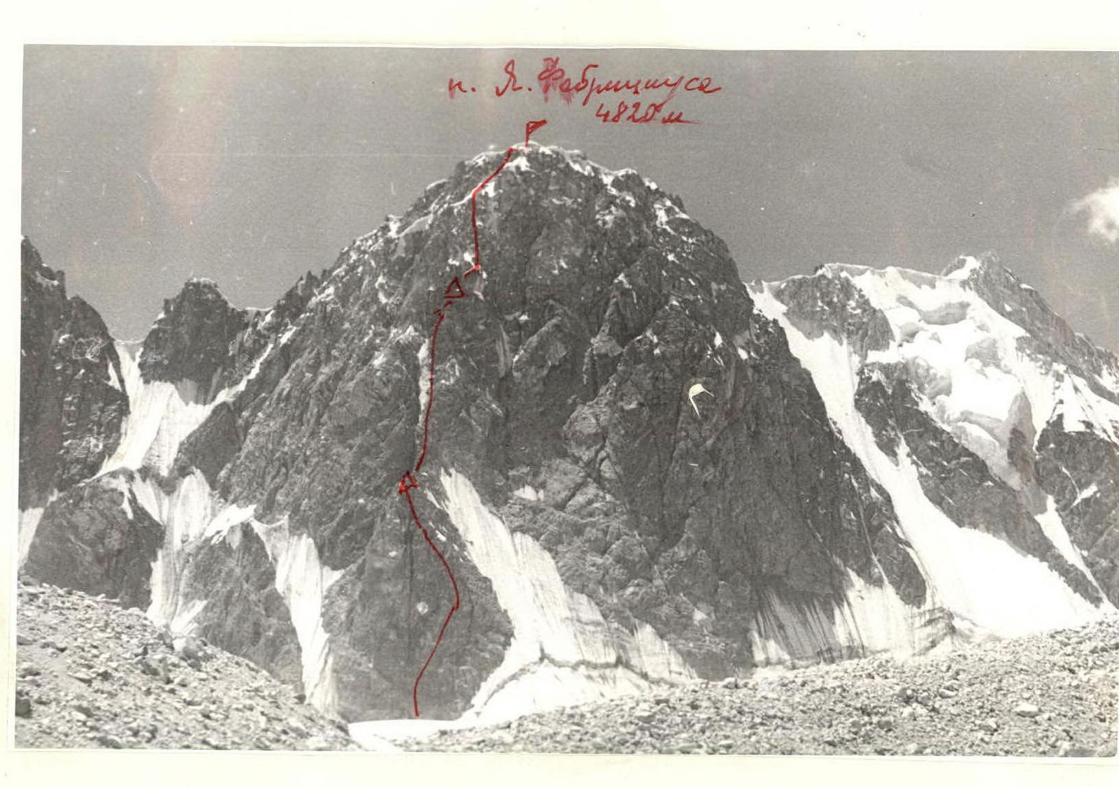
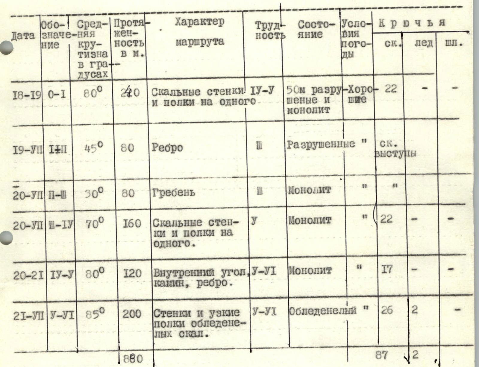
I. Ascent class - technical. 2. Ascent area: Pamir-Alai, Alai ridge, Alaudin glacier. 3. Peak, its height and ascent route: peak Jana Fabriciksa 4820 m, via the North face. 4. Proposed difficulty category - 5B. 5. Route characteristics: height difference - 650 m, average steepness - 75°, length of sections - 880 m (R1–R6: R1 - 240 m, R2 - 80 m, R3 - 80 m, R4 - 160 m, R5 - 120 m, R6 - 200 m). 6. Pitons driven: for belay: rock - 87, ice - 2, bolted - (dash); for creating TPU: rock - 4, ice - 1, bolted - (dash). 7. Number of climbing hours - 33. 8. Number of nights and their characteristics - three nights, good, snow available. 9. Surname, first name, patronymic of the leader and participants, their sports qualification: 1. Kokorevich Valerian Yanovich - Candidate Master of Sports 2. Reinik Gunar Aleksandrovich - Master of Sports 3. Migla Aldis Vilgelmovich - 1st sports category 4. Miller Karl Karlovich - 1st sports category 10. Team coach: Kokorevich Valerian Yanovich. II. Date of departure on the route and return: July 18, 1977 - July 22, 1977.
Route Table
Route Description
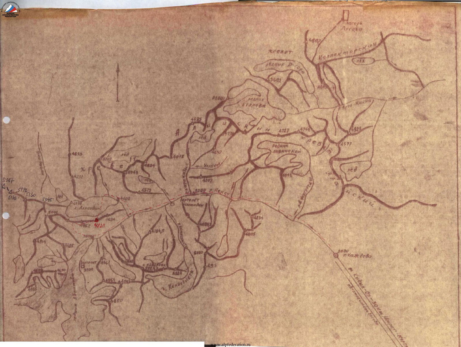
Approach from the end of the road near the mountain Kozhdeba along the trail, on the right (in the direction of travel) bank of the Koksu river to the tributary of the Alaudin river (7–8 hours).
There are bridges across all major tributaries of the Koksu river.
Along the Alaudin river, ascend to the tongue of the glacier and then along the right (in the direction of travel) lateral moraine rise opposite peak Ya. Fabriciksa and perpendicularly cross the Alaudin glacier.
On the moraine of debris from the northern slopes of the ridge, there is an overnight stop (2–3 hours).
The route begins in the center of the rhomboid bastion of the North face. Bypassing the bastion to the right along the ice falls and ice slope is dangerous! Abundant rockfall!
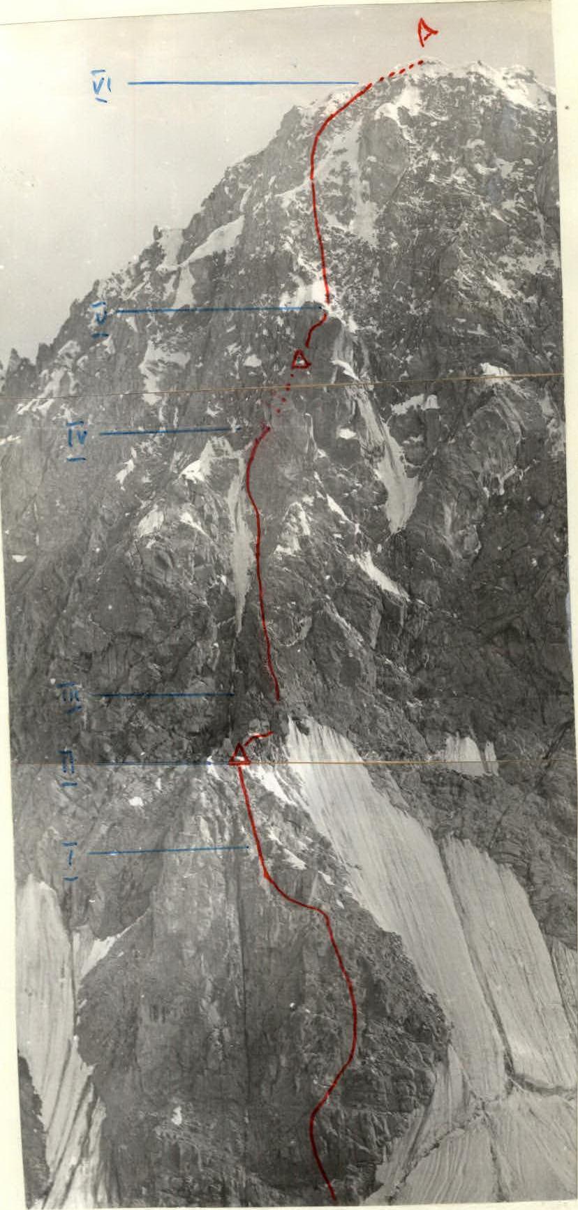
Cross the bergschrund and up the center of the rhomboid wall, then to the right along an oblique wide crevice to a ledge (2 ropes). Here is the first bivouac, possible overnight stop, but no water.
From the ledge, straight up the wall (2.5 ropes). A small ledge.
Traverse left along a vertical wall, which drops far down, and move up into a chimney. Up the chimney to a gentler wall, transitioning into the ridge of the rhomboid peak (5 ropes). Here is a good overnight stop, snow available for water.
Given the difficulty of the wall and the lack of overnight stops, it is recommended to process the wall the previous day (3–4 ropes).
From the overnight stop, along the ridge of the rhomboid to the foot of the second bastion of the North face. Straight up the wall, sticking closer to the left ice couloir.
Approach the sheer wall of the upper part of the bastion "chip". Overcome the wall along the couloir in its upper part and exit to the right into a narrow chimney, exiting onto the shoulder of the "chip" (7 ropes).
Here is a good overnight stop.
From the overnight stop, up to the left to the top of the "chip" (1 rope).
From the top of the "chip", up to the right along a steep ice slope with embedded rock blocks (3 ropes), exit onto a snowy ridge. The ridge leads up to the right again onto a steep rocky-ice slope and along it to the summit ridge between two snowy cornices (2.5 ropes).
Descent from the summit by traversing along the ridge to the West, bypassing peak 4862 along the southern ledges, ascend again to the ridge and along it to the large snowy-ice falls to the right. From here, descend to the South onto the Abramov glacier on the high black moraine and return to camp.