Ascent Passport
- Ascent class — technical
- Ascent area — southern spurs of the Alay ridge, Kok-Su valley.
- Peak, its height, ascent route — Ossonaly (M) peak, 4300 m, via the north-eastern wall.
- Difficulty category — 5B.
- Route characteristics: height difference — 770 m, length of sections with 5th diff. cat. — 400 m, 6th diff. cat. — 40 m, average steepness — 70°.
- Number of pitons hammered for belaying — 76 for ITO — 5
- Number of travel hours — 15.
- Team composition: Barchuk A.N. — CMS. Panteleev B.L. — CMS.
- Team coach — Barchuk A.N.
- Date of departure on the route — August 17, 1982, date of return — August 18, 1982
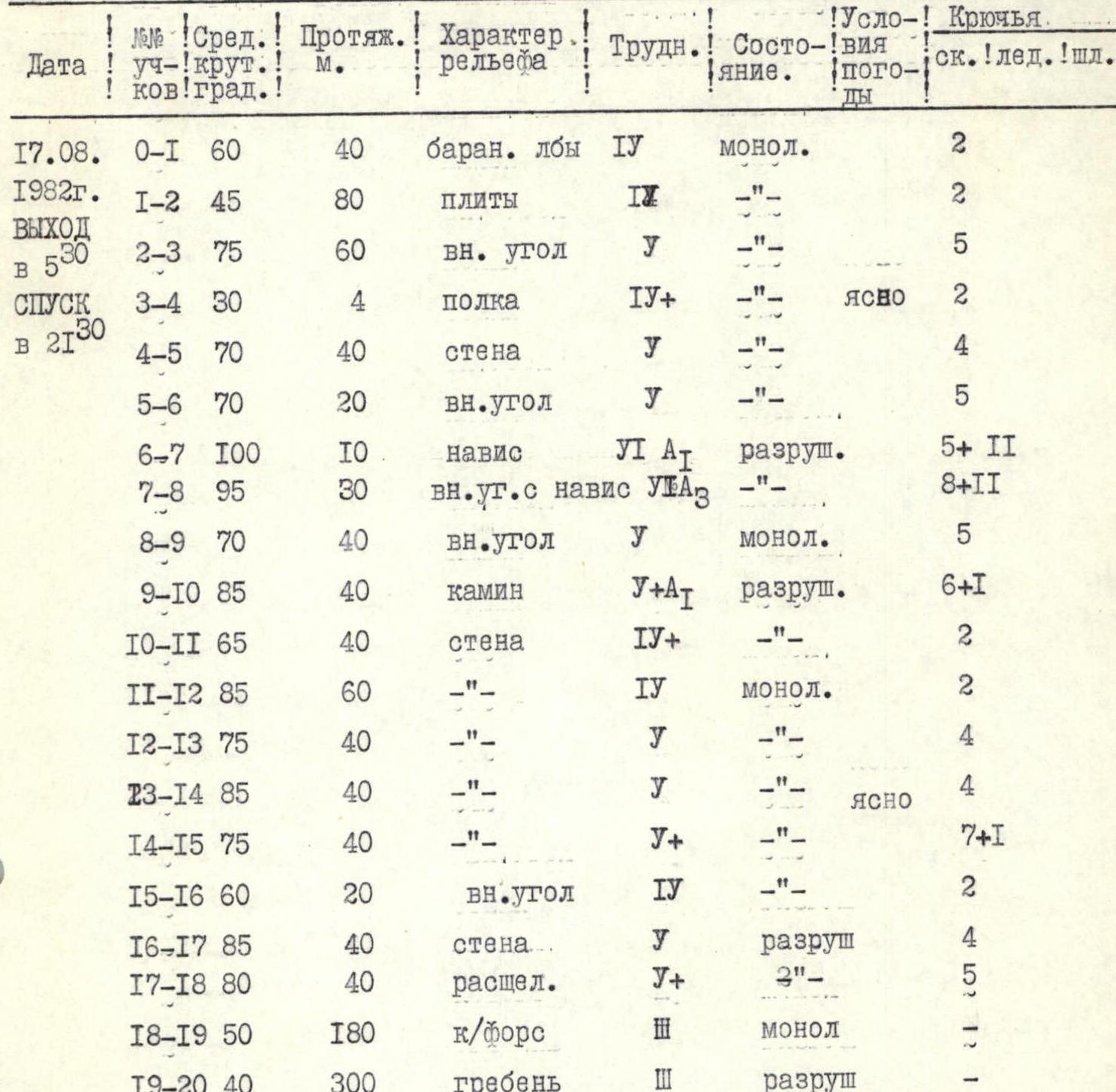
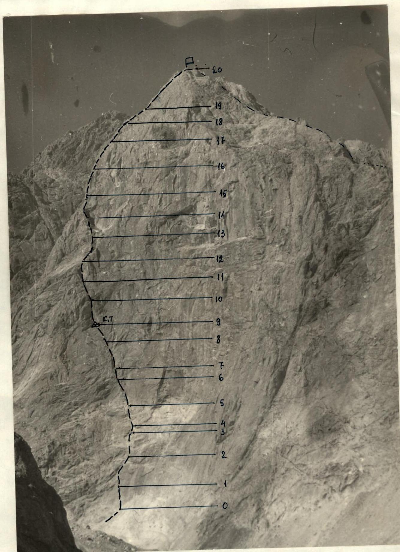 Table of main route characteristics
 Ossonaly (M) peak is located in the north-western corner of Ossonaly cirque. Approaches from "Alay" tourist center are made along the left (orographically) bank of Kok-Su river along the trail. Passing by the first geologists' base in Dzhugur-Tash tract, cross the bridge to the right bank and then proceed to the stream flowing out of Ossonaly cirque. The stream is crossed via a bridge, then along the left bank of the stream upwards in the direction of Ossonaly (M) peak's V. kf.
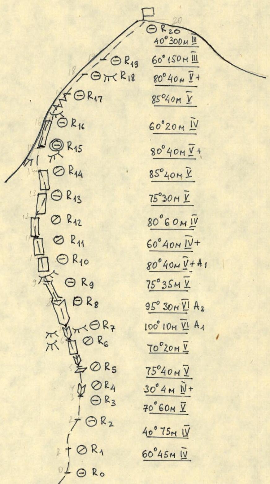
The route starts along steep "baranii lby" and slabs leading to the beginning of a 60 m internal corner going left upwards. Further, the route goes along the internal corner with an exit to a 4 m wide ledge (R2–R3, R3–R4). From the ledge straight up the wall for 40 m (R4–R5) under a 20 m internal corner (R5–R6). Left upwards along the internal corner under an overhang (R6–R7), which is passed with a ladder. Again, left upwards along the internal corner with overhangs, transitioning into a chimney (R9–R10) (very difficult) (ITO). Further along the wall of varying steepness for about 200 m to a 20 m external corner (R15–R16), ascent along which leads to a 40 m wall (ITO, very difficult). Along the wall to a crevice (R17–R18), leading to V. kf. for 180 m. Along the counterfort and 300 m along the ridge to Ossonaly (M) peak.
Descent along the destroyed rocks of Ossonaly (M) peak's N.–E. ridge towards Kok-Su valley.
UIAA Symbol Route Diagram