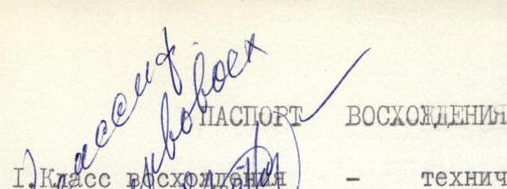
ASCENT PASSPORT.
- Ascent class — technical, 3B.
- Ascent area, ridge — Alaysky ridge, Kок-su tract area, cirque of Aydarbek glacier.
- Peak, its height, ascent route — p. 5027 (p. Commune), via the North ridge.
- Proposed category of difficulty — 4B.
- Route characteristics: height difference — combined, 1300 m. Length of sections with 5–6 difficulty category — 340 m. Average steepness 55°.
- Pitons driven: for belay, for artificial support points:
- rock — 20;
- ice — 11;
- bolt — none.
- Number of climbing hours — 14 hours.
- Number of bivouacs and their characteristics — none.
- Surname, name, patronymic of the leader, participants and their qualification:
- Prilepinа T.M. — leader, 2nd sports rank
- Boev Yu.N. — 1st sports rank
- Bubynin L.V. — 1st sports rank
- Korenyugin I.K. — 2nd sports rank
- Team coach — Zaev E.F.
- Date of departure on the route and return
- Departure — July 24, 1977, at 4:00
- Return — July 24, 1977, at 16:00
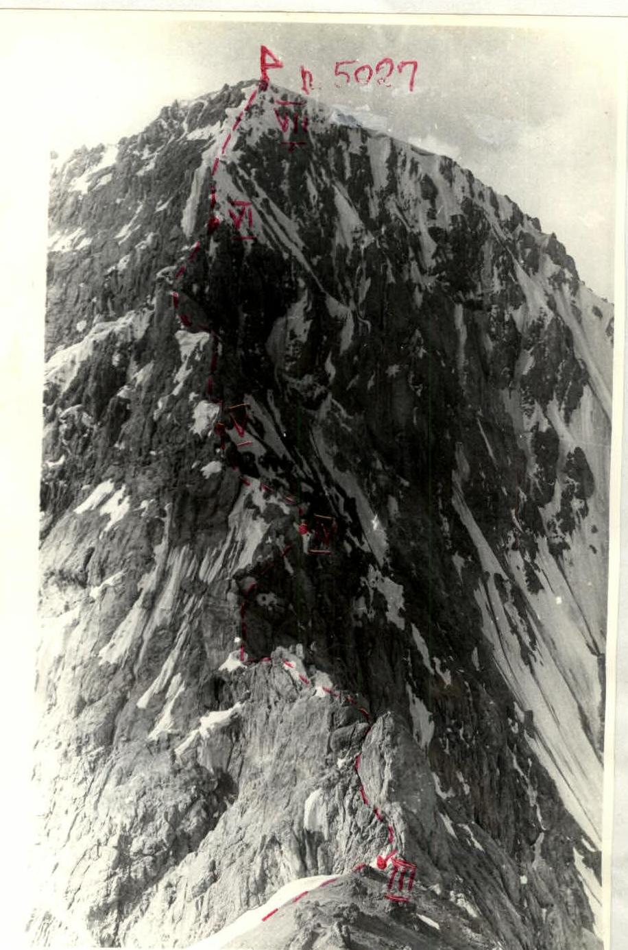
Photo of the North ridge of peak 5027 (view from the saddle between p. 5027 and p. 4784)

Map of the Kок-Su tract area
Brief description of the approach to the route.
The base camp is located in the Koksu gorge, at the confluence of the Koksu and Kemiodnikty rivers, on their right banks.
From the base camp:
- Go upstream along the Kemiodnikty river (15 minutes) to a stone bridge across it.
- Cross to the opposite bank.
- Ascend along the left bank of the stream flowing from the Aydarbek glacier.
The route begins at the tongue of the glacier flowing from the slopes of peaks 5027 and 4784.
From the base camp to the start of the route — 1.5 hours.
See the table below (Appendix 2).
Appendix 2.
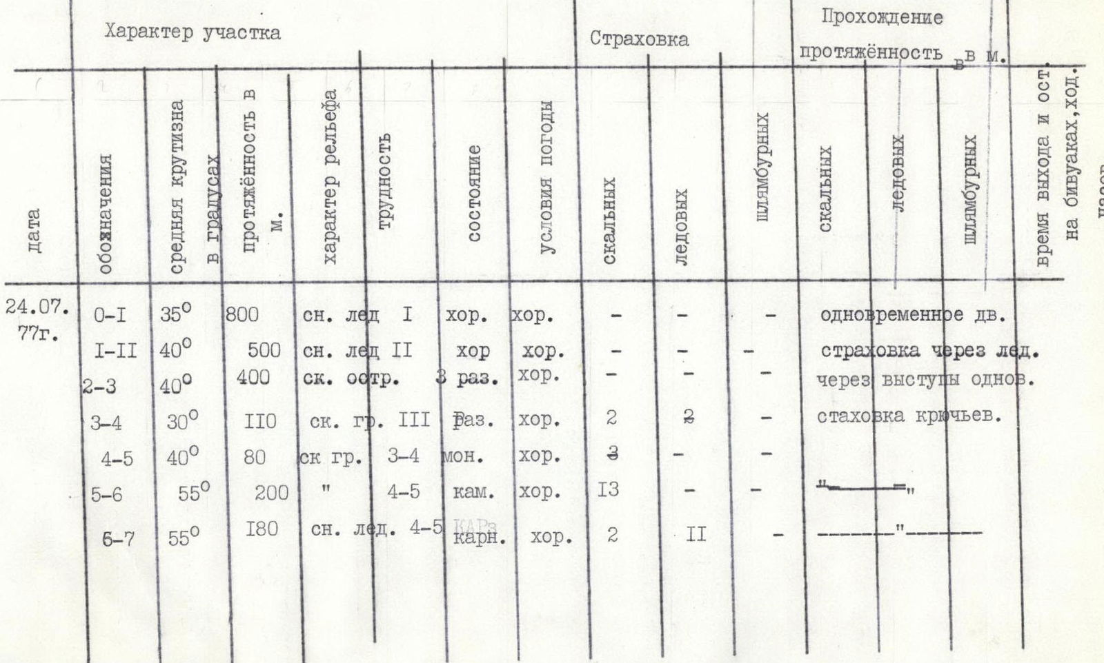
Brief explanation of the table (Appendix 2).
Section R0–R1. Presented by a snow-ice slope. Initially, it goes through snow, then traverses up to the right, exiting onto ice with a steepness of 30–35°. One can walk in crampons. The ice continues for 60–70 m, and a snow slope begins. Early in the morning, the snow is dense and it is easy to walk in crampons. Initially, follow the center of the snow-ice couloir, and closer to the bergschrund, move towards the right part of it — towards the slopes of peak 4784 (p. Molodoy Kommunar). The movement throughout the section is simultaneous.
Section R1–R2. The bergschrund is overcome on the right side near the slopes of p. 4784, either via an ice gully (4 m wall) or via rocks. Beyond the bergschrund, the ascent path runs along the slopes of p. 4784. The couloir is exposed to sunlight at 7:30, at which time rocks start falling, and one should move onto the rocks. Movement on this section is simultaneous, with alternating movement on steep sections and when crossing gullies.
Section R2–R3. The ascent occurs on rocks with scree shelves; be cautious and avoid being under each other. Rocks do not fall spontaneously. Movement is mostly simultaneous.
Section R3–R4. The section involves bypassing gendarmes located on the ridge. The first gendarme can be bypassed on either the right or the left. Be cautious of "live rocks".
Section R4–R5. Movement is mainly along the ridge with monolithic rocks. It is better to traverse this section in galoshes; in crampons, the speed and reliability significantly decrease. At the end of the section, on the "shoulder", there is a control cairn.
Section R5–R6. This section is one of the key points of the route. It features three steep ascents with an average steepness of 70° and a length of 30–40 m each. Traverse in galoshes with piton belays. The walls have "live rocks".
Section R6–R7. Movement is in crampons on the front teeth. Belays can be organized using ice screws as well as rock screws, as small rocky outcrops are encountered along the ascent. Be cautious of cornices on the left. The snow-ice ridge ends with a small, narrow rocky crest (15 m), on which a control cairn is located.
The descent is made via scree to the south towards p. 4890 to a saddle, then again via scree to the southeast, onto the Aydarbek Glacier, and further, following the stream flowing from the glacier, back to the base camp. The descent takes 3–4 hours. The entrance to the route should be no later than 4:00 am.
The group assesses the complexity of the route as 4B category of difficulty. The group, being the first ascenders, proposes to name the peak "pik Commune".
Fig. Primenka