Ascent Record
I. Ascent Class: Technical
-
Ascent Area: Pamiro-Alay, Alaysky Ridge
-
Peak, its height — Shait 4916 m. Ascent route via North-East wall: (following Mogilevtsev's path), official route.
-
Expected difficulty category: 5B category difficulty.
-
Route characteristics: Height difference 850 m. Average steepness 67 degrees. Length of sections: 1 – 80 m, 3 – 250 m, 4 – 365 m, 5 – 320 m, 6 – 85 m.
-
Pitons driven:
- For belaying:
- rock – 58
- ice – –
- chocks – 43
- For creating R.P.E. – 2
- For belaying:
-
Number of climbing hours: 14 hours
-
Number of nights and their characteristics: no nights
-
Surname, name, patronymic of the leader and participants, their sports qualification:
- Shumikhin Gennadiy Ivanovich K7 CMS
- Svitov Anatoliy Mikhaylovich CMS
-
Team coach: Yakovlev Vitaliy Dmitriyevich, senior instructor, Master of Sports of the USSR
II. Date of departure and return:
1979
- July 15, 3:00 AM — departure
- July 15, 5:45 PM — return
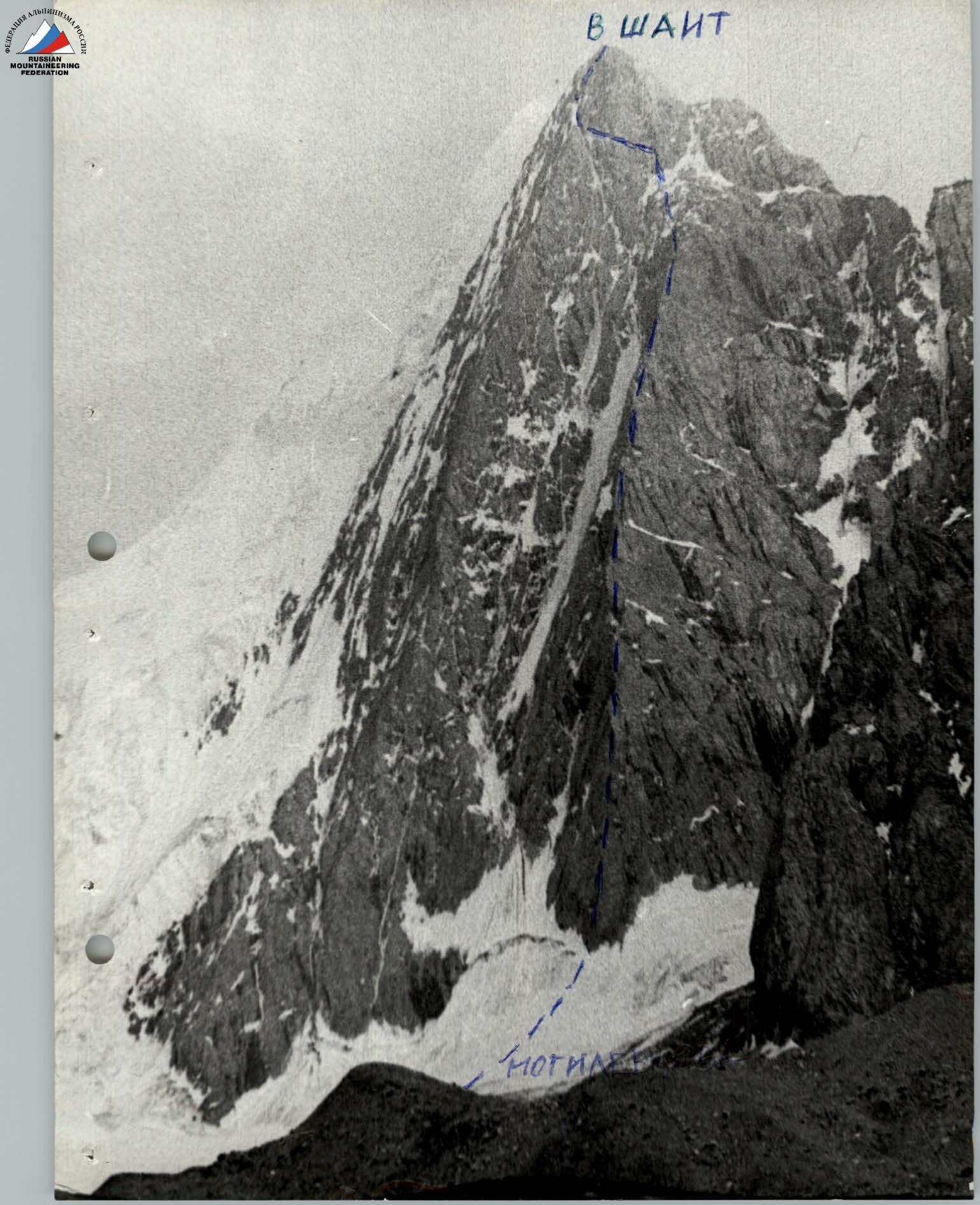
Table of main route characteristics
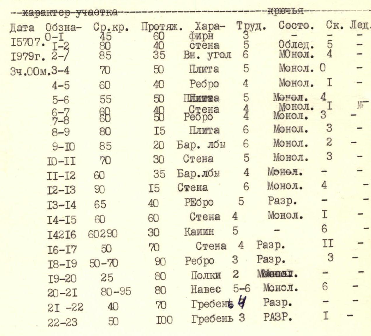
2:25 PM July 15, 1979
Brief explanation of the table
R0–R1 Firn with ice, bergschrund №, 1.5 m.
R1–R2 Icy rocks, partially destroyed, good cracks.
2–3 Exit to the rib plates, chocks are well used.
3–4 Plates with small shelves.
4–5 Rib, mostly monolithic with wide cracks.
5–13 Rib, mostly monolithic, partially difficult climbing over 4–8 m length. Clearly visible from section 4–5.
13–14 Gullies on the wall like a gully, at the top overhanging, difficult section.
16–17 Wall with chimney.
20–21 Chocks-stoppers are well used, wide cracks. Monolithic.
21–22 Simple rocks, stones! Careful climbing.
22–23 Exit to the pre-summit ridge, exfoliating plates. Careful climbing.