Peak "Uzbekistan", 5100 m, category 5B via North wall, V. Rassokha, 76.
Route type: combined.
Route elevation gain: 900 m (by altimeter);
route length — 1270 m;
length of category V sections — 60 m;
category VI sections — 20 m;
average steepness:
main part of the route — 70–75°
entire route — 55–60°
Pitons left on the route: 0.
Pitons used on the route:
removable bolted pitons — 0 pcs. (incl. artificial anchors — 0 pcs.)
Total artificial anchors (artificial points of protection) used — 0.
Team's travel time: 28 hours, 3 days.
Team leader: Elena Nikolaevna Shirina, 1st sports category.
Team members:
Evgeny Mikhailovich Lebasov, 2nd sports category
Alexey Vladimirovich Shebeko, 2nd sports category
Coach: Valery Grigoryevich Plotnikov, Master of Sports.
Departure to the route: 7:00 AM; August 23, 2004.
Summit reached: 1:30 PM; August 24, 2004.
Return to Base Camp: 10:10 PM; August 25, 2004.
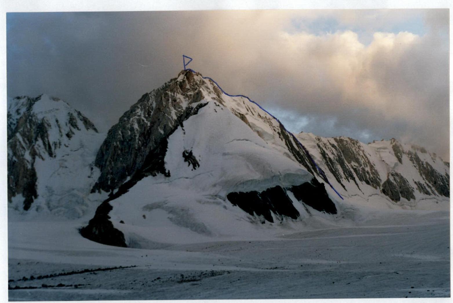
Peak Uzbekistan. Category 5B route via North wall, V. Rassokha, 76. General photo of the summit. Taken by the group on August 23, 2004, from Dugoba glacier.
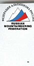
Technical photograph of the route. Δ—overnight stay location.
Photo of the team on the summit. Photographic illustrations of category V–VI sections are missing due to mechanical camera malfunction in low temperatures.

 Peak Uzbekistan. Category 5B route via North wall, V. Rassokha, 76. General photo of the summit. Taken by the group on August 23, 2004, from Dugoba glacier.
 Technical photograph of the route. Δ—overnight stay location.
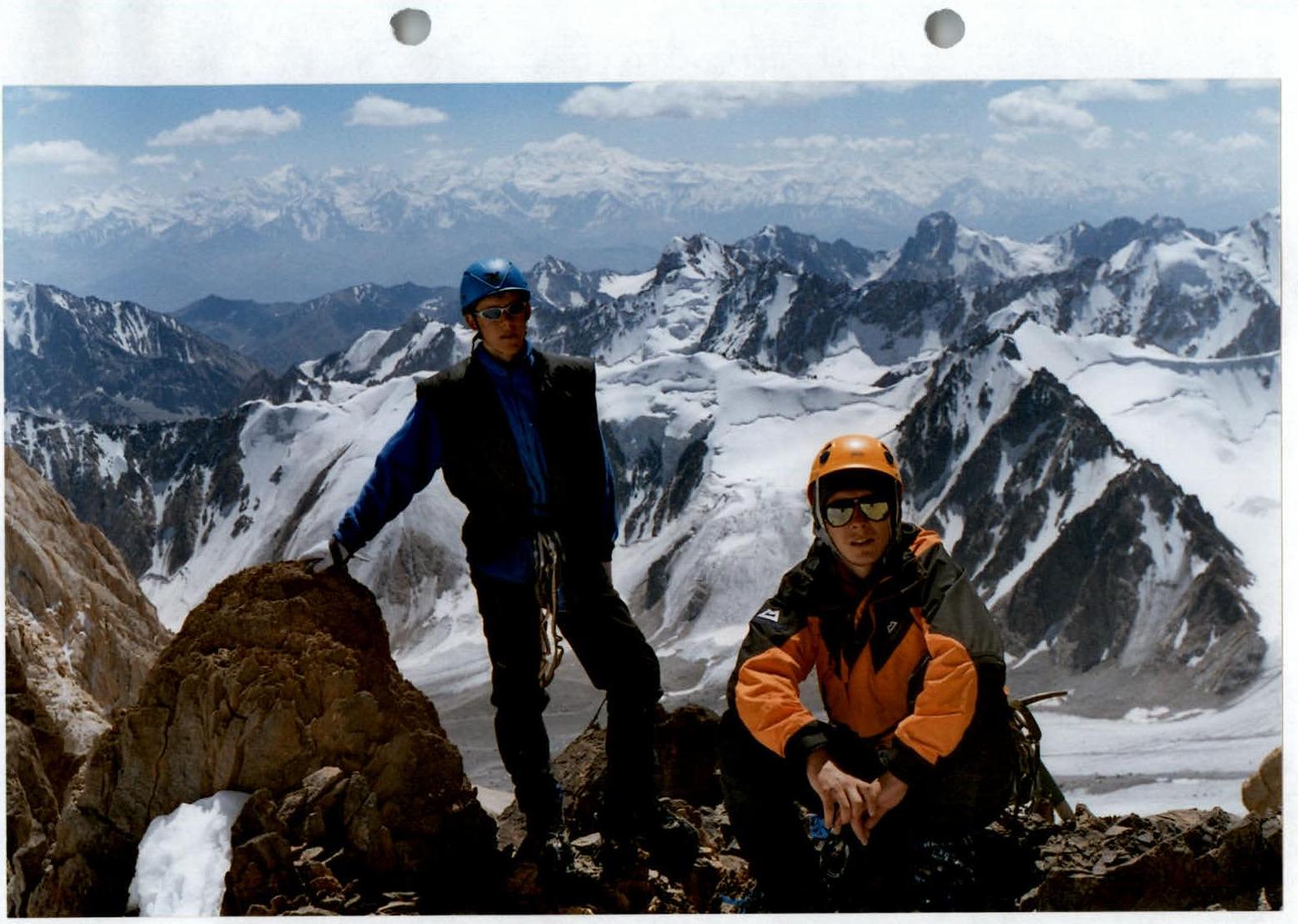 Photo of the team on the summit. Photographic illustrations of category V–VI sections are missing due to mechanical camera malfunction in low temperatures.
Comments
Sign in to leave a comment