Ascent Passport
-
Ascent class — rock climbing
-
Ascent area, ridge — Pamir-Alai, spurs of the Kollektor Ridge
-
Peak, its height, ascent route — p. "Novichok" 4000 m, NE ridge
-
Proposed difficulty category — 2A category
-
Route characteristics: height difference, length of sections with 5–6 difficulty categories, average steepness
-
Number of pitons hammered for belaying — 8 rock pitons
-
Number of walking hours — 7 hours
-
Number of overnight stays and their characteristics —
-
Surname, name, patronymic of the leader, participants, and their qualification
Ivanov E. V. — 1st sports category, Peshcherikova N. F. — CMS
-
Team coach — Gromov L. V.
-
Date of departure and return — June 25, 1983, June 25, 1983
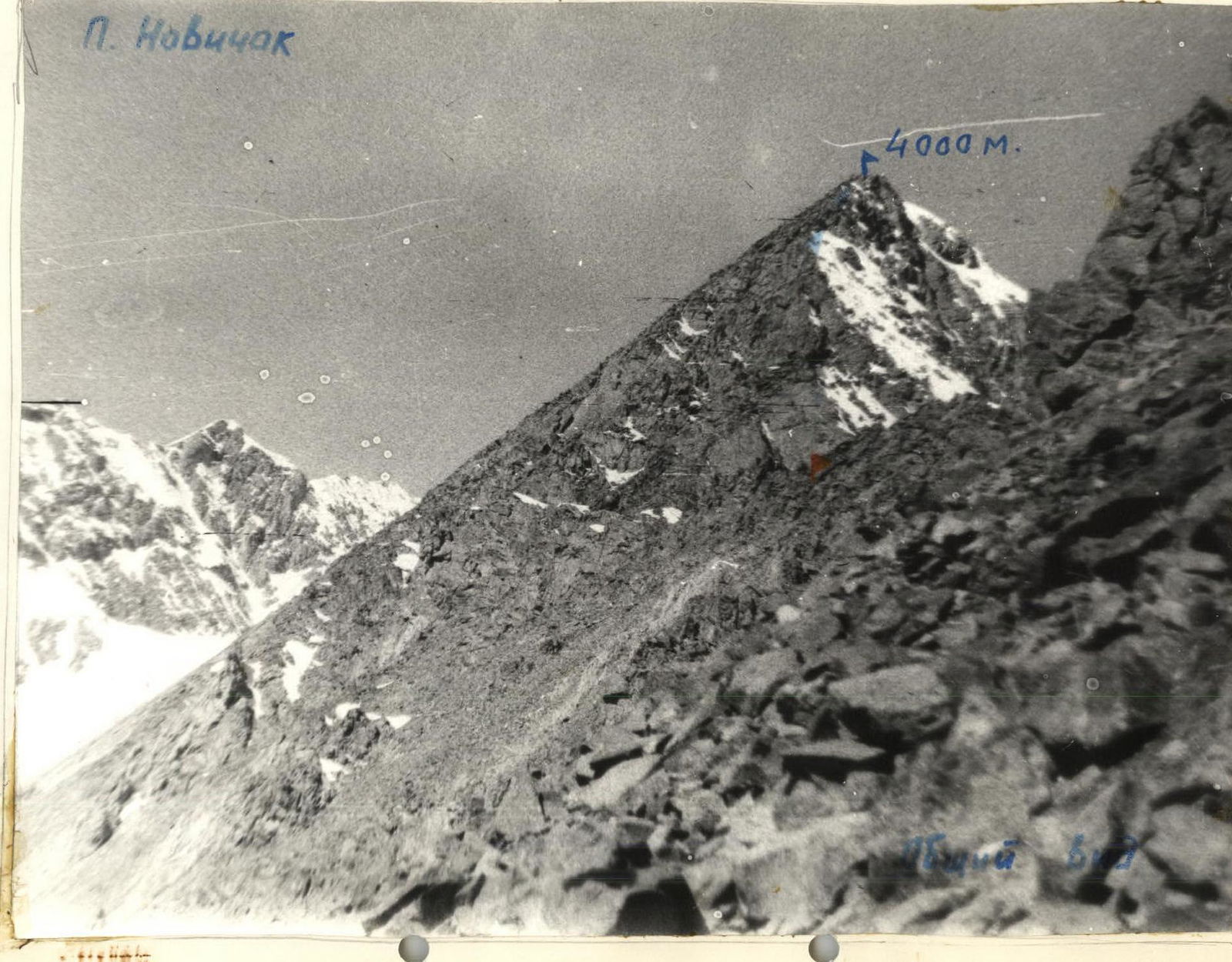
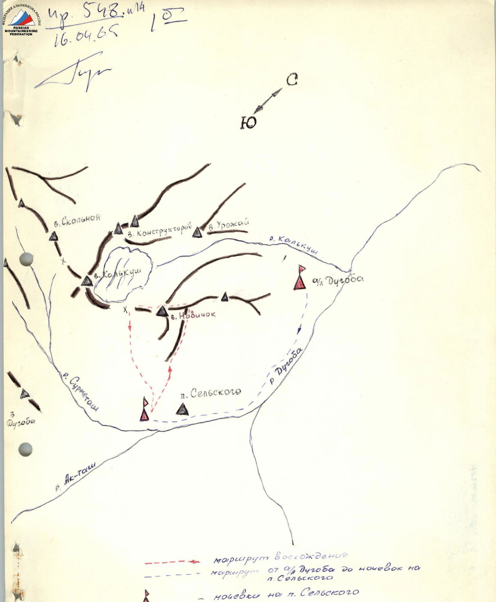
Table of main characteristics of the ascent route
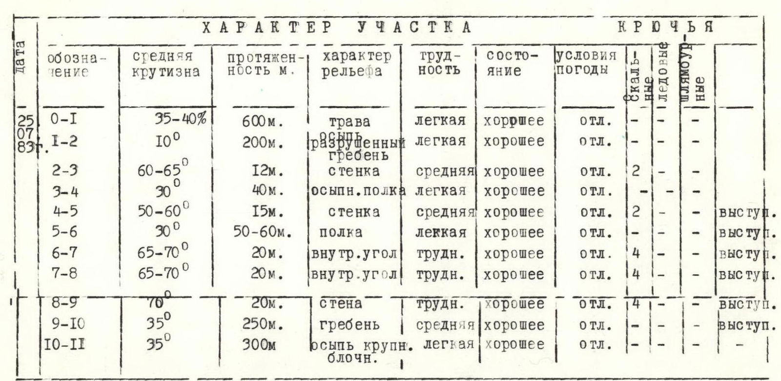
| Designation | Average steepness | Length, m | Relief characteristics | Difficulty | Condition | Weather conditions | Rock pitons | Ice pitons | Bolt pitons | Notes |
|---|---|---|---|---|---|---|---|---|---|---|
| R0–R1 | 35–40% | 600 m | grass | easy | good | excellent | ||||
| R1–R2 | 10° | 200 m | destroyed ridge | easy | good | excellent | ||||
| R2–R3 | 60–65° | 12 m | wall | moderate | good | excellent | 2 | |||
| R3–R4 | 30° | 40 m | scree shelf | easy | good | excellent | ||||
| R4–R5 | 50–60° | 15 m | wall | moderate | good | excellent | 2 | ledge | ||
| R5–R6 | 30° | 50–60 m | shelf | easy | good | excellent | ledge | |||
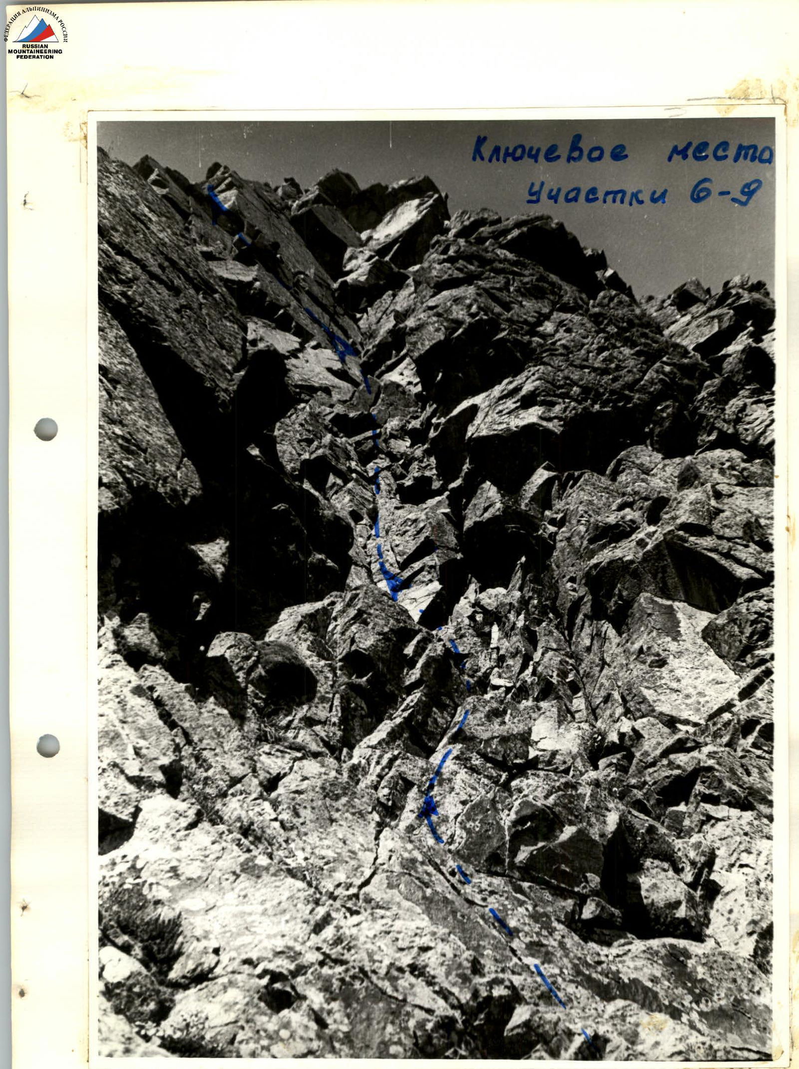
| R6–R7 | 65–70° | 20 m | inner corner | difficult | good | excellent | 4 | ledge | ||
| R7–R8 | 65–70° | 20 m | inner corner | difficult | good | excellent | 4 | ledge | ||
| R8–R9 | 70° | 20 m | wall | difficult | good | excellent | 4 | ledge | ||
| R9–R10 | 35° | 250 m | ridge | moderate | good | excellent | ledge | |||
| R10–R11 | 35° | 300 m | large block scree | easy | good | excellent |
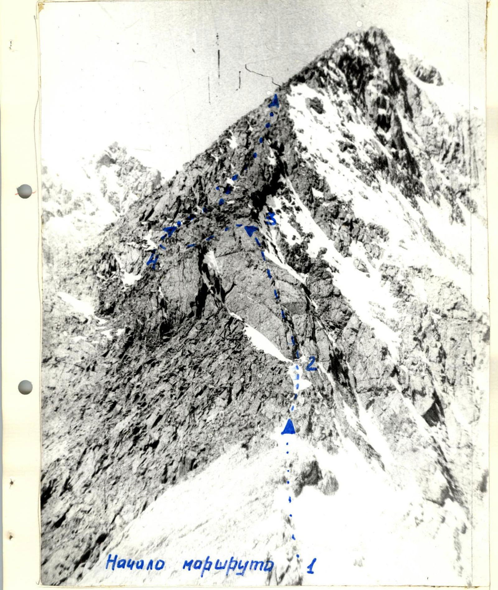
Brief description of the route
From the overnight stay at p. Sel'skogo, ascend to the col. Then move straight up, bypassing the training rocks on the right, with an exit to a grassy slope turning into scree — 2 hours (R0–R1). Then — left along the destroyed ridge to the start of the route on the scree isthmus — 30 minutes (R1–R2).
The start of the route — up the rock wall 12 m in the center, R2–R3. Piton belay.
Then along the inclined scree shelf R3–R4 to the left of the ridge under the wall 15 m, R4–R5. Piton belay and through ledges.
Bypass on the left a gendarme in the ridge R5–R6 and approach the inner corner — the key location.
Up the inner corner straight up, piton belay. After 20 m — a reception point R6–R7.
Another 20 m (R8–R9), piton belay and through ledges.
Move to the summit straight along the ridge R9–R10 — simultaneous and alternate belay, many ledges.
Time — 3 hours.
Descent from the summit — to the Kalkush pass along large block scree R10–R11 — 15 minutes.
Recommendation: use a shortened rope.