MOSCOW CITY ALPINISM CHAMPIONSHIP 2013 TECHNICAL ASCENT CLASS
Report
ON ASCENDING THE SUMMIT OF p. Konstruktors via 5B cat. diff. route (right part of the South face, variation)
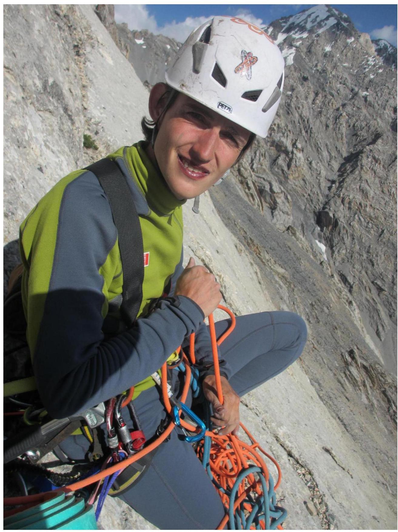
The route was climbed by the MPEI team on June 26-27, 2013 (duo: Romanov Alexey, Dorfman Roman)
Moscow, 2013
Ascent Passport
- Ascent area: Pamiro-Alai, Altai ridge, Gadzhir gorge.
- Ascent route: p. Konstruktors, right part of the South face (variation of L. Krasnukhin's route)
- Route characteristics: rock
- Difficulty category: 5B
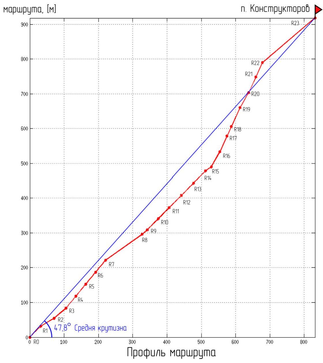
- Length: 1260 m
- Height difference: 918 m
- Average slope: 47.8°
- Length of V and VI cat. diff. sections: 630 m
- Used (IT) / left points on the route: wired elements: 94/0/0; anchor hooks: 15/0/0
- Team's travel days and hours: 16 h 40 min
- Number of bivouacs: one
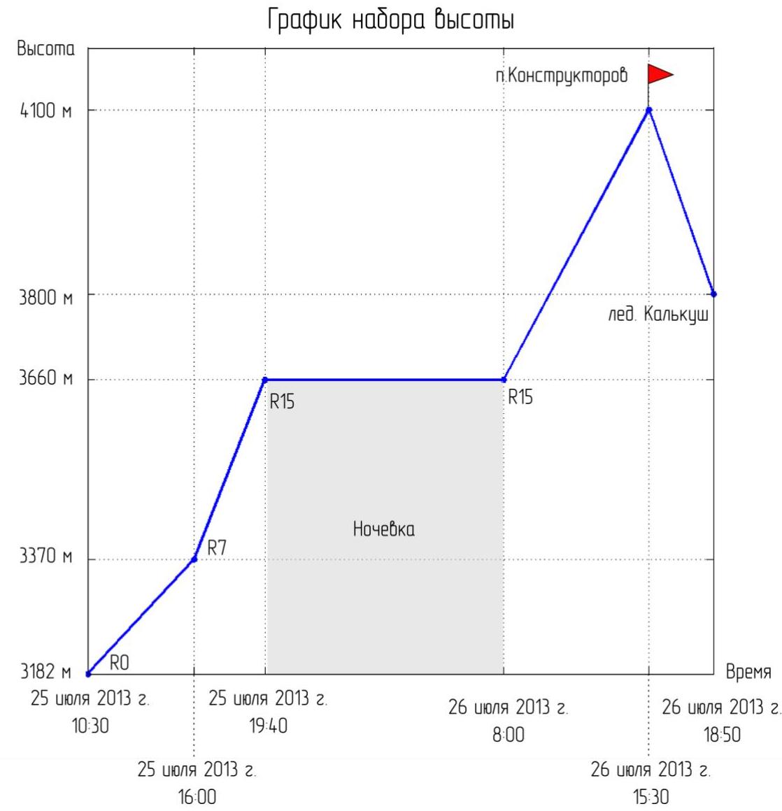
- Start of ascent: July 25, 2013, 10:30
- Summit reach: July 26, 2013, 15:30
- Descent from the summit: July 26, 2013, 18:50
- Group composition:
Romanov Alexey, 1st sports category; Dorfman Roman, 2nd sports category
- Coaches: Kutkin S.A., Dorfman L.V.
- Organization: MPEI Climbing and Mountaineering Club
Photo of the ascent object
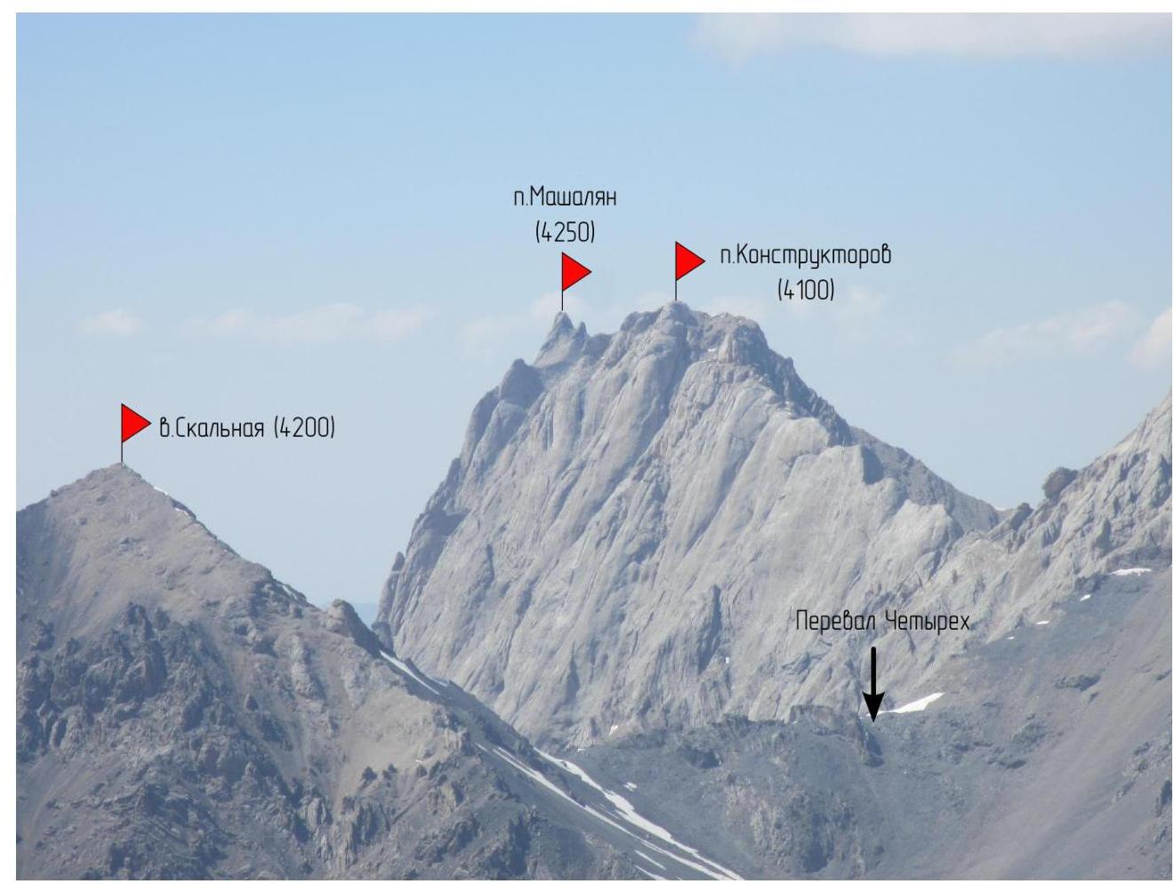
Photograph of p. Konstruktors and neighboring peaks from v. Mekhnat
Overview of the area
1. Brief geographical description of the area
The Dugoba area is located in one of the most picturesque places in the south of the Fergana valley, on the territory of Kyrgyzstan. The core of the area is the Alai ridge. Relatively convenient approaches, diverse terrain, favorable climate, absence of avalanche danger in the summer, good weather, rich flora and fauna, and a variety of peaks with various classified mountaineering routes have made the Dugoba area popular among enthusiasts of active recreation and athletes. The average height of peaks in the area ranges from 3800 to 5200 m above sea level. Routes of various difficulties have been laid out in the area:
- 1B cat. diff.
- 6A cat. diff.
1.1. Object of ascent
Peak Konstruktors is located quite far from the Dugoba tourist center, in the Gadzhir gorge. To approach the technically challenging south face, one needs to cross the Chetirekh pass and descend about 1 km in height, approaching its south face. Only three routes have been laid out on this face, all with 5B cat. diff.
The south face of Peak Konstruktors has firmly established itself as having some of the most challenging rock climbing routes in the Dugoba tourist center area. The remoteness and technical difficulty of the routes have led to the face being visited extremely rarely.
Known ascents:
- The previous known ascent via the south face was made by Ivan Temerev's team in August 2012.
- There is no information on other ascents made in the 21st century.
Descent and safety features:
- The significant length of the face and the limited number of good cracks for belays complicate the descent from the face, especially in its upper part.
- Essentially, the only straightforward descent is via the summit.
- Remoteness and lack of radio communication with the camp add to the difficulties in organizing rescue operations.
All these factors place a special responsibility on climbers for their actions, especially when ascending in a duo.
Krasnukhin's route is quite logical, except for a section that traverses an oblique talus shelf and proceeds on foot. The team found a well-visible inner corner slightly below the shelf, which they used for their ascent. As a result:
- The route was straightened.
- Five ropes of interesting climbing of V cat. diff. were added.
1.2 Climbing conditions
The weather in the Dugoba tourist center area is considered one of the most stable among Kyrgyzstan's mountain regions. However, 2013 was marked by an anomalously rainy summer. Continuous rains fell throughout June and early July, which is not typical for this area. By the time of the ascent, the weather had stabilized: the sun was shining, with small clouds in the sky. The south face of p. Konstruktors is well-lit by the sun and dries quickly, allowing the team to successfully climb the entire face without using IT.
However, during the bad weather, a certain amount of ice and snow accumulated in the upper part of the face, resulting in:
- Streams running through numerous gullies from the summit to the base of the face.
- Water in potential bivouac sites on the face (in drier seasons, there is no water on the face).
- Complicated passage through gullies and chimneys.
Additional difficulties were created by thawing ice chunks in the upper part of the face, which could cause significant injuries as they accelerated down the smooth slabs. This required careful selection of protected locations for setting up stations. According to descriptions and consultations received by the group, in drier years, the problem of rock and ice fall on the face is absent.
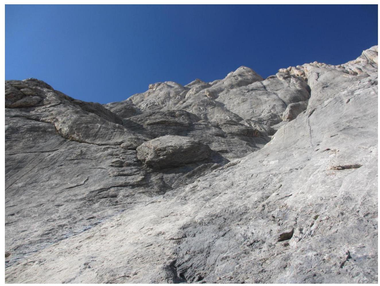
The south face of Peak Konstruktors is primarily composed of limestone slabs, very similar in structure to those in Crimea. The face lacks macro-relief, with mostly small and passive holds, relying heavily on friction. Cracks are infrequent and mostly blind, making belay organization challenging.
For the ascent, it is recommended to have:
- Anchor hooks,
- Small-sized cams,
- Wired elements.
On the team's route, in the upper part, there is a chimney where climbing is possible on monolithic rocks. However, over long sections of the monolith, there are no cracks, necessitating belay organization in the destroyed, icy crevices of the right chimney wall. Small and medium-sized hexcentrics are most suitable for this.
In case of unforeseen circumstances, considering the complexity of belay organization on the face, it is recommended to have a few bolt hanger hooks.
Shortly before the ascent, some of the team's equipment was stolen by a local resident. During the approach to the route, after lengthy negotiations, most of the stolen gear was recovered. Without having extra time to descend to the camp, the team decided to carry all their equipment with them. As a result, the group carried an additional 10 kg of unnecessary gear on the route.
1.3 Approach and descent routes
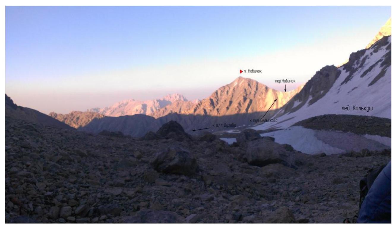
The approach to the route from the Dugoba tourist center goes through a bivouac on the Sel'skogo hill. Then, one needs to proceed under the south face of peak Kalkush to the col of the Chetirekh pass. Descending from the pass along a small talus leads to the base of the south face of p. Konstruktors. There are bivouac sites under the face. According to many descriptions, there is water at these sites, but during the group's ascent, all streams had gone underground. This possibility should be considered when planning a late arrival at the bivouac.
Depending on the group's preparation, the approach can take from 6 to 10 hours.
The classic descent from the routes on the south face is towards the Kalkush glacier via a 3B cat. diff. route, which includes:
- Two 50 m rappels,
- Descent on foot along the talus to the moraine of the Kalkush glacier.
At the time of the group's passage, renewed rappel rings were present on the descent route.
From the moraine of the Kalkush glacier, one can descend along the trail going down the Kalkush gorge towards the Dugoba tourist center, or, by crossing the Novice pass, reach the bivouac sites on the Sel'skogo hill.
When choosing the further descent route, consider:
- The trail along the Kalkush gorge is significantly less popular than the trail leading to the Sel'skogo hill.
- Orientation and finding the trail in the Kalkush gorge in the dark can be extremely challenging.
From the team's route, an emergency descent is possible from point R8 to point R3 via Krasnukhin's original route, which goes along an oblique talus shelf and simple rocks. Descent from the route via the ascent path above R18 is extremely difficult and would likely require the use of bolt hanger hooks or leaving a significant amount of equipment.
Map-scheme of the ascent area
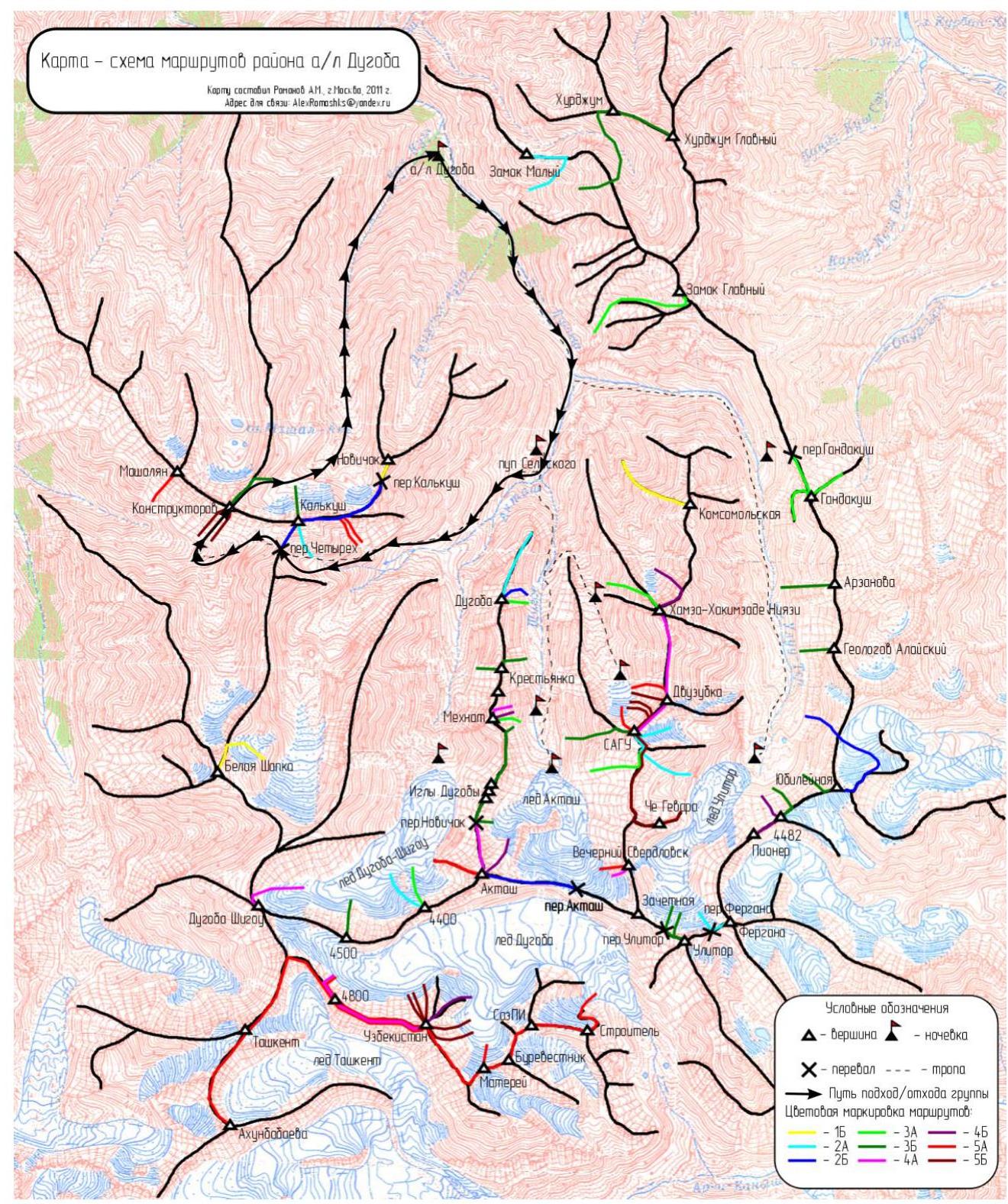
The team's path on the approach and descent is indicated by black arrows.
Route profile
Elevation gain from the start of the route, [m]
Ascent schedule
- Start of ascent: July 25, 2013, at 10:30
- Reach the ridge above the inner corner: July 25, 2013, 16:00
- Set up bivouac: July 25, 2013, 19:40
- Leave bivouac: July 26, 2013, 8:00
- Reach the summit: July 26, 2013, 15:30
Weather conditions during the ascent were favorable:
- Daytime: t +15 °C
- Nighttime: −2 °C
- Weather: sunny, partly cloudy
- Wind: with gusts
Technical photographs
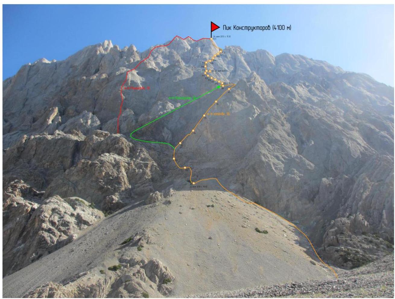
Photo from under the start of the route, indicating the thread of Krasnukhin's route and the team's variation.
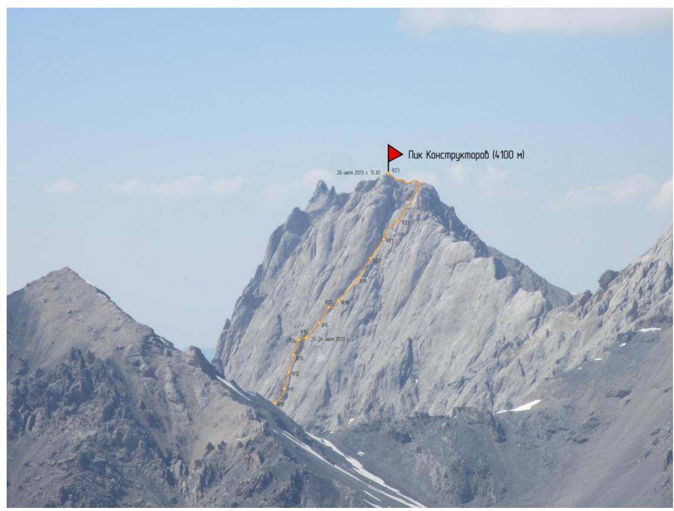
Photo of the gutting part of the route with the summit of Mekhnat

Photo of the upper part of the route from the summit of Mekhnat
July 26, 2013, 8:00
Route description by sections
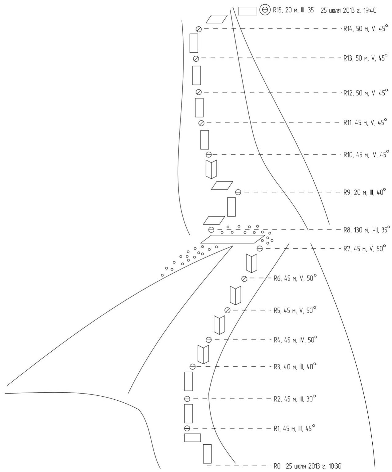
R0–R1 45 m III, 45°. Start the route from a bush. Go straight up, then traverse left, following the easiest path. Station on a shelf. Rocks are monolithic, with places for belays.
R1–R2 45 m III, 30°. Climb straight up through destroyed rocks towards a well-visible inner corner, which diagonally traverses the entire lower bastion of the face from left to right.
R2–R3 45 m III, 40°. Climb straight up, entering the inner corner. Rocks are initially destroyed, then monolithic. Station on the left wall of the corner.
R3–R4 45 m IV, 50°. Climb straight up through the inner corner. Rocks are monolithic, with places for belays. Station in the inner corner.
R4–R5 45 m V, 50°. Climb straight up through the inner corner. Rocks are monolithic, with places for belays. Station in the inner corner.
R5–R6 45 m V, 50°. Climb straight up through the inner corner. Rocks are monolithic, with places for belays. Station in the inner corner.
R6–R7 45 m V, 50°. Climb straight up through the inner corner. Rocks are monolithic, with places for belays. Station on a rock lip before the start of the talus shelf.
R7–R8 130 m I–II, 35°. Reach the shelf and simultaneously move right-up into the base of a mulde. A bivouac is possible here, and if necessary, a descent to the left along the talus shelf to R3 is possible via Krasnukhin's original route. At the time of the team's ascent, there was water at the potential bivouac site.
R8–R9 20 m III, 40°. Traverse right along smoothed slabs. Rocks are monolithic; belaying is challenging. Station in a crevice between two slabs.
R9–R10 45 m IV, 45°. Move left 10 m, then up into the base of an inner corner. Climb up through the inner corner until exiting it. Rocks are monolithic; there's a crevice in the inner corner suitable for medium-sized cams. Station after exiting the inner corner.
R10–R11 45 m V, 45°. Climb up along slabs towards a rock ridge. Rocks are monolithic; crevices are scarce. Belaying is challenging. Anchor hooks, cams, and small-sized hexcentrics are used for belays.
R11–R12 50 m V, 45°. Climb up along slabs towards a rock ridge. Rocks are monolithic; crevices are scarce. Belaying is challenging. For belays, anchor hooks, cams, and small-sized hexcentrics are used.
R12–R13 50 m V, 45°. Climb up along slabs towards a rock ridge. Rocks are monolithic; crevices are scarce. Belaying is challenging. For belays, anchor hooks, cams, and small-sized hexcentrics are used. Station on a slab under a "hat".
R13–R14 50 m V, 45°. Climb up along slabs towards a rock ridge. Rocks are monolithic; crevices are scarce. Belaying is challenging. For belays, anchor hooks, cams, and small-sized hexcentrics are used. Station on a large crevice.
R14–R15 20 m III, 35°. Before reaching the rock ridge, move right-up, cross a gully, and emerge onto a flat area before a rock wall. Movement is simultaneous.
We set up a bivouac on the flat area, which is safe.
During the team's passage:
- Water was flowing in the gully just below the bivouac site.
Belay organization at the bivouac site involved setting up a station 10 m higher and hanging doubled rappel lines from it.
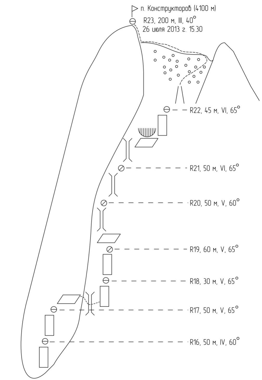
R15–R16 50 m IV, 60°. Climb straight up from the bivouac site. Rocks are monolithic; there are crevices for wired elements and cams. Station on a shelf.
R16–R17 50 m V, 65°. Climb straight up towards a standalone rock pillar. Rocks are monolithic; belaying is good. Station on a shelf that goes right-up.
R17–R18 30 m V, 65°. From the station, move right along the shelf. At the end of the shelf, there's a rock protrusion. From the protrusion, descend (the second climber needs to down-climb) into a chimney. Move to the opposite (right) wall of the chimney and climb up along monolithic rocks. After descending, belaying is challenging; there are blind crevices for anchor hooks. Station on anchor hooks and small wired elements.
R18–R19 60 m V, 65°. Climb straight up from the station, moving along a narrow gully. Holds are good but many are wet. Rocks are monolithic; without using bolt hanger hooks, belaying is challenging.
- The distance from the previous station to the nearest reliable belay point is 60 m.
- Station is in a small, wet grotto.
- In the second half of the day, water may flow through the station.
R19–R20 50 m V, 60°. From the station, traverse left into a chimney along slabs with challenging belaying. Then move up the chimney. In the chimney, there is ice and wet, icy rocks. Sometimes, small ice chunks fall through the chimney. The terrain is generally monolithic but lacks good crevices, so belays are organized in the destroyed rocks of the right chimney wall. Small and medium-sized hexcentrics work well for belays. Station in the chimney.
R20–R21 50 m VI, 65°. Climb straight up the chimney. In the middle of the rope, overcome a small ledge directly. The terrain and belaying characteristics are similar to the previous rope. Station in the chimney.
R21–R22 45 m VI, 65°. Climb straight up the chimney from the station. Before reaching the end of the chimney, move right along difficult rocks on an overhanging lip. Traverse right to:
- Bypass the overhanging lip,
- Reach a crack on its right side.
Then climb up to a station on a large rock outcrop. Handholds are passive; feet rely on friction. Belaying is good using medium-sized cams. The terrain is monolithic.
R22–R23 200 m III, 40°. Climb straight up from the station through destroyed rocks into a short couloir, up the couloir, and then along talus to the ridge. Then, traverse along the ridge to reach the summit tower. Finally, climb simple rocks to the summit. Rocks on the ridge and summit are generally monolithic; belay organization is not problematic.
Descent photo

View of the descent via the 3B route from the moraine of the Kalkush glacier. Rappel rings are marked with circles.
View of the Kalkush glacier and possible return paths to the camp.
Photographs of individual route sections
At station R9
View of sections R9–R15
View from the bivouac site downwards (R15)
Start of section R15–R16

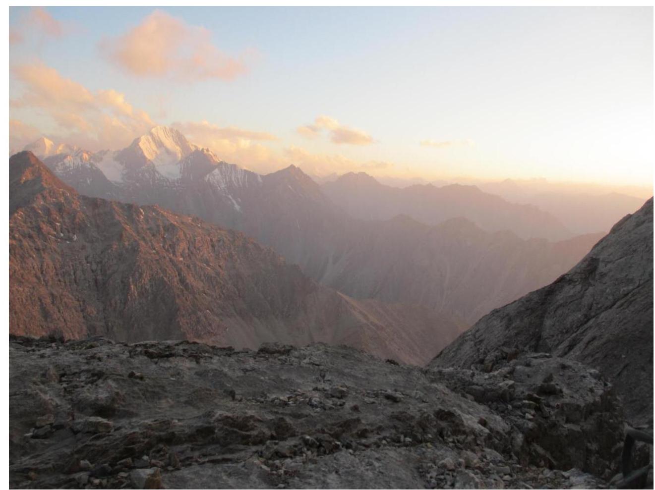
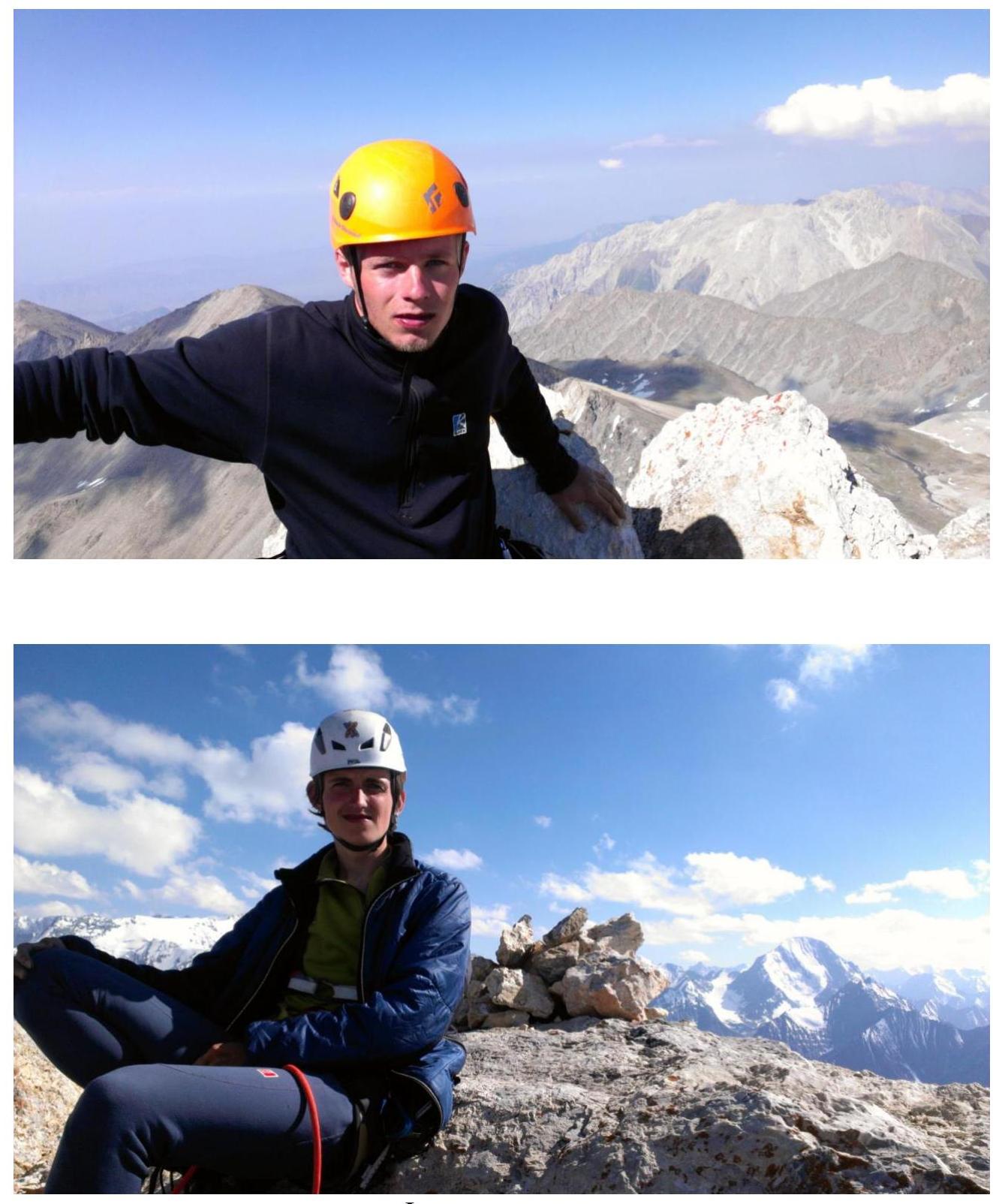
Summit photos
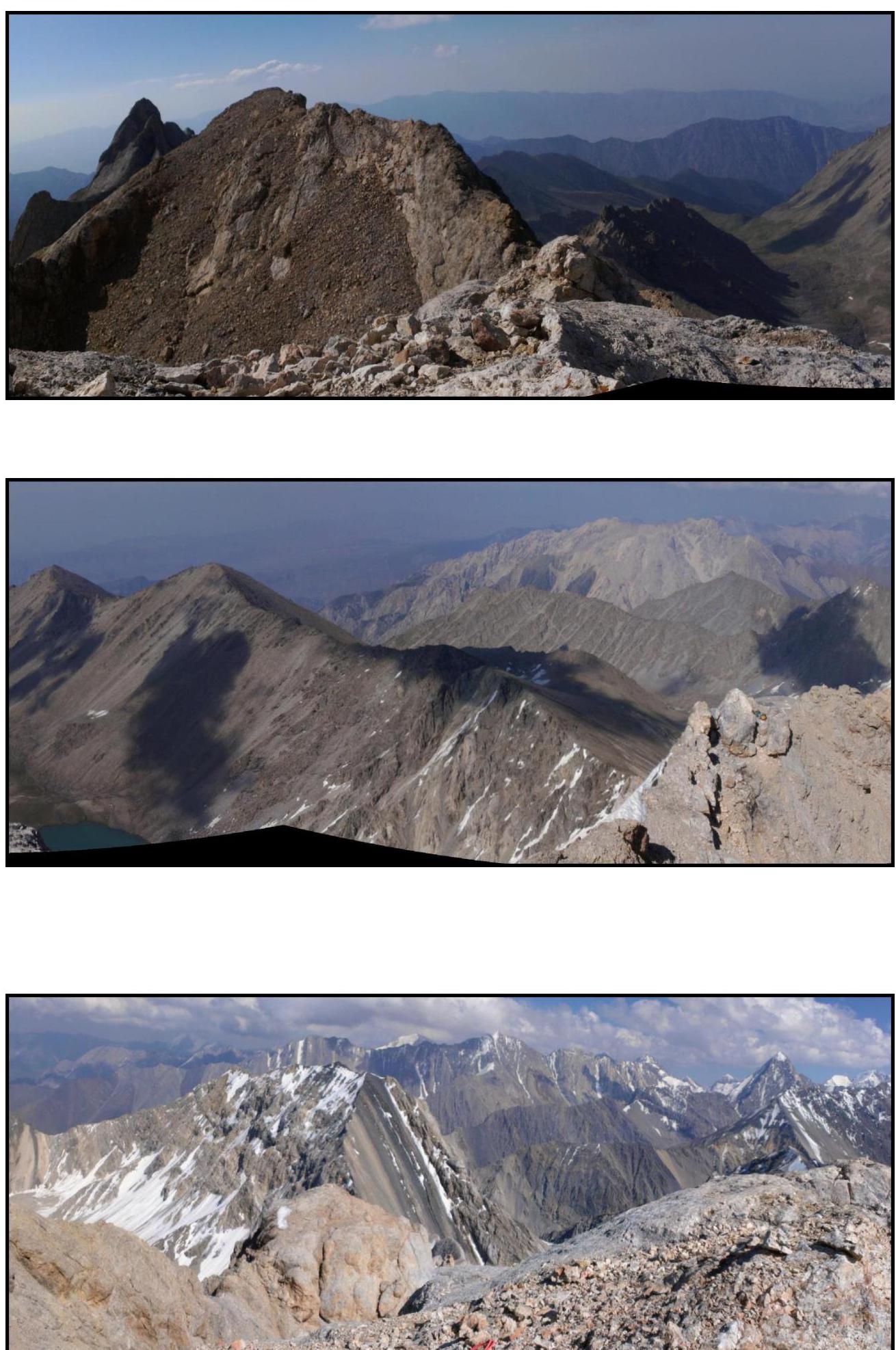
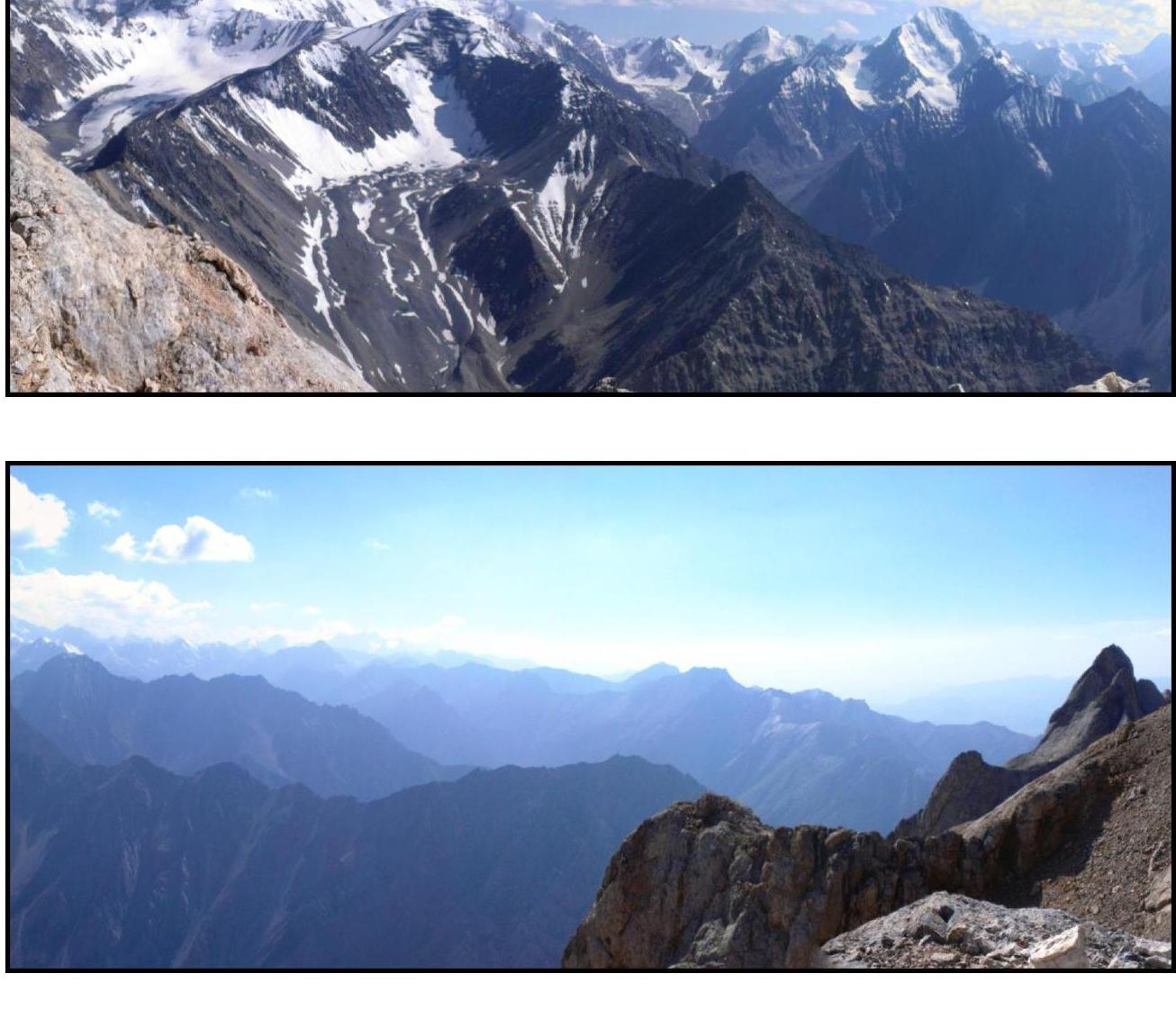
Panoramic view from the summit from Mashalyan towards the Dugoba tourist center and back to Mashalyan
1999


