
Description of the route to Peak Geologov via the western counterfort.
The route was completed on July 6-7, 1969 by a group consisting of:
- G. G. Andreev — Candidate Master of Sports, leader
- Yu. A. Logachev — Candidate Master of Sports
- O. I. Shumilov — Candidate Master of Sports
- T. G. Andreeva — 1st sports category
- V. P. Veiko — Candidate Master of Sports (4300 m)
Peak Geologov is located in a secondary ridge closing the Ulitor gorge in the area of the Dughoba tourist camp in the Pamir-Alay region. There are no classified routes to Peak Geologov. The goal of the ascent was to find a technically interesting and safe route of approximately 3B-4A category difficulty. Therefore, out of several counterforts, the western counterfort was chosen, which leads directly to the summit of Peak Geologov - this is the steepest and yet the safest route to the summit from the west.
The approach from the Dughoba tourist camp follows a trail through the Ulitor gorge (see the map-scheme) to Peak Geologov — 4-5 hours.
The route begins in a wide couloir under the western counterfort. On both sides, this couloir is bounded by two of the longest ridges extending from the summit.
On the moraine under the couloir, there is a cairn.
Up the couloir to its end — it then turns into two narrow gullies:
- To the left of the black gully (left), the western counterfort begins with a rusty wall.
- The exit to it is a few meters above the wall via inclined slabs.
- Further up to the control cairn.
Protection is provided through rock outcrops.
Up the counterfort to the first steep wall — about 70-80°. Under the wall, there is a control cairn. The wall is 50 m, climbing is difficult, and piton protection is necessary (5 pitons). The rocks are monolithic. The wall is climbed first in the left part, in the upper part — traverse to the right — upwards. Above the wall, the ridge is of medium difficulty, with short 1-2 m overhanging sections — requiring increased attention, as they are often composed of blocks. Protection is provided through outcrops and pitons (3 pitons). The grey steep ascent is bypassed on the left via a narrow ledge above the sheer face (about 15 m). Then — a rusty wall with a diagonal chimney. Climbing is difficult, the upper overhanging wall of the chimney pushes outwards. The chimney is 8 m, 1-0.5 m wide, 2 pitons. Further — a ridge of medium difficulty to a saddle before the last steep ascent — on the left, a red strongly overhanging wall. The ascent is climbed "head-on" with piton protection (3 pitons), the last steep section of the ascent is bypassed on the right following the ledges. Via a wide internal corner — exit to inclined slabs leading to the summit. Descent to the saddle towards Peak Gandekush and down the scree.
The length of the route — from the start of the counterfort — is about 500 m. 13 pitons were hammered in. Time on the route (from leaving the overnight stay by the Ulitor river under Peak Geologov to returning to the overnight stay) — 10 hours.
Route assessment:
- In terms of technical difficulty, the route corresponds to 3B-4A category.
- The descent is extremely easy (2A category).
- Overall, the group believes that the route should be classified as not lower than 3B category.
The description was compiled by G. G. Andreev Photos by V. A. Logachev
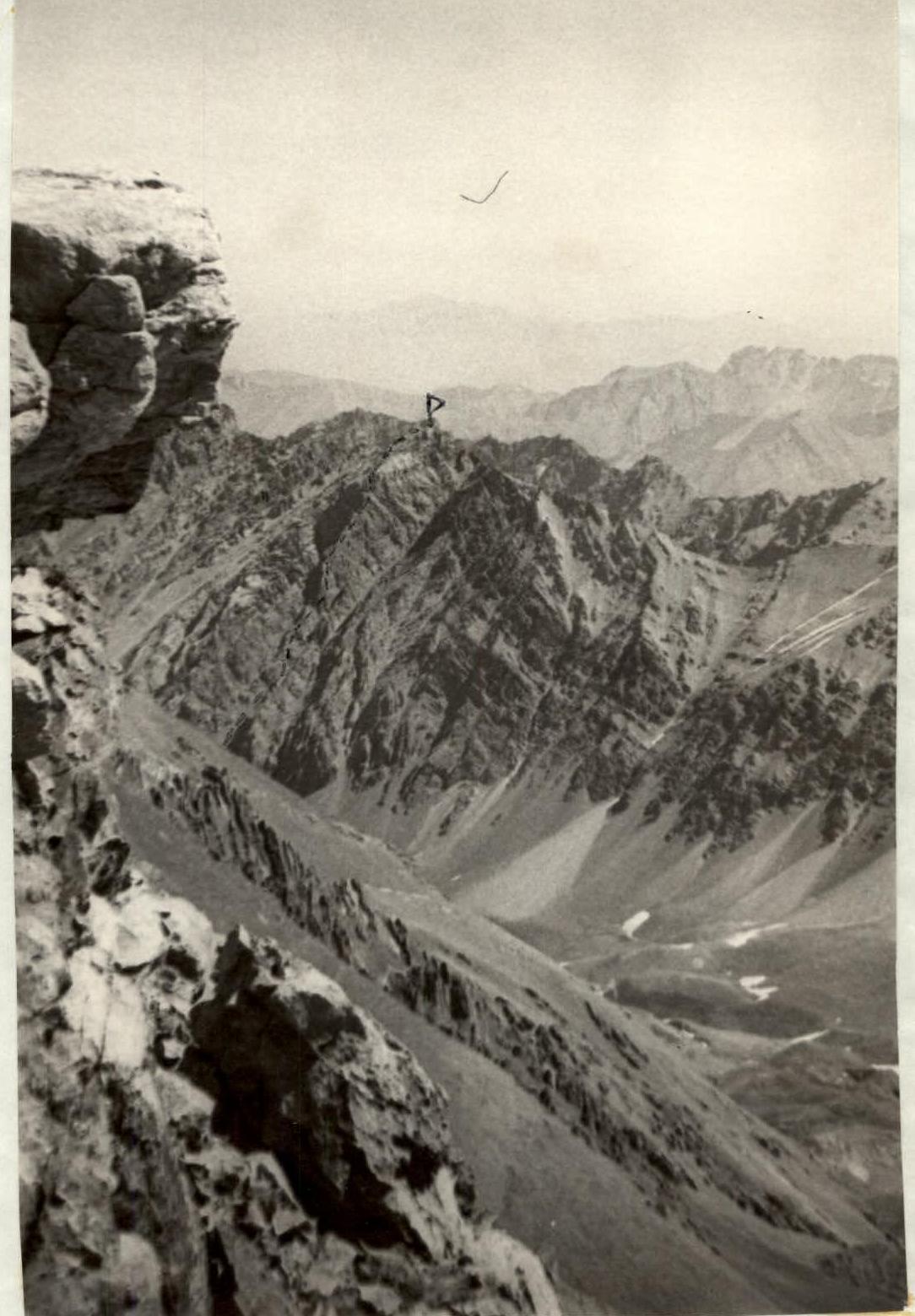
Fig. 1. P. Geologov from v. 50 let VLKSM.