Ascent Passport
- Ascent category: technical
- Ascent area; ridge: Pamir-Alay, Alay ridge
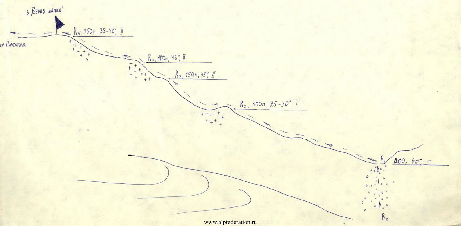
- Peak, its height, ascent route, route characteristics: Belaya Shapka, 4666 m, via north-eastern ridge, combined
- Proposed category: 2A
- Route characteristics:
- height difference 600 m;
- length of sections with category 5–6 complexity — none;
- average steepness 40°
- Pitons used: none (rock outcrops were used)
- Total hours of ascent: 9 h
- Number of nights and their characteristics: none
- Surnames, names, patronymics of the leader and participants, their qualification: Bayramov Batyr Yazmuradovich — 1st sports category, leader Kuldzhaev Anatoly Annaberdievich — 1st sports category, participant Lyapin Evgeny Anatolyevich — Candidate for Master of Sports, participant Polyansky Vladimir Vasilyevich — Candidate for Master of Sports, participant
- Team coach: Bocharov Vladimir Nikolaevich — Master of Sports of the USSR
- Date of departure and return: September 15, 1987
- Organization: AUSV "Dugoba"
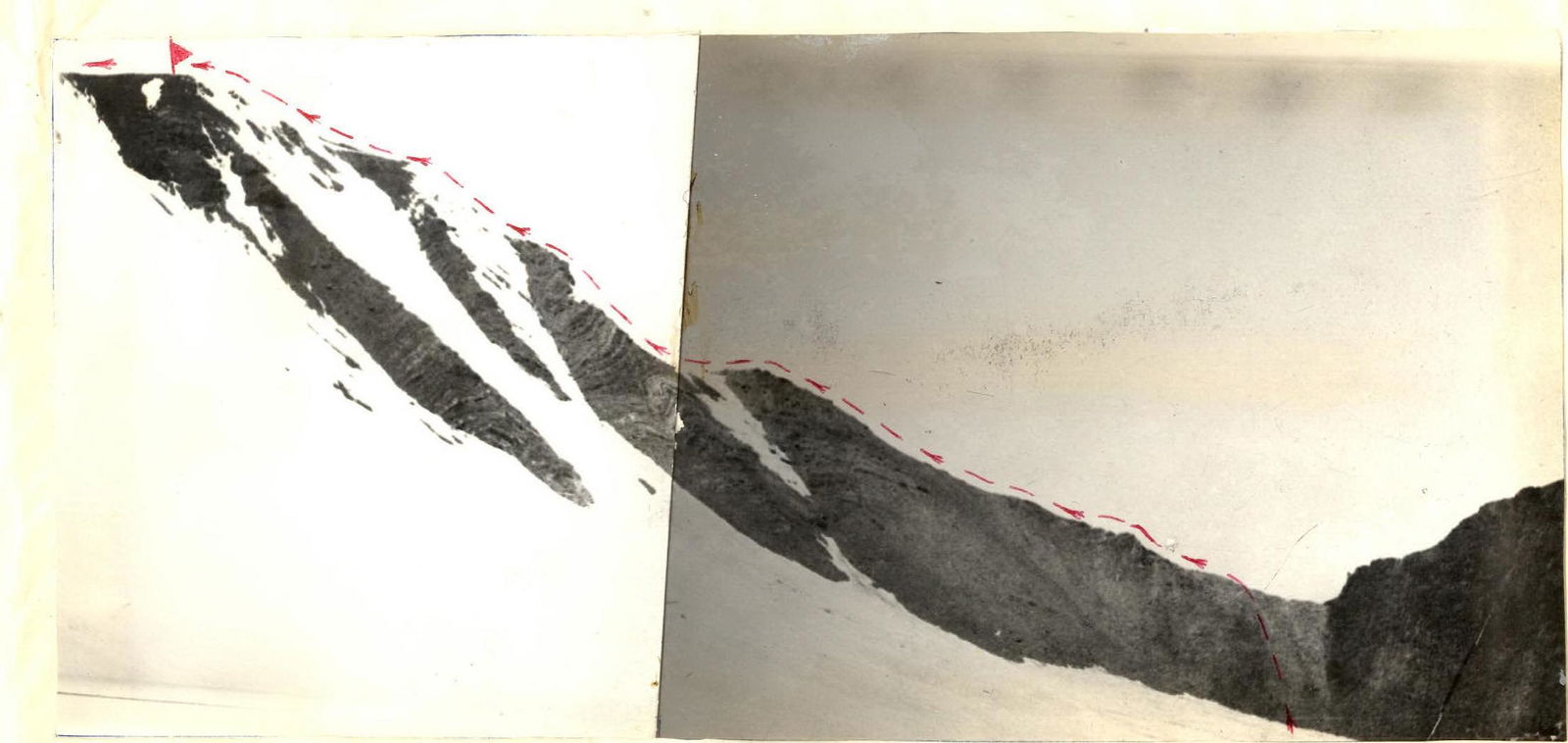
Photo 1. General view of the peak
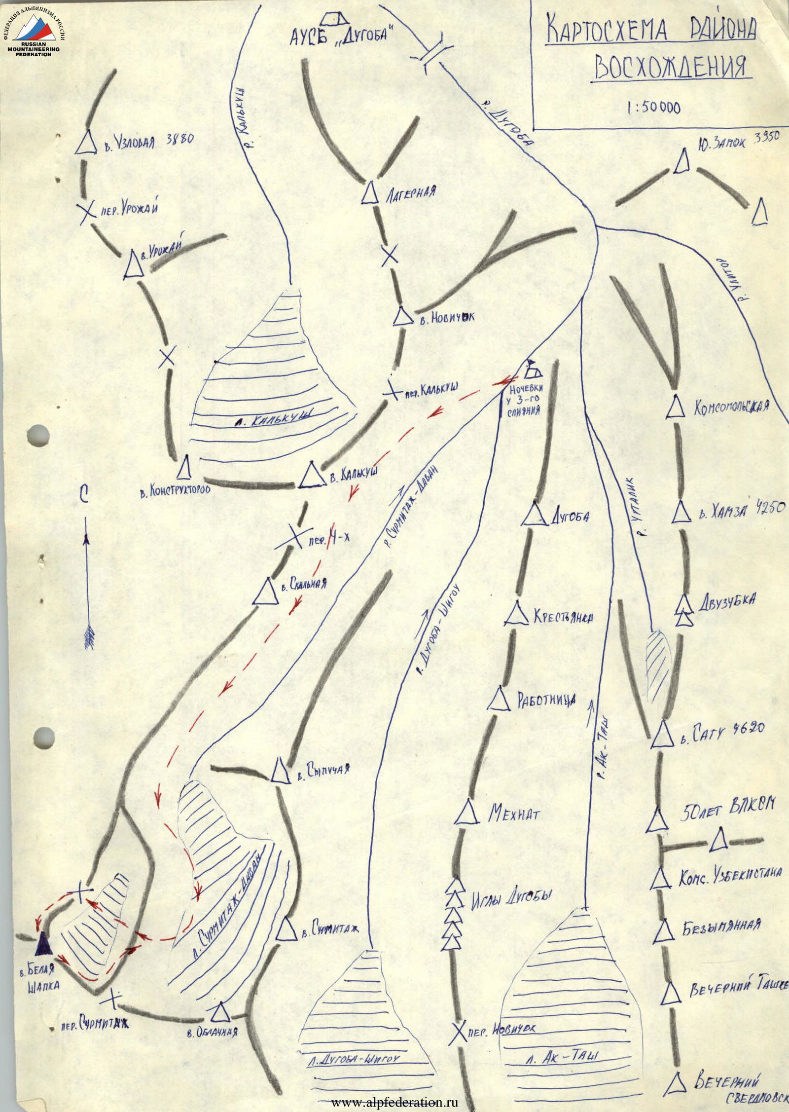
Brief description of the approach
From AUSV "Dugoba", moving up the Surmitash-Davan valley along the KZ ridge, peak Skalnaya, reach the Surmitash-Davan glacier. Approximately in its middle part, turning right (in the direction of travel), cross the NE buttress of the SE ridge and descend to a small unnamed glacier. Crossing the glacier in its middle part, approach the pass in the NE ridge of peak Belaya Shapka. This is the start of the route.
Route diagram in symbols