ASCENT PASSPORT
- Climbing type: rock
- Ascent area, ridge: S-3 Tian-Shan, Talassky ridge
- Peak, its height, ascent route: DJOLOY ZAPADNY (WESTERN) via the northern glacier slope
- Estimated difficulty category: 4A
- Route characteristics: height difference 630 m length of sections 5–6 difficulty category average steepness 50°
- Pitons hammered: for insurance rock — ice — 42 bolted — for creating and organizing emergency stops rock — ice — bolted —
- Number of travel hours: 6
- Number of overnight stays and their characteristics: —
- Surname, name, patronymic of the leader, participants and their qualification: Konovalov Yu.V. — 1st sports category, leader; Dudchenko Yu.V. — participant; Nakhabtsev D.N. — —; Troshchinenko L.A. — Master of Sports
- Team coach — Troshchinenko L.A., Master of Sports of the USSR. Date of departure on the route and return — May 3, 1981.
AREA MAP OF THE ASCENT
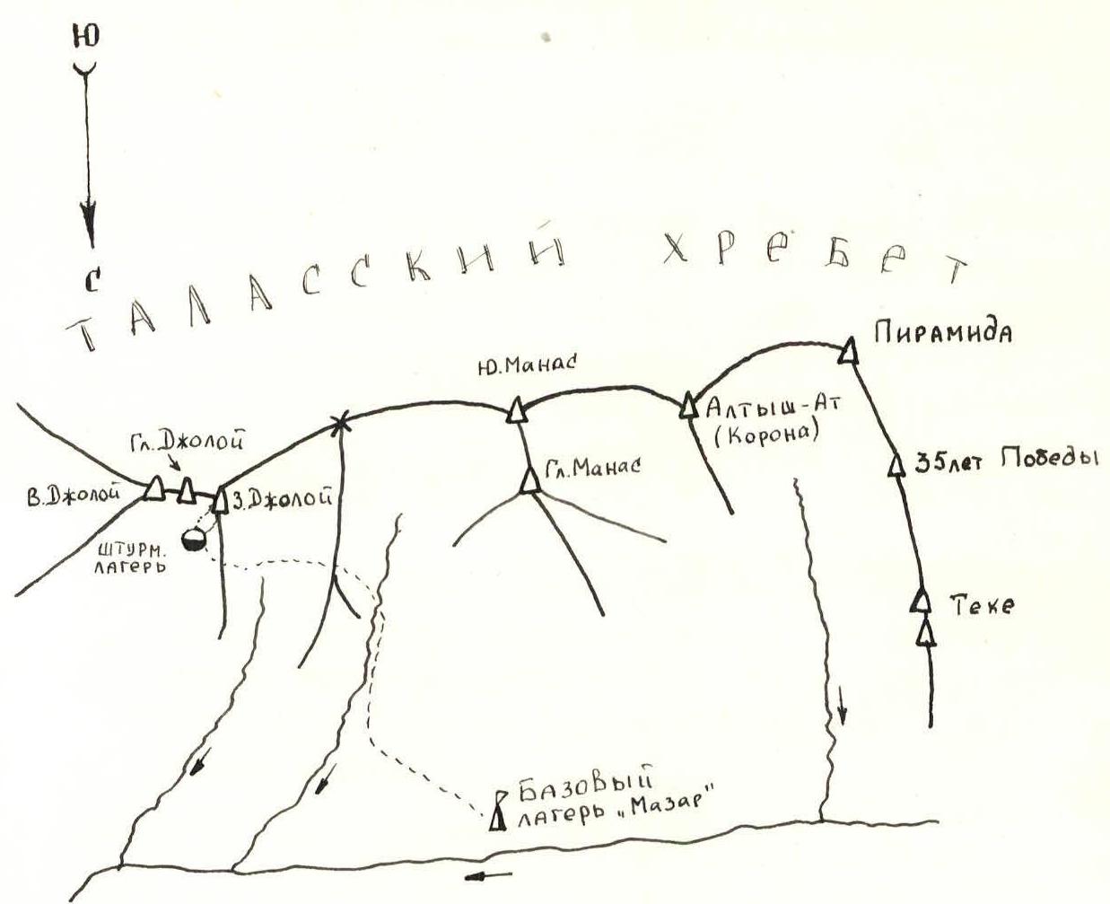
Brief description of the approach to the ascent route to v. Djoloy Zapadny (Western) — via the northern glacier slope (4A category)
From the "Mazar" base camp, follow the trail upwards, along the left orographic bank of the stream to the gorge that goes to the left. Through it, exit through a saddle in the ridge to the marshy Plain (3–3.5 hours). Cross the Plain and follow the ridge of Z. Djoloy peak to the moraine of the Djoloy glacier (1.5 hours). Overnight stays are located here, and they serve as the assault camp.
The object of the ascent is the right extreme peak of the Djoloy massif with a snow-ice slope and a serac in the lower part of the route. The route passes through the central part of the snow-ice slope.
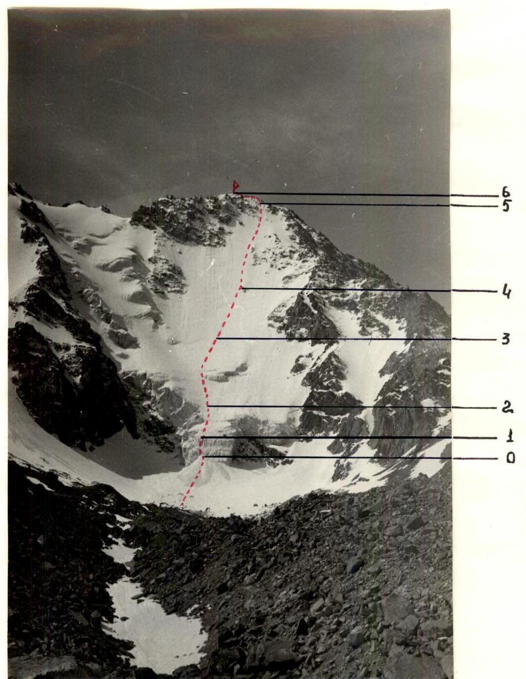
Photograph of the ascent route
TABLE OF MAIN CHARACTERISTICS OF THE ASCENT ROUTE
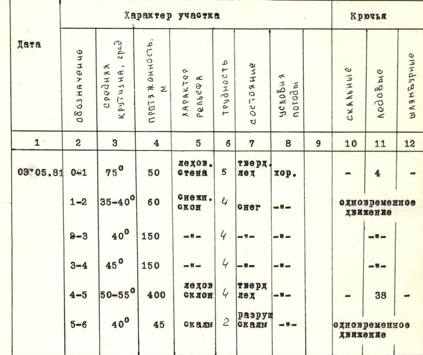
Brief explanation of the table of main characteristics of the ascent route
R0–R1 Serac. In winter conditions, the ice is hard, piton insurance is necessary. In the summer, an increase in the route is possible due to a decrease in the avalanche cone.
R1–R4 Snow slope. Bypass the serac on the left and then to the rock island.
R4–R5 The route goes to the left of the rock islands and then between them.
R5–R6 Snow-covered, destroyed rocks.
Recommendations for climbers
- In the summer, ice may appear on the snow slopes.
- Passage of the route in winter and summer is recommended in the early morning hours due to the risk of avalanches and rockfall.