ASCENT PASSPORT
-
Ascent class — technical
-
Ascent area, ridge — Western Tian-Shan, Tanassky ridge.
-
Peak, its height, ascent route — p. Dzholoy, 4355 m, via the North counterfort of the North-Eastern ridge.
-
Presumed difficulty category — 3B category.
-
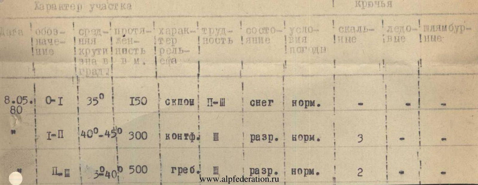
Route characteristics: height difference, length of section I–5, average steepness in degrees. 800 m, 950 m, II–III — 150 m, III — 800 m.
-
Pitons driven for protection to create artificial holds:
Rock — 5
Ice —
Bolt —
-
Number of travel hours — 5–6 hours
-
Number of overnight stays and their characteristics —
-
Surname, name, patronymic of the leader and participants and their qualification.
- Shataev V.I. — Master of Sports
- Oreshko V.V. — Candidate Master of Sports
-
Team coach —
-
Date of departure on the route and return — May 8, 1980
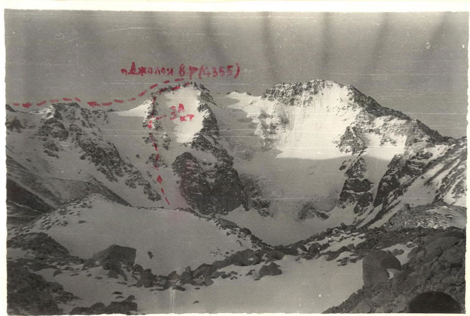
p. Dzholoy (East summit — 4355 m) via the North counterfort of the North-Eastern ridge — 3B category (from the bivouac on the Dzholoy glacier — 3560 m). From the bivouac located in the left part of the Dzholoy glacier cirque, move along the moraine (snow-covered depending on the time of year) to the north counterfort, lying to the left of the northern edge leading to the summit. The steepness of the snow slope is 30°, then it gradually becomes steeper — up to 40° — all this is overcome in 40–60 minutes, depending on the condition (snow or firn); at the end of the summer season, ice is possible.
Then move along the rocks, mainly sticking to the left (by the way) part of the counterfort. The rocks are heavily destroyed, climbing is simple and moderately difficult. In 5–6 places, on short — 3–5 m — rock walls, piton protection is required. The movement of a group of more than two rope teams requires increased attentiveness.
The exit to the North-Eastern ridge is on the left by the way. The counterfort is overcome in 1.5–2 hours. The rocks of the North-Eastern ridge are heavily and moderately destroyed. The ascent path goes directly along the ridge to the left (by the way) of the ridge's pinnacles. The last two pre-summit pinnacles are overcome directly head-on.
The North-Eastern ridge is traversed in 1–1.5 hours. Descent from the summit along the path of 3B category via the North-Eastern ridge to the bivouac at 3560 m, located on the Dzholoy glacier moraine.
The entire route takes 5–6 hours. First ascent made on May 8, 1980 by a group of the USSR Sports Committee.
- Shataev V.I.
- Oreshko V.V.
Recommendations for climbers
-
Number of participants — no more than 6 people
-
Initial bivouac — parking on the Dzholoy glacier moraine
-
Departure from the bivouac at 5–6 am
-
Equipment per group: Main rope — 3 × 40
Rock pitons (various) — 5–6 pcs.
Ice axes — 2 pcs. Rock hammers — 2 pcs.
In case of a sharp deterioration in weather (thunderstorm), descend along the snow couloirs to the right by the way from the summit.