
First ascender: Zhukov V. — rest of the information is lost. Further data on Shekhovtsov S.'s group.
Ascent Passport
-
Western Tian-Shan, Chatkal Ridge. #7 / 7.12 according to the 2001 classifier
-
Mt. Bolshoy Chimgan. 3309 m via N ridge / W spur.
-
Proposed category: 2A category of difficulty
-
Route type: Combined (ridge)
-
Route elevation gain: 1499 m (by GPS)
Route length: 3680 m (by GPS) Section lengths:
- II category of difficulty – 2267 m (by GPS)
- III category of difficulty – 338 m (by GPS)
Average slope:
- main part of the route — 37.7°
- entire route — 31.5°
-
Pitons left on the route: 0
Including bolt pitons: 0 Pitons used on the route: 12 Chocks used: 8 Total number of artificial aids used: 0
-
Team's total climbing hours: 28 hours, 4 days
-
Team leader: Shekhovtsov Sergey, 1st sports category.
Team members:
- Golovtsov Dmitry, 2nd sports category.
- Khamidov Sanjar, 3rd sports category.
-
Coach: Starodumova I.K., Candidate Master of Sports, 1st category instructor
-
Route start from Base Camp:
Route started: 11:30, February 29, 2008 Summit reached: 13:30, March 3, 2008 Return to Base Camp: 12:30, March 4, 2008 Descent from the summit: via W spur (1B category of difficulty) to Ak-Sai valley;
-
Organizing body: Tashkent, FEGT RU, "Burevestnik" sports club
-
Report responsible: Shekhovtsov S.A.
[email protected] (+99897) 1570741
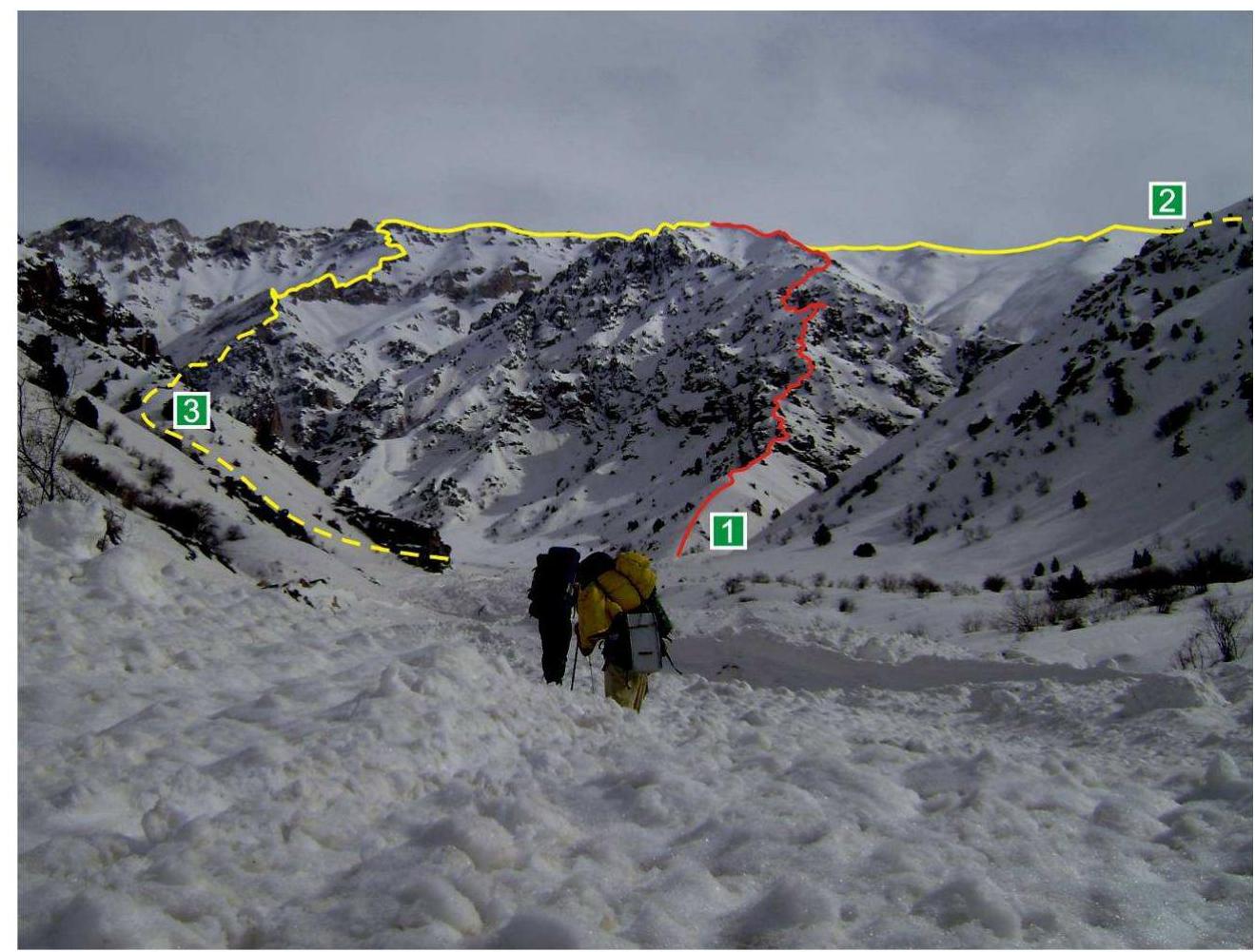
Bolshoy Chimgan massif (summit not visible) (February 29, 2008 — 13:28) taken from the Aksay riverbed Routes marked:
- N ridge / W spur (2A category of difficulty n/k)
- W spur (1B category of difficulty)
- W ridge / N spur (2A category of difficulty)
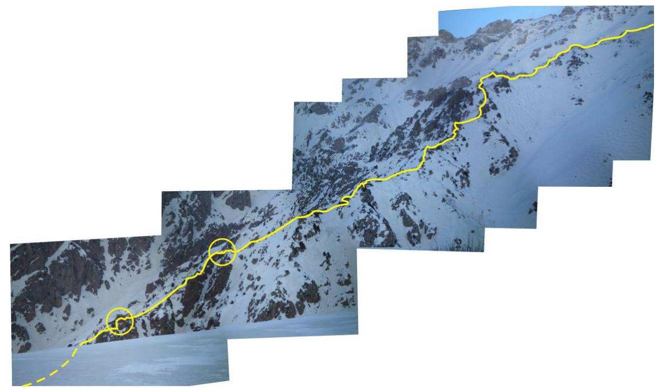
N ridge / W spur taken from W spur (March 4, 2008 10:02)
The lower part of the route is not visible in the photograph due to a ridge overhang. Key sections are highlighted. The route transitions to the upper part of W spur on the right side of the photograph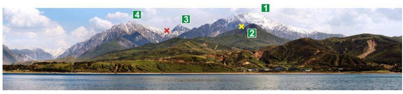
Panorama of Chimgan massif taken from Charvak reservoir:
- Bolshoy Chimgan (3309 m)
- Maly Chimgan (2098 m)
- Per'ya (?)
- Okhotnichya (3099 m) red cross) pass Tumanny (2885 m) yellow cross) pass Gul'kam (Pesochny) (1832 m)
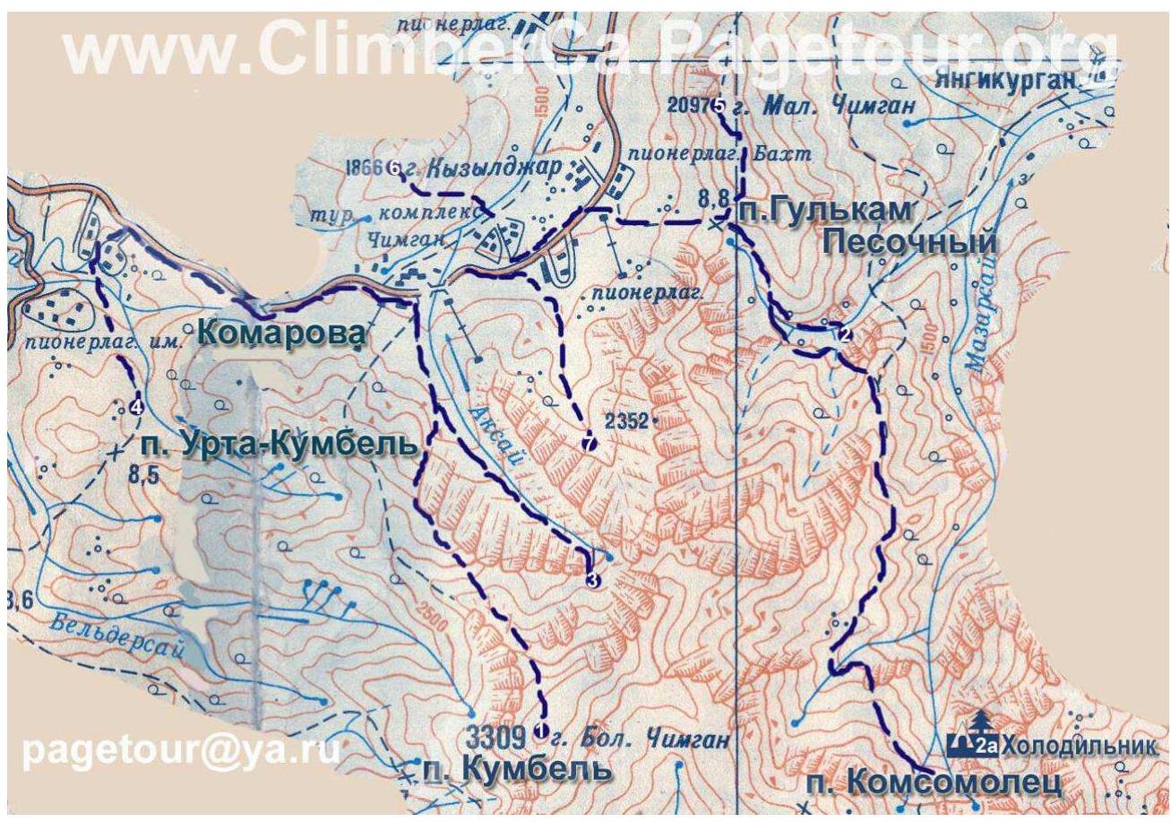
Map of the area
Geographic coordinates of the summit: 41°29′40″ N 70°03′28″ E Bolshoy Chimgan mountain — one of the highest peaks (3309 m) in the Chatkal Ridge of western Tian-Shan, located in the north of Tashkent region, Uzbekistan, 80 km east-northeast of Tashkent. Chimgan is 25 km and 30–40 minutes from the district center Gazalkent, 30 km from Charvak settlement. A paved road passes through the former tract, which is a segment of the Tashkent–Brichmulla highway. The nearest international and local airport is Tashkent, 100 km, 2 hours drive. Chimgan can be reached from Gazalkent by public bus in 50 minutes. Routes operate between Chimgan–Gazalkent (departure times 6:30 and 13:00) and Gazalkent–Chimgan (10:30 and 14:30). Private cars, including taxis, can also be used. The route is accessible throughout the year, with possible restrictions in spring due to landslides and mudflows, and in winter — in avalanche-prone areas. Alternative means include helicopters (although their use is currently limited). Approach from the highway to the start of the route takes 3–4 hours through a snowy field (if snowshoes are not available).
| Section # | Length (m) | Slope, degrees | Terrain characteristics | Category of difficulty | Number of pitons |
|---|---|---|---|---|---|
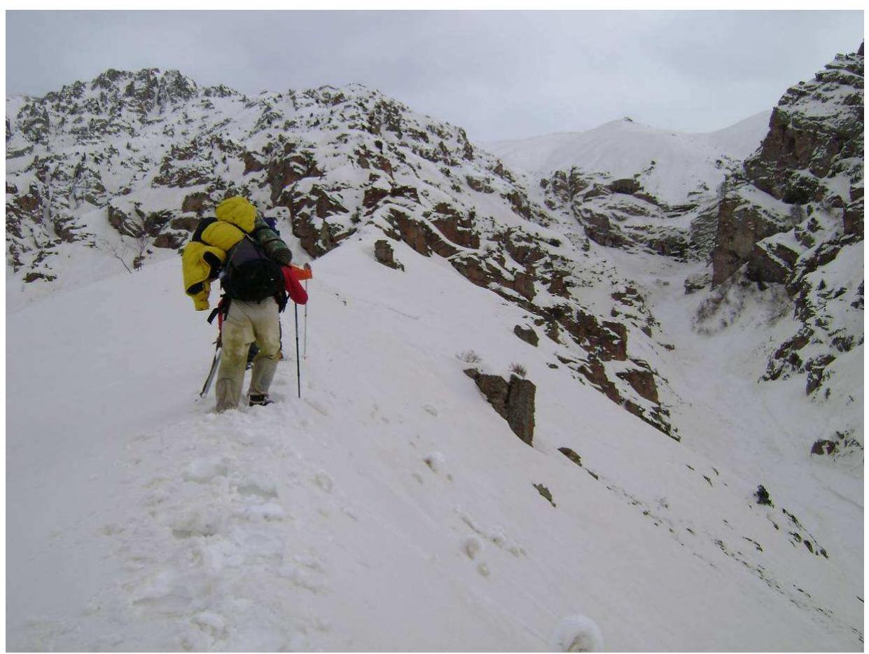
| R0–R1 | 330 m | 26° | Gentle snowy ridge | 1 | 0 |
| R1–R2 | 840 m | 35° 80° 75° | Rocky ridge with gendarmes. 1st key (350 m from the start of the section). 2nd key (690 m from the start of the section). Cornices. | 2, 3, 2+ | 6 |
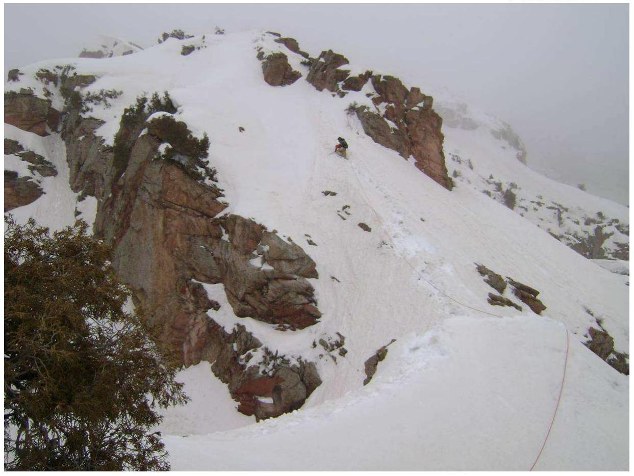
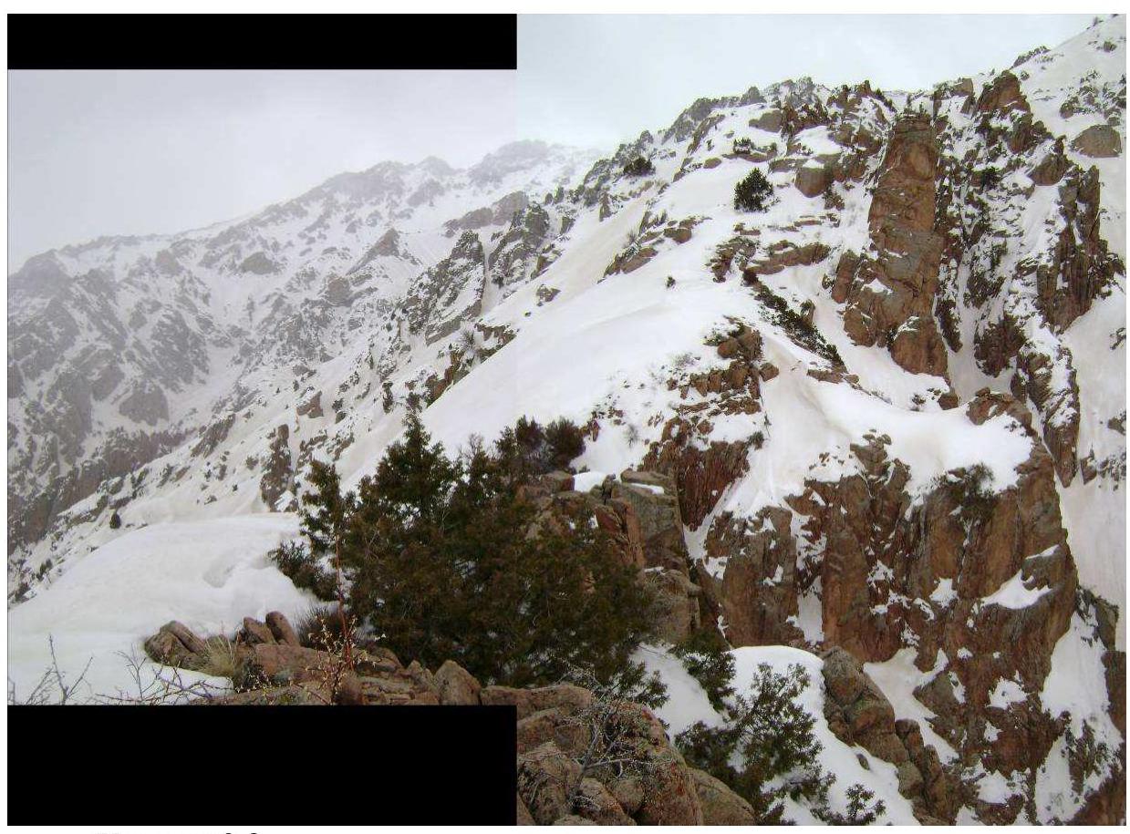
| R2–R3 | 230 m | 24° | Snowy ridge with rocky outcrops. Cornices. | 2 | 0 |
| R3–R4 | 170 m | 38° | Slope. Snow is not deep. Many unreliable rocks. Passed along the edge on the left side. | 2 | 0 |
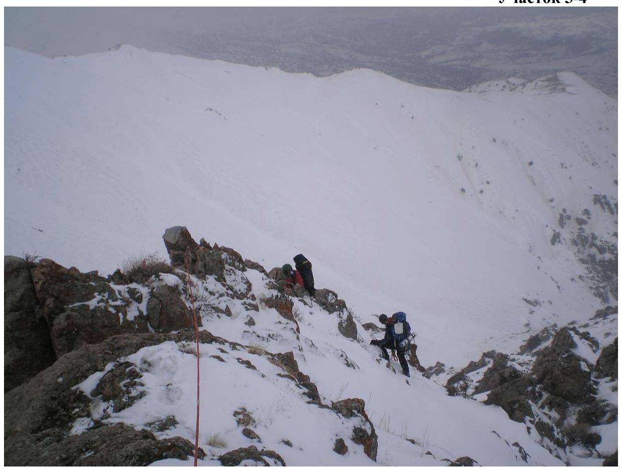
| R4–R5 | 220 m | 34° | Slope with rocky outcrops. Passed along ledges. | 3– | 0 |
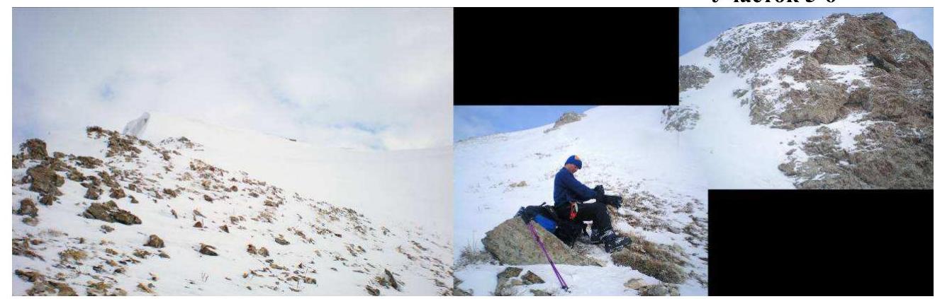
| R5–R6 | 550 m | 27° | Ridge becomes gentler and wider. Exit to W spur. Avalanche hazard. Cornice. Control cairn (60 m from the start of the section) | 2 | 0 |
| R6–R7 | 260 m | 22° | From the junction of spurs to a large gendarme. | 1 | 0 |
| R7–R8 | 30 m | 24° | From the gendarme to the grotto. Gendarme is passed "head-on". | 2+ | 2 |
| R8–R9 | 180 m | 56° | From the grotto to the 2nd gendarme. Gendarme is passed "head-on" in winter | 2, 3 | 3 |
| R9–R10 | 210 m | 27° | After the gendarme, movement along the ridge to a steep snowy slope. Climb in the lower part along rocks, gradually transitioning to snow. Belaying is challenging. Avalanche hazard. Slope length — 70 m | 1 | 4 |
| R10–R11 | 190 m | 29° | Movement along a narrow rocky ridge. Belaying. | 2 | 2 |
| R11–R12 | 110 m | 16° | Bypass a large gendarme by descending to the right along a talus ledge. | 1 | 0 |
| R12–R13 | 100 m | 52° | Climb from the ledge along rocks to the ridge. Risk of deep fall. | 2 | 2 |
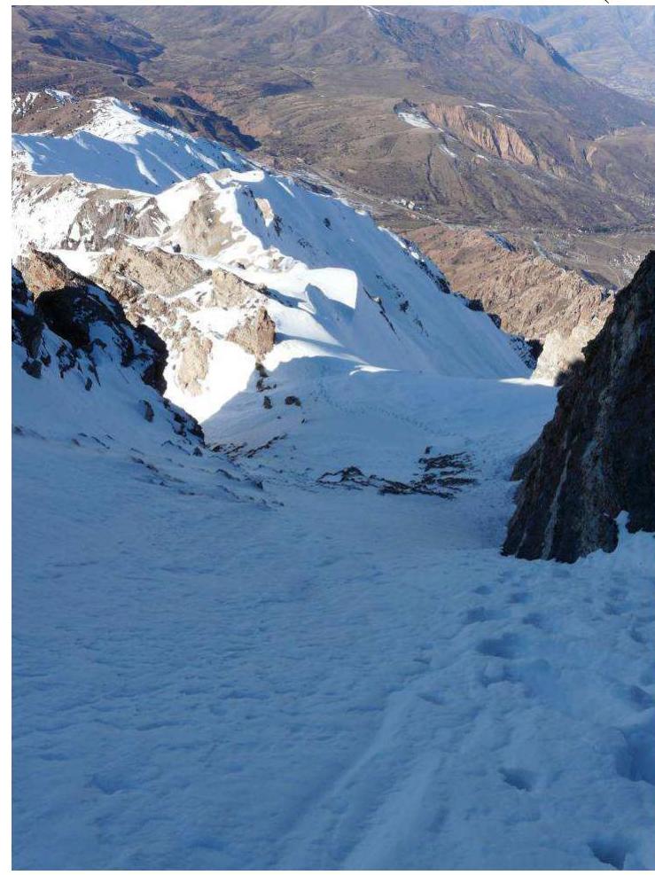
| R13–R14 | 40 m | 37° | Snowy slope. Ice in the lower part. Move to the left along rocks. Avalanche hazard. | 1 | 0 |
| R14–R15 | 200 m | 28° | Movement along a wide snowy slope towards the summit, deviating to the left. Avalanche hazard. Summit | 1 | 0 |
Route description
From the base camp, we followed the snow-covered Aksay riverbed. Movement was relatively easy only within the riverbed. In other areas, the snow did not hold, and we sank above our knees. Section #1 — Gentle snow-covered ridge leading to inclined (45°–50°) icy rock slabs. Ridge length — 330 m. Snow is deep, sinking waist-deep. In some places, it's even deeper. Section #2 — First night bivouac under the rocks. After 350 m — a narrow chimney with a plug (key #1). It was half-buried in snow. We dug out a control cairn. Inclined slabs give way to a series of gendarmes on the ridge. Gendarmes are passed "head-on", except for the final one (key #2). The key section requires careful navigation — a fall would result in a significant drop. Ridge sections between gendarmes are snow-covered. Cornices. Section #3 — Snowy ridge. To the right, a steep slope; to the left, rocky drop-offs. Cornices hang to the left. On this section, a team member fell with a cornice, dropping 12 m. They were caught by the rope. Second night bivouac. Section #4 — Snow-covered slope. Frozen rocks protrude from the snow. Simultaneous movement. Section #5 — Long navigation through ledges mixed with simple climbing. Simultaneous movement. Section #6 — Emerged under the junction of spurs. Control cairn. As we approached the junction, fog rolled in, and snow started falling, making navigation impossible. We waited for an hour. Section #7, 8 — Moved along a wide ridge to a gendarme composed of inclined blocks. Rocks are iced. Belaying, rope protection. A few meters later, a rocky grotto. Third night bivouac. Section #9 — Started the assault "light". From the grotto, traversed a snowy slope to a large gendarme. Due to the risk of cornice collapse, we passed the gendarme "head-on", hanging a rope along the internal angle on the right side. Section #10 — Along a narrow ridge through characteristic rocky "gates". Then, under the next rocky massif, on its left side. Before a steep snowy slope, we set up a piton belay. Initially, movement was along icy rocks. Higher up, we transitioned to snow. Movement was very unreliable, and belaying was challenging. Psychological key. We tied on additional rope due to the inability to set up an intermediate belay. Slope length — 70 m. Section #11 — Along a narrow rocky ridge. Movement required great care — steep drop-offs on both sides. Piton belaying and belaying over the ridge crest. Section #12 — The next gendarme on the ridge was not climbed "head-on" due to ice on the rocks. We bypassed it on the right, descending slightly to a good talus ledge. Section #13 — From the ledge, climbed step-like rocks back onto the ridge. Section #14 — Immediately after regaining the ridge, we found ourselves on a small saddle. Due to strong wind, there was no snow — ice and firn. The higher we climbed, the softer the snow became. Section #15 — The rest of the ascent was on snow. It's best not to approach rocky outcrops — the slopes are steep, and one can slip into a crevasse significantly. In two places, this was unavoidable — traversing an avalanche-prone slope. Rocky outcrops provided good cover. Deviating slightly to the left and bypassing the summit cornice, we ascended to the north ridge and reached the summit. One photo was taken (battery died), we changed the note, and began our descent. Fourth night bivouac and descent to Base Camp.
Tactical actions of the team
We started the route with one tent. We took two 50 m long, 8.5 mm diameter ropes to save weight. We brought 6 pitons, including 2 horizontal, 2 vertical, and 2 wedges. Reliable cracks on the route were scarce, and most were filled with ice. We brought 2 medium and 2 small chocks. We mostly used chocks for belaying or utilized the terrain and juniper tree trunks.
In the first two days, we moved slowly due to the large amount of snow on the route. Once we rose above the level of the western spur, movement became easier — the snow was blown off the rocks. The wind was strong, making movement challenging in some areas. Throughout the route, there were many cornices (to the north) that posed a hazard. From the junction of the spur and the ridge, the situation became quite avalanche-prone. We proceeded with all necessary safety precautions.
Weather
The weather was sunny only on the day of arrival. For the rest of the days, there was constant cloud cover.
Periodically Mountain states, which were interchanging:
- Snowfall
- Fog
At such times, visibility dropped to near zero, and we often had to stop and wait for a "window".
The temperature remained slightly below zero. Subjectively, it was around -7 to -8 °C. It was relatively comfortable — we didn't get wet.
Section R1–R2
Section R2–R3
Section R2–R3
Section R3–R4
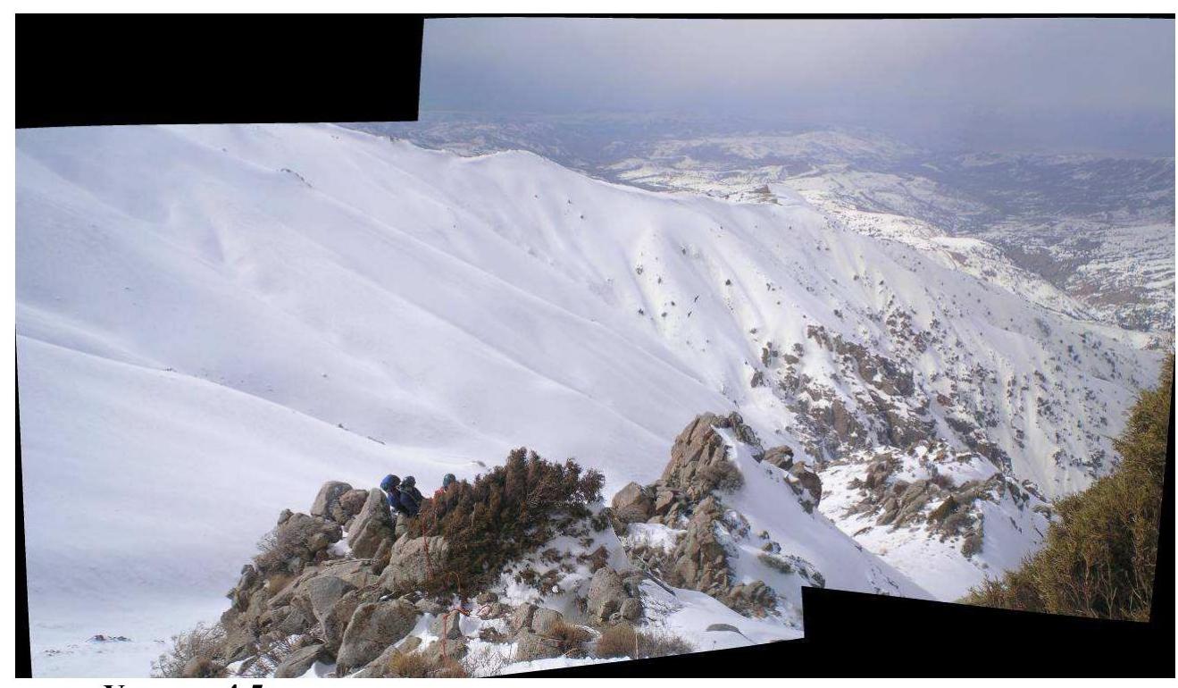
Section R4–R5
Section R5–R6
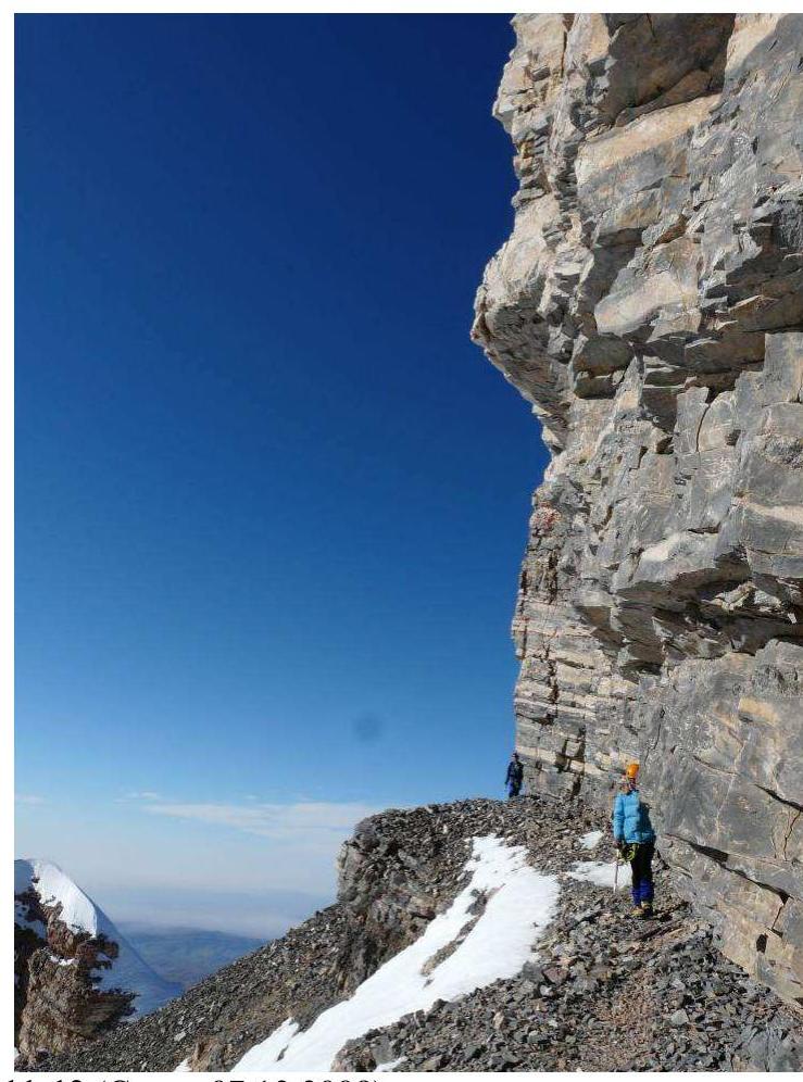
Section R11–R12 (Taken on December 7, 2008)
Section R13–R14 (Taken on December 7, 2008)
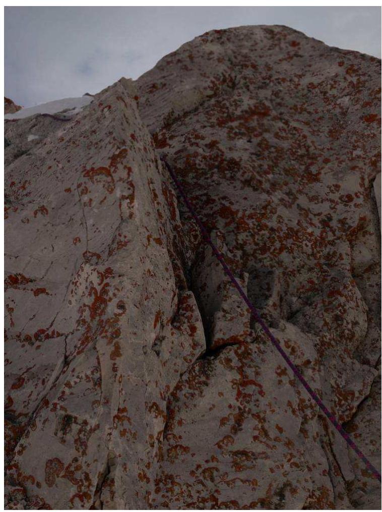
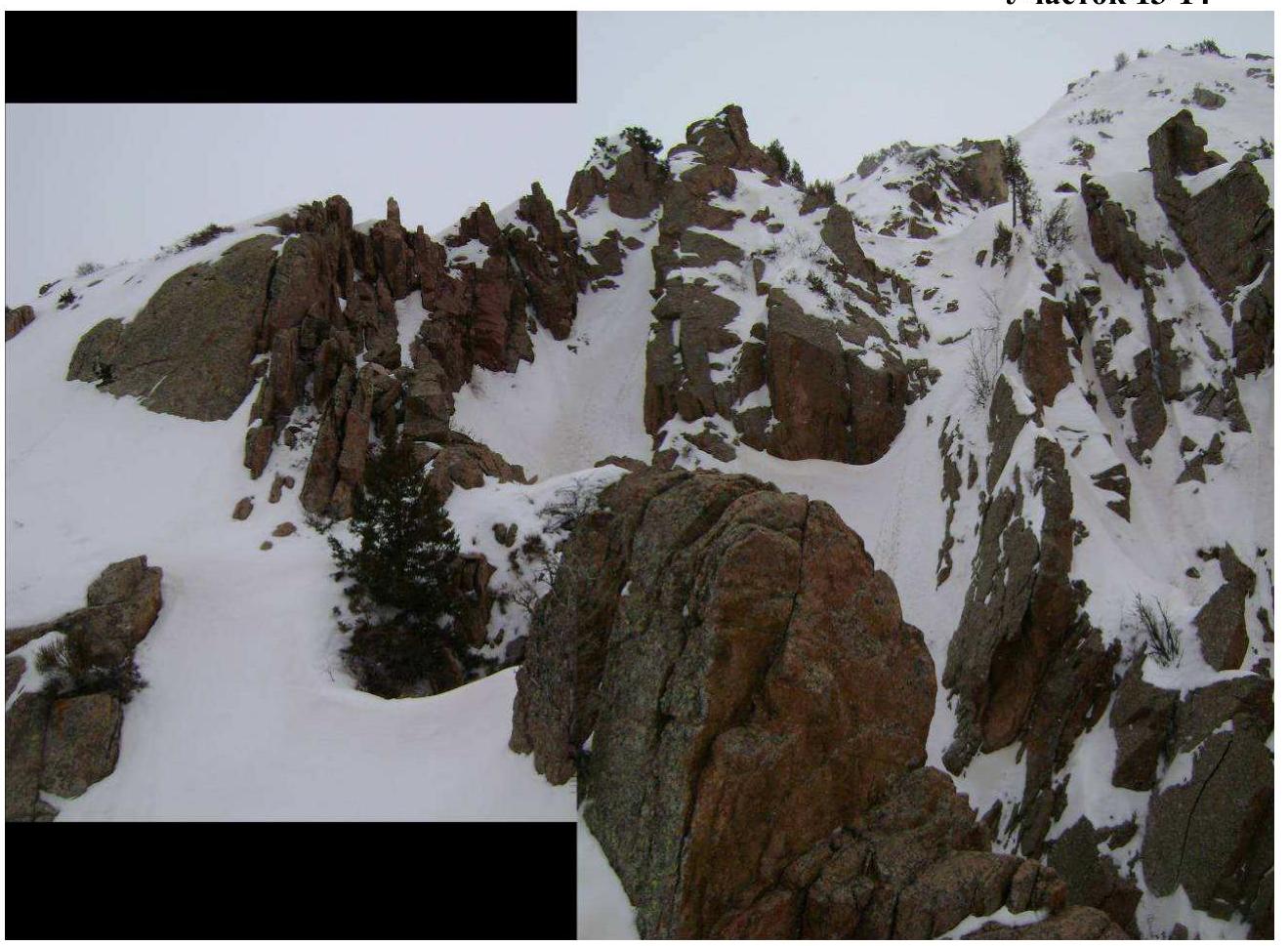
Section R11–R12 (key #1)
Section R13–R14
(key #2. Bottom photo is taken in summer for clarity)
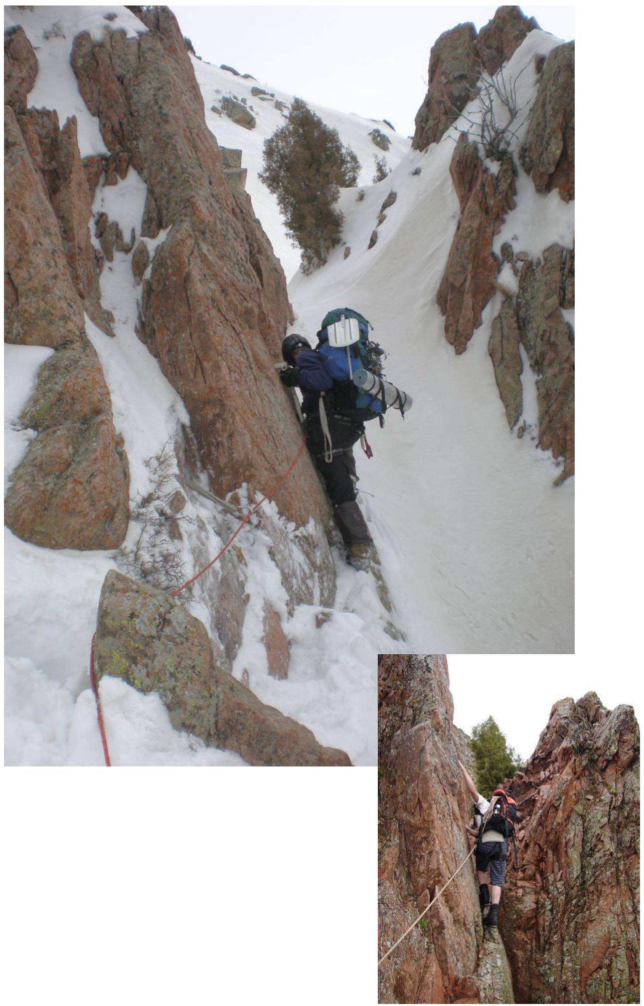
At the summit of Bolshoy Chimgan (March 2, 2008)
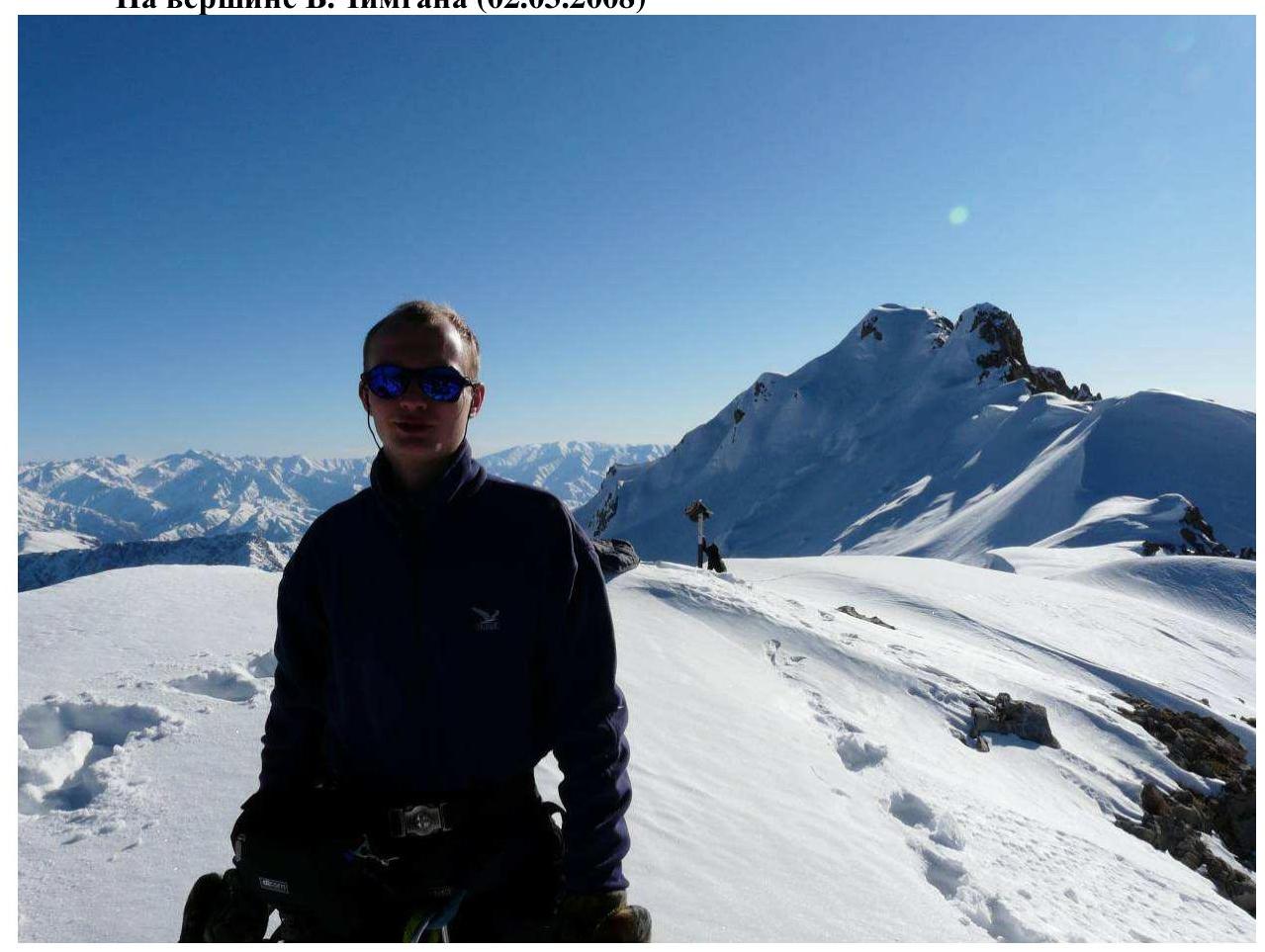
Taken from the triangulation point (3309 m) in the background of the true summit (3327 m). We were unable to take more photos at the summit — the battery died.

Comments
Sign in to leave a comment