
Ascent Passport
I. Ascent class - rock 2. Ascent area - South-Western Tian-Shan, Chatkal Ridge 3. Ascent route - Traverse of Maly and Bolshoy Babaitag (Shakhtyor) from the south 3555 m 4. Estimated difficulty category - 2A 5. Route characteristics: height difference - 2000 m average steepness - 25° 6. Number of rock pitons driven - 7. Number of overnight stays - 8. Number of walking hours - 9 9. Full name of the leader, participants, and their qualification:
Plotnikov V. V. - 2nd sports category, Plotnikov M. V. - 2nd sports category, Ponomarenko S. V. - 2nd sports category, Mardanova R. M. - 2nd sports category.
10. Team coach - Tysyachnaya G. G.
11. Date of departure and return - April 15, 1983
Route Description
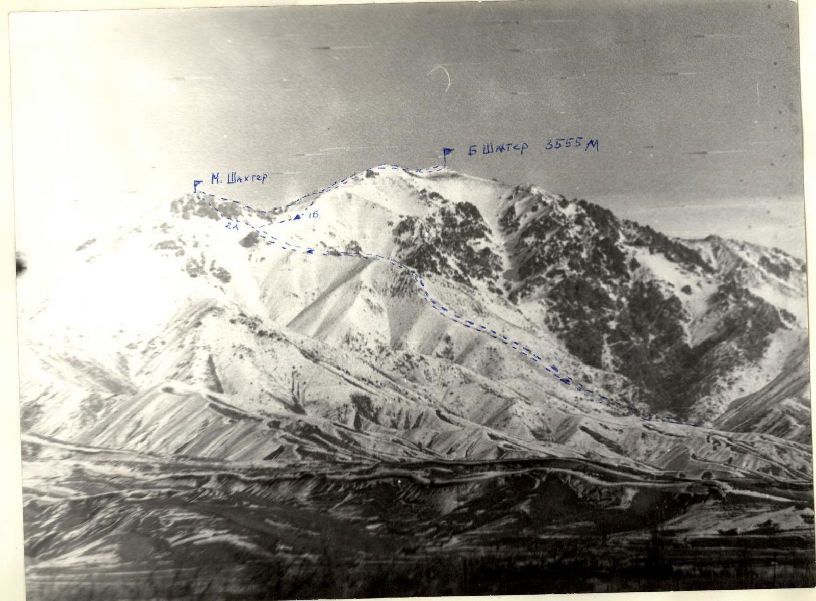
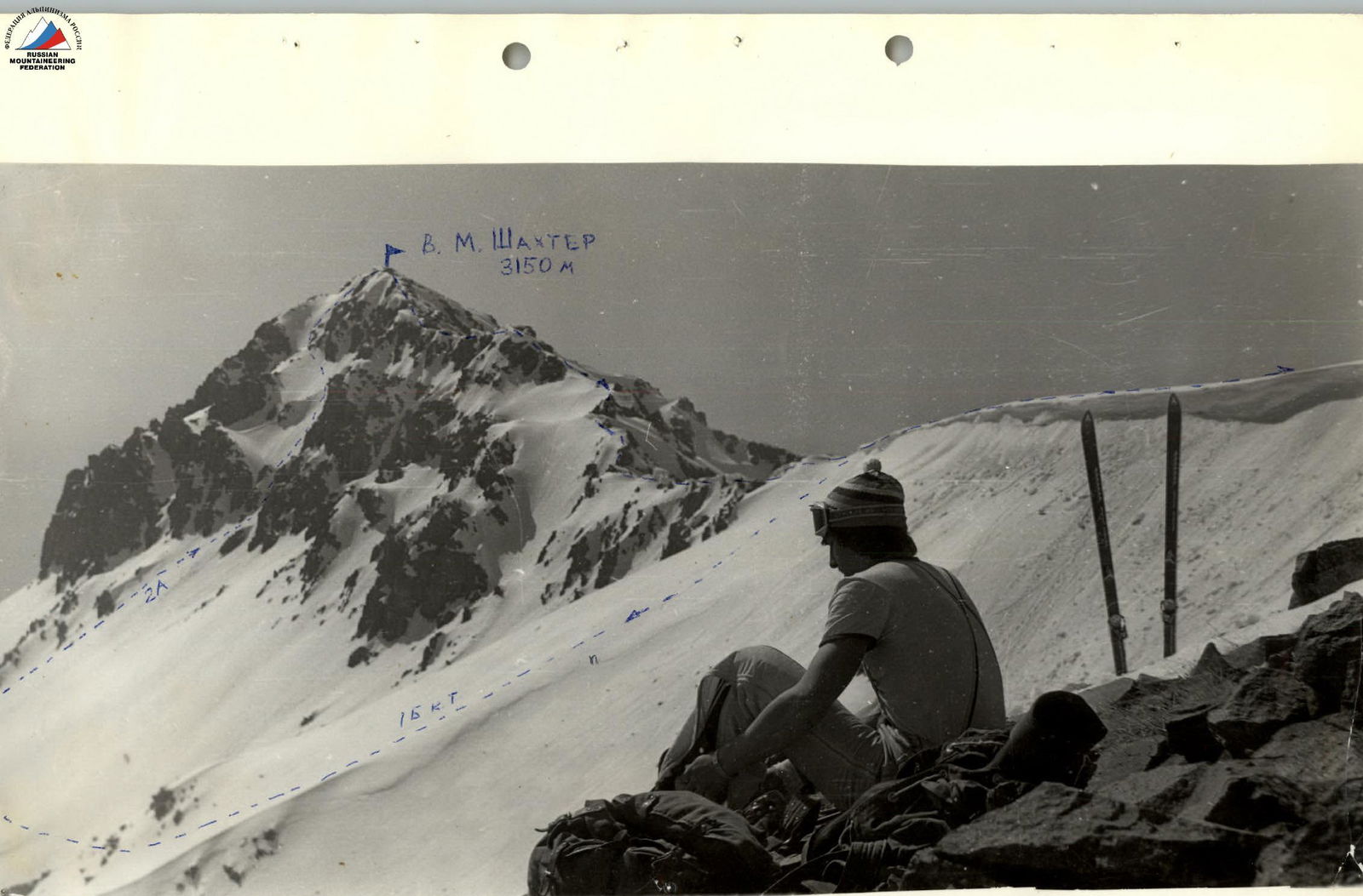
The Babaitag (Shakhtyor) peak 3555 m is located in the spurs of the Chatkal Ridge of the South-Western Tian-Shan. It is clearly visible when entering the Angren valley, towering directly above the city of Angren. The peak consists of Maly 3150 m and Bolshoy 3155 m Babaitag. The peaks of the Chatkal Ridge in this area typically do not exceed 4000 m. The peaks following Babaitag are:
- Kara-Kush 3800 m
- Arashan 3850 m
- Kyzyl-Bobo 4050 m
There is a rescue team of the Angren alpine club in Angren.
From Angren, drive along the Kokand highway to the "Plotina" stop - 113 km. To the left of the car, a dirt road leads up towards v. Babaitag. After 2 hours, the road turns into a trail that leads to the "Rodnikov" clearing. The clearing is the base camp. From the highway to the clearing is 2.5-3 hours.
Section R0–R1. From the base camp, along the counterfort of the South ridge, straight up, gaining height, we move towards v. Maly Babaitag - 3-4 hours.
Section R1–R2. Ascent along a steep snowy slope in the direction of a snowy couloir. Insurance is alternating. Time - 1 hour.
Section R2–R3. Ascent along a snowy couloir to the right up to the yellow wall. We pass the wall head-on. Then we traverse to the left with an exit to the snowy ridge.
Section R3–R4. Along a steep snowy ridge, we reach v. M. Babaitag. There is a cairn on the summit. Time - 30 minutes.
Section R4–R5. From the summit of M. Babaitag along the ridge towards B. Babaitag, we move along a rocky "saw". Insurance is through ledges.
Section R5–R6. Along the south-western ridge to the saddle between M. and B. Babaitag, bypassing 2 gendarmes on the left. Insurance is alternating. Descent to the saddle. Height difference: 200 m. Time - 30 minutes.
Section R6–R7. From the saddle along the ridge along heavily destroyed rocks, sticking to the left side in the direction of movement. Insurance is simultaneous - 1.5-2 hours.
Descent along route 1B cat. diff. 2.5-3 hours.
Table of main characteristics of the ascent route to v. 3555 m. Traverse of Maly and Bolshoy Babaitag 2A cat. diff. (approximately)

| Designation | Avg. steepness | Length | Relief character | Cat. diff. | Insurance | Weather | Rock pitons | Ice pitons | Walking hours |
|---|---|---|---|---|---|---|---|---|---|
| R0–R1 | 20° | 1.5 km | snow | 1 | simultaneous | good | 3 hours | ||
| R1–R2 | 35° | 300 m | snow | 2 | simultaneous | good | 1 hour | ||
| R2–R3 | 60° | 200 m | snow, rocks | 3 | pitons | good | 2 | 30 minutes | |
| R3–R4 | 50° | 150 m | snowy ridge | 3 | alternating | good | 30 minutes | ||
| R4–R5 | 30° | 200 m | gendarmes | 2 | through ledges | good | 20 minutes | ||
| R5–R6 | 35° | 200 m | rocky ridge | 2 | alternating | good | 30 minutes | ||
| R6–R7 | 30° | 300 m | destroyed rocks | 1 | simultaneous | good | 1.5-2 hours |
Comments
Sign in to leave a comment