ASCENSION DOCUMENT
- Type of ascent — rock climb
- Area of ascent — Western Tian-Shan, Ugam ridge
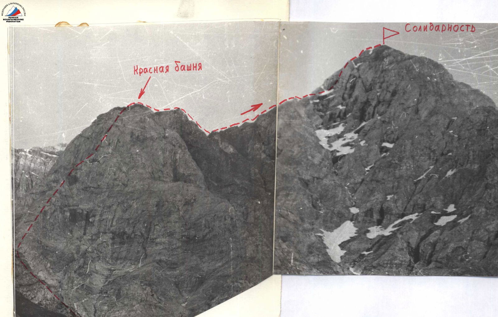
- Peak Saliidar (Solidarnost) 3600 m via NW ridge
- Proposed category of difficulty — 4A
- Characteristics of the route:
- Height difference — 600 m, length of sections: category IV — 125 m, category V — 60 m, average steepness of the route — 55°
- Number of pitons: rock pitons — 42/3, protection — 30/2
- Number of climbing hours — 14 hours
- Number of bivouacs — none
- Full name of team leader and participants: Smertnev D.A. — P, team leader Pogadaev D.V. — P Minin A.A. — P Povstyan A.T. — P Ustinova T.G. — P
- Team coach — Honored Coach of KazSSR — Popenko V.S.
- Date of departure and return — August 30–31, 1987
- Organization — Kazakh Club of Alpinists
Solidarnost
 Route category 4B
First ascent route
Route category 4B
First ascent route
Route Photos
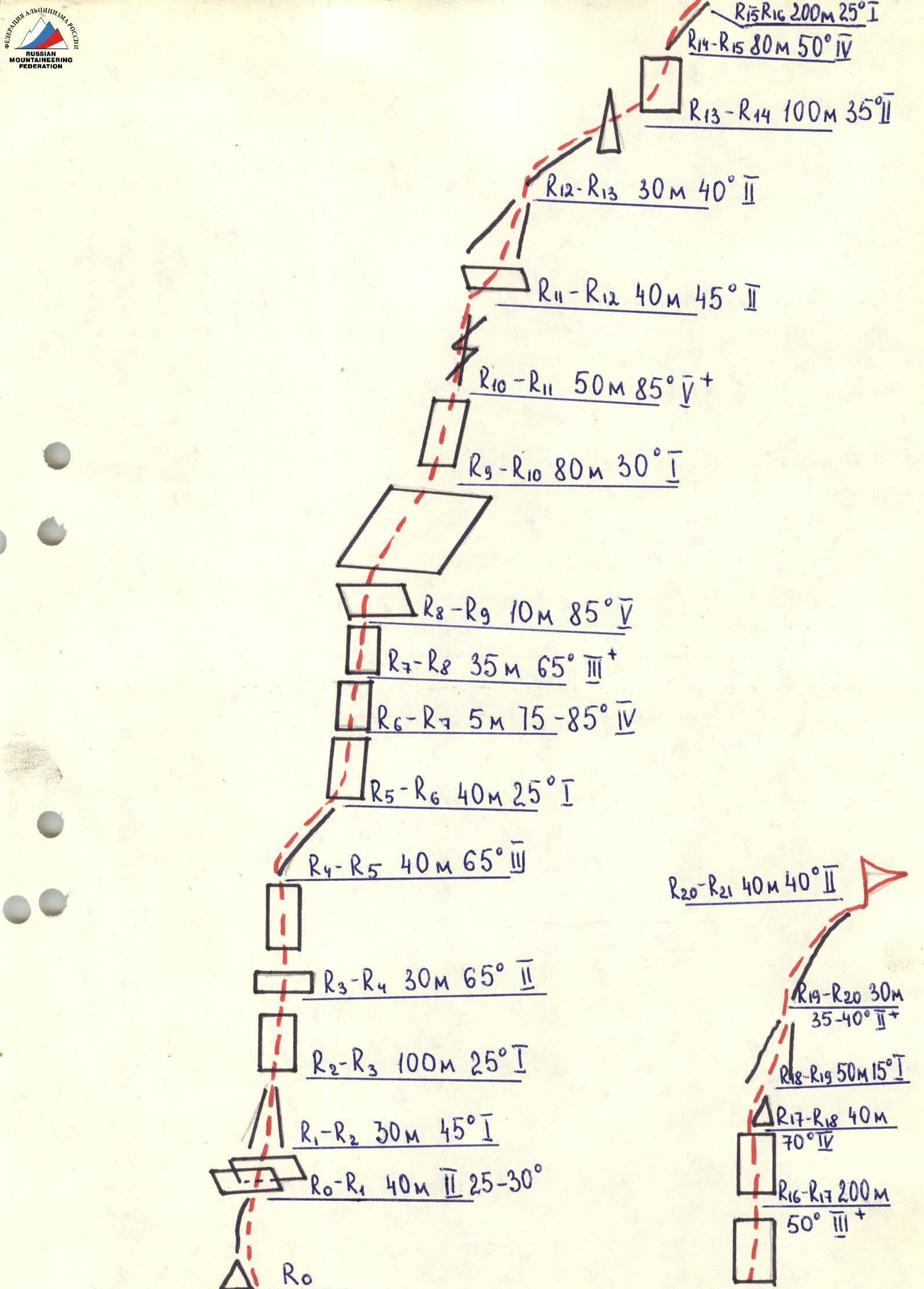

- R0–R1: 40 m, 2, 25–30°
- R1–R2: 30 m, 45°, 1
- R2–R3: 100 m, 25°, 1
- R3–R4: 30 m, 65°, 2
- R4–R5: 40 m, 65°, 3
- R5–R6: 40 m, 25°, 1
- R6–R7: 5 m, 15–85°, 4
- R7–R8: 35 m, 65°, 3+
- R8–R9: 10 m, 85°, 5
- R9–R10: 80 m, 30°, 1
- R10–R11: 50 m, 85°, 5+
- R11–R12: 40 m, 45°, 2
- R12–R13: 30 m, 40°, 2
- R13–R14: 100 m, 35°, 1
- R14–R15: 80 m, 50°, 4
- R15–R16: 200 m, 25°, 1
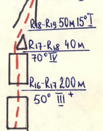
- R16–R17: 200 m, 50°, 3+
- R17–R18: 40 m, 70°, 4
- R18–R19: 50 m, 15°, 1
- R19–R20: 30 m, 35–40°, 2+
- R20–R21: 40 m, 40°, 2