Ascent Passport
- Region: Western Tien Shan, Ugam Ridge. 7.11
- Peak name: Sayram, route name: via the 2nd buttress of the North face.
- Difficulty category: assumed 5B, 2nd ascent.
- Route characteristic: rock.
- Route height difference: 813 m, route length: 1127 m, section lengths: V difficulty category — 504 m, VI difficulty category — 73 m, average steepness: main part of the route — 77°, entire route — 72°.
- Pitons left on the route: total — 4.
Pitons used on the route:
| Rock | Bolt | Nuts | Ice |
|---|---|---|---|
| 23 | - | 120 | - |
-
Team's travel hours: 16 h (with processing on 11.08.02).
-
Leader: Prudskikh A., Candidate Master of Sports.
Participants: Melnikov V., Candidate Master of Sports; Zhivaev S., Candidate Master of Sports.
-
Coach: Benkin Vladimir Samuilovich, Master of Sports
-
Departure to the route: 7:00, August 12, 2001.
Return to camp: 23:00, August 12, 2001. Summit ascent: 18:00, August 12, 2001.
General photo of the summit.
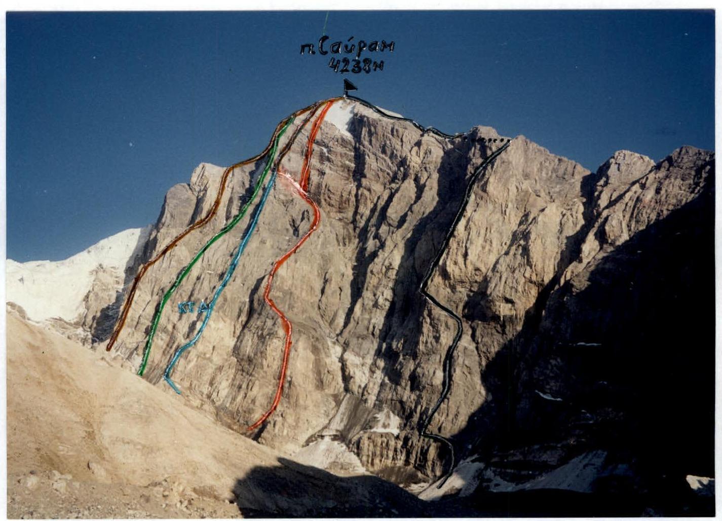
Photo taken on August 11, 2001. Location: glacier in front of the N wall at Sayram.
- Via the left buttress of the N wall, 5A (Yu. Svolik, 88)
- Via the central bastion of the N wall, 5B (A. Bobrov, 86)
- Via the N wall, 5B (V. Sedelnikov, 77)
- Via the 3rd buttress of the N wall, 5B (V. Starlychanov, 77)
- Route taken by the team, via the 2nd buttress of the N wall, assumed 5B.
Profile of the wall on the right
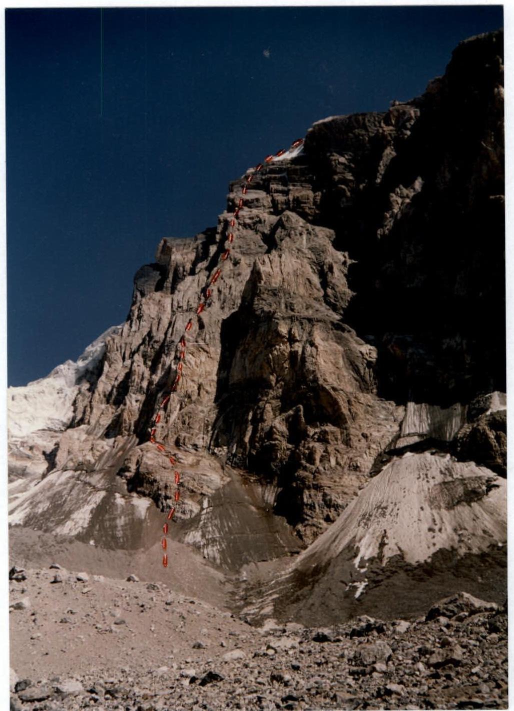
Photo panorama of the area
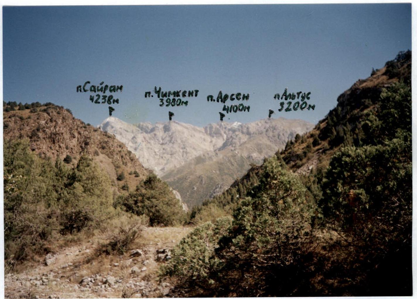
Photo taken on: August 8, 2001. Location: Campsite
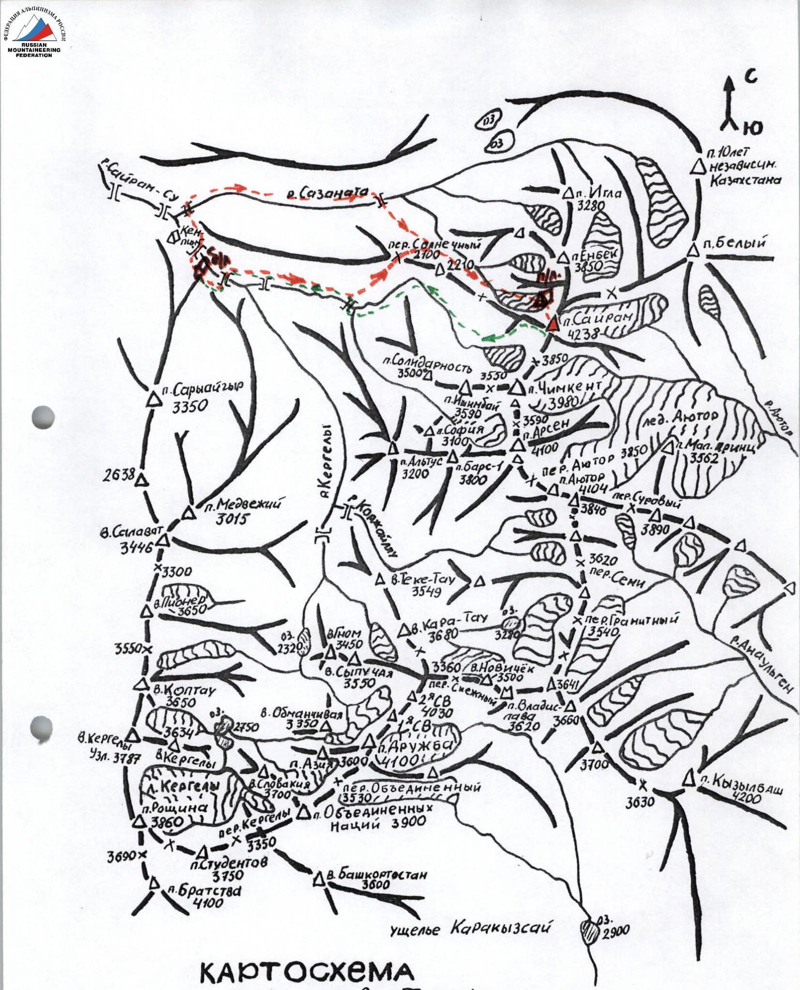
Schematic map
Sayram-Su valley, Western Tien Shan, Ugam Ridge, Scale 1:50 000
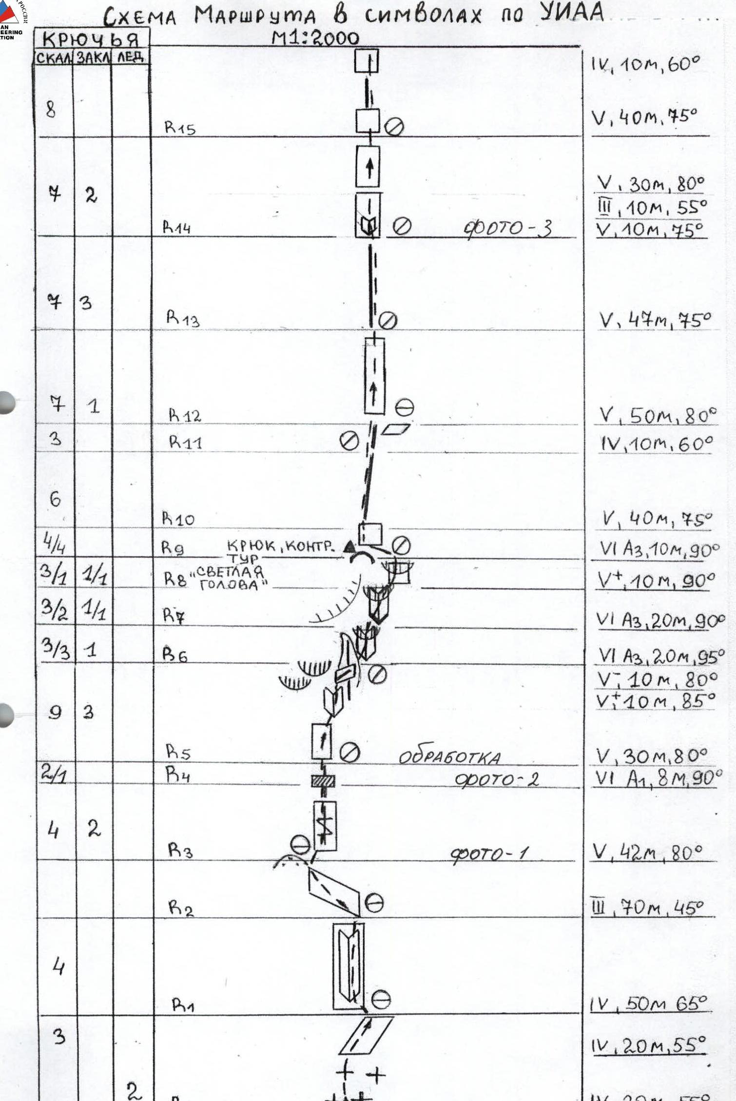
Route diagram in UIAA symbols
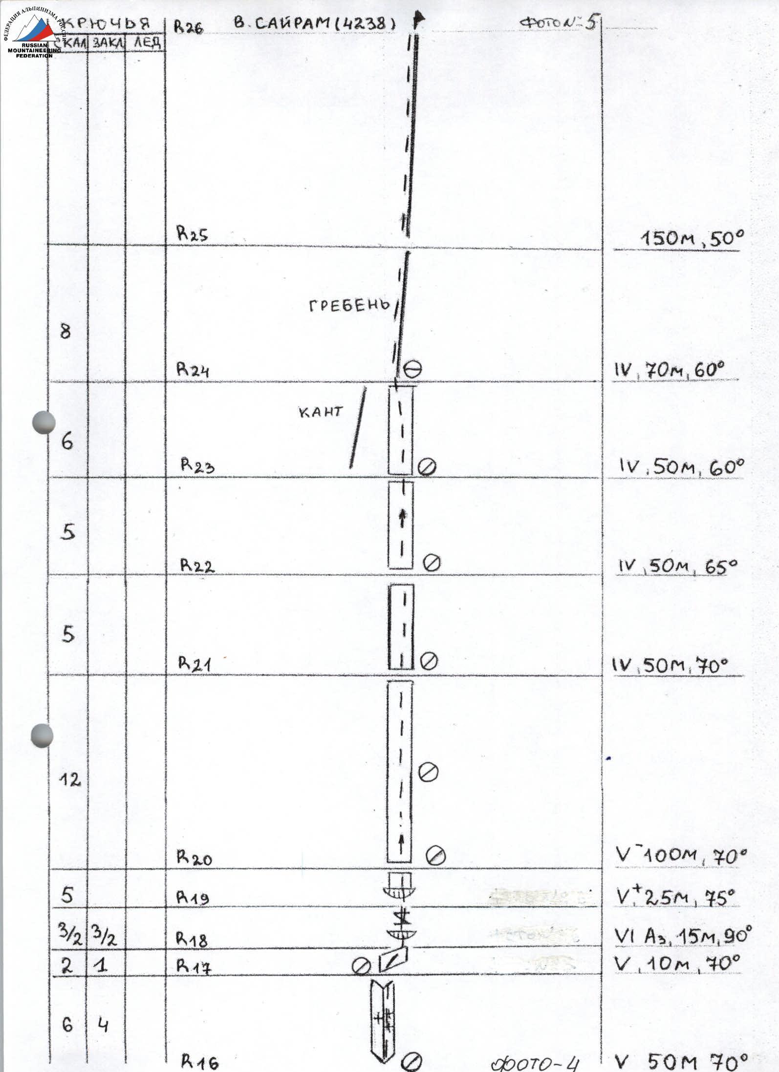
150 m, 50° V, 70 m, 60° V, 50 m, 60° V, 50 m, 65° V, 50 m, 70° V–100 m, 70° V+, 25 m, 75° VI A3, 15 m, 90° V, 10 m, 70°
Route description by sections
R0–R1 From the moraine, 30 m, 55° on ice, and 20 m, 55° on broken rocks. Rockfall hazard. R1–R2 Up and left through an internal corner 50 m, 65°. R2–R3 Left along a rock ledge 70 m, 45° to a scree shoulder at the base of the buttress. R3–R5 Up through cracks 42 m, 80°, the upper part of the crack has no holds 8 m, 90°. R5–R6 Up and right on smooth monolithic rocks 30 m, 80° and up an internal corner 10 m, 85°. Right of the light wall with an overhang, traverse along a ledge 10 m, 80° to an edge. R6–R9 Ascend up an internal corner 20 m, 95° with overhangs, using artificial aids, towards the "light head". Then right into an internal corner with overhangs 20 m, 90°, and right along the wall with an overhang 10 m, 90°, exit onto the "light head" to a control cairn. R9–R10 Up a wall left 10 m, 90°, using artificial aids. Exit onto the edge of the buttress. R10–R11 Along the edge 40 m, 75°. R11–R13 Along the edge 10 m, 60° to a ledge. Up a wall 50 m, 80°. R13–R14 Along an edge 47 m, 75° under a wall to an internal corner. R14–R15 Through an internal corner 10 m, 55°, along a wall 10 m, 55°, up a wall 30 m, 80°. R15–R16 Along an edge 40 m, 75°, then 10 m, 60°. Exit to a sloping slab. R16–R17 Up an internal corner on the right part of the slab 50 m, 70°, with snowy sections on the slab. R17–R20 From the middle of the slab right along a sloping ledge 10 m, 70°, up a crack with overhangs using artificial aids 15 m, 90°, then 25 m, 75° — exit to the upper slab. R20–R23 Up and left along slabs 200 m, 65–70°. R23–R24 Right of the slab's edge 50 m, 60°. Exit to a ridge. R24–R25 Along a ridge 70 m, 60°. R25–R26 Along a scree ridge 150 m, 50°. Summit.
Technical photo of the route
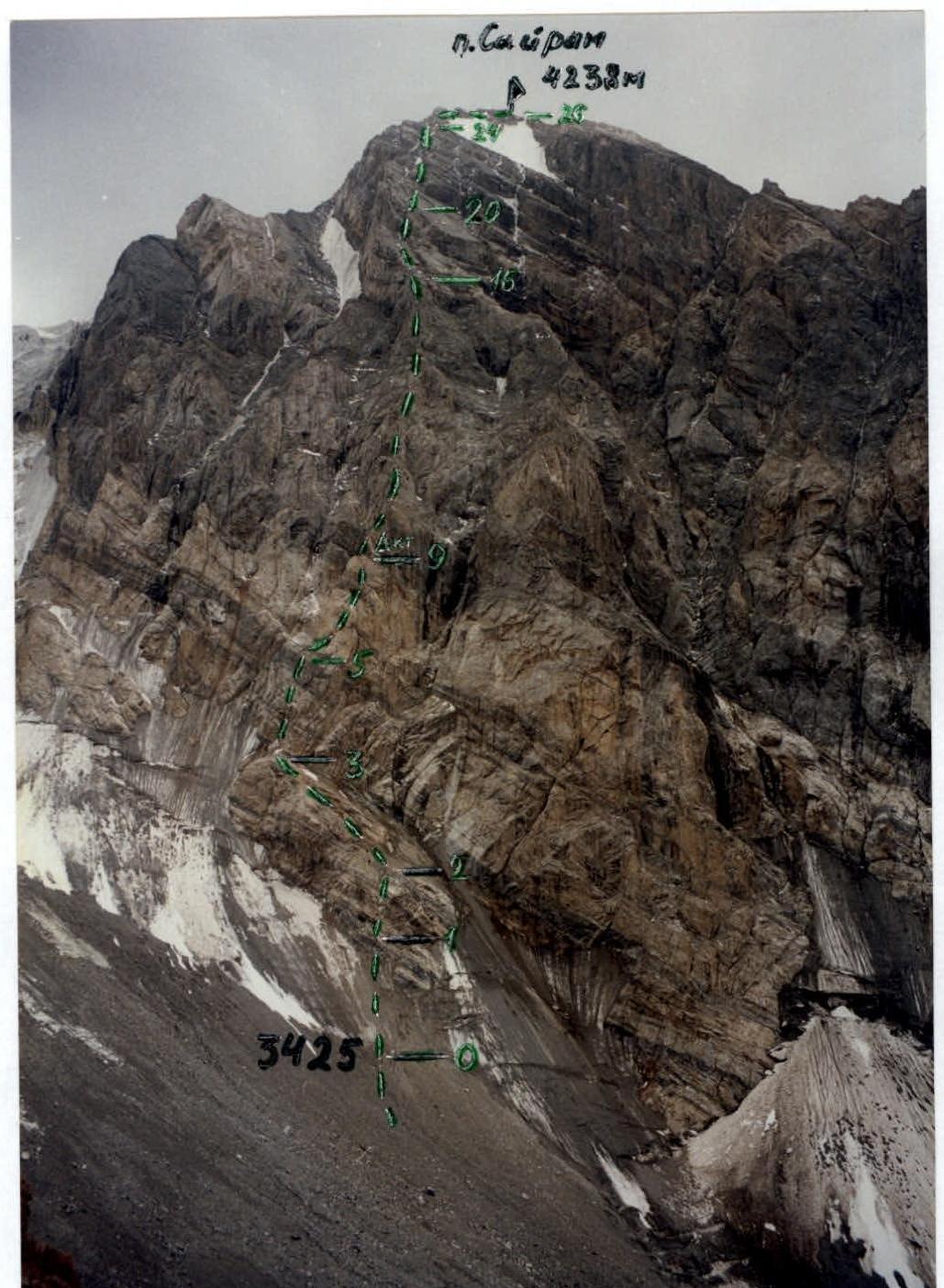
Photo illustration of the report
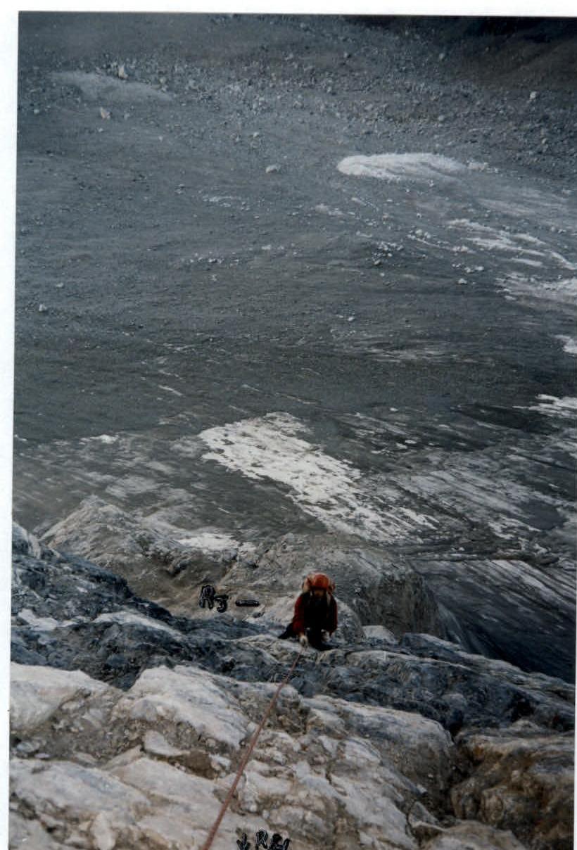
Photo-1. Participant on rope R3–R4.
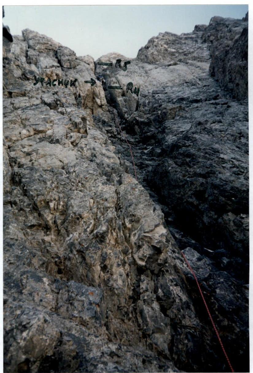
Photo-2. Participant overcoming a crack on section R4–R5.