I. Climbing category: combined 2. Climbing region: Western Tian-Shan, Ugam Ridge 3. Peak, its height, and ascent route: "Druzhba" 4100 m via the chimney from bastion 3 of the ridge 4. Estimated difficulty category: 5B 5. Route characteristics: height difference: 650 m average steepness: 80° length of sections with 5th and 6th difficulty categories: 375 m 6. Pitons hammered: rock pitons: 20 pcs nut placements: 65 pcs bolt pitons: 4 pcs ice screws: 6 pcs 7. Travel time: 17 hours 8. Number of nights and their characteristics: none 9. Participants' full names and sports qualifications: Pyaček František — Master of Sports of International Class Kukučka Róbert — Master of Sports 10. Date of ascent and return: September 19, 1988 II. Organization: SKF "Altex"

Brief description of the route
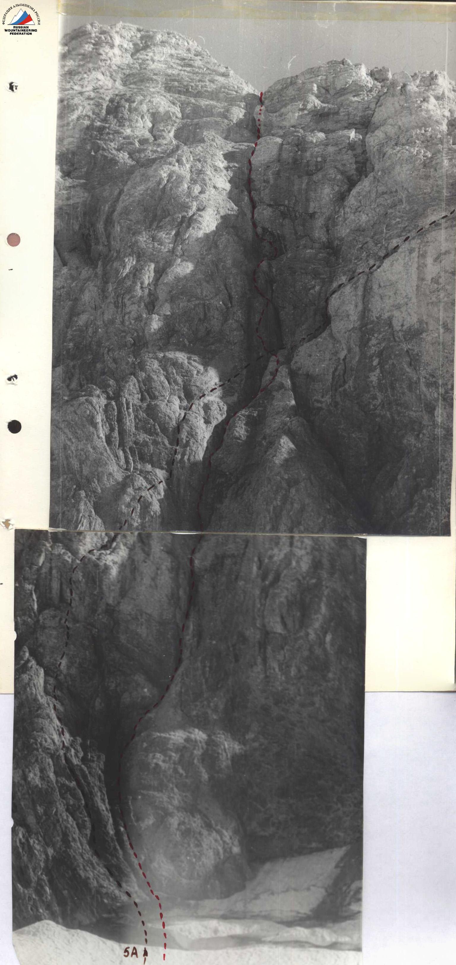
The "Druzhba" peak is located in the Ugam Ridge (Western Tian-Shan), southwest of the "Sairam" peak, the highest point in the area.
From Chimkent city, take the asphalt road to the Kask-Su village and then continue on the dirt road along the river (Sairam-Su) to the base camp (see the area map).
From the base camp, follow a good trail along the Kergely river for 4 hours and 30 minutes to reach the overnight spot near the upper lakes.
The approach to the start of the route takes 2 hours, walking on a wide moraine leading to the cirque of the "Druzhba" peak.
Then, traverse the ice through the bergschrund to the chimney, which is the route. The descent from the summit is via the 103rd ridge, before reaching the "Obedinenny" pass, heading down to the right towards the upper lakes.