ASCENT DOCUMENT
- Ascent class: combined
- Ascent area: Tian Shan (Ugamsky Ridge)
- Peak, its height, and ascent route: "Druzhba" 4100 m, Central couloir N-3 of the wall
- Estimated difficulty category: 4A
- Route characteristics:
- height difference: 620 m
- average steepness: 43°
- length of sections: II — 850 m, III — 165 m, IV — 150 m, V — 50 m 6.7 Number of pitons driven:
- rock: for belay — 16, for aid climbing — 2
- protection elements: for belay — 12, for aid climbing — none
- ice: for belay — 18, for aid climbing — none
- bolt: for belay — none, for aid climbing — none
- Number of climbing hours: 10
- Number of bivouacs and their characteristics: none
- Participants' full names and their sports qualification:
- Galiev M.Sh. — CMS, leader
- Urazalin E.K. — CMS, participant
- Frik Ya.O. — 2nd sports category, participant
- Danilyuk S.V. — 2nd sports category, participant
- Popenko Yu.S. — ICMS
- Team coach:
- Date of departure to the route/peak and return: September 5, 1987
- Organization: Kazakh Alpinist Club
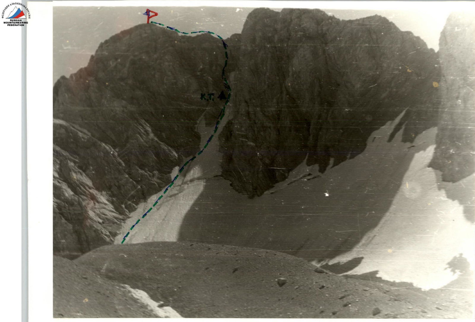
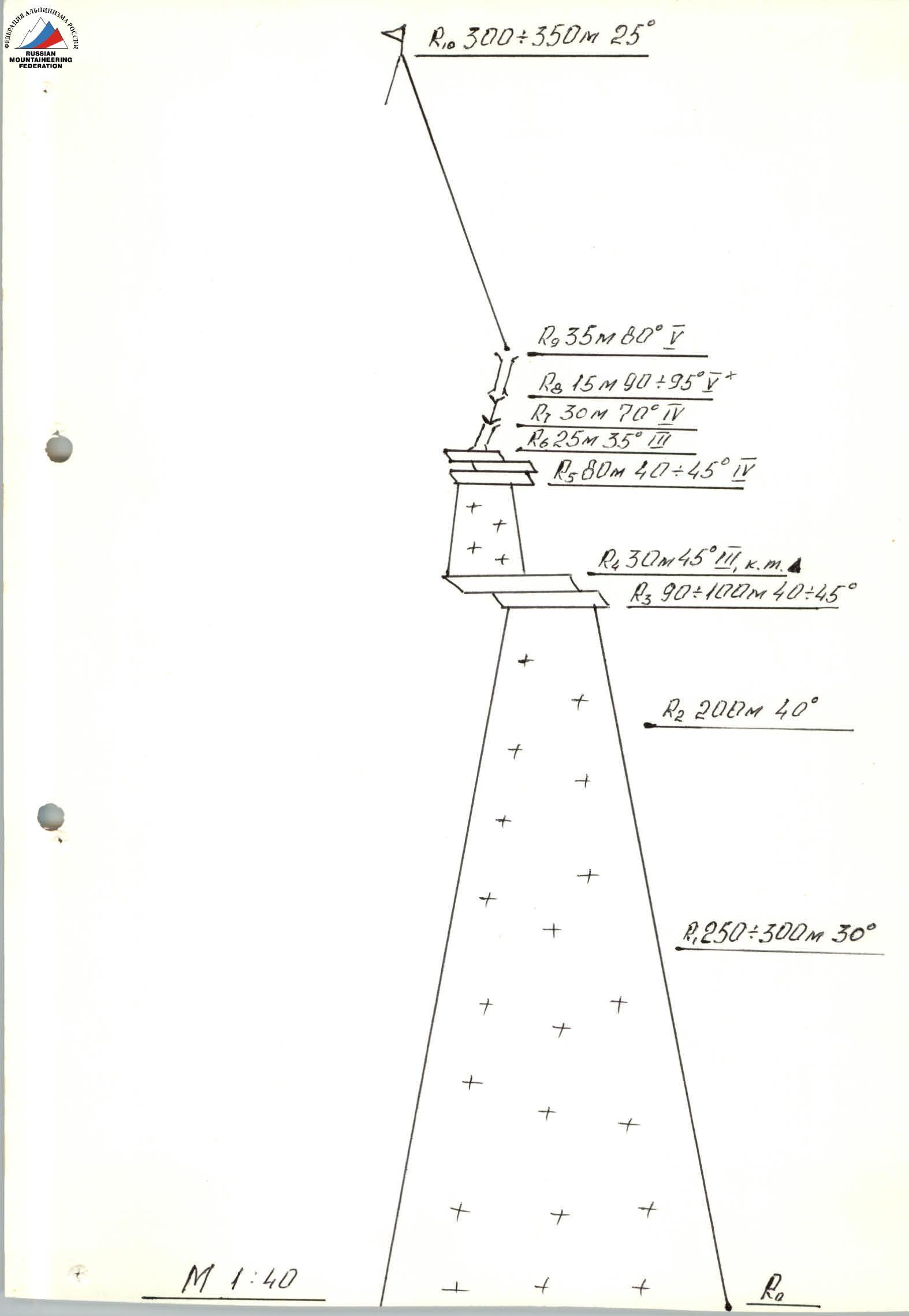
R–R: The route starts on a snowy slope, a bergschrund is visible ahead, it's better to bypass it on the left (hard firn).
- R1–R2: Move all the time to the left, near the rocks. Then move to the center of the couloir (be careful with ice).
- R2–R3: Then move towards the rocky island. Ice belay with pitons.
- R3–R4: On the rocky island, 30 m (fragile rocks). This is the first control point.
- R4–R5: From the rocky island, move 40 m towards the icy couloir. The next 40 m move along the couloir. Then move left to the rocky ridge. Be extremely careful when transitioning to rocks, as they are fragile.
- R5–R6: Then move along the rocks towards the clearly visible rocky "Tooth".
- R5–R7: The rocky "Tooth" is bypassed on the left via a chimney, this is the first crux.
- R7–R8: Ahead, an internal corner of 12–15 m is visible, the second crux. Difficult climbing.
- R8–R9: Here is a good platform where two or three people can gather. From here, climb straight up a 35 m chimney that leads to the pre-summit ridge.
- R9–R10: Along the ridge, after 300–350 m, the summit is reached. Descent from the summit to the south.