Ascent Log
- ASCENT TYPE — ROCK CLIMB
- ASCENT AREA — UGAM RANGE
- PEAK "ALTUS" (3200), NORTH RIDGE
- DIFFICULTY CATEGORY — 3B
- ELEVATION GAIN — 700 m
- NUMBER OF ROCK ANCHORS — 21
- TOTAL CLIMBING TIME — 12 hours
- TEAM MEMBERS:
- RAFIKOV SH.R. — 2nd sports category
- METZDORF V.R. — 2nd sports category
- ZHURAVSKY N.N. — 2nd sports category
- GUZOVSKY K. — 2nd sports category
- ASCENT DATE — May 4, 1977
Description of the ascent to peak "Altus" (3200) category 3B
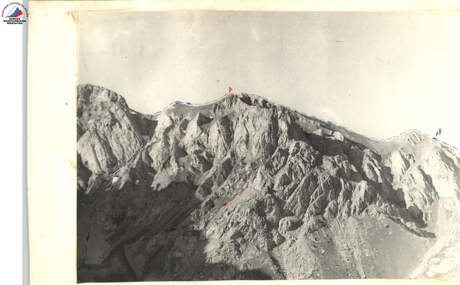
Via the north ridge. From "Green Glade" to the fork in the gorge — 40 min. From the fork, bypassing the north ridge of peak "Altus" on the left, exit onto the moraine under the northeast wall of peak "Altus". From the fork — 3 hours. Overnight stay here.
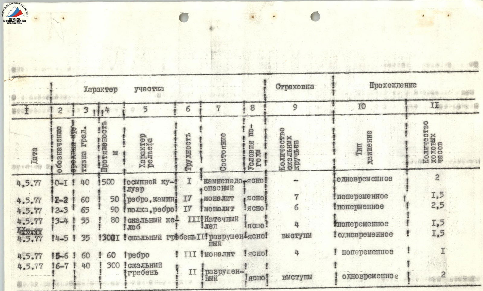
Section 1
- Enter the breach in the north ridge, forming a window, via the right side of a wide scree-filled couloir.
- Early departure from the overnight camp, as the couloir is prone to rockfall.
- Within the breach — the first control cairn.
Section 2
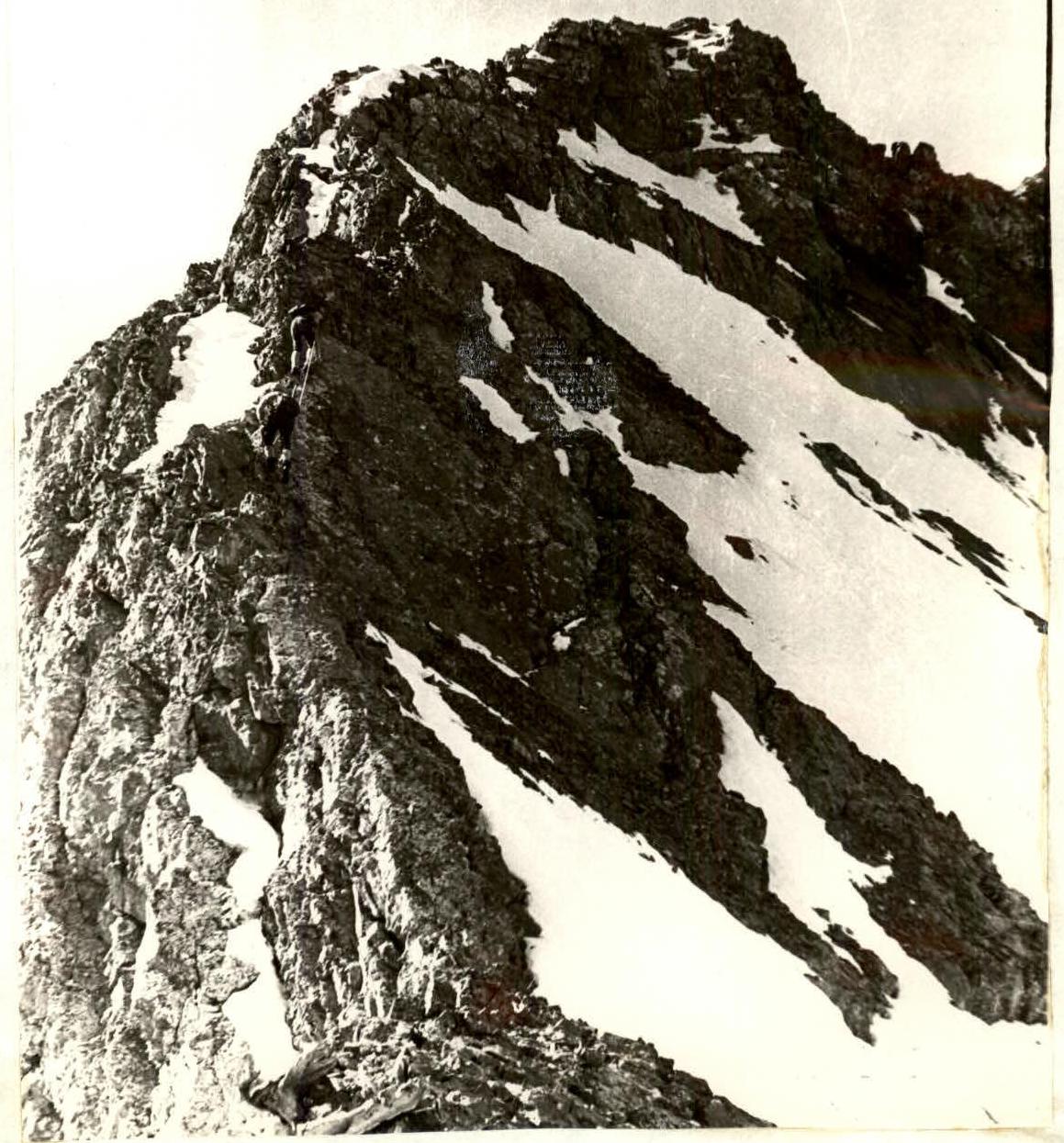
The path along the ridge begins with a 25-meter wall with a steepness of 70°. The rocks are complex. Further on — a 5-meter vertical chimney leading to an inclined ledge on the left side of the ridge.
Section 3
Along the 60-meter ledge upwards and the base of a 30-meter wall, which is climbed directly. Difficult climbing, small holds. The wall's steepness is 85°. At the top of the wall — a platform with the second control cairn.
Section 4
From the platform, upwards to the right along a snowy slope (45°), leading into a rocky gully filled with meltwater ice and having a steepness of 60°. The section is 80 m long.
Section 5
The path follows a heavily jagged 300-meter rocky ridge to the base of a gendarme. From the overnight stay — 8 hours. At the base of the gendarme — a convenient overnight spot.
Section 6
Ascent to the top of the gendarme. The path follows a sharp rocky edge with a series of 4–6-meter walls. On the gendarme's summit — the third control cairn.
Section 7
From the gendarme's summit to the next step of the ridge leads a 45-meter rocky "knife-edge", transitioning into a sharp rocky ridge with a steepness of up to 40°, leading to the summit. The ridge's length is 300 m.
Descent from the summit (100 m):
- initially along moderately difficult rock,
- then along a wide scree-filled ridge — to a saddle in the ridge and the massif of peak Sayramsky,
- further left, down a couloir to the overnight location.
 Section 2. Beginning of the ridge traverse