Ascent Passport
- Climbing category: Technical
- Climbing region: Tian-Shan, Terskey Ala-Too Ridge, Tong Pass area, Ashutor tract.
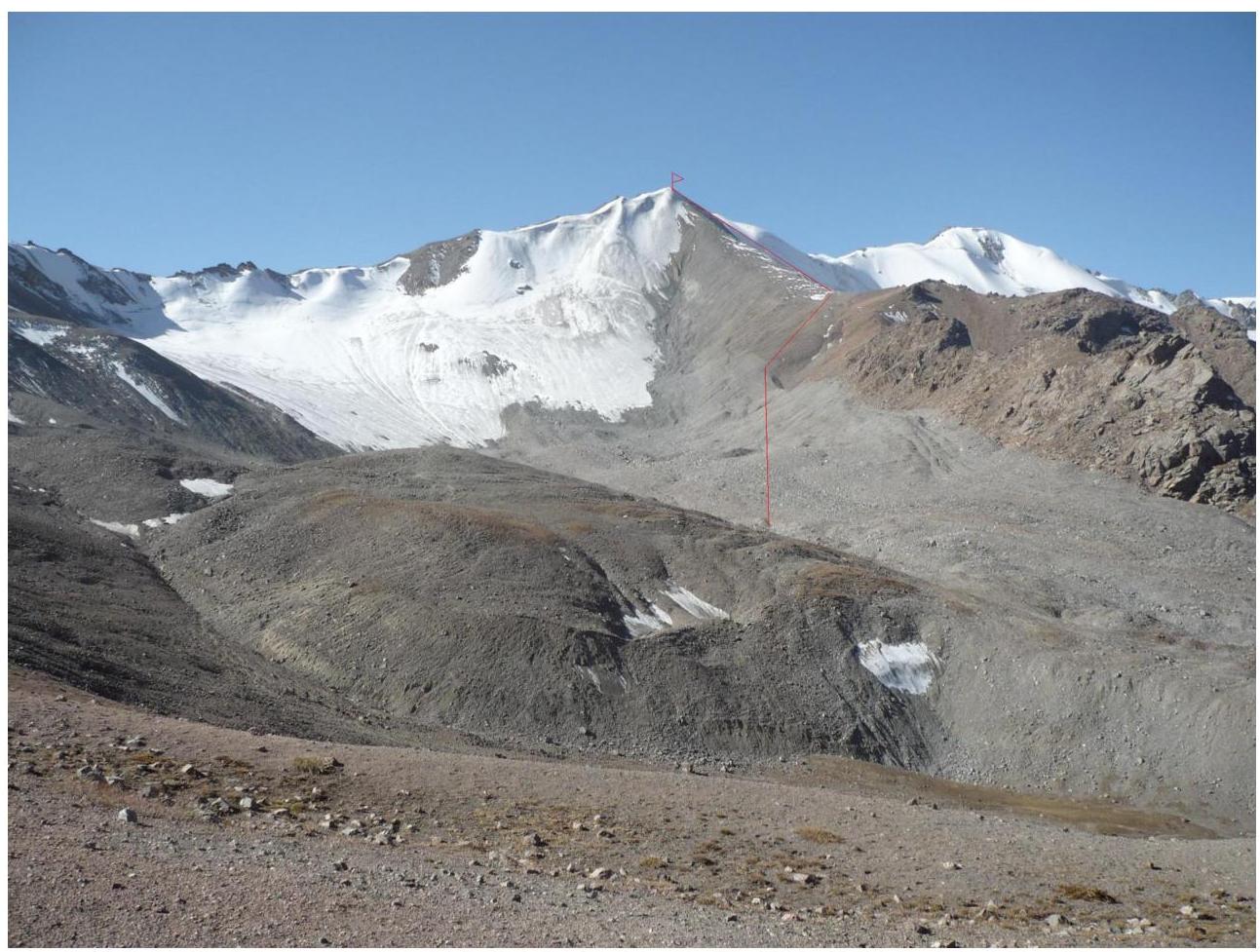
- Peak, route: First ascent to the peak 4290 m via the northern ridge.
- Assumed category of difficulty: 1B.
- Height difference: 707 m.
- Total route length: 1020 m.
- Length of key sections: 38 m.
- Including 3rd category of difficulty: 38 m.
- Number of pitons driven; ice screws — 4 pcs.
- Number of walking hours/days: 11 hours.
- Leader: Bogolyubov V.V., CMS.
- Participants: Zhyrgalbekova Zh.Zh., Bekbolotova K.N., Dootu uuulu Nursultan
Dootu uuulu Nursultan
- Coach: Bogolyubov V.V., CMS.
- Route start: 8:00. Date October 4, 2013.
- Reaching the summit: 15:00. Date October 4.
- Return: 19:00. Date October 4.
Route Description
| Section # | Category of difficulty | Steepness | Length | Insurance | Notes |
|---|---|---|---|---|---|
| R0–R1 | 1st cat. diff. | 10-30^{*} | 982 m | ||
| R1–R2 | 3rd cat. diff. | 40^{*} | 38 m | Alternating piton belay. | |
| :-- | :--: | :--: | :--: | :--: | :--: |
R0–R1 — the route starts from the Tong valley, ascending via the small scree of the northern ridge.
R1–R2 — reaching the summit via a 40° ice slope. Descent via the same path as the ascent.
 map
ascent area diagram
map
ascent area diagram
