Ascent Log.
-
Rock climbing category.
-
Terskey-Alatoo ridge, Tashtambektor gorge.
-
Panoramnaya peak, 3600 m, via the North-Eastern ridge.
-
Assumed category complexity 1B, first ascent.
-
Characteristics: height difference — ~600 m, average steepness — 30°.
-
Pitons driven for belay — none.
-
Departure and return date — July 26, 1977.
-
Total climbing hours — 3.5 hours.
-
No overnight stays.
-
Group composition from MOS DSO "Zenit":
Gorohoff A.A. — 3rd sports category, KSP doctor Starikov G.A. — CMS, instructor Kovalev A.V. — CMS, instructor Lakeenkova N.V. — 1st sports category
-
Coach — Penchuk V.L., Master of Sports of the USSR.

Ascent Description.
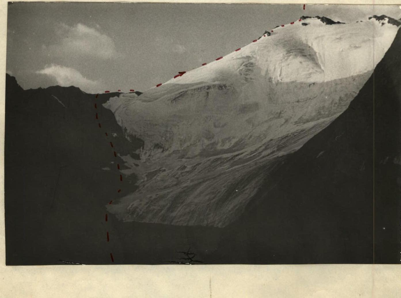 Panoramnaya peak (I) is situated in the eastern spur of Tashtambektor peak (see map of the area). The entire ascent route is visible from the base camp (photo I).
The ascent proceeds as follows: crossing the Tashtambektor river via boulders, we ascend a grassy slope along a stream into the cirque of Panoramnaya peak — 1 hour. Then, via talus, we descend to the tongue of the glacier and further ascend along the left edge of the cirque — on the move towards the NE ridge col. The ascent to the col proceeds via a series of rocky-talus couloirs — another 1.5 hours.
Forming rope teams, the movement initially proceeds along a simple rocky ridge with an exit onto a steep snowy slope about 200 m, leading to the foot of the peak. Via simple, broken rocks — 40 m — we ascend to the summit tower, a small platform.
From the base camp, it takes 3.5 climbing hours. The peak is a good viewpoint for the area.
The descent proceeds via the ascent route and takes 1.5 hours. The route corresponds to category 1B complexity when compared to other classified routes.
Description by A. Gorohoff
