Ascent Passport
-
Tian-Shan, Terskey Ala-Too, 7.10.
-
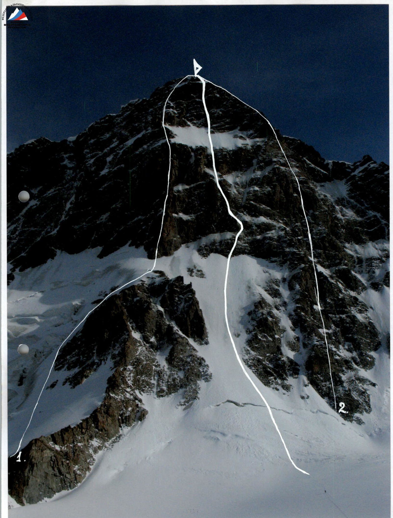
Jigit peak, 5170 m, via the center of NW wall.
-
Proposed 6A category of complexity, first ascent.
-
Route type: combined.
-
Route elevation gain: 1016 m.
Route length: 1165 m. Section lengths:
- V category of complexity — 205 m
- VI category of complexity — 200 m Average steepness:
- main part of the route — 66°
- entire route — 66°
-
Pitons left on the route: total — 16; including piton hooks — 14* Pitons used on the route: 417
- stationary piton hooks — 14; including artificial holds — 0
- removable piton hooks — 0; including artificial holds — 0
- total artificial holds (AID) used — 211**
-
Team's total climbing hours: 60.6 hours.
-
Team leader: Korobkov Alexander Alexandrovich, Master of Sports Team members:
- Bobrov Igor Borisovich, Candidate for Master of Sports
- Borich Mikhail Alexandrovich, Candidate for Master of Sports
- Grachev Sergey Anatolyevich, Candidate for Master of Sports
- Dashkevich Sergey Alexandrovich, 1st sports category
- Smagin Nikolai Vladimirovich, 1st sports category
-
Coach: Timofeev Sergey Vladimirovich, Master of Sports
-
Departure to the route: 9:00, March 1, 2006. Summit: 14:10, March 6, 2006. Return to Base Camp: 22:00, March 7, 2006.
* for descent
** including ice screws
General photo of the summit
- A. Ryabukhin, 65, 6A "by the bulls"
- A. Ryabukhin, 66 6A
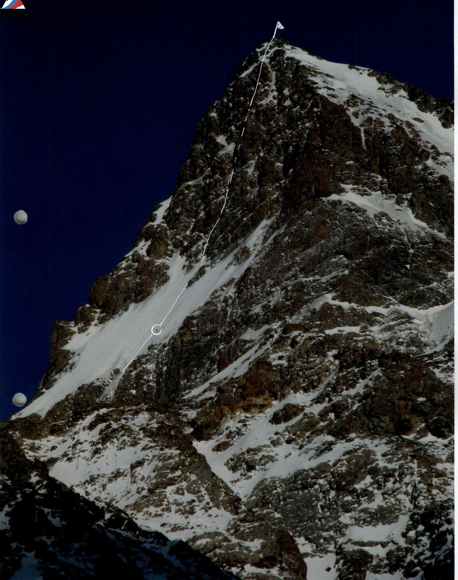
Photo of the pre-summit bastion profile from the right

Photo of the wall profile from the left. The Terskey-Ala-Too ridge frames the Issyk-Kul lake basin from the south in a latitudinal direction. The ridge is about 375 km long. The highest point is Karakol peak (5281 m) in the Karakol area. A major node of glaciation is located in the upper reaches of the Karakol, Jety, and Oguz rivers.
The climate is harsh, with frequently changing weather influenced by Lake Issyk-Kul. The average daily temperature in summer at an altitude of 3000 m becomes positive only at the beginning of July, and the most favorable period is from July 15 to August 31. In winter, conditions are created for the stagnation of cold air and its strong supercooling:
- Average February temperature — minus 28°C
- Absolute minimum — minus 53°C.
Just 40 km from the city of Przhevalsk is the Karakol area, where from the tops of 5-thousand-meter giants, the water surface of Issyk-Kul — the pearl of the "Celestial Mountains" — can be seen in the sunset haze. The rays of the setting sun color the northern walls of Karakol peak (5281 m) and Slonenok peak (4726 m) golden, and at sunrise, they ignite the rock bastions of the "disgraced Soviet generals" peaks — Karbyshev (4700 m), Tukhachevsky (4715 m), and Blyukher (4720 m), which close the grand cirque of the Karakol valley. Nearby, the grandiose Jigit massif (5170 m) blocks the Kel-Tor valley with its vertical 1.5-kilometer North wall, flashing with the color of sunrise in the mornings. The imagination pictures a huge rider galloping over the mountain world, with his head bent down to the mane of his horse...
More than 12 routes have been laid on Jigit peak, of which 10 have a category of complexity 5B and 6A. The Eastern ridge was first ascended in 1939 by a group of Uzbek climbers led by V. Racek. The North wall is the most inaccessible. With a height difference of 1700 m, it was conquered in 1965 by a group of climbers from Chelyabinsk led by A. Ryabukhin, who also made the first ascent of the North-West wall in 1966. Subsequently, other routes were climbed, including the route by I. Slesov on the central part of the North wall, the route by D. Sharashenidze on the triangle of the North wall, and the route by V. Vakuryan on the center of the Kara North wall (all 6A category).
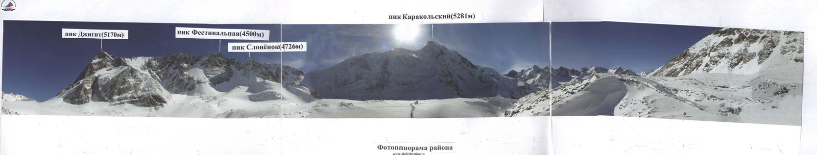
Panorama of the area
Approach to the North-West wall of Jigit peak
From the city of Karakol in winter, the road is divided into several stages. Due to the low traffic in the area, there is only a road up to the forestry house. Therefore, we were transported to Jigit peak in four stages.
First stage: by car (preferably with three driving axles) to just above the forestry house.
Second stage: transportation of cargo on horses; we skied with light backpacks and trod a path for the horses. We were transported just above the Karakol base camp. The first and second stages took a whole day (12 hours).
Third stage: we shuttled cargo to a small moraine in front of Karakol peak, where we set up the base camp. It took three days.
Fourth stage: it took another two days to tread a path and transport cargo to the North-West wall of Jigit peak.
Recommendations:
- it is advisable for all participants to have skis;
- sleds for transporting cargo;
- the ideal option is to have snowmobiles for transportation.
In summer, it is possible to reach the North-West wall of Jigit peak from the On-Tor glacier in one day. In winter, we took six days.

Climbing days, including processing days, August 15–16
| Time worked on the route (hours) | Hours of bad weather during work on the route (hours) | Route height (m) | |
|---|---|---|---|
| 01.03 | 9 | 4 | 4459 |
| 02.03 | 10 | 5 | |
| 03.03 | 9 | 5 | |
| 04.03 | 10 | 4 | |
| 05.03 | 10 | 4 | |
| 06.03 | 12 | 2 | 5170 |
| Section # | Ice screws | Rock pitons | Nut placements | UIAA SYMBOLS M 1:2000 route diagram | Section complexity | Length (m) | Steepness (degrees) |
|---|---|---|---|---|---|---|---|
| 8 | 2 | 0 | 0 | 02.03.06 + | 4 | 20 | 65 |
| 7 | 4 | 0 | 0 | + | 4 | 50 | 65 |
| 6 | 4 | 0 | + | 4 | 50 | 65 | |
| 5 | 4 | 0 | + | 4 | 50 | 65 | |
| 4 | 4 | 0 | 0 | + | 4 | 50 | 65 |
| 3 | 4 | 0 | 0 | + | 4 | 50 | 65 |
| 2 | 5 | 0 | 0 | PHOTO N 1 + | 4 | 50 | 65 |
| 1 | 0 | 0 | 0 | 01.03.06 + | 2 | 100 | 60 |
| 17 | 2 | 2 | PHOTO N 10 | 5 | 45 | 75 | |
| 16 | 2 / 8 * | 8 / 3 | 6 | 25 | 80 | ||
| 15 | 3 / 15 * | 4 / 2 | 6 | 15 | 85 | ||
| 14 | 3 | PHOTO N 5 + PHOTO N 6 03.03.06 PHOTO N 7 | 4 | 20 | 55 | ||
| 13 | 3 / 6 * | 8 | PHOTO N 9 | 6 | 25 | 75 | |
| 12 | 1 | 3 | 4 | 15 | 50 | ||
| 11 | 5 / 12 * | 6 / 1 | PHOTO N 3 | 6 | 25 | 80 | |
| 10 | 2 | 4 | 10 | 55 | |||
| 9 | 2 / 10 * | 8 / 2 | PHOTO N 4 | 6 | 30 | 75 | |
| 25 | 0 | 1 / 30 * | 6 | 6 | 20 | 80 | |
| 24 | 2 | 0 | 0 | + | 4 | 25 | 55 |
| 23 | 6 | 0 | 0 | + | 4 | 90 | 55 |
| 22 | 1 | 1 / 5 * | 8 | PHOTO N 13 | 5 | 25 | 65 |
| 21 | 2 | 0 / 8 * | 2 | PHOTO N 12 | 6 | 15 | 90 |
| 20 | 2 | 4 / 15 * | 4 | 6 | 25 | 85 | |
| 19 | 2 | 0 | 0 | 4 | 15 | 65 | |
| 18 | 3 | 1 | 0 | 05.03.06 PHOTO N 11 | 4 | 45 | 70 |
| 33 | 0 | 0 | 0 | PHOTO N 15 PHOTO N 16 PHOTO N 17 | 1 | 20 | 35 |
| 32 | 0 | 0 | 0 | + | 3 | 45 | 55 |
| 31 | 2 | 2 | 8 | + | 4 | 40 | 70 |
| 30 | 0 | 3 | 15 | + | 5 | 45 | 70 |
| 29 | 0 | 2 / 24 * | 15 | + | 5 | 45 | 85 |
| 28 | 0 | 1 / 15 * | 5 | PHOTO N 9 + | 5 | 20 | 65 |
| 27 | 0 | 0 / 25 * | 9 | + | 6 | 20 | 75 |
| 26 | 0 | 1 / 30 * | 6 | 5 | 25 | 70 |
* ice screws
The height of Jigit peak: 5170 m.
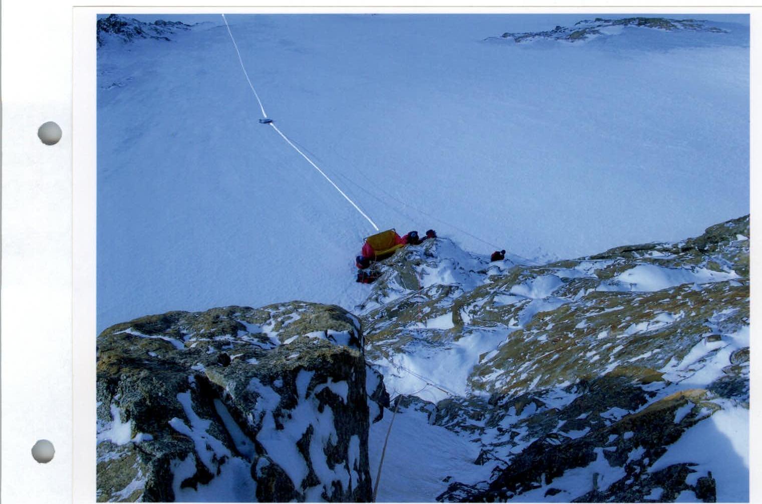
Photo 2. Camp №2
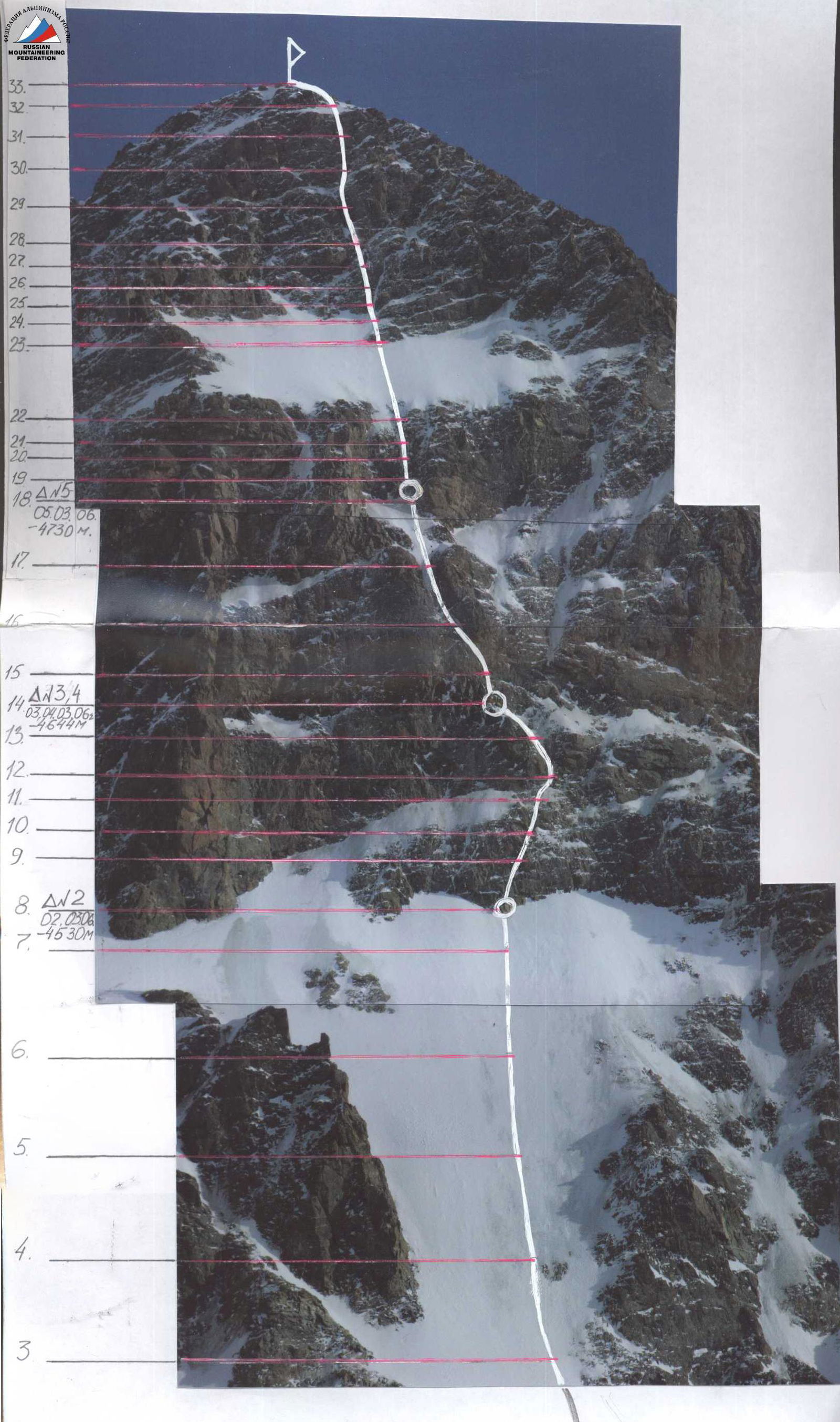
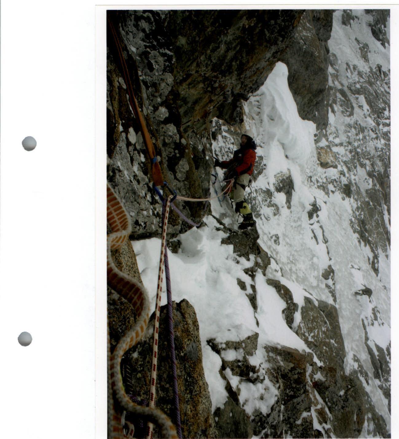
Photo 3. Section R11
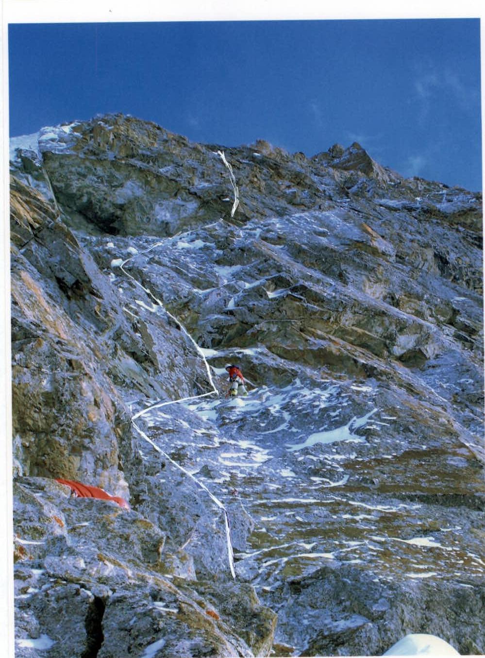
Photo 4. R9–R12
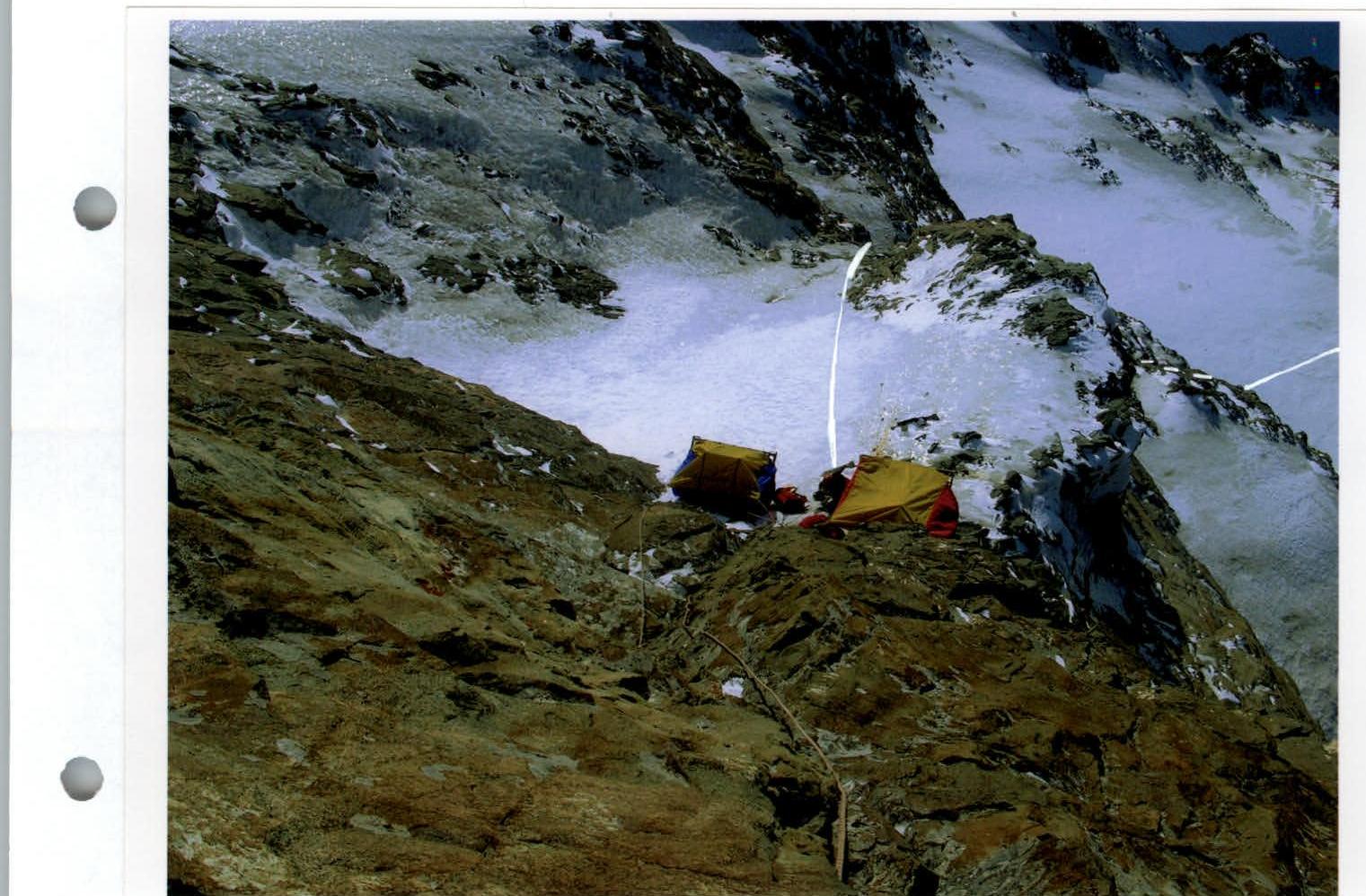
Photo 5. Camp №3

Photo 6. Section R13–R14
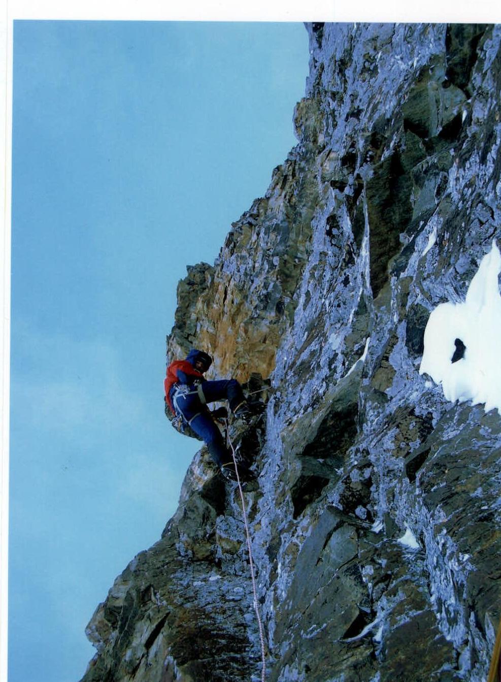
Photo 7. Section R14–R15

Photo 8. Section R14–R15

Photo 9. R14–R16
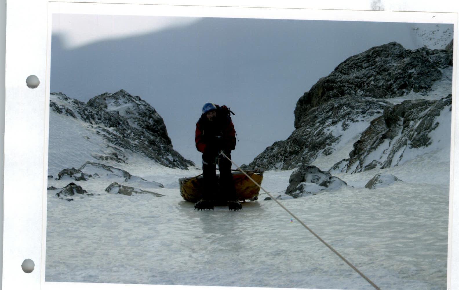
Photo 10. Section R17
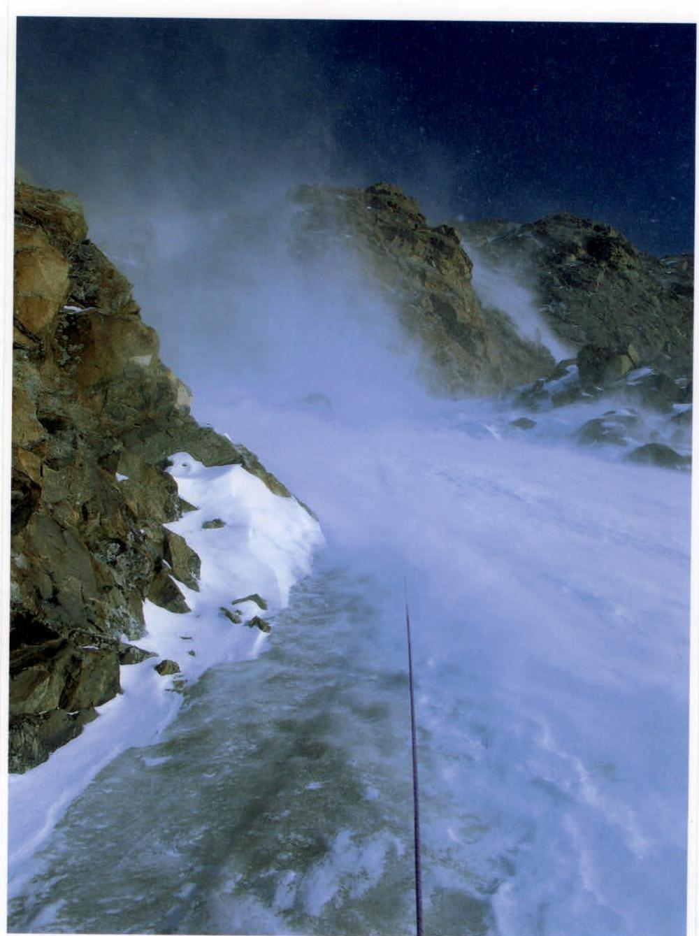
Photo 11. Section R18
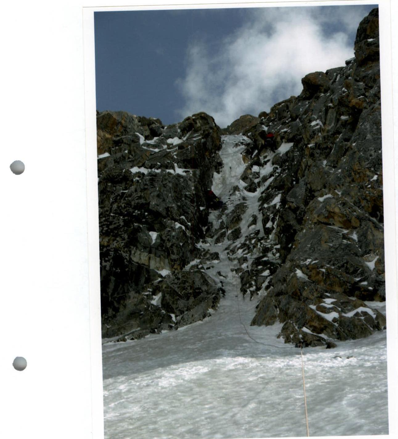
Photo 12. Section R21
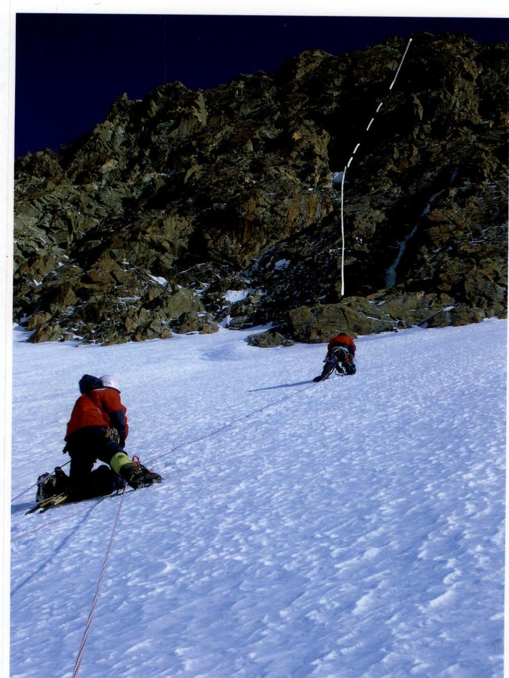
Photo 13. Section R21–R23