Ascent Passport
- Ascent area: Tian Shan, Terskey Ala-Too range, Karakol valley
- Peak 20 let Latvii ~4130 m via the eastern counterfort and NE ridge
- Proposed category of complexity: 2B. First ascent.
- Route character — combined
- Route elevation gain: 500 m (by altimeter)
- Route length: 800 m
- Used on the route: ice screws — 12, rock pitons and chocks — 0, bolt hangers — 0
- Pitons left behind — 0
- Team's climbing hours — 13
Departure from base camp in Karakol valley — July 26, 2012 at 6:00,
start of work on the route — 9:30,
summit — 14:00,
descent to camp — 19:00
10. Descent from the summit: via the NW slope.
11. Ascent made by the team of Salnikov Dmitriy (1st sports category, instr. No. 1210), Artamonov Sergey (2nd sports category), Semenov Pavel (3rd sports category)
12. Coach: Salnikova Mariya Petrovna (1st sports category, 2nd category judge)
13. Organization: Tomsk Regional Public Organization "Tomsk Alpine Federation", Tomsk
14. Compiled by: Semenov Pavel Arkadyevich (paxan_semenov@mail.ru)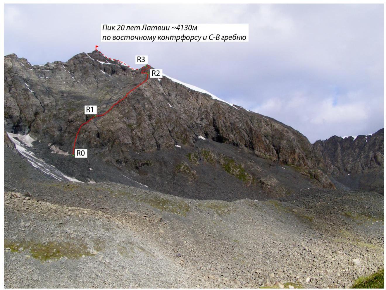
Tomsk 2013
Peak 20 let Latvii from Karakol valley. Distance to the start of the route is 700 m (July 26, 2012)
Route breakdown:
| Section # | Length | Steepness | Terrain character | Category of difficulty | Number of pitons |
|---|---|---|---|---|---|
| R0 | 150 m | 45–50° | Broken rocks | II–III | - |
| R1 | 400 m | 40–45° | Broken rocks | II | - |
| R2 | 100 m | 50° | Icy rocks | III | - |
| R3 | 150 m | 40–50° | Snow | II | 6 |
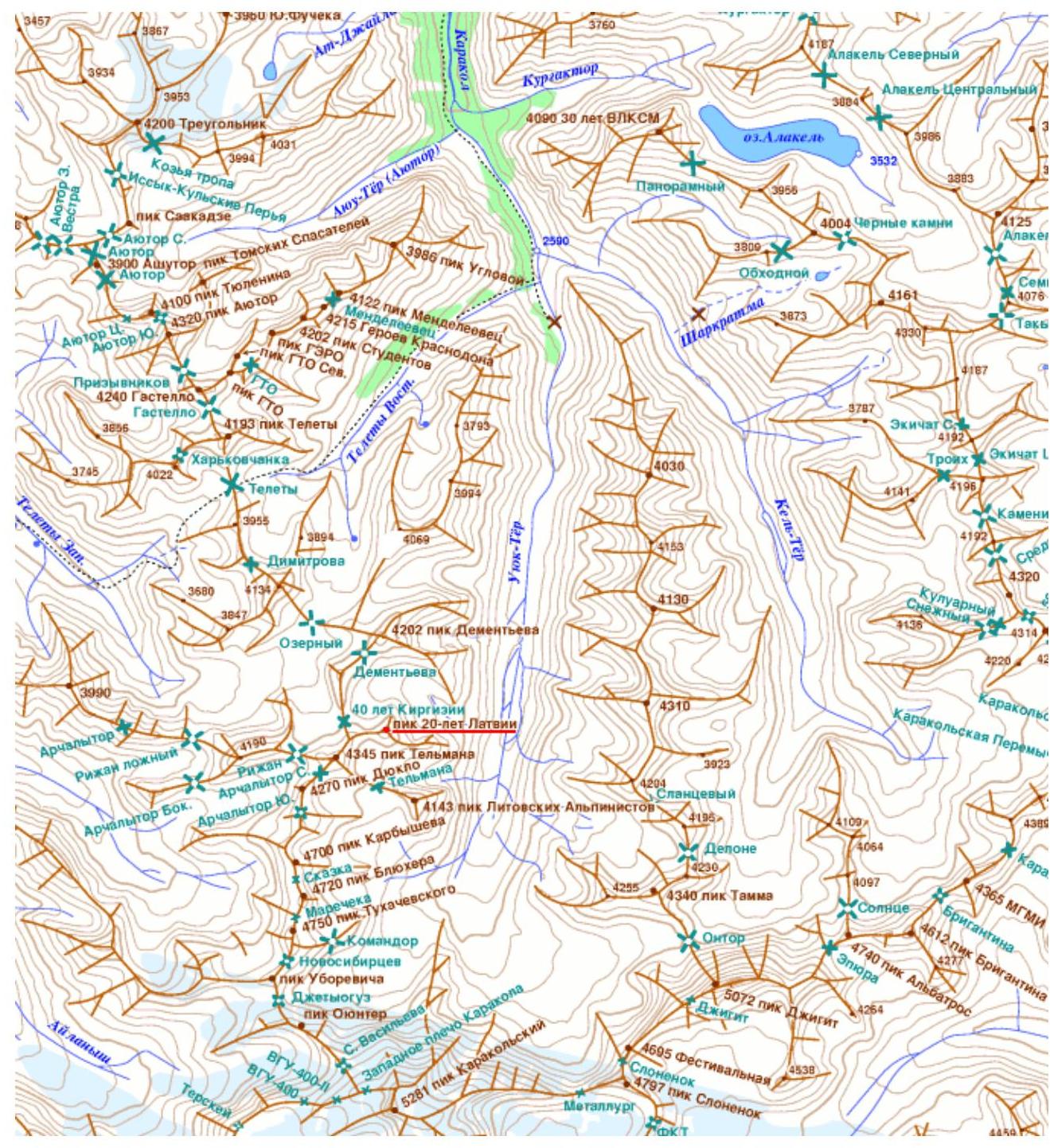 |
Area map

Description of the route
Peak 20 let Latvii is a summit located in the western chamber of the upper part of Karakol valley. The summit is adjacent to Peak Telman, and via the 40 let Kirgizii pass — to Peak Dementyev. It is located in the so-called "Lithuanian corner" together with other peaks.
The ascent started from the camp, set up on the gravel areas of the valley in front of the Ontor glacier. The valley is located at an altitude of 3200 m. Departure from the camp was planned for 6:00. Approach to the summit was made via a steep scree couloir on the slope of the valley. The scree is stable and very convenient for ascent. A landmark is also a waterfall on the left side, above the middle of the valley slope (photo 1).
The ascent via the couloir to the cirque takes 1–2 hours. At 8:30, a general view of the summit opened up (photo 2) at an altitude of about 3500 m.
After conducting reconnaissance to find a logical path to the summit, a route via the eastern counterfort was chosen. And at 9:30 we were already under the route (photo 3).
Section R0 represents a fairly steep ascent via the inner corner onto the counterfort of the mountain. The rocks here are broken and there is a risk of rockfall. The length of the section is about 150 m with a steepness of 45–50°. Alternating movement, protection through rock outcrops.
After approaching section R1, a panorama of the rock couloir under the summit and the counterfort to the right, ending in a drop, opens up. It is not recommended to move in the couloir due to the risk of snow cornice collapse from section R3. Therefore, we chose a route via the counterfort.
Section R1 represents a heavily broken rock ridge with a steepness of 40–45°. Movement on sections R0–R1 is simultaneous with protection through rock outcrops. After 350–400 m, this ridge ended in a huge gendarme, which we decided to bypass on the left (section R2), as there was a huge drop to the right. On the other side, the gendarme was covered with snow and ice. The icy inner corner leads upwards. The abundance of snow allowed us to pass the section via snow steps, after which we found ourselves above the gendarme and near the snow cornices. At this point, in different weather conditions, it is possible to use a rope for protection to overcome the steep section.
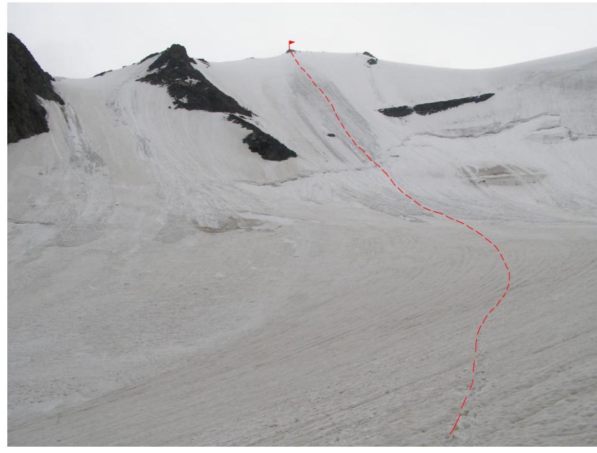
Finding ourselves in front of the snow ridge (section R3, photo 4) leading to the summit, it was decided to put on crampons and move in a rope team towards the summit. To the southeast, the cornice drops off with large overhangs. Large snow cornices, up to several meters wide, are hanging. To the northwest, the ridge slopes down at an angle of 45–50°. The thickness of the snow cover was about 1 m. We found ourselves in rather unfavorable weather conditions with wet snow. The ascent is avalanche-prone. We moved towards the summit in a rope team, with simultaneous protection, using ice screws. The ice under the snow cover was quite fragile and unreliable, and it took a lot of time to place each screw.
We reached the summit (photo 5) around 14:00. We found: several tin cans, a cairn, a rotten note. The state of the note was so poor that it was not possible to unfold and read it.
After a short stay on the summit, it was decided to descend down the icy slope of the mountain (NW slope), which ended in a glacier surrounding the mountain. The approaching thunderstorm made it impossible to descend via the ascent route. And besides, the descent via the ice wall looked logical, fast, and safe with proper preparation.
We needed 7–8 ropes to safely descend down to the gentle section. At the bottom, there was a fairly wide bergschrund (2–4 m), which was partially already filled with snow. Once on the flat section of the glacier, we moved without a rope and crossed the glacier, continuing our descent. The glacier is open. In some places, it is broken by radial crevasses.
The descent route (photo 7) can be graded 2B–3A. The main difficulty is the bergschrund at the base. A fairly high steepness (about 50°) does not allow snow to accumulate. And the ascent route is relatively safe. The route length is 350–450 m.
After descending to the flat part of the glacier, the weather worsened. Rain started, which prevented us from descending from the slope of Karakol valley. For some time, we waited for the weather to improve at the foot of the rock above the start of the descent. After 1–2 hours of waiting, we descended to the camp via relatively dry rocks by 20:00.
The route turned out to be interesting and diverse in terms of terrain forms. It is not recommended in wet, rainy weather, as the rocks are quite steep and heavily broken. The route can be recommended for acclimatization before ascending higher and more serious peaks in the Ontor glacier cirque and Karakol valley. The descent route can also be used for ascent.
Photos
Photo 1: Waterfall on the slope of Karakol valley
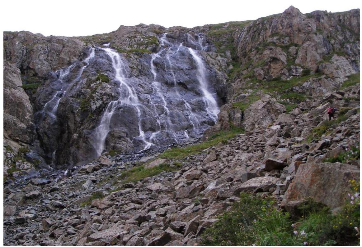
Photo 2: General view of the mountain
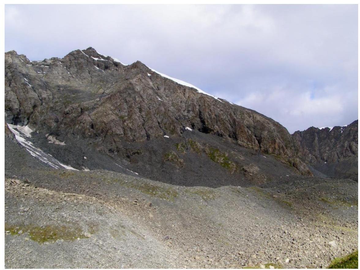
Photo 3: Section R0, start of R1
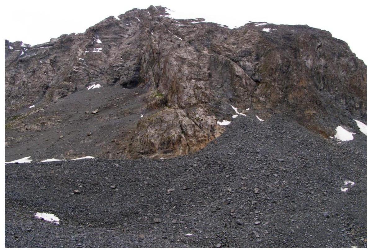
Photo 4: Section R3
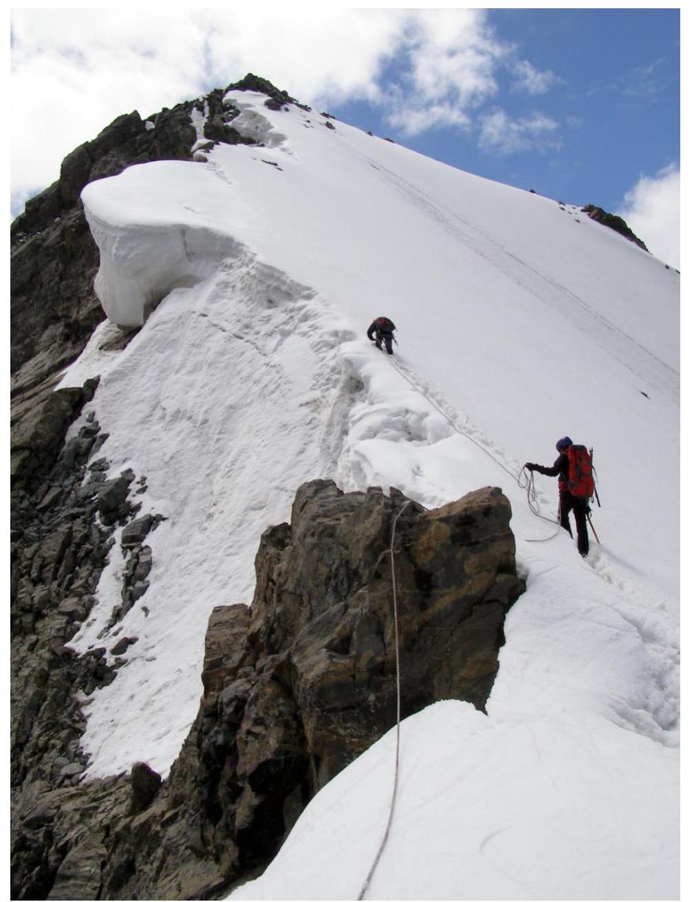
Photo 5: Summit
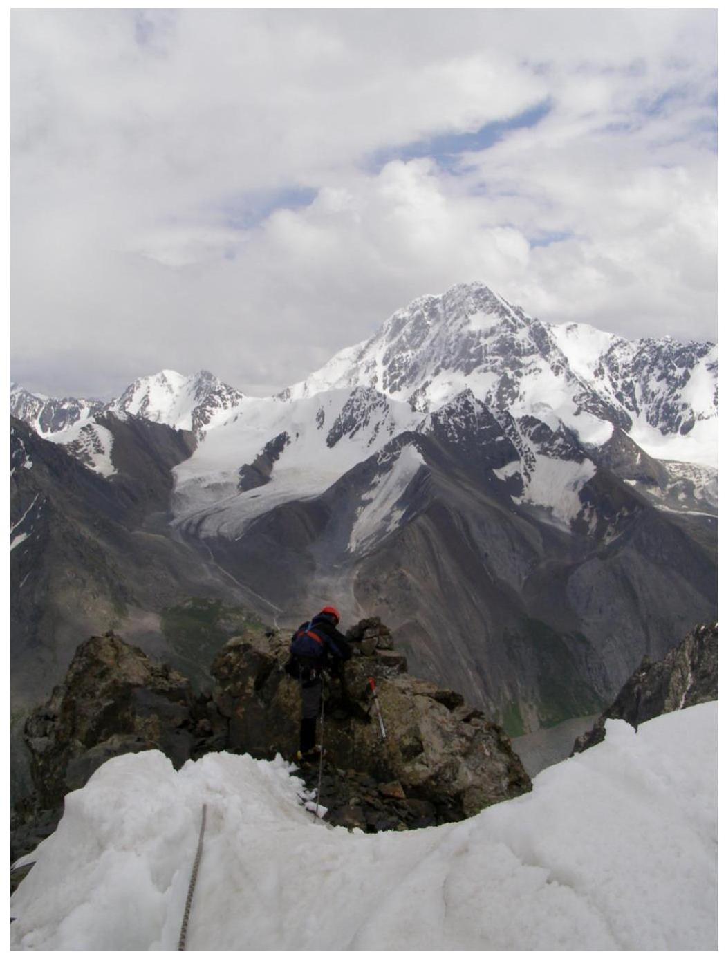
Photo 6: Descent from the summit
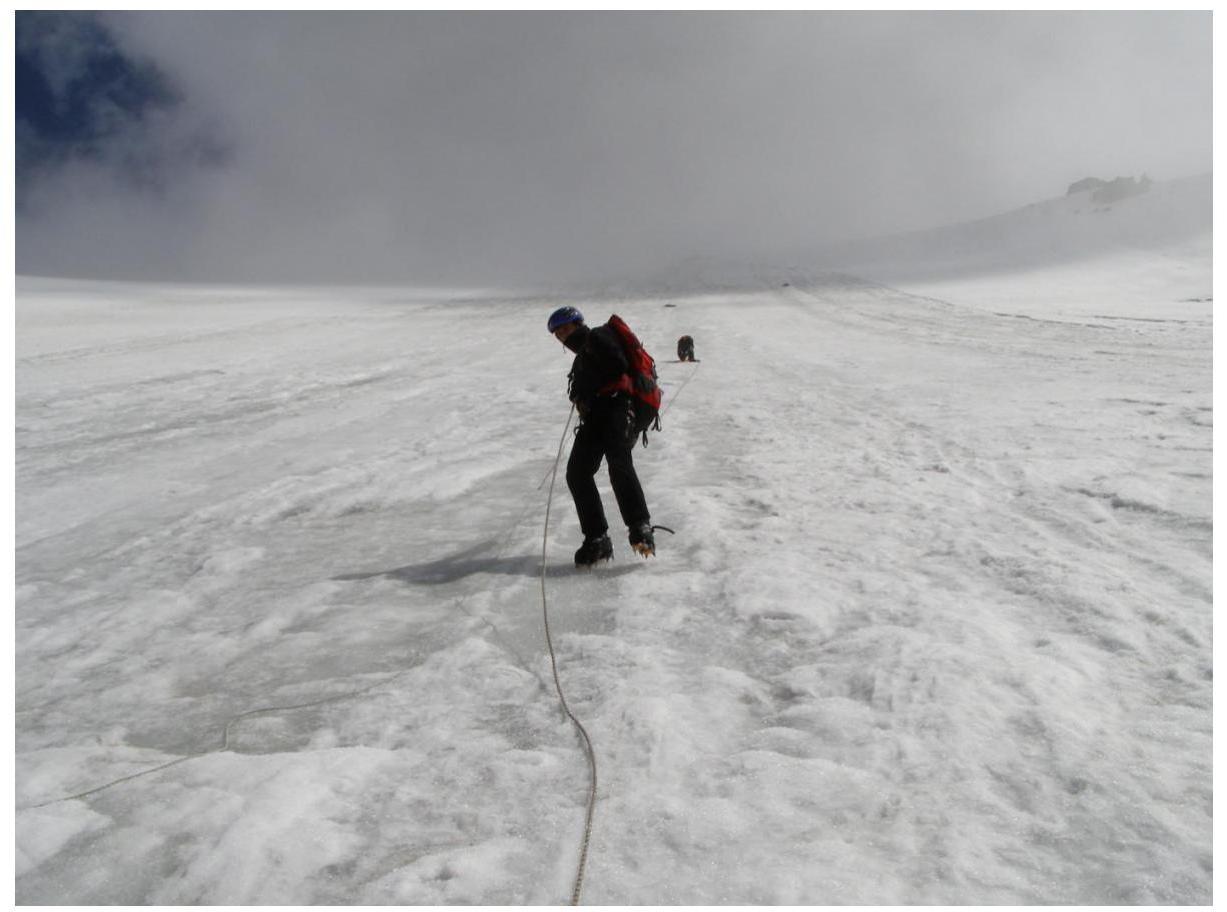
Photo 7: Peak 20 let Latvii, NW slope; descent line