
Ascent Log
I. Ascent class: technical.
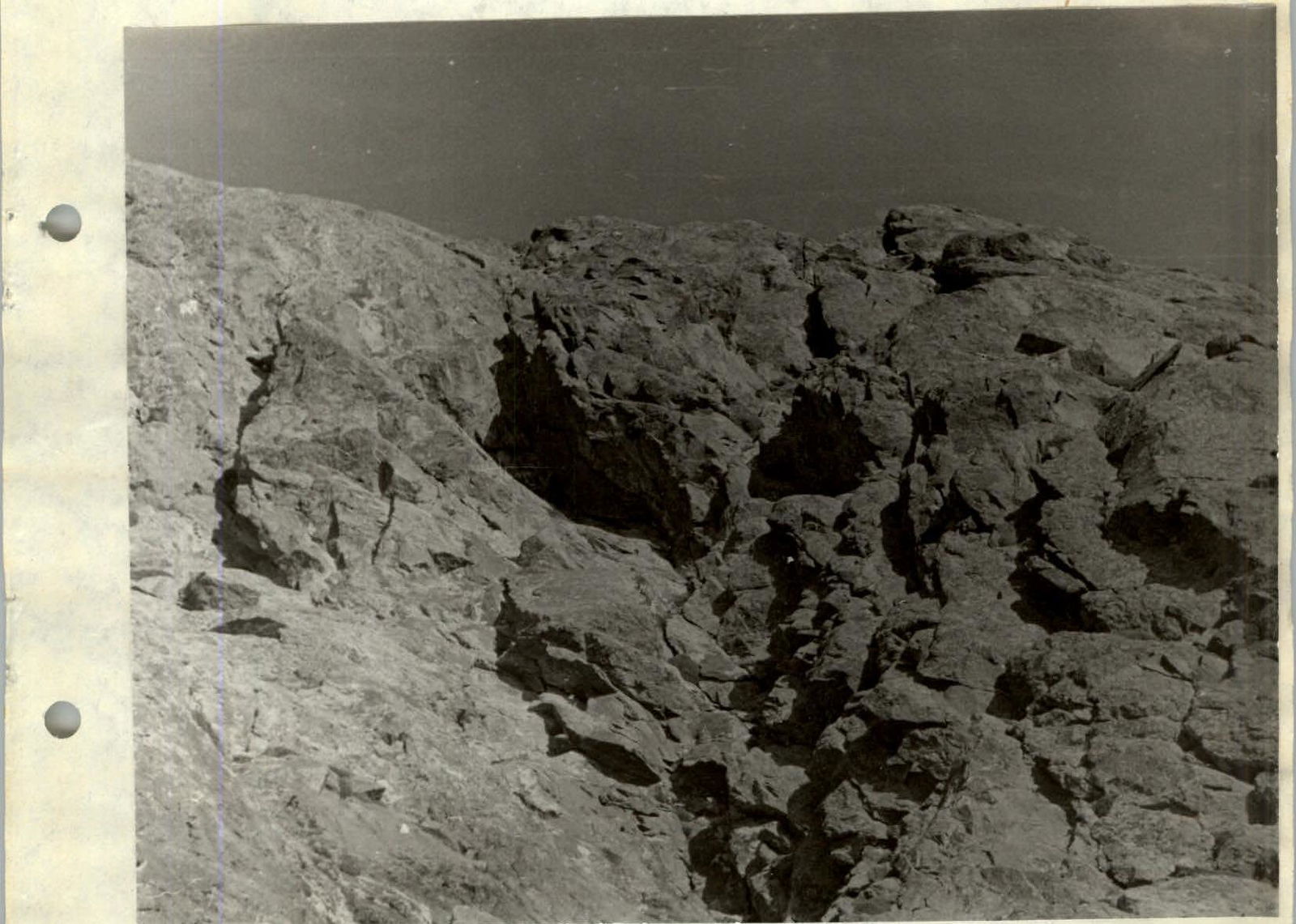
2. Ascent area: Tien Shan, Terskey Ala-Too range.
3. Peak, its height, and ascent route:
Ayuter, 4382 m, via the Southeast wall.
4. Proposed difficulty category: 4A.
5. Route characteristics:
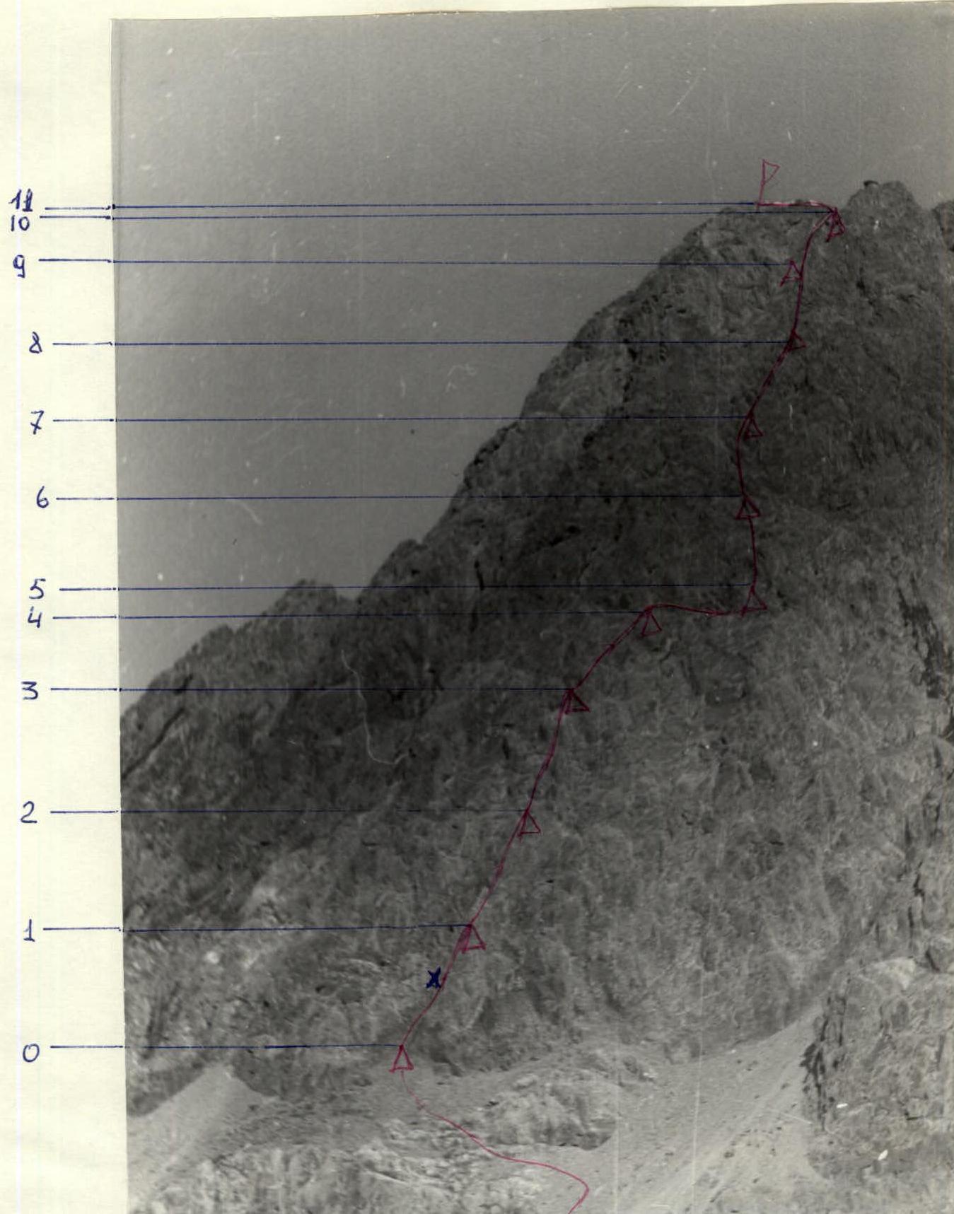
Height difference — 720 m, average steepness — 57°. Section lengths: III — 460 m, IV — 360 m, V — 40 m.
6. Pitons hammered:
for belay, for creating belay stations: rock II, ice —, bolted —.
7. Number of climbing hours — 12.
8. Number of nights spent — none.
9. Surname, name, patronymic of the leader and participants, and their sports qualification:
Ustinovich V.V. — 1st sports category — leader,
Zhdanovich A.E. — 1st sports category,
Zhur B.P. — 1st sports category,
Petukhov A.M. — 1st sports category.
10. Team coach: Lozovsky Leonid Ivanovich, Master of Sports of the USSR.
11. Date of departure to the route and return: August 9, 1978.
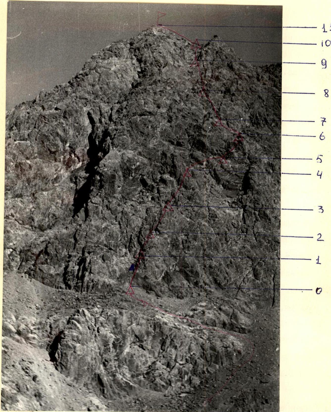
Table of ascent sections to peak Ayuter via the Southeast wall, 4A category, 4382 m
| Date | Designation | Steepness in ° | Length in m | Section characteristics | Difficulty (cat.) | Condition | Weather conditions | Pitons | Notes |
|---|---|---|---|---|---|---|---|---|---|
| I | 2 | 3 | 4 | 5 | 6 | 7 | 8 | 9 | 10 II |
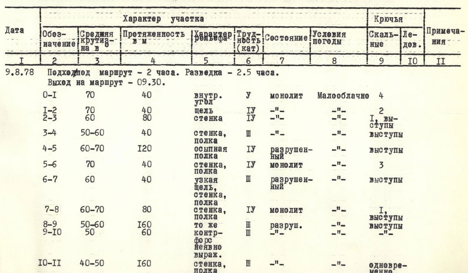
| 9.8.78 | Approach to the route — 2 hours. Reconnaissance — 2.5 hours. | ||||||||
| Start of the route — 09:30. | |||||||||
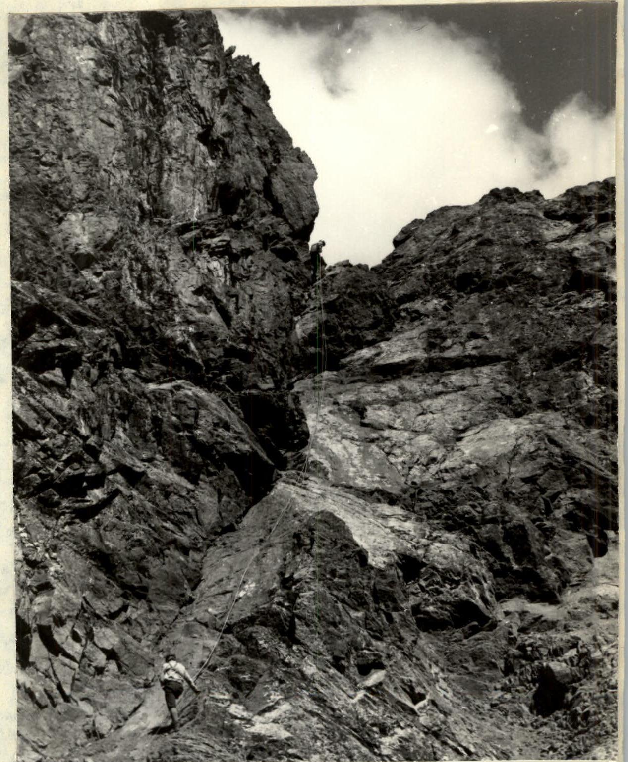
| R0–R1 | 70 | 40 | inner corner | 1 | monolith | Partly cloudy | 4 | — | |
| R1–R2 | 70 | 40 | crack | 4 | — | — | 2 | — | |
| R2–R3 | 60 | 80 | wall | 4 | — | — | 1, ledges | — | |
| R3–R4 | 50–60 | 40 | wall, ledge | 3 | — | — | ledges | — | |
| R4–R5 | 60–70 | 120 | scree ledge | 4 | destroyed | — | ledges | — | |
| R5–R6 | 70 | 40 | wall, ledge | 4 | monolith | — | 3 | — | |
| R6–R7 | 60 | 40 | narrow crack, wall, ledge | 2 | destroyed | — | ledges | — | |
| R7–R8 | 60–70 | 80 | wall, ledge | 4 | monolith | — | 1, ledges | — | |
| R8–R9 | 50–60 | 160 | same | — | destroyed | — | ledges | — | |
| R9–R10 | 50 | 60 | buttress weakly expressed | 3 | — | — | — | — | |
| R10–R11 | 40–50 | 160 | wall, ledge | 3 | — | — | simultaneously | — | |
| Reach the summit at 16:30. Climbing time 7 hours 00 minutes. |
Brief explanation of the table
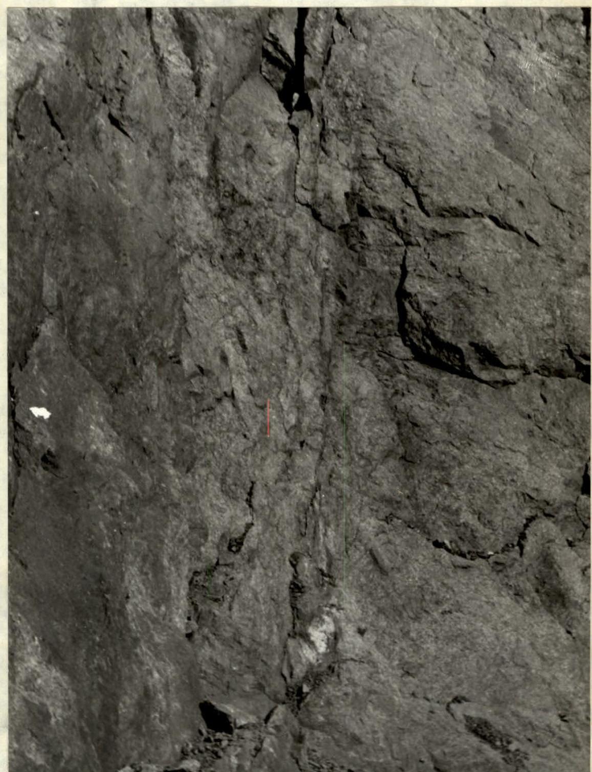
The route follows the Southeast wall between the Southeast ridge 4A category and the large scree couloir branching off from the Northeast ridge 3A category. From the glacier, traverse up the scree to the right, then across the rocks resembling "sheep's foreheads" to approach the wall to the right part of the inner corner. Here is a cairn marking the start of the route. Up the smooth rocks along a weakly expressed inner corner for 10 m. Then vertically up the inner corner for 30 m under an overhanging rock, 70°, section R0–R1. The overhanging rock is traversed to the right onto a ledge with a control cairn. After the control cairn, ascend a vertical crack, 70°, one rope length, section R1–R2. Then, below a slab with black streaks, ascend rocks of moderate difficulty — 2 rope lengths, 60°, section R2–R3. The slab is bypassed to the right and up rocks of moderate difficulty, one rope length, 50–60°, section R3–R4. Then, the character of the rocks is ledge-wall, 60–70°, exiting onto a wide scree ledge under a wide crack trending left. Here is a suitable place for an overnight bivouac. To the right is a narrow crack trending up and to the right, section R4–R5. Then, from the wide scree ledge, ascend to the right and up a narrow crack, one rope length, 70°, section R5–R6. Next, follow a wide ledge-couloir upward, 40°, one rope length, section R6–R7 (water present). To the right of a small stream, ascend destroyed rocks first to the right and up — one rope length, then to the left and up — one rope length, 60–70°, to a couloir, section R7–R8. To the right of the couloir, ascend destroyed rocks to the right and up — 4 rope lengths, 50–60°, section R8–R9. In the upper part, cross the couloir to the left and up under small smooth slabs; ascend the slabs for 10–15 m to exit onto a weakly expressed buttress. The summit is visible; 1.5 rope lengths, 50°, section R9–R10. To the summit, ascend about 4 rope lengths on destroyed rocks, 40–50°, section R10–R11.
Descent via the Northeast ridge, 3A category.
Section R0–R1. Beginning
Section R9–R10
Descent
Comments
Sign in to leave a comment