
Climbing Passport
-
Class: technical ascent.
-
Area: central Tien Shan, Arashan valley.
-
Route: ascent to the eastern peak of Ak-Su wall (4650 m) via the southern counterfort from Stepkin Pass.
-
Route characteristics: height difference — 700 m, average steepness — 45°, total length of difficult sections — 150 m.
-
Pitons driven:
rock — 13,
ice — 1.
- Time spent on the route: 13 hours.
- Characteristics of bivouacs: no bivouacs on the route.
- Surname, name, and patronymic of the leader and participants:
Bitinas V. K. (leader), Candidate for Master of Sports Zakaryavichyus L. I., 1st sports category Paplavskas V. Ya., 2nd sports category Muliulis Yu. D., 2nd sports category Migla I. N., Master of Sports Augunas R. V., 1st sports category
- Team name: "Neman" Sports Society combined team.
- Date of ascent: July 31, 1979
Description of the Climbing Area
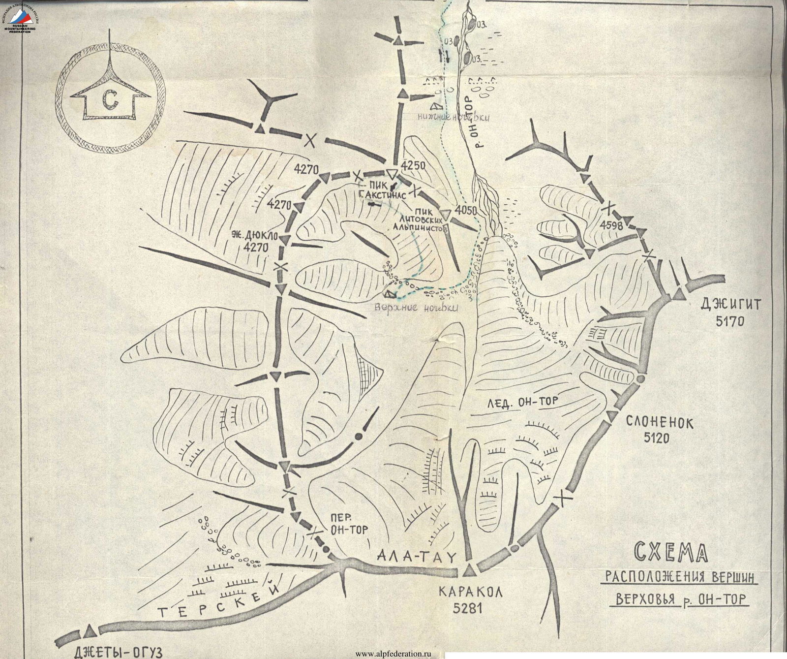
The object of the Lithuanian expedition in 1979 was the Ak-Su wall area in central Tien Shan. It can be reached from Przhevalsk city:
- By car to Teploklyuchenka settlement
- Further up the Alтын-Arašan valley
- At the head of the Alтын-Arašan river, where Chon-Uzen and Tashtaktor rivers merge, turn right up the Chon-Uzen river
- After 1.5 hours of walking, we approach the left tributary of Chon-Uzen river — Takyr-Tor stream
Here, in a clearing, was the base camp of the Lithuanian team. From here, to the south, the Ak-Su wall is visible with a white central triangle (v. Zhalgirys) and a number of unnamed peaks.
The meteorological conditions of the area are very similar to those of the Karakol valley, which are influenced by Lake Issyk-Kul: it often rains in the second half of the day.
Preparation for the Ascent
Preparing for the ascent, the group familiarized themselves with the area, made a training ascent via a route of 2nd category complexity to the fourth peak of the Ak-Su wall, completed the full program of the 5th stage of training, and gathered information about the intended route.
Description of the Route Passage
On July 30, 1979, we left the base camp. After 2 hours, we approached the Chon-Uzen glacier, turned southeast towards Khatadji Pass. The glacier is open, with few crevasses. Under Khatadji Pass, on the right moraine of the glacier, we set up a bivouac. Weather conditions were excellent. At 4:00 am on July 31, we left the bivouac and, via Khatadji Pass (30 minutes), reached the Sarychat glacier. We moved along the glacier towards Stepkin Pass, leaving the eastern peak of the Ak-Su wall to our right (in the direction of travel). Approaching the pass, we turned to the right and reached a ridge above Stepkin Pass. Here begins our planned route. Section R0–R1: snow-ice slope (250 m, 40°). We moved towards light-brown rocks. Insurance was simultaneous-alternating via ice axe. Section R1–R2: along the brown rocks, we traversed to the right to a snowy couloir (20 m), then up the right side of the couloir (40 m) and reached the ridge. Along the ridge, another 80 m to the base of the first wall. Insurance was via ledges; many "live" stones; used ropes. Section R2–R3: rocky wall. Rocks were snowy and heavily broken (30 m, 70°). Insurance was via pitons. Section R3–R4: ridge with many "live" stones, snowy-ice rises (150 m, 30–40°). Insurance was simultaneous and alternating via ledges. Section R4–R5: rocky wall (40 m, 75–80°). In the upper part of the wall, a wide chimney leads to a platform for two people. Rocks were monolithic. Insurance was via pitons and ropes. Section R5–R6: very broken, narrow, almost horizontal part — a crest (70 m). Snow cornice! Insurance was alternating via ledges. The crest ends at a 10–15-meter monolithic gendarme. Section R6–R7: we bypassed the gendarme to the left via an ice couloir (insurance!); further, the route goes along a snowy-ice ridge (100 m, 35°) with many simple rocky walls. Insurance was alternating via ledges. Section R7–R8: steep snowy-ice slope — a wide ridge — with rocky outcrops. Rocks were heavily broken. The slope leads to a simple pre-summit crest. Insurance was alternating, ropes: (50 m, 55°). Along the crest, we ascended to the summit: 13:00. On the summit, we built a stone cairn and left a note stating that the eastern peak of the Ak-Su wall was named "NEMUNAS".
Descent was via the ascent route
From the Ascent Debriefing Protocol
Group members, the leader, and the first release supervisor of the gathering, Migla Ina, and the head of the gathering, Stepulis V., believe that the route taken corresponds to a route of 3B category complexity. The route was counted for the participants as a first ascent via the route to peak "Nemunas" from Stepkin Pass, approximately third category complexity.
Table of Main Route Characteristics
Ascent route: eastern peak "Nemunas" of the Ak-Su wall via the southern counterfort from Stepkin Pass, approximately 3B category complexity (first passage and first ascent).
Height difference: 700 m. Length of complex sections: 150 m. Average steepness: 45°. Steepness of complex sections: 75–80°. 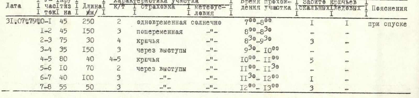
Report prepared by... /Yu. Muliulis/ 
General view of the "Nemunas" route ridge (photo taken by S. B. Zhalegiris)
General view from the ridge of MGLU peak
Stepkin Pass
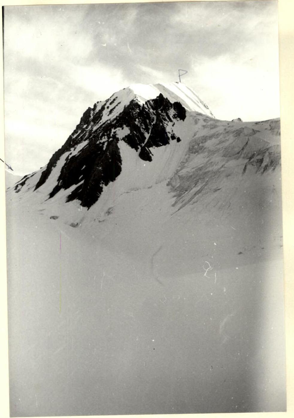
View of peak "Nemunas" from Stepkin Pass
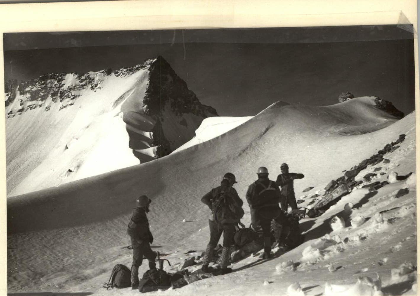
Start of the route. On the ridge above Stepkin Pass 
Comments
Sign in to leave a comment