Ascent Route to the Summit
(Mt. Akstinas, 4250 m, Category 2B difficulty)
The summit of Mt. Akstinas is located in the Tian Shan mountain range, on a spur of the Terskey-Alatau ridge, which runs from west to north and from the west side closes the Karakol valley.
The summit of Mt. Akstinas together with the summit of Litovskikh Alpinistov (total ridge length — 2 km) closes a rocky amphitheater filled with eternal snow and ice.
The path from the base camp, which is located at the confluence of the two rivers On-Tor and Kol-Tor, goes along a trail on the left bank of the Ot-Tor River to the tongue of the On-Tor glacier. Here are the "lower" campsite, the journey takes 4 hours.
The "upper" campsite is located on the southern green slope of the Litovskikh Alpinistov summit. The path to the "upper" campsite:
- along the right lateral moraine to the On-Tor glacier;
- then, bypassing the Litovskikh Alpinistov summit from the left, we cross over to the glacier located on the right.
The journey to the "upper" campsite takes 2-3 hours.
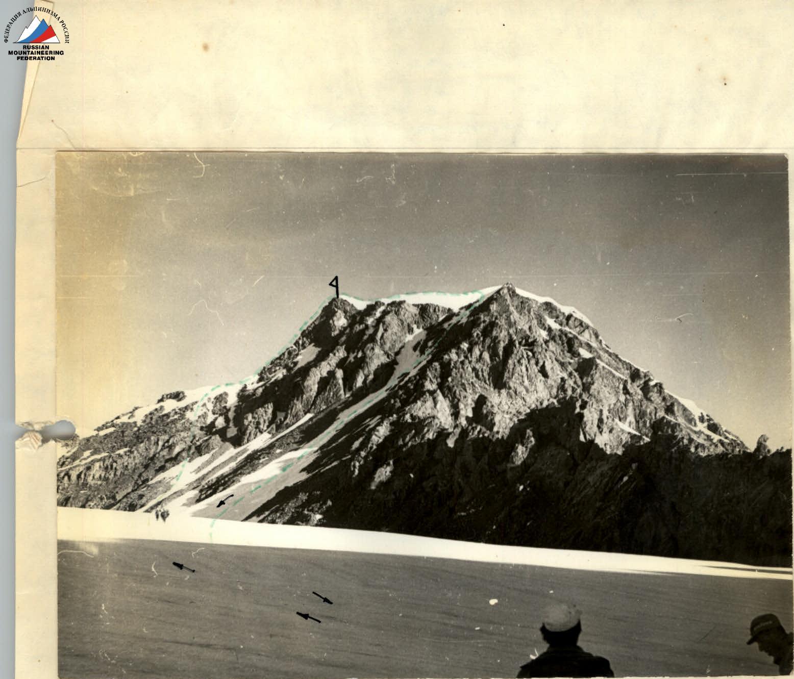
The path then leads to the summit of Mt. Akstinas. We ascend a steep moraine to the Bezymyannyy glacier, and along it to the saddle between the Bezymyannaya and Mt. Akstinas summits. The journey takes 3-4 hours.
On the glacier, it is necessary to move in rope teams as there are hidden crevasses.
From the saddle, the path goes along the ridge to the right towards the summit. It is necessary to stay on the right side (in the direction of travel). On the left is a snow cornice! The rocks are of medium difficulty. The ascent is done with alternating belays.
Before the summit, there is a 6-7-meter wall of difficult climbing ( tricky belay).
The journey from the saddle to the summit takes 5-6 hours.
The summit itself is snowy. At the summit, there is a cairn and a photograph of Mt. Akstinas and a metal plaque with the inscription: "Summit of Mt. Akstinas - to the pioneer of Lithuanian mountaineering, who died in 1959 during the ascent to the Dykh-Tau summit".
Descent
The descent is down the southern ridge, then down to the glacier along a large snow couloir with alternating belays. After descending to the glacier, we continue the descent along the ascent route. The descent time is 2-3 hours.
The summit of Mt. Akstinas was first conquered in 1959 by Lithuanian mountaineers led by Alim Romanov. In 1969, 4 more groups of Lithuanian mountaineers ascended to the summit (in 1960, 1961, 1962, and 1965).
In 1969, during the Lithuanian SSR mountaineering event, another 16 groups of various sporting classifications (from candidate masters of sports to badge holders) made the ascent.
This description was made by a group consisting of:
-
- D. Stankute - leader, 1st sports category
-
- O. Tamulenaite - member, 1st sports category
-
- V. Stepulis - 1st sports category
-
- R. Navickas - 1st sports category
-
- A. Dembinskas - 1st sports category
-
- A. Petrov - coach-observer, Master of Sports.
The group classified the route as Category 2B difficulty.
Appendix
-
- Map of the area
-
- Photo of the summit of Mt. Akstinas
Equipment for 6 people
- tents - 2
- main ropes - 3 (30 m)
- auxiliary ropes - 6 (prusik cords)
- hammers - 2
- rock pitons - 4
Description compiled by: D. Stankute
Summit of Mt. Akstinas


