PASSPORT
- Class: snow-ice
- Central Tien-Shan: Jety-Oguz gorge
- Peak Oguz-Bashi Glavnaya: via the north-eastern wall
- Proposed: 5B category of difficulty, first ascent
- Height difference: 1468 m, length 1970 m Length of categorized sections: 1340 m Average steepness of the main part: 50° Route length: 430
- Pitons driven: Rock: 51 Ice: 146
- Team's working hours: 16.5 hours and 2 days
- Overnight stay: lying on the ridge
- Team leader: Ershov A.A. CMS Team members: Kolomytsev V.G. MS Elagin V.I. MS Grebenshchikov I.E. MS
- Coach: Kolomytsev V.G. MS
- Route entry: August 14, 1984 Summit: August 15, 1984 Return: August 15, 1984
- Organization: CS DSO "Burevestnik"
"Burevestnik"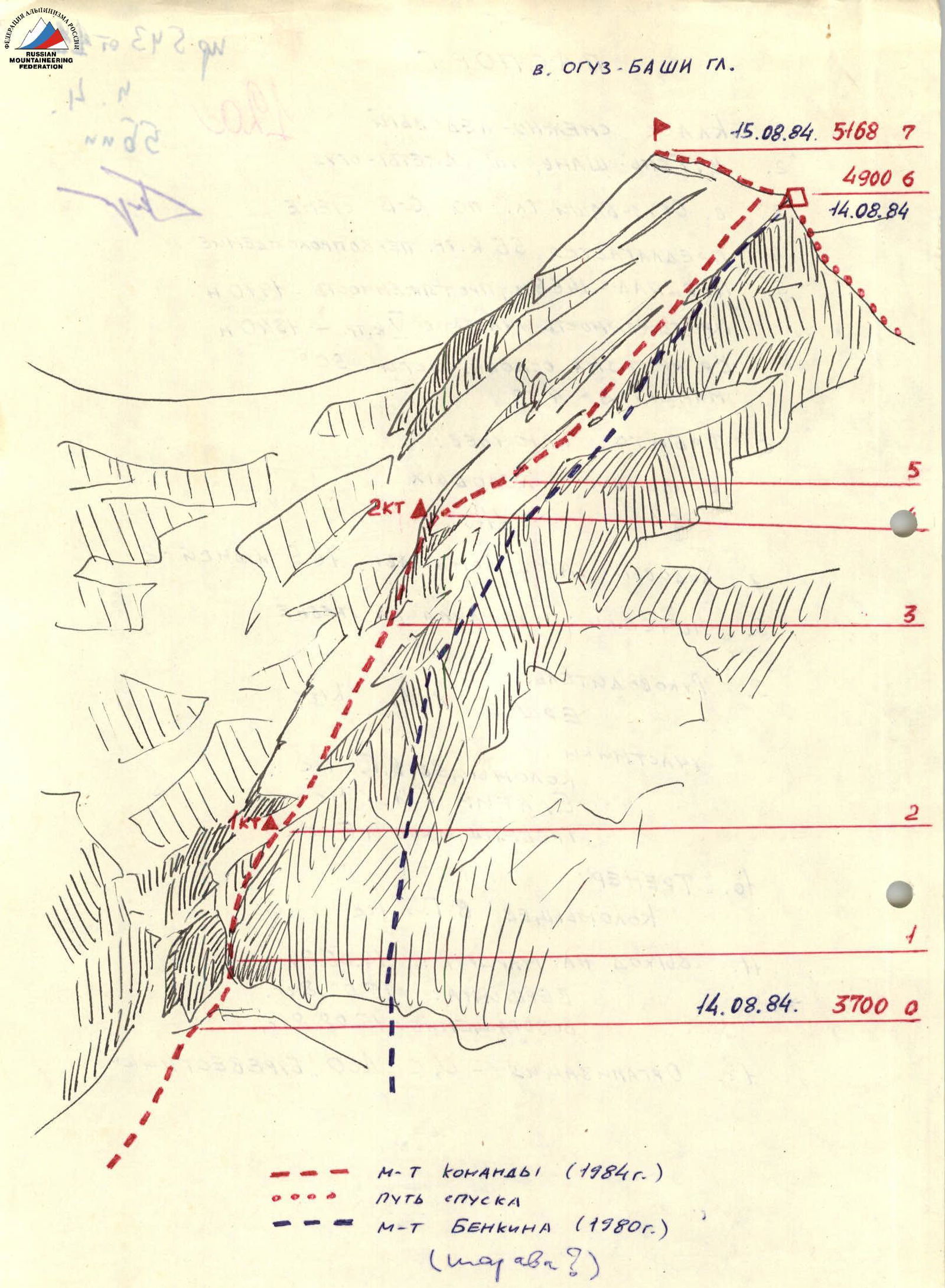 www.alpfederation.ru
www.alpfederation.ru
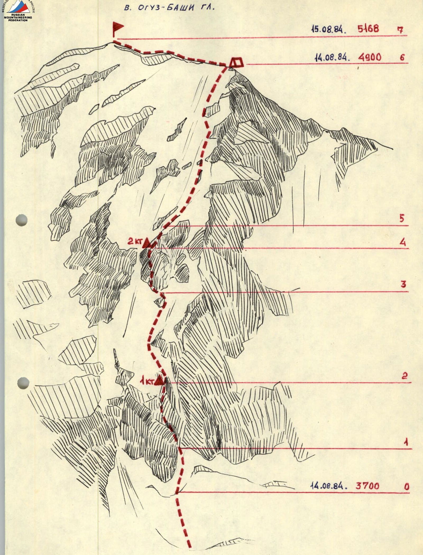
V. OGUZ-BASHI GL. 15.08.84. 5168 7 4900 6 14.08.84 5 3 2 1 14.08.84. 3700 0
ROUTE of the Team (1984) DESCENT PATH ROUTE of Benkin (1980) (MAYAVR?) www.alpfederation.ru↗
Tactical Actions of the Team
The team planned to start the route on August 13 at 3:00. They left on schedule, approached the route, but did not start due to the very warm night and the danger of rockfall. The ascent was postponed for a day.
The next night (August 13-14) was colder. They left the bivouac at 3:00 and reached the bergschrund by 4:00. The first rope team, Elagin—Grebenshchikov, worked on the ice and then on the rocks. Sections R0–R2 were climbed with headlamps. The second rope team followed on the fixed rope. The upper part (20 m) of the rock belt was climbed on the right side of the wet rocks with flowstone. The ice section R2–R3 was climbed by the rope teams autonomously, moving simultaneously. The second rock belt was climbed on a steep, difficult rock ridge between two gullies. The rope team Elagin—Grebenshchikov fixed the ropes here. At 12:00, the group gathered on a convenient ledge under an overhang for lunch and rest. The height was around 4300 m. About 1000 m had been gained from the moraine bivouac. After rest, the rope team Ershov—Kolomytsev led the way. They alternately climbed a rope on ice, then a rope on rocks, and reached the base of the upper ice field. The ice steepness was 45–50°. The rope teams worked autonomously. Kolomytsev—Ershov led the way. They moved up, deviating slightly to avoid falling rocks. At 19:30, they reached the pre-summit ridge to the right of the cornices. They organized a bivouac by descending from the ridge on a rope to a rock ledge (in case of a possible thunderstorm). The concerns were unfounded, as the weather was very stormy.
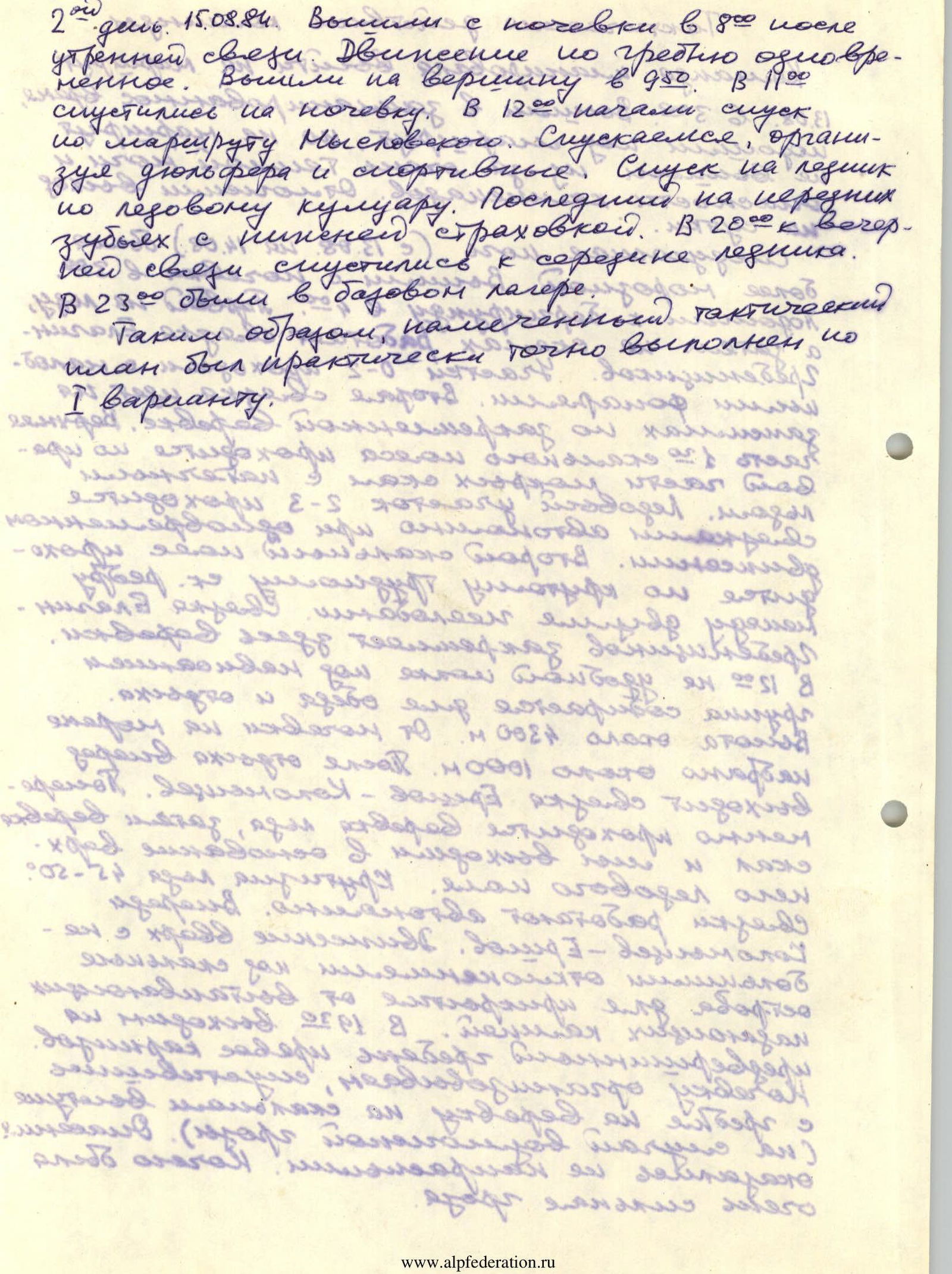
On August 15, 1984, they left the bivouac at 8:00 after morning communication. They moved along the ridge simultaneously and reached the summit at 9:50. At 19:00, they descended to the bivouac. At 12:00, they began descending via the Myslovsky route. They descended, organizing rappels and sports descents. They descended to the glacier via an ice couloir. The last person descended with a pioneer belay to the glacier tongue. At 20:00, they reached the middle of the glacier for the evening communication. At 23:00, they were back at the base camp. Thus, the planned tactical plan was practically executed according to the first variant.
Working hours (summit): 2 Working hours (approach and up to 4900 m): 14.5 Rock pitons: 51 Ice pitons: 116
| Height / Point | DIFFICULTY | Length | Steepness | Section | Date / Note |
|---|---|---|---|---|---|
| 5168 m | R7 | Summit, August 15, 1984 | |||
| 3 | 550 m | 30° | R7–R6 | ||
| 4900 m | R6 | August 14, 1984 | |||
| 4 | 720 m | 45° | R6–R5 | ||
| 4 | 80 m | 47° | R5–R4 | ||
| 5 | 80 m | 75° | R4–R3 | ||
| 5 | 240 m | 50° | R3–R2 | ||
| 5 | 280 m | 60° | R2–R1 | ||
| 5 | 80 m | 55° | R1–R0 | ||
| 3700 m | R0 | ||||
| www.alpfederation.ru↗ |
Route Description by Sections
Section R0–R1. From the bergschrund, up and to the right, on a steep ice slope towards the inner corner on the first rock belt with a stream. Length about 80 m, steepness ~55°. Section R1–R2. Inner corner with a stream. The rocks are monolithic with few holds. Then on more gentle rocks with flowstone. Length about 220 m. Average steepness ~60°. Category of difficulty 1. Section R2–R3. First ice field between the 1st and 2nd rock belts. Length 240 m. Steepness 50°. Direction of movement — towards the rock ridge between two gullies. Section R3–R4. First, up and to the right, on the inner corner, then on the right part of the rock ridge. Rocks are difficult, partially covered with flowstone. In the upper part, about 7 m of very difficult rocks with overhanging sections. On the ledge, category of difficulty 2. Section R4–R5. From the ledge, on an ice slope, up and to the right, towards the inner rock corner and up to the base of the upper ice slope. Section R5–R6. On the ice slope, towards two rocks resembling a "gate", and then straight up to the ridge, to the right of the cornices. Movement between rock outcrops. Section R6–R7. Pre-summit ridge. Movement on its right part (left — cornices!). www.alpfederation.ru↗
V. OGUZ-BASHI GL.
15.08.84. 5168 7 14.08.84. 4900 6 5 2 кт 4 3 2 4 14.08.84. 3700 0
General Information about the Route
Peak Oguz-Bashi Glavnaya (or Jety-Oguzskaya wall) with a height of 5168 m is located in the Tien-Shan, in the Terskey-Alatau ridge, in the upper reaches of the right (eastern) tributary of the Jety-Oguz river — the Aylanysh river.
The first ascent of the North ridge of this peak was made by a team from the MGS DSO "Burevestnik" consisting of: Grebenshchikov I.— leader, Myslovsky E., Ivanov V. on August 4, 1973.
The second ascent of this route was made on August 5, 1973, also by a team from the MGS DSO "Burevestnik" led by Yu. Borodkin. The route was classified as 5B category of difficulty.
This report describes the third ascent of this route, made by a team from the Kyrgyz RS DSO "Spartak", participating in the Kyrgyz SSR alpine championship, from August 24 to 27, 1979. www.alpfederation.ru↗