
Ascent Passport
-
Tian-Shan, Tengri-Tag ridge (KMGV section No. – 7.9)
-
Peak Khan-Tengri (6995 m) via SW crest SSW rib (V. Sviridenko, 82)
-
6B category of difficulty
-
Route type — combined
-
Route elevation gain — 2595 m.
Route length — 3720 m. Length of sections with 5 category of difficulty — 460 m, 6 category of difficulty — 380 m. Average steepness: main part of the route — 58°, entire route — 49°
-
Pitons left on the route: total – 0, including bolted – 0.
Pitons used on the route: stationary bolted – 0, including for artificial climbing – 0. Removable bolted – 0, including for artificial climbing – 0. Total artificial climbing anchors used – 13.
-
Team's total climbing hours – 56, days – 7.
-
Team leader: Foigt Alexander Vadimovich – MS
Team members:
- Stalkovsky Vladimir Viktorovich – MS
- Belkin Alexander Valentinovich – CMS
- Zvyagintsev Maxim Vladimirovich – CMS
- Zuev Sergey Vasil'evich – CMS
- Kuvakin Arkady Anatol'evich – CMS
-
Coach: Zuev Sergey Vasil'evich, CMS
-
Departure to the route: 8:00 August 9, 2003.
Summit arrival: 12:00 August 15, 2003. Return to Base Camp: 11:00 August 16, 2003. Summit photo
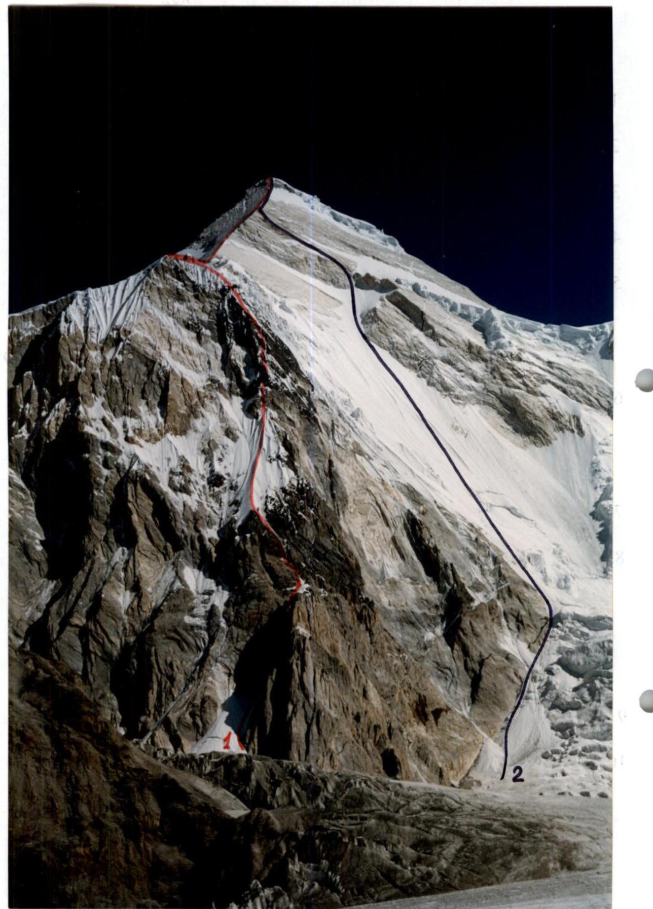
1 – route taken by the team via SW crest SSW rib, 6B category of difficulty (V. Sviridenko, 82). 2 – route via S wall, 6A category of difficulty (G. Isachenko, 82)
Photo taken: August 4, 2003 from South Inylchek glacier
| Section No. | Pitons used, with artificial climbing in denominator | Route diagram | Difficulty, length (m), steepness | ||
|---|---|---|---|---|---|
| rock | cammed | ice | |||
| R11–R12 | 15 | 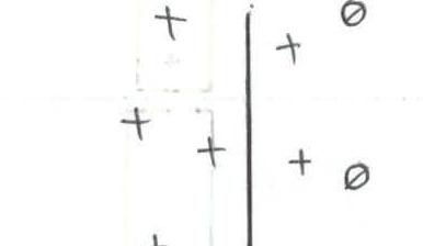 | 4, 150 m, 50° | ||
| R10–R11 | 10 | 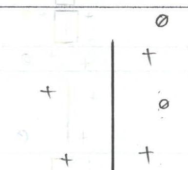 | 3, 200 m, 45° | ||
| R9–R10 | 4 | 4 | 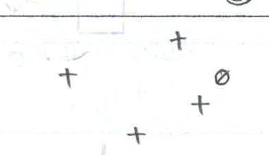 | 3, 100 m, 45° | |
| R8–R9 | 4 | 4 | 3, 50 m, 60° |
| Section No. | Pitons used, with artificial climbing in denominator | Route diagram | Difficulty, length (m), steepness | ||
|---|---|---|---|---|---|
| rock | cammed | ice | |||
| R25–R26 | 12 | 2 | 2 | 5, 30 m, 70° | |
| R24–R25 | 8/2 | 6/1 | 6, 50 m, 75°, A1 | ||
| R23–R24 | 7 | 2 | 5, 40 m, 70°, photo No. 4 | ||
| R22–R23 | 1 | 2 | 3, 10 m, 40° | ||
| R21–R22 | 3/1 | 1 | 1 | 6, 10 m, 80°, A2 | |
| R20–R21 | 5/2 | 4/1 | 6, 20 m, 80°, A2 | ||
| R19–R20 | 3 | 5, 10 m, 70° | |||
| R18–R19 | 8 | 2 | 5, 40 m, 65° | ||
| R17–R18 | 8 | 3 | 5, 40 m, 75°, photo No. 3 | ||
| R16–R17 | 6 | 2 | 4, 50 m, 55° | ||
| R15–R16 | 3 | 3 | 2 | 5, 40 m, 70° | |
| R14–R15 | 5/2 | 2 | 6, 30 m, 80°, A2 | ||
| R13–R14 | 5 | 6, 20 m, 75° | |||
| R12–R13 | 8 | 5, 40 m, 60° |
| Section No. | Pitons used, with artificial climbing in denominator | Route diagram | Difficulty, length (m), steepness | ||
|---|---|---|---|---|---|
| rock | cammed | ice | |||
| R33–R34 | 2 | 6 | 5, 40 m, 60°, photo No. 7 | ||
| R32–R33 | 3, 20 m, 60° | ||||
| R31–R32 | 12 | 6, 120 m, 60°, photo No. 6 | |||
| R30–R31 | 2 | 3, 5 m, 20° | |||
| R29–R30 | 4/2 | 3 | 6, 30 m, 80°, A2 | ||
| R28–R29 | 5 | 1 | 5, 30 m, 65° | ||
| R27–R28 | 3/1 | 3/1 | 6, 20 m, 70°, A1 | ||
| R26–R27 | 20 | 5, 120 m, 70°, photo No. 5 |
| Section No. | Pitons used, with artificial climbing in denominator | Route diagram | Difficulty, length (m), steepness | ||
|---|---|---|---|---|---|
| rock | cammed | ice | |||
| R36–R37 | 25 | 28 |  | 3, 450 m, 45° | |
| R35–R36 |  | 2, 100 m, 40° | |||
| R34–R35 |  | 2, 500 m, 30° |
| Section No. | Pitons used, with artificial climbing in denominator | Route diagram | Difficulty, length (m), steepness | ||
|---|---|---|---|---|---|
| rock | cammed | ice | |||
| R40–R41 |  | 1, 100 m, 20° | |||
| R39–R40 | 2, 30 m, 40° | ||||
| R38–R39 | 5 | 1 | 3, 40 m, 50° | ||
| R37–R38 | 46 | 27 |  | 3, 700 m, 50° |
Technical photo of the route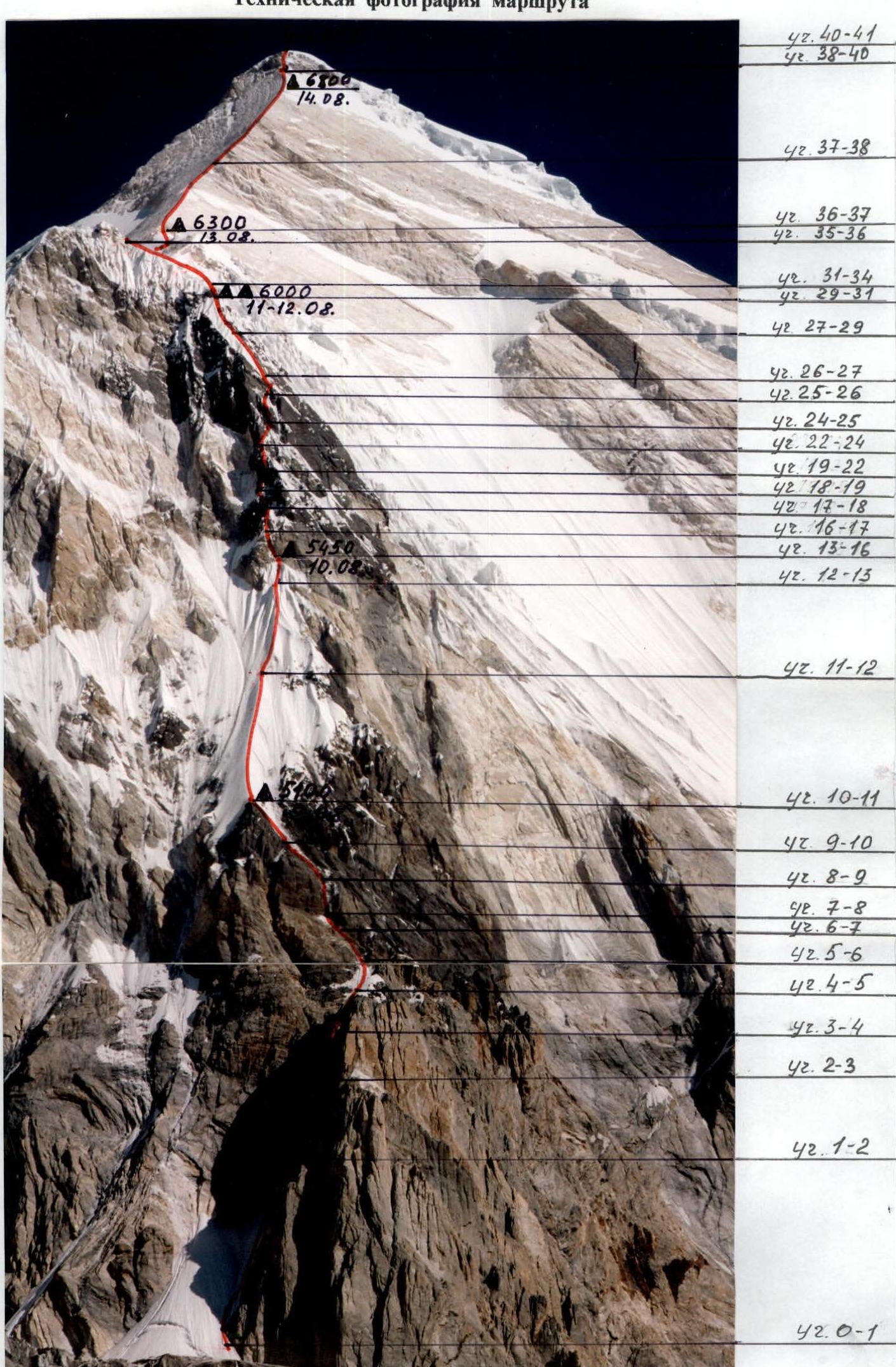
Report photo illustration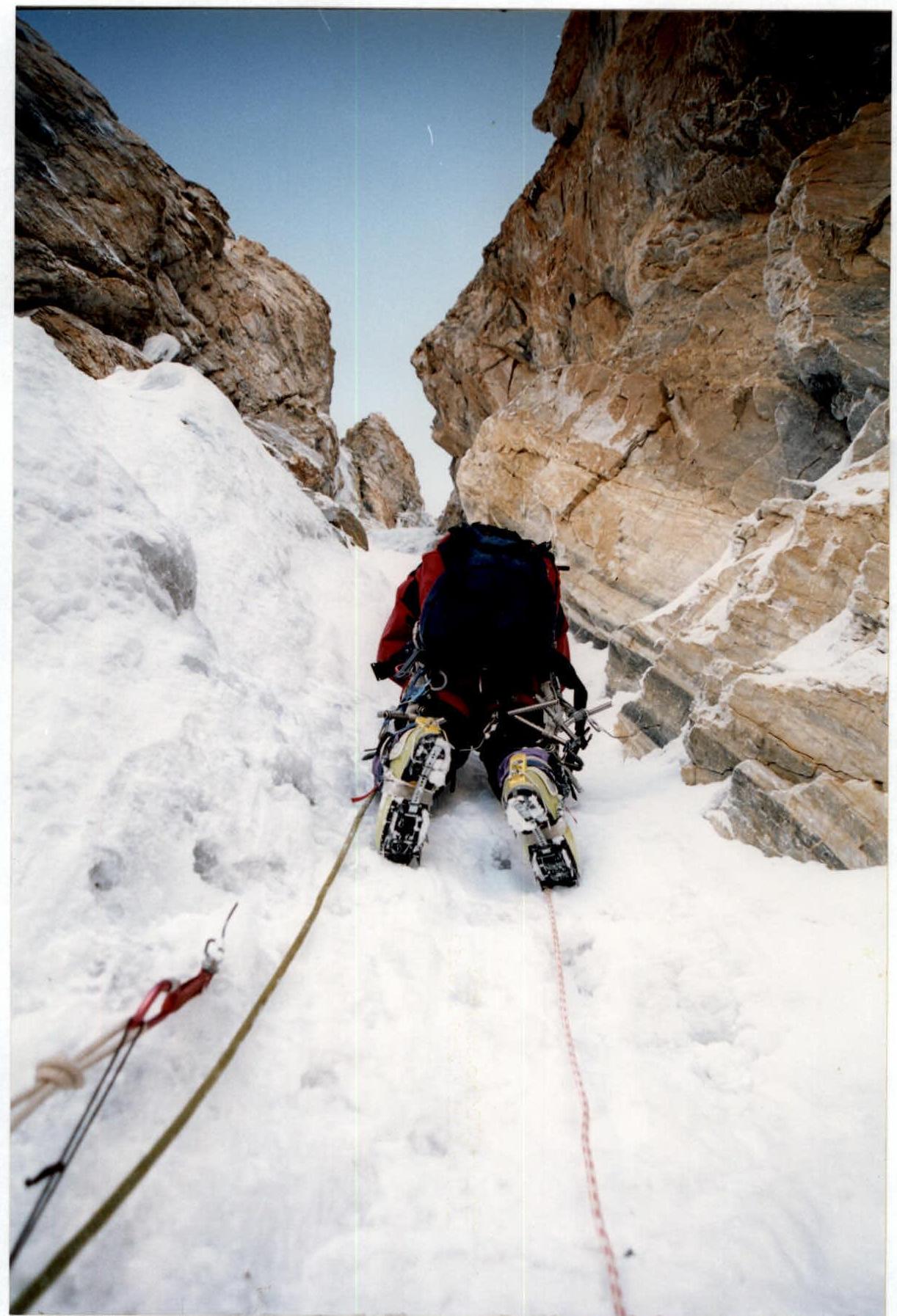
Photo No. 1. Passage of section R1–R2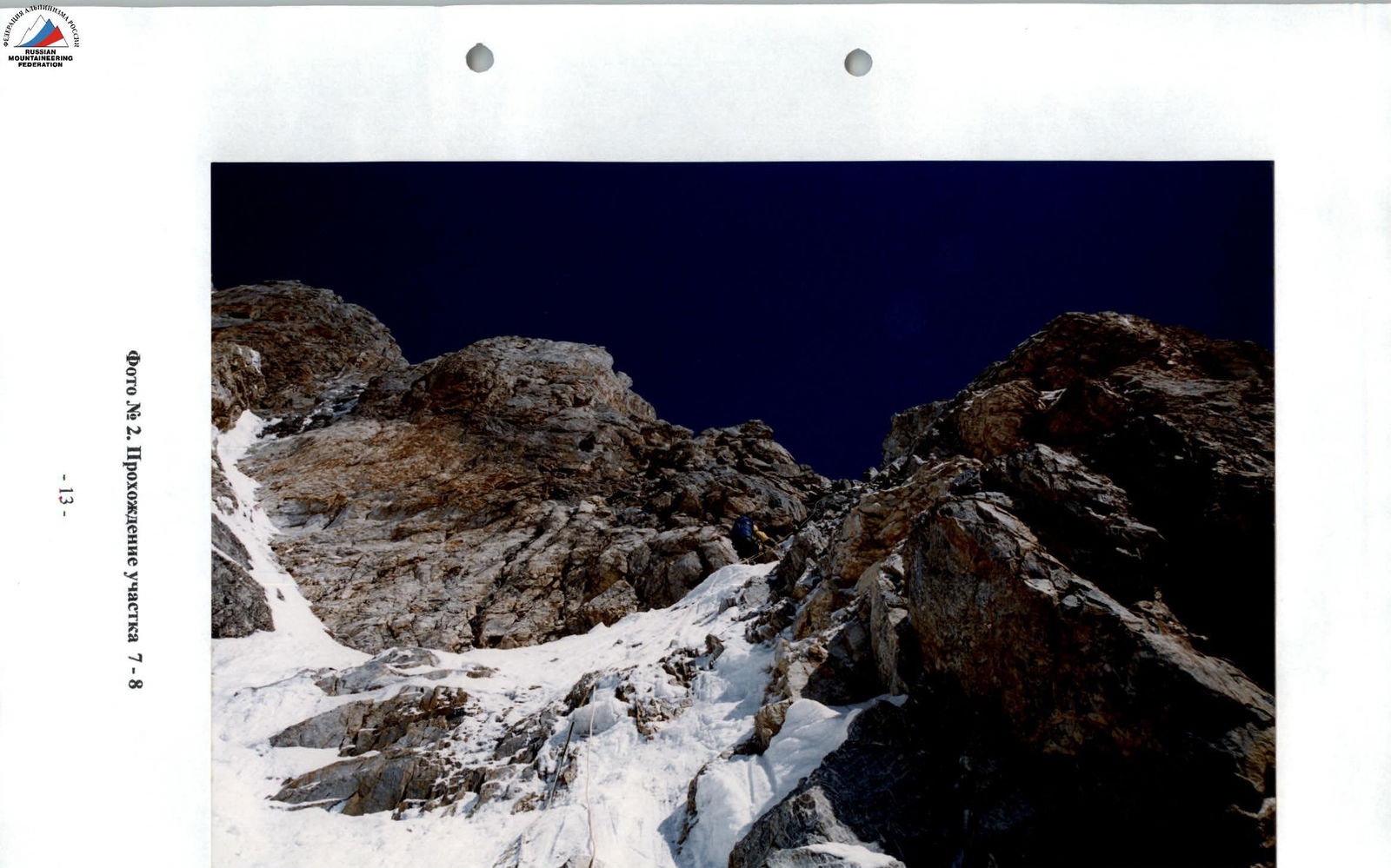
Photo No. 2. Passage of section R7–R8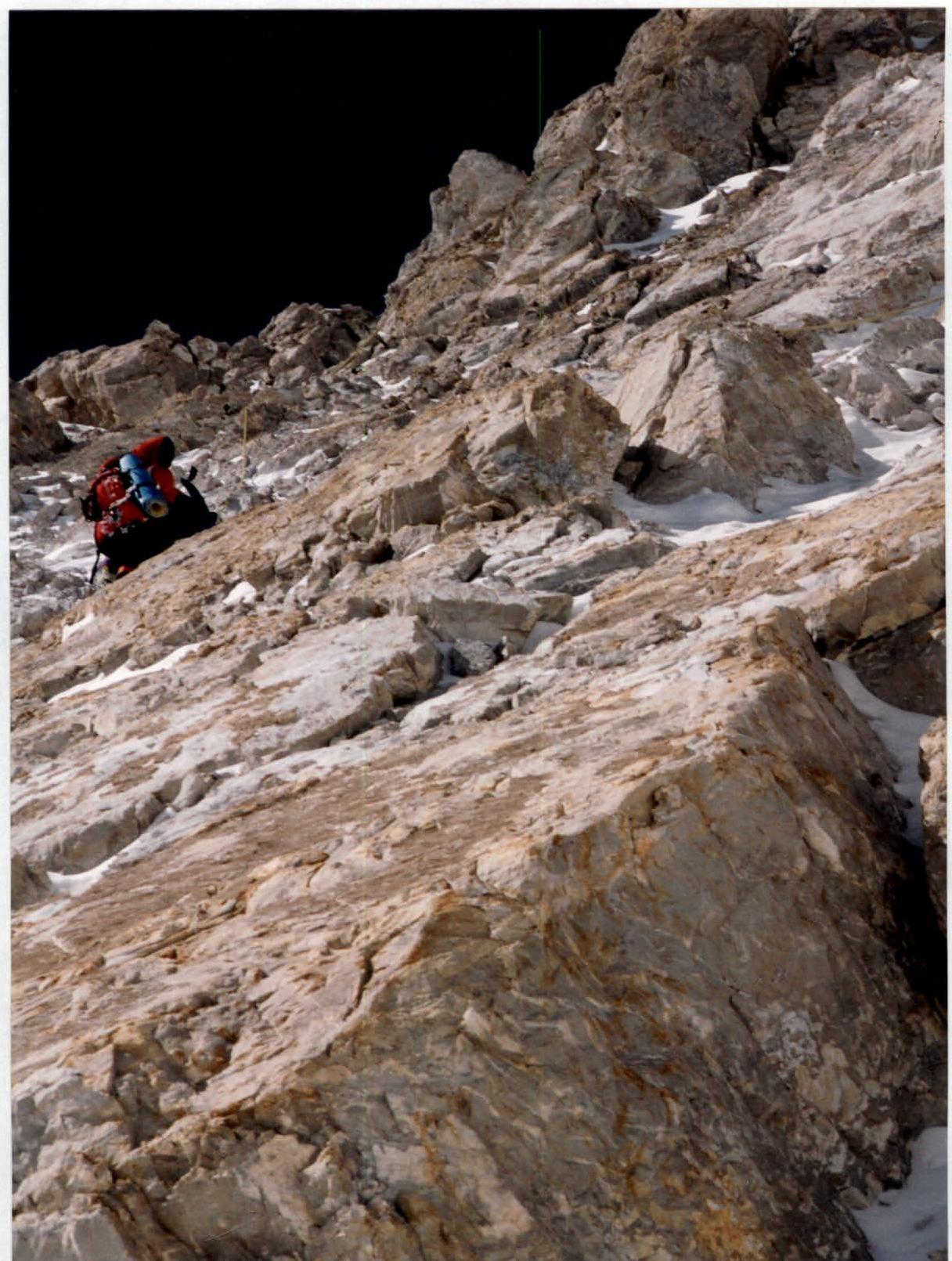
Photo No. 4. Passage of section R23–R24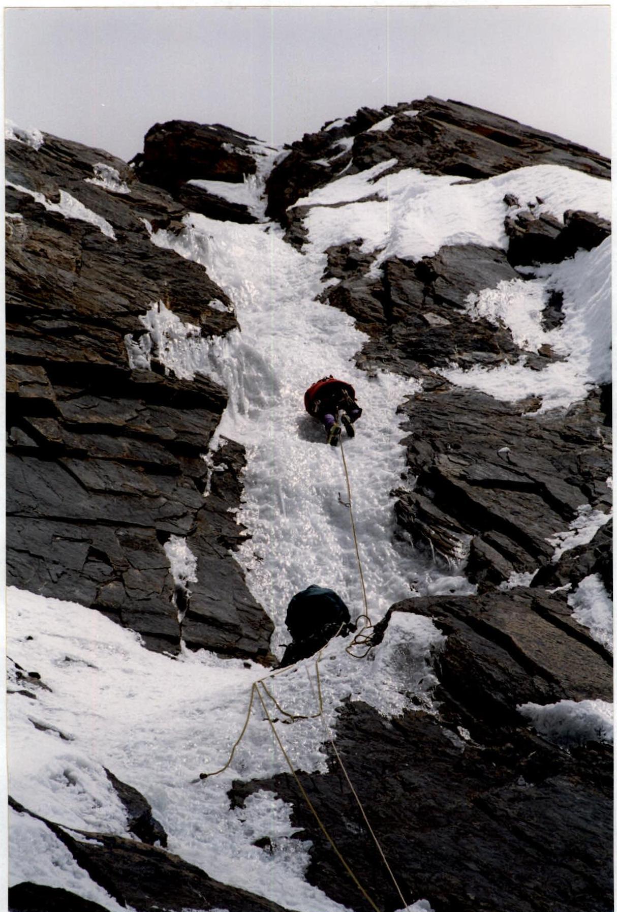
Photo No. 5. Passage of section R26–R27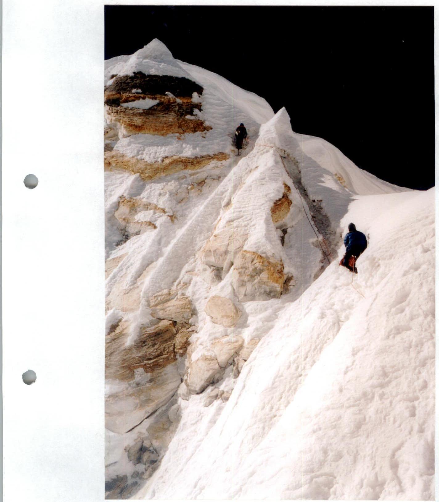
Photo No. 7. Passage of section R33–R34
Comments
Sign in to leave a comment