Climbing Passport
-
Central Tian-Shan, Tengri-Tag range, 7.9
-
Peak Khan-Tengri, 6995 m, via North Ridge, 7.9.11/11a
-
Category 5B, combination
-
Route type — combined
-
Route elevation gain — 3000 m, Route length — 5000 m, Length of sections with category V difficulty — 300 m, Average slope of the wall section — 70 degrees (6500–6800 m) Average slope of the entire route — 47 degrees
-
Pitons used on the route: total — 170
Rock pitons 94, Ice screws 27, Snow anchors 36, Cams 13
-
Climbing time / days: 20 hours / 3 days
-
Leader: Yermachek Yuri Vladimirovich, Master of Sports
Participant: Shkabara Vadim Nikolayevich, 1st category
-
Coach: Mikhailov Alexander Alexandrovich, Honored Master of Sports, Honored Coach of Russia
-
Departure to the route: 13:00 — August 23, 2003 Summit: 15:00 — August 25, 2003 Return to Base Camp: 22:00 — August 25, 2003
-
Ministry of Physical Culture, Sports and Tourism Sverdlovsk Oblast: 620219, Yekaterinburg, Malysheva str., 60
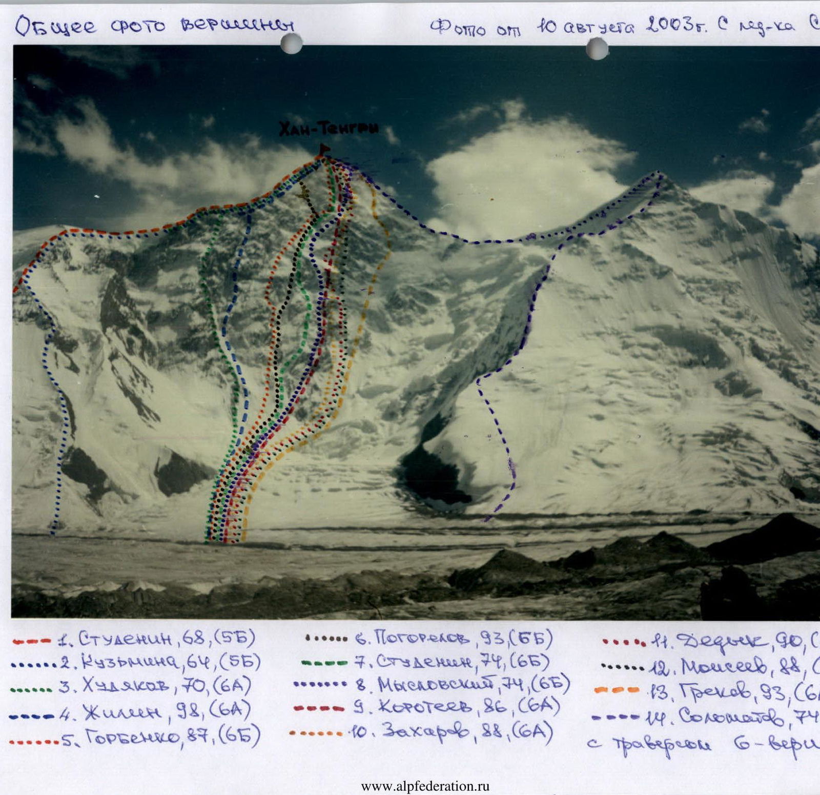
General Summit Photo
Photo from August 10, 2003. From North Inylchek Glacier
- 1. Studenin, 68, (5B)
- 2. Kuzmina, 64, (5B)
- 3. Khudyakov, 70, (6A)
- 4. Zhileen, 98, (6A)
- 5. Gorbenko, 87, (6B)
- 6. Pogorelov, 93, (5B)
- 7. Studenin, 74, (6B)
- 8. Myslovsky, 74, (6B)
- 9. Koroteev, 86, (6A)
- 10. Zakharov, 88, (6A)
- 11. Dedyk, 90, (6A)
- 12. Moiseev, 88, (6A)
- 13. Grekov, 93, (6A)
- 14. Solomatov, 74, (6B)
- with traverse of 6 peaks
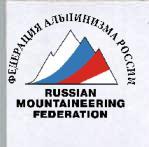
Technical Photo of the Route
Annotations to the technical photo:
- Summit: 6995 m, 15:00, R5, August 25, 2003
- 6300 m, R4, August 24, 2003, 2nd bivouac
- 5900 m
- 5300 m, 1st bivouac, R2
- 4900 m, R1
- R0
- Legend:
- "arrow" — location of the shot
- "triangle" — bivouac sites
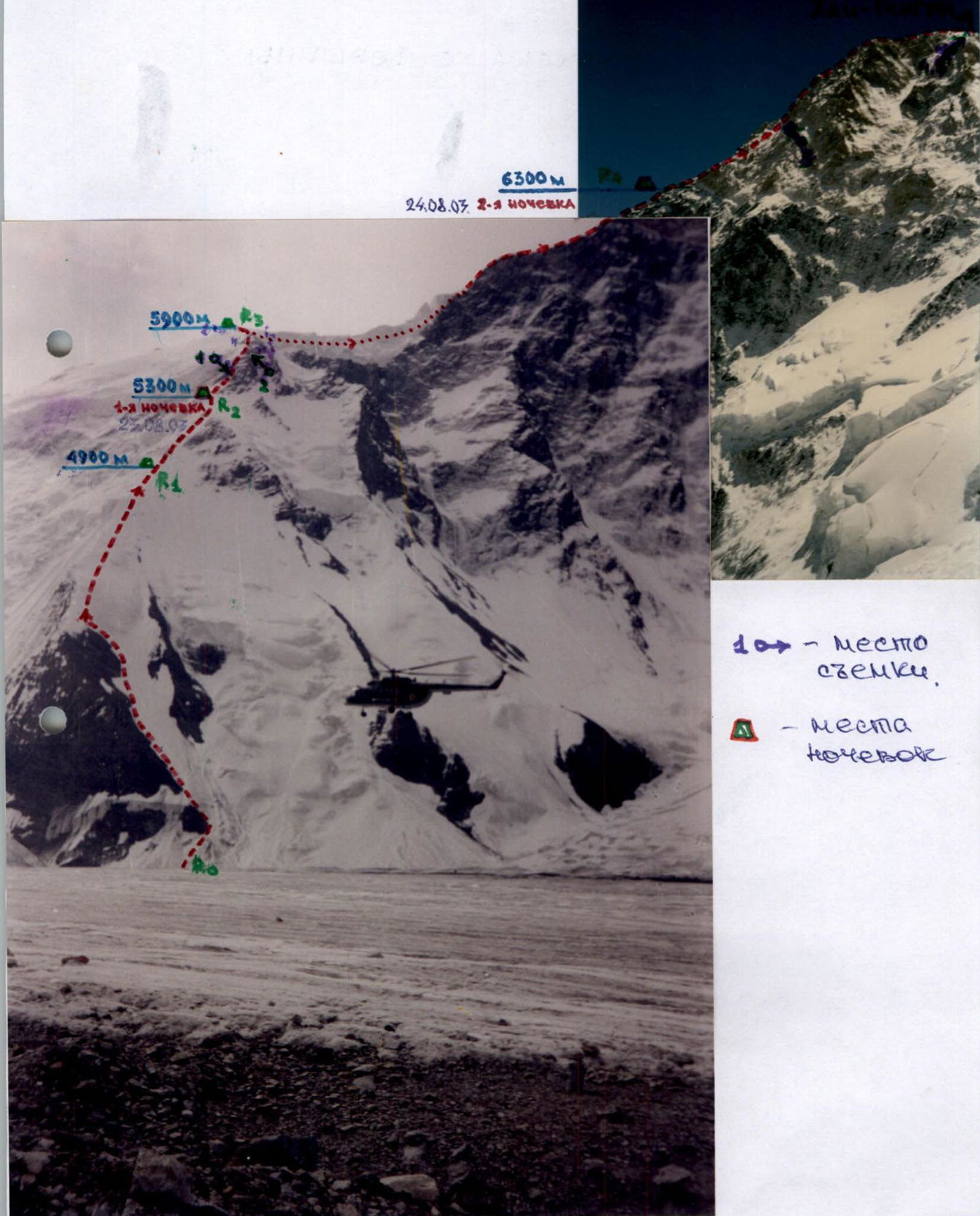
Section R2–R3, Photo 1.
Start of the rock belt above the 2nd camp.
Altitude 5400 meters.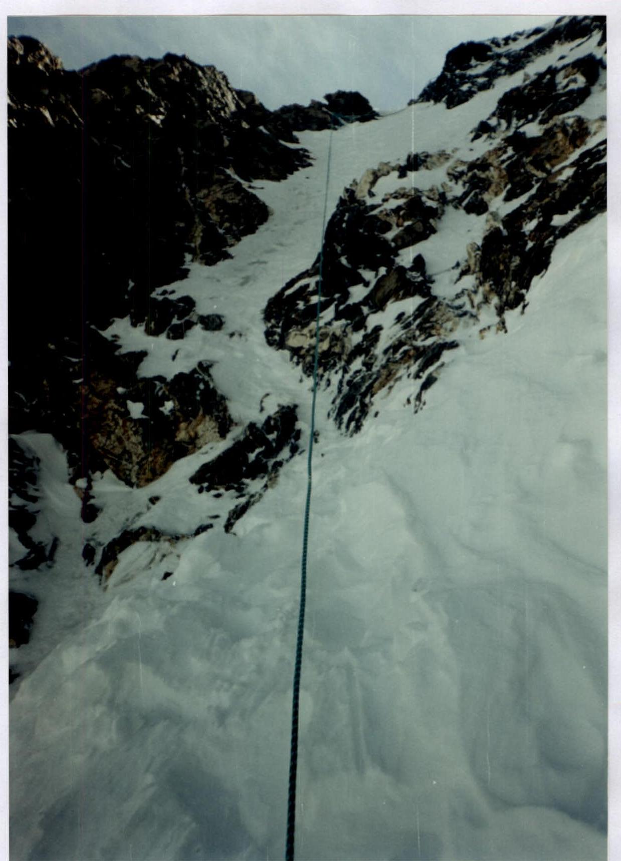
Section R2–R3, Photo 2.
Exit from the rocks to the ridge.
Altitude 5700 meters.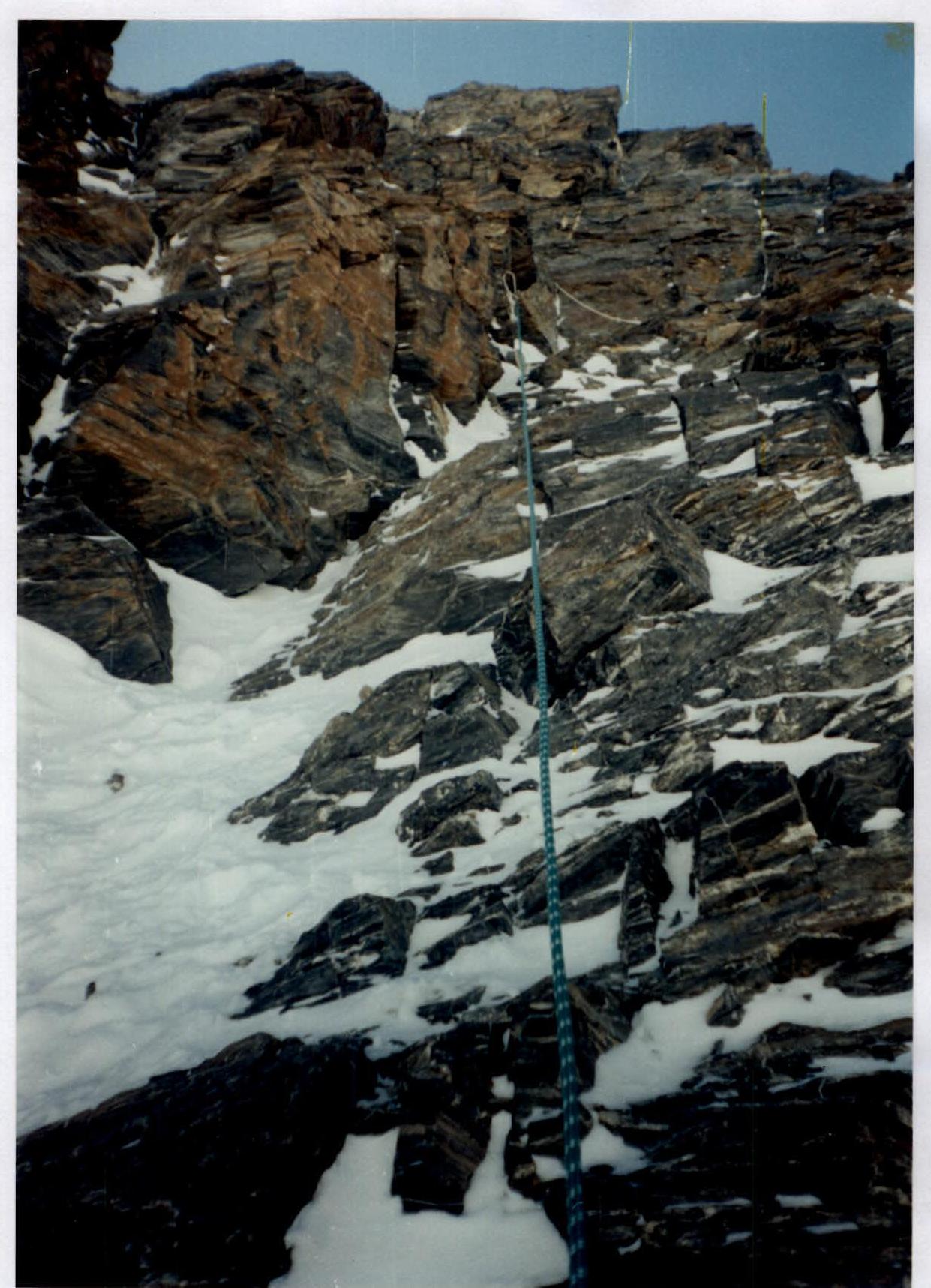
Section R4–R5, Photo 3. "Rusty, marble" rock belt. Altitude: 6700 meters.