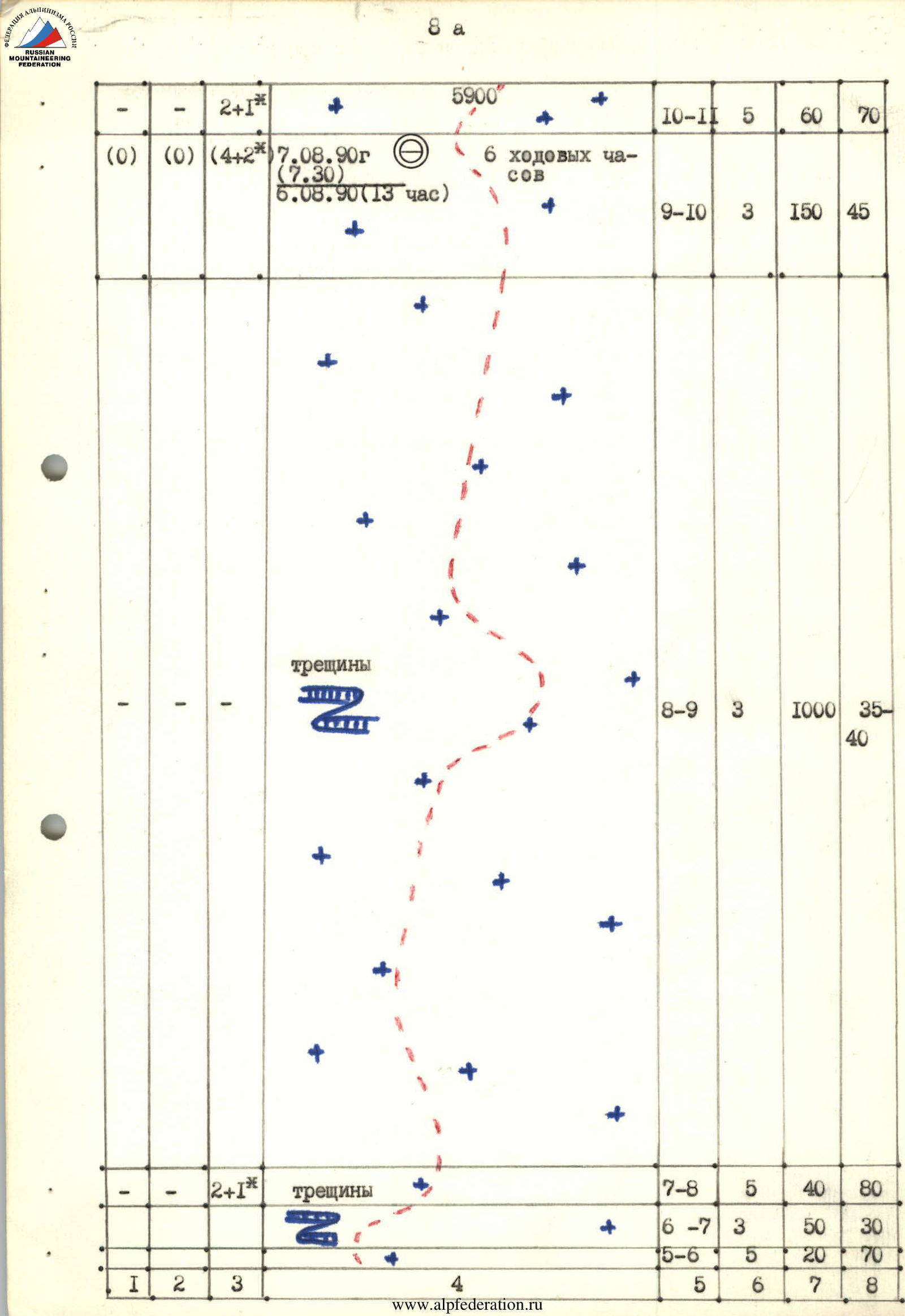
I. Altitude class 2. Tian Shan, Tengri Tagh ridge 3. Khan Tengri peak via the Southwest slope 4. Route difficulty category — 5B 5. Elevation gain: 2695 m, length 3830 m
Length of sections with 5th category difficulty — 340 m. Average steepness of the route — 42°.
- Pitons driven: rock 9+9*, chocks 16, ice screws 8+4*
- use of previously driven pitons
- Team's travel time: 13.5 hours, days — 2
- Overnight stays: I — good in a cave
- Leader: Sergey I. Tserkovnikov — Candidate Master of Sports
Team members:
- Alexander V. Ivanov — Candidate Master of Sports
- Viktor I. Igolkin — Master of Sports
- Andrey G. Sukharev — Candidate Master of Sports
-
Coach: Viktor I. Igolkin — Master of Sports, 2nd sports category.
-
Approach to the route: August 6, 1990 Peak ascent: August 7, 1990 Return: August 8, 1990
-
Organization: MSU Alpine Club together with the Magnitogorsk Mountain Sports Committee.
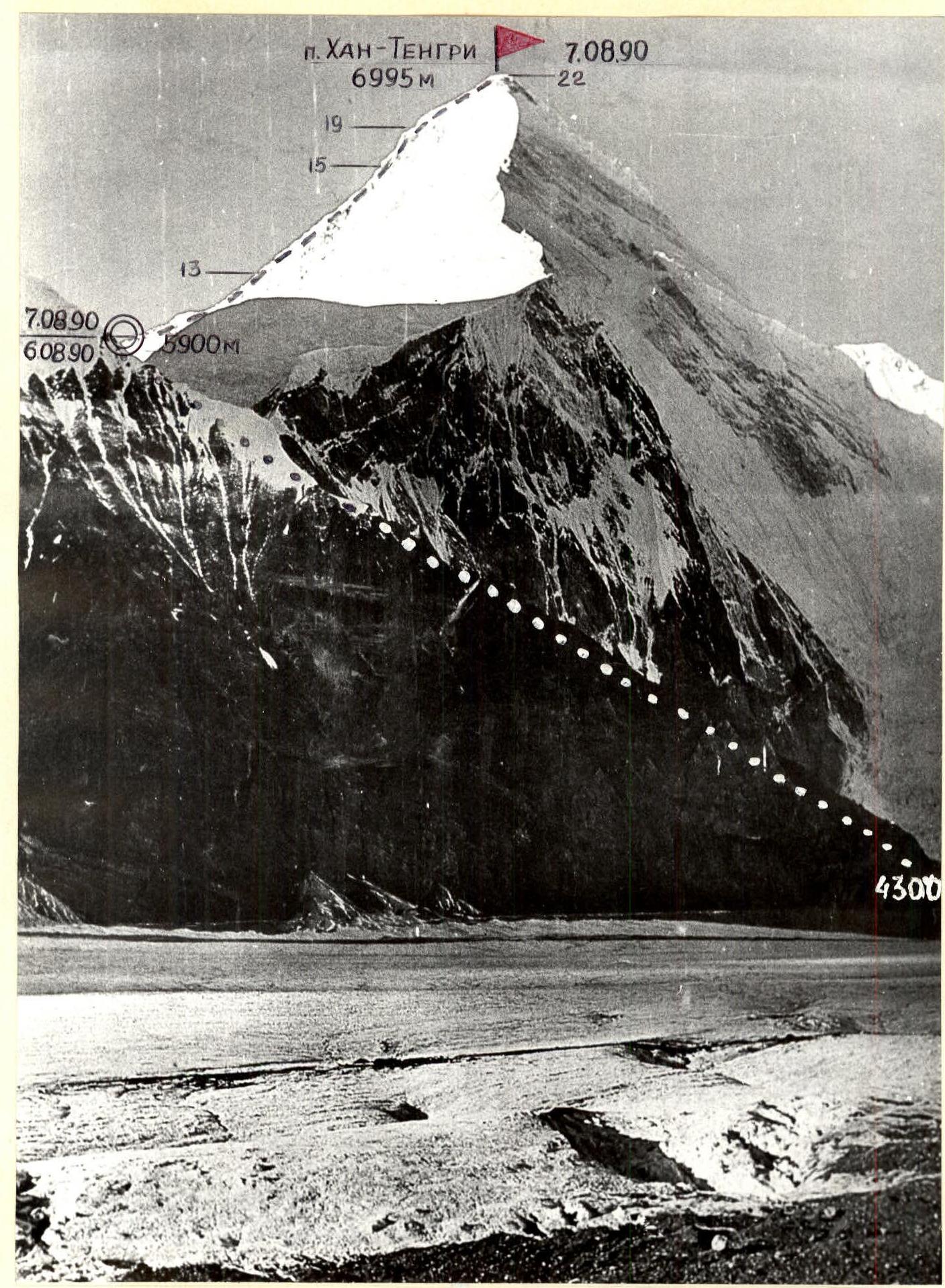
Photo 1. General photo of the peak. The picture was taken from a slide shot in August 1989 by V. Tenenev. Distance to the object is approximately 8 km, shooting point F1, height of the shooting point is approximately 4000 m.
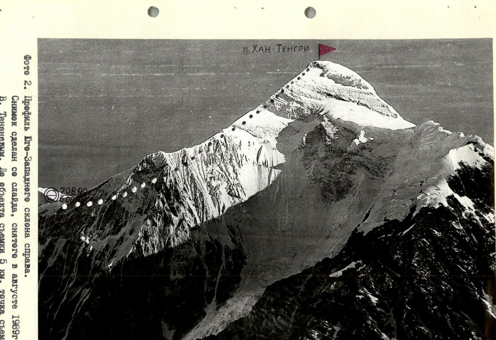
Photo 2. Profile of the Southwest slope on the right. The picture was taken from a slide shot in August 1989 by V. Tenenev. Distance to the object is 5 km, shooting point F2 on the map of the area, height of the shooting point is approximately 4400 m.
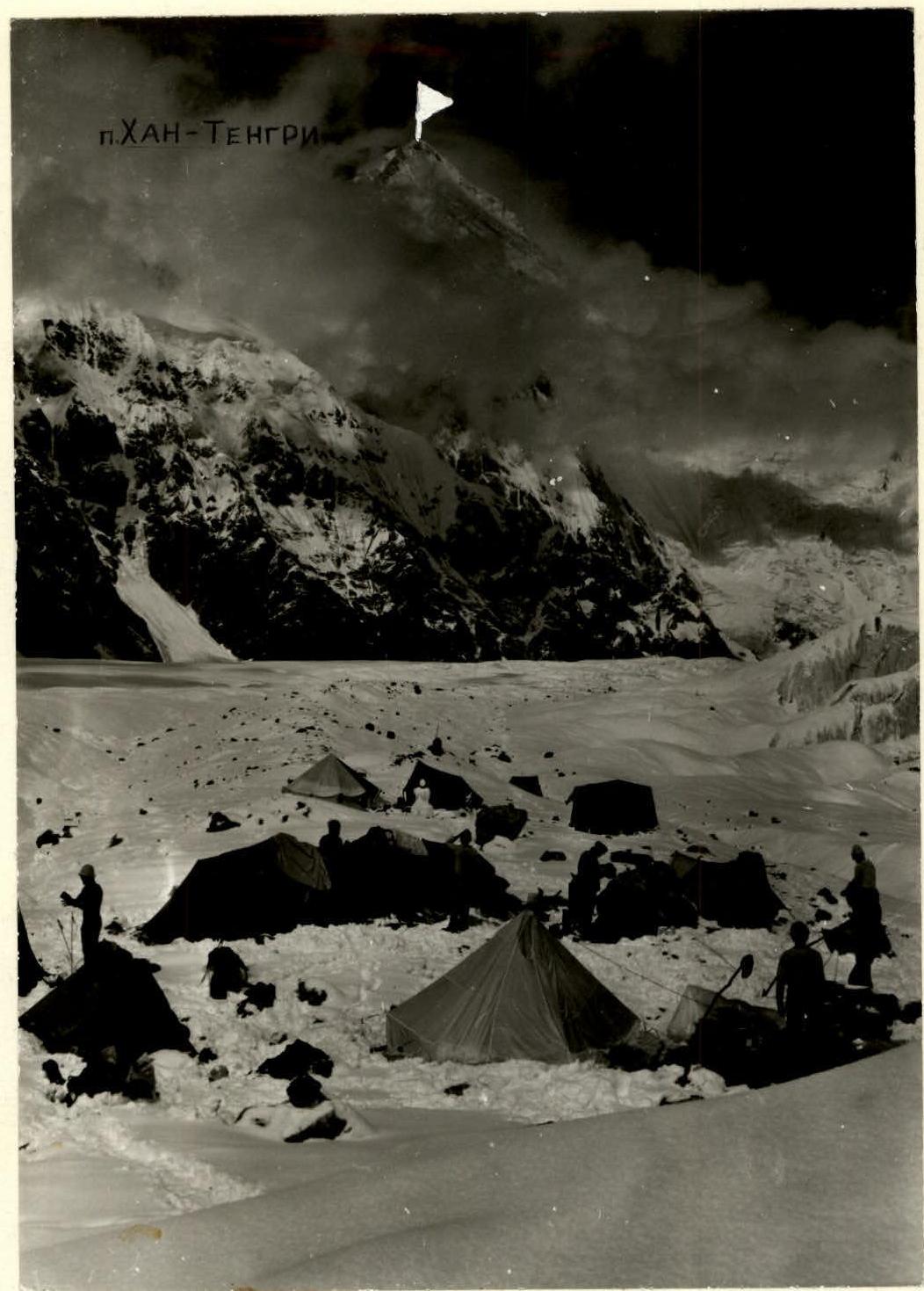
Photo 3. Photopanorama of the area from the base camp. The picture was taken on August 4, 1990. Distance to the object is 4–8 km, shooting point F3 at a height of approximately 3900 m.
Tactical actions of the team.
The team's tactical plan was designed to complete the route to Khan Tengri peak in three travel days, including the descent. The ascent was planned to be made at a fast pace from the base camp located at the confluence of the Zvezdochka and South Inylchek glaciers, with an overnight stay on the ridge in a cave. In optimal weather conditions on the first day and moderate conditions (clear, not very strong wind) on the second day, the tactical plan was fulfilled.
The team left the base camp at 5:00, reached the route from the 4300 m mark at 7:00, and arrived at the ridge (5800) at 13:00. Before reaching the ridge, the team moved mainly in pairs: Ivanov — Tserkovnikov, Igolkin — Sukharev, with mutual belay on steep ice-firn slopes and crevassed areas.
Simultaneously, a backup group of 8 people followed, waiting for the team on the ridge. A good cave was dug on the ridge, guaranteeing a reliable overnight stay.
After the ridge, the team moved in the same pairs independently, with alternate and simultaneous belay (9 mm French rope "UIAA"). Safety was ensured by:
- choosing the direction of movement;
- avoiding having one rope team directly below another;
- using high-quality, including imported, "UIAA" gear;
- having two backup groups.
Meals were two times a day (morning and evening) using high-calorie sublimated products and high-calorie individual rations, and a drink from flasks during the day.
Communication with the base camp and the backup group, as well as observation from the ridge, were carried out using a "Kaktus" radio station. Observation was conducted through a 12x binocular.
The team's reserves included:
- excellent technical and physical preparation of the participants;
- good material base (food, gear, medicine);
- presence of a backup group and a good cave on the ridge;
- presence of a doctor-resuscitator in the group (Candidate of Medical Sciences, 1st sports category);
- one and a half times reserve of food and gasoline;
- reliable radio communication.
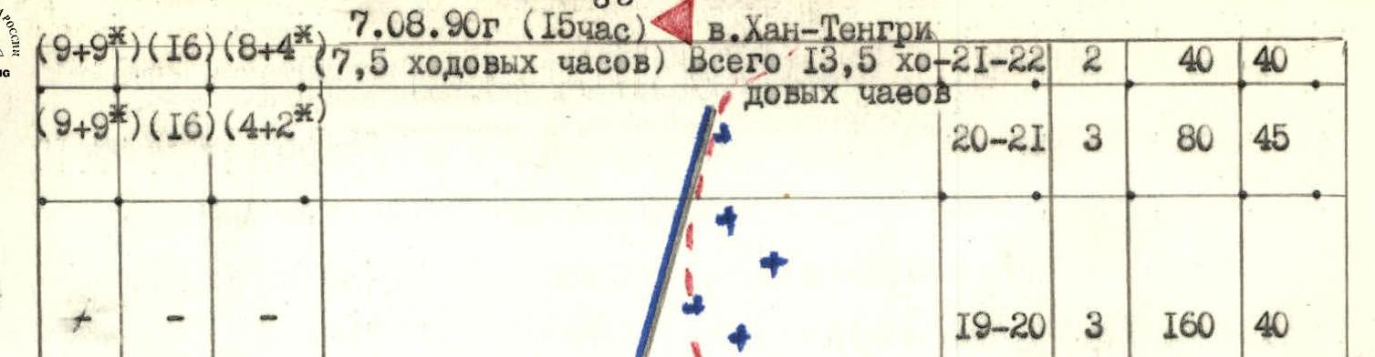


Route description by sections
The route begins at approximately 4300 m on the South Inylchek glacier, on the southern slope between Chapayev Peak and Khan Tengri Peak, then transitions to the Southwest slope of Khan Tengri. After the ridge (5900), the route follows the right part of the Northwest ridge, i.e., its Southwest face.
At the beginning of section R0–R1 — large deep crevasses with bridges, especially hazardous when covered with freshly fallen snow.
Section R1–R4 — a long snow slope of variable steepness, with exposed ice and narrow transverse crevasses in some places.
Section R4–R5 — threatened by hanging icefalls and seracs from the slopes of Chapayev Peak and Khan Tengri Peak; here the slope bends and the ice relief is heavily dissected. It is safer to pass this section in the morning.
Section R5–R8 — the narrowest part of the slope, cut by several longitudinal crevasses with edges at different levels (minimum difference 30 m). This is more like an icefall on a steep slope bend. The most complex and hazardous section of the route before the ridge.
Section R8–R10 — further to the ridge, a more gentle slope with varying steepness and steep crevasses in the middle part.
Section R10–R11 — a steep firn slope leading to the ridge. Caves are usually built here. The left part of the slope is a powerful icefall.
Section R11–R12 — movement along the ridge through deep snow towards the Northwest ridge.
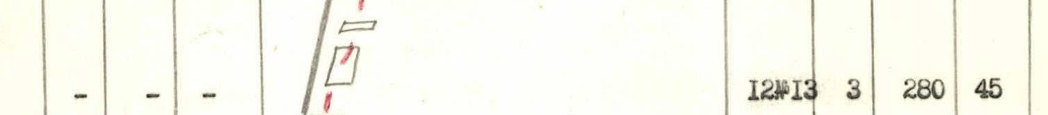
Section R12–R13 — movement along ruined rocks of medium steepness with ledges and sections of firn and ice.
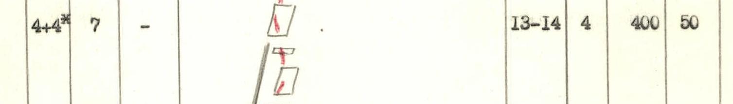
Section R13–R14 — the steepness of the rocks increases, here the route enters marbled limestone of light gray color. The route passes 10–30 m to the right of the ridge, sometimes reaching it.
Section R15–R18 — a powerful steep couloir with ice and firn in the middle part. This is the key section of the route. Exit from the couloir by traversing under the wall along a snow-ice slope to a narrow snow ridge.
Section R18–R19 — from the ridge, the final steep rocks lead to the snow-firn summit dome. A steep slope leads to a narrow firn ridge, and again a slope with rock outcrops leads to the highest point of the mountain.
The descent along the ascent route to the ridge took the team about 3 hours. There was a 2nd overnight stay in the cave on the ridge, from where on September 8, 1990, the team descended to the South Inylchek glacier in 2.5 hours.