Climbing Passport
- Region — Tian-Shan, Sary-Jaz ridge, 7.8.
- Peak — 5576 m (1000th anniversary of Kazan) via the southern ridge from Inylchek glacier
- Proposed category of difficulty — 5A, first ascent
- Route type — combined
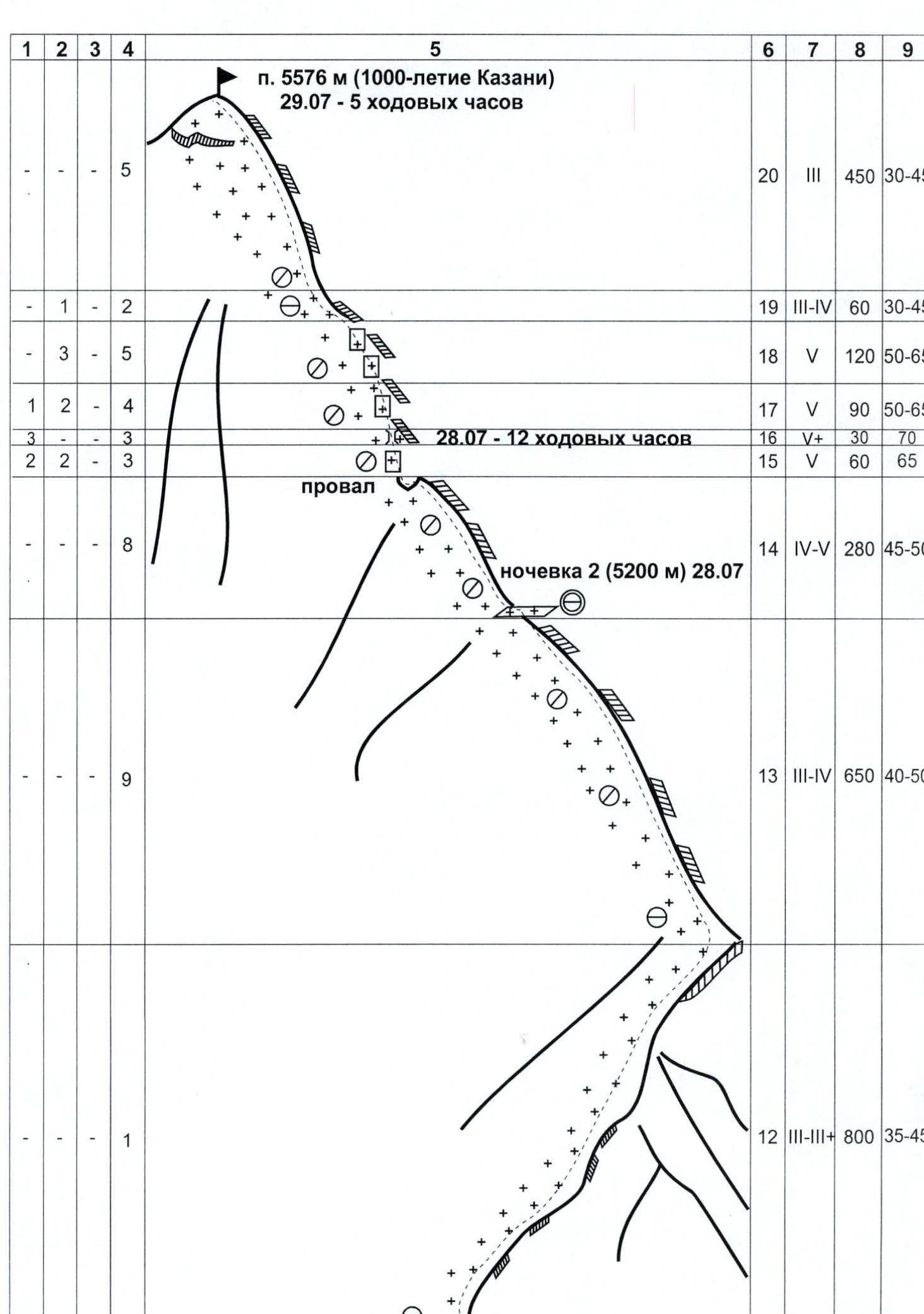
- Route characteristics: height difference (by altimeter) — 2426 m, route length (from the saddle) — 4167 m, length of sections with 5th category of difficulty — 527 m, average steepness: main part of the route — 57°, entire route — 45°. Total used on the route: rock pitons — 7, nuts — 23, ice screws — 56; stationary pitons — 0, incl. TME — 0; removable pitons — 0, incl. TME — 0. Total "piton" left on the route — 0.
- Total hours of climbing — 27, days — 3.
- Team leader: Kudryashov Valeriy Sergeevich, CMS
Team members:
- Akhmadiev Aidar Gapтельнурович, CMS
- Baskakova Svetlana Nikolaevna, MSMS
- Rozhnov Evgeniy Aleksandrovich, CMS
- Khusainov Niyaz Mirgazyamovich, CMS
- Team coach: Kudryashov Valeriy Sergeevich, CMS, 1st sports category.
- Departure to the route — July 27, 2005 at 5:00 Summit ascent — July 29, 2005 at 12:00 Return to Base Camp — July 31, 2005 at 15:00
- Organization: Ministry of Youth, Sports and Tourism of the Republic of Tatarstan.
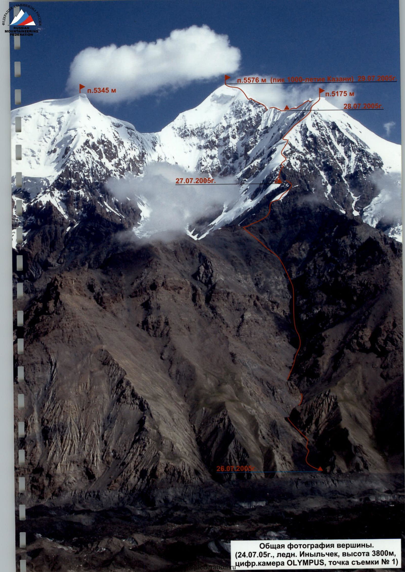
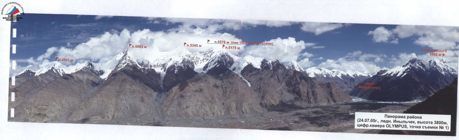
General photograph of the summit. (July 24, 2005, Inylchek glacier, altitude 3800 m, OLYMPUS digital camera, shooting point No. 1).
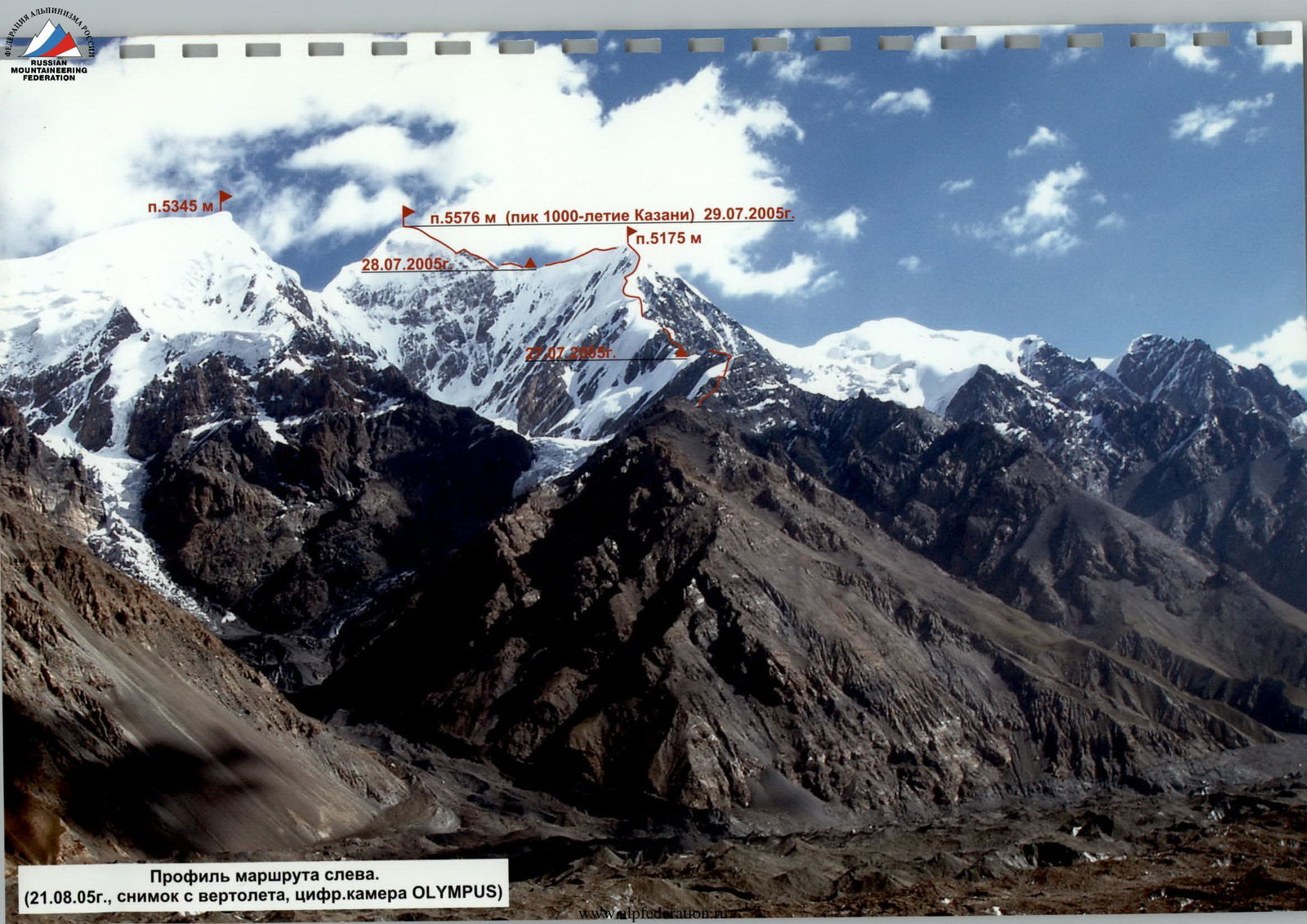
Route profile from the left. (August 21, 2005, taken from a helicopter, OLYMPUS digital camera).
Peak 5576 m (Peak 1000th anniversary of Kazan) July 29, 2005.
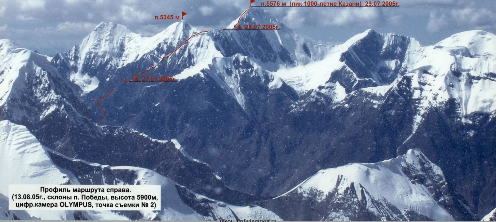
Route profile from the right. (August 13, 2005, slopes of Peak Pobeda, altitude 5900 m, OLYMPUS digital camera, shooting point No. 2).

Route scheme in UIAA symbols.
 www.alpfederation.ru↗
Route description by sections
From the base camp on the left bank of Inylchek glacier (stream, altitude 3200 m) cross the glacier to the central Y-shaped couloir of the "fence" adjacent to the southern subsidiary peak (peak 5175 m or peak 175th anniversary of Bauman MSTU). 200 m above the glacier there is a convenient camping spot. Altitude 3150 m. 2.5–3 hours from the base camp.
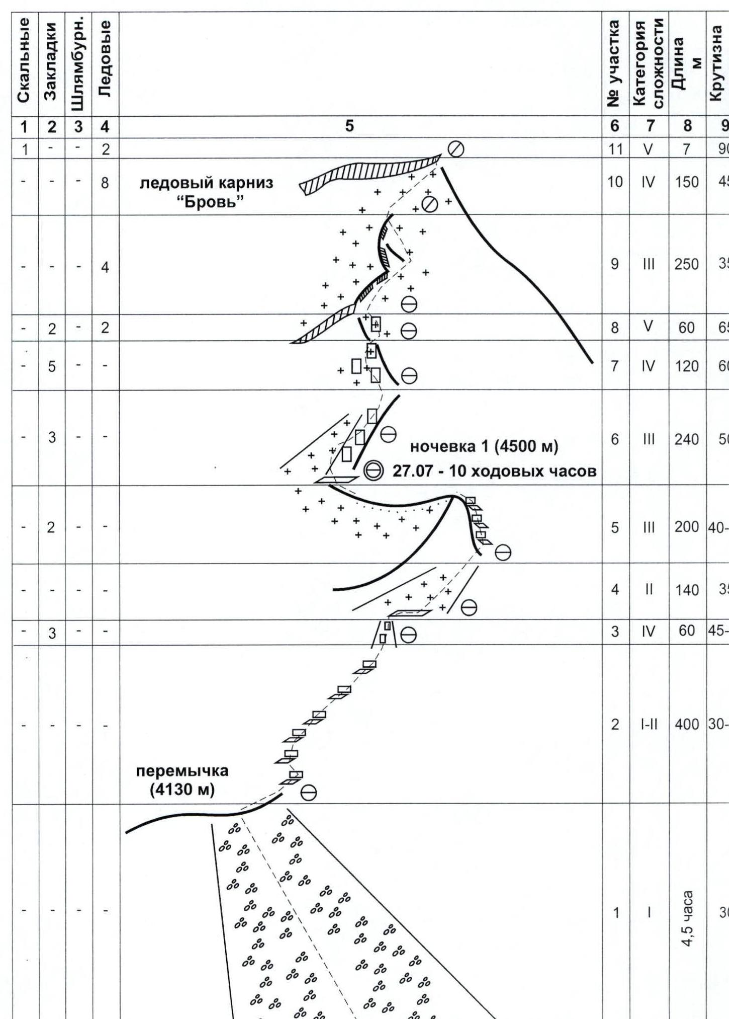
Section 1. Ascend the couloir (3 hours) to a clear fork, then follow the left (by direction) branch. The couloir gradually turns into scree slopes. Reach the saddle of the "fence" (1.5 hours). Convenient camping spot. Altitude 4130 m.
Sections 1–5. Then 400 m to the right along the scree ridge and easy rocks to a wide steep couloir leading to a snowfield. Ascend the couloir to a narrow shelf below the snowfield. Cross the snow slope to the right and upwards towards the first pillar. Ascend the pillar via a rocky ridge with separate walls. Descend from the pillar using a rappel and then follow an easy snow ridge to a saddle on the ridge. Convenient camping spot. Altitude 4500 m. 4.5 hours from the saddle.
Sections R6–R7. From the saddle, ascend upwards to the ridge via moderately difficult rocks and then through several pillars to a steep snow-ice slope below a rocky wall. Bypass the wall on the left. Then ascend to the ridge via an internal angle. Many loose rocks!
Section 8. On the right side of the ridge, ascend via severely deteriorated icy rocks (ice axe) — exit below the first large snow-ice cornice.
Sections 9–10. Bypass the cornice and the ridge with snow cornices on the right via a snow slope. Bypass a not very steep rocky rib — exit onto a snow ridge. The ridge turns into a steep snow-ice slope with increasing steepness, leading below the second large ice cornice "Eyebrow". Insurance is alternating, ice screws are used.
Section 11. On the right part of the cornice, ascend via a sheer ice wall — exit onto the ridge. Tense and complex climbing using ice axes.
Section 12. Then follow a wide snow ridge of varying steepness (in the lower and upper parts, snow cornices are on the right!) — exit onto the southern subsidiary peak 5175 m. Immediately after the summit, there is a hollow with rocky outcrops — a convenient camping spot. 4–5 hours from the saddle at 4500 m.
Section 13. Behind the hollow, there is a snow-ice ascent, then a steeply dropping snow ridge to the left with large cornices hanging to the right. Insurance via ice axes is problematic due to very loose snow; it is necessary to dig to the ice and use ice screws. Exit into a wide horizontal hollow. Convenient camping spot. Altitude 5200 m. 2–2.5 hours from the southern subsidiary peak.
Section 14. From the hollow, ascend to the left via a snow-ice slope. First, cross a small bergschrund to the left and upwards, then a complex traverse of a steep snow ridge with delicate cornices. Insurance is problematic; the snow is very loose, and ice under the snow is present only in some places. Descend into a small depression. 2 hours from the hollow.
Sections 15–18. From the depression, ascend to the left and upwards via a steep, heavily snowed-up rocky wall. The first rope length is climbed using ice axes; climbing is complex, insurance is combined (rock and ice screws, nuts). Then directly upwards via a complex icy chimney, then to the left and upwards along a steep, heavily snowed-up ridge with several steep pillars covered with snow cornices. Pillars are climbed head-on. It is necessary to dig trenches in the snow and through the cornices. Through a small pillar-finger — exit to the pre-summit slope.
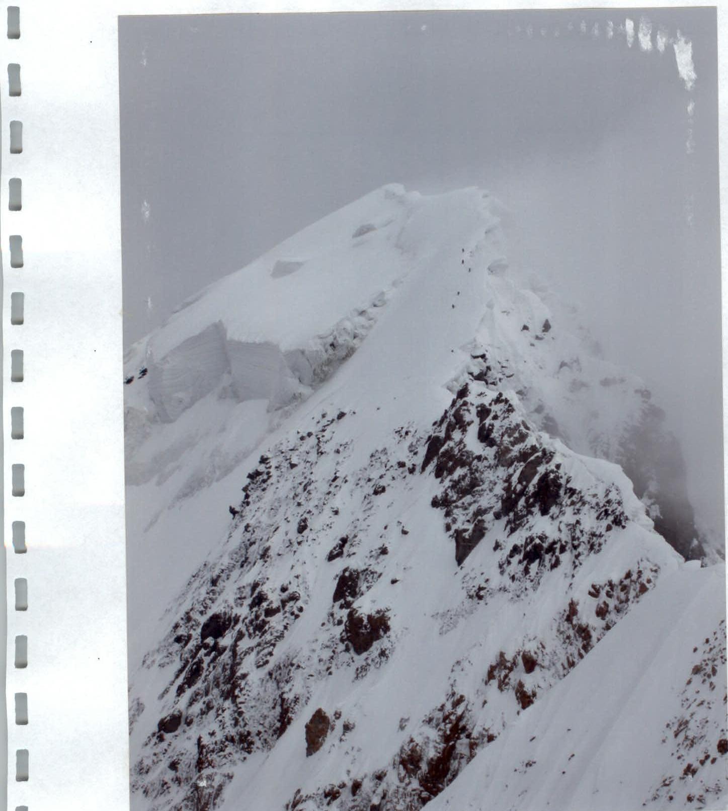
Sections 19–20. The pre-summit snow-ice slope of varying steepness leads to the summit snow cap. Insurance is alternating in some places via ice screws. On the right, there are dangerous snow cornices! The summit is a large snow-ice cornice. Descend via the ascent route. In honor of the anniversary of Kazan, the team proposes to name the summit "Peak 1000th anniversary of Kazan" by right of first ascent.
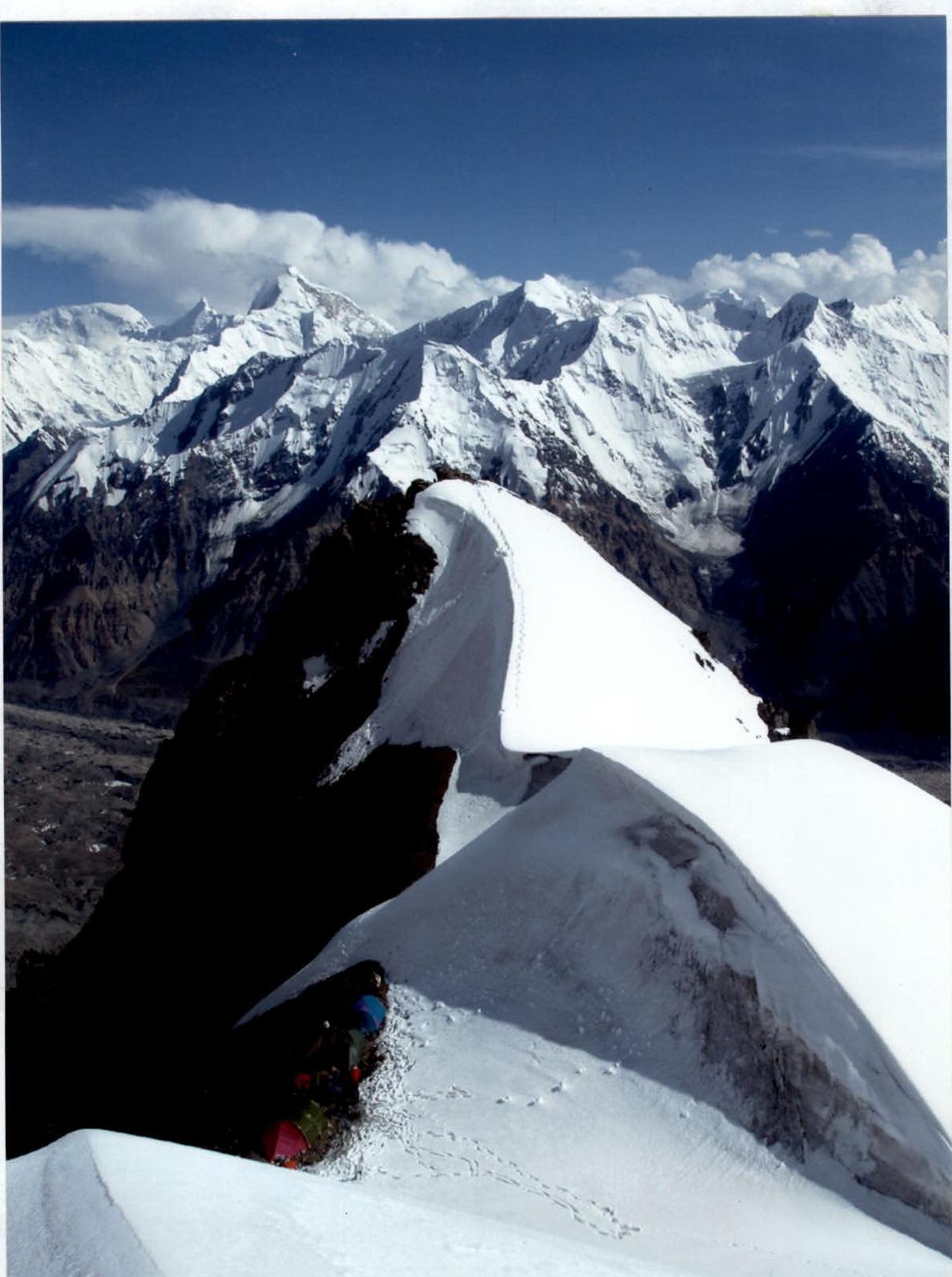
Photo 1. End of section 5, camping spot 1.
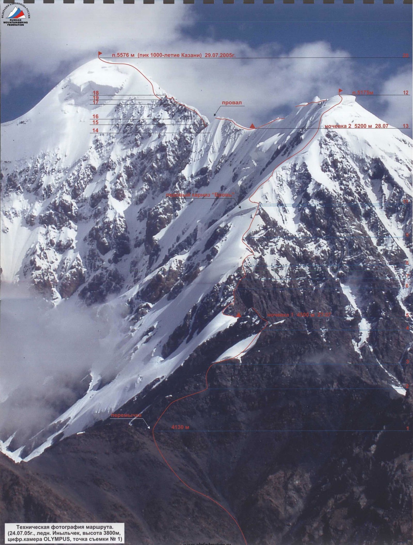
Technical photograph of the route. (July 24, 2005, Inylchek glacier, altitude 3800 m, OLYMPUS digital camera, shooting point No. 1).
 www.alpfederation.ru↗
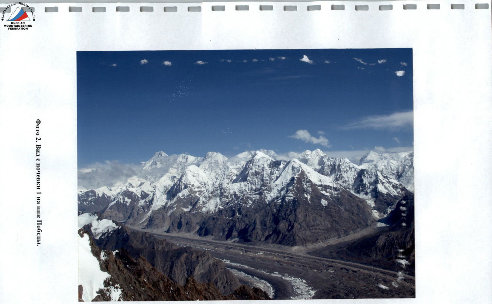
Photo 2. View from camping spot 1 towards Peak Pobeda.

Photo 3. Section 10.
Photo 4. Ice cornice "Eyebrow", end of section 10.
Photo 5. Passing section 11.
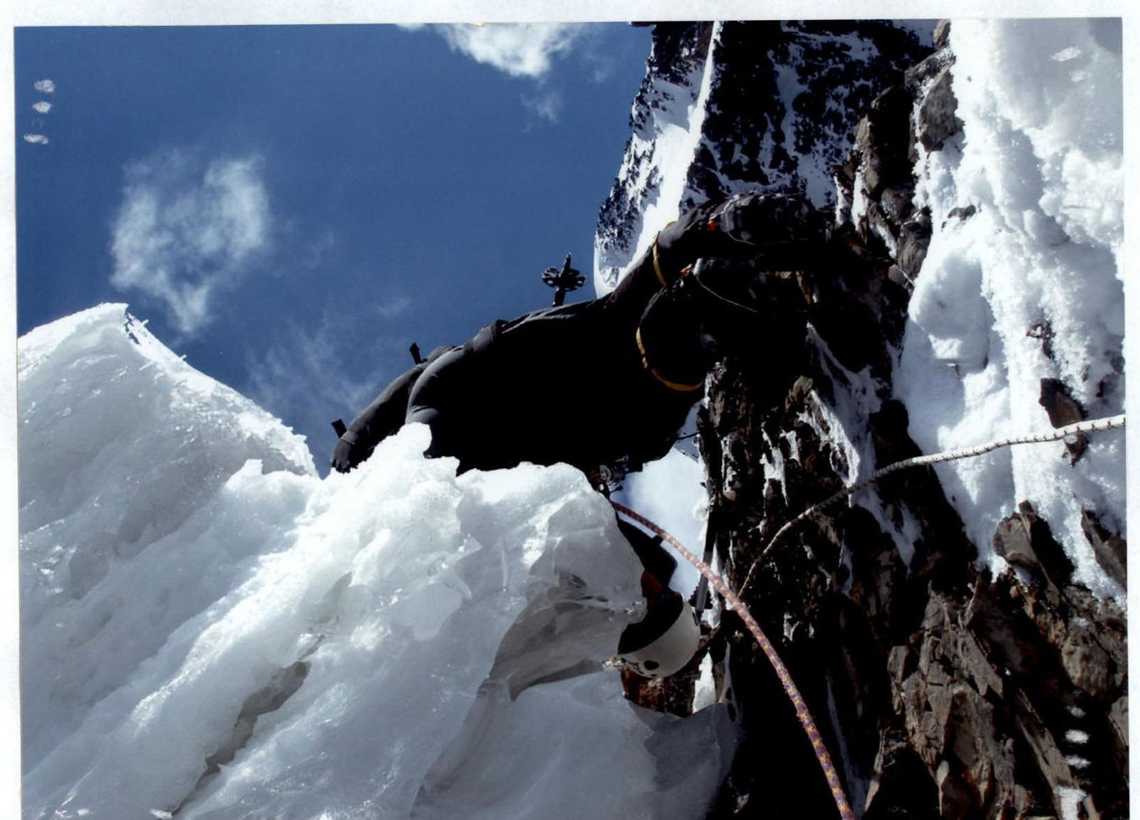
Photo 6. Cornice ridge, sections 13–14.

Photo 7. Section 17.
Photo 8. Section 18.
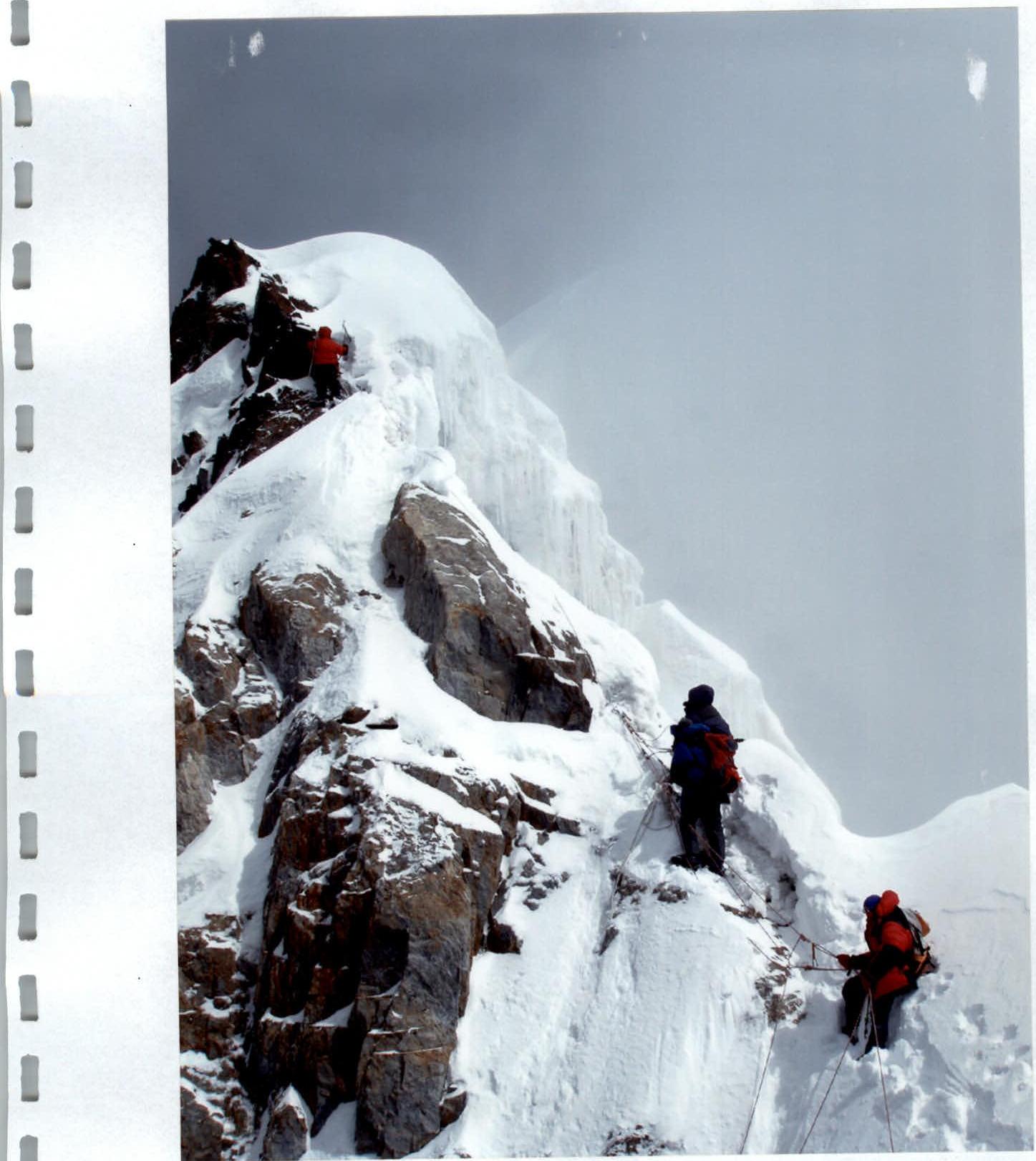
Photo 9. Section 19.

Photo 10. Group on the pre-summit ridge, section 20.