
REPORT
on the ascent of the team of the Chelyabinsk Region Alpine Federation to the peak - Spartakiad of Peoples of the USSR, Chok-Tal massif, via the southern slope from Choktal glacier.
Magnitogorsk 2014 by Biserov V.P.
Captain: Biserov Vladimir Pavlovich 455021, Magnitogorsk Leningradskaya 11-9 Tel.: (3519) 224-109 902-861-14-15 Coach: Igolkin Viktor Ivanovich 455000, Magnitogorsk Lenina 37-23
Ascent Passport
- Alpine event: Training gathering of the Chelyabinsk Region Alpine Federation and Magnitogorsk Alpine Club.
- Ascent class: snow-ice, combined.
- Region: ***Northern Tian Shan, Kungey Ala-Too ridge, Chok-Tal massif, eastern part.
- Peak: Spartakiad of Peoples of the USSR, height 4605 m.
- Ascent route: via the southern slope of the eastern ridge, ascent from Choktal glacier.
- Cat. diff.: first ascent, proposed 3B.
- Route characteristics: snow-ice.
- Height difference - 385 m.
- Route length - 650 m.
- Average steepness - 38°.
- Pitons driven: rock - 0. ice - 23. stationary loops - 16.
- Number of climbing hours: 22 h. climbing days - 1.5.
- Departure to the route: May 4, 2014 at 6:00. Reach the summit: May 4, 2014 at 17:36. Return to base camp: May 5, 2014 at 2:00.
- Leader: Biserov Vladimir Pavlovich, 2nd sports category, Magnitogorsk.
Participants:
- Ilkov Sergey Avenirovich, 3rd sports category, Chelyabinsk.
- Sushkin Konstantin Evgenievich, novice, Chelyabinsk.
- Team coach: Igolkin Viktor Ivanovich, Master of Sports, Magnitogorsk.
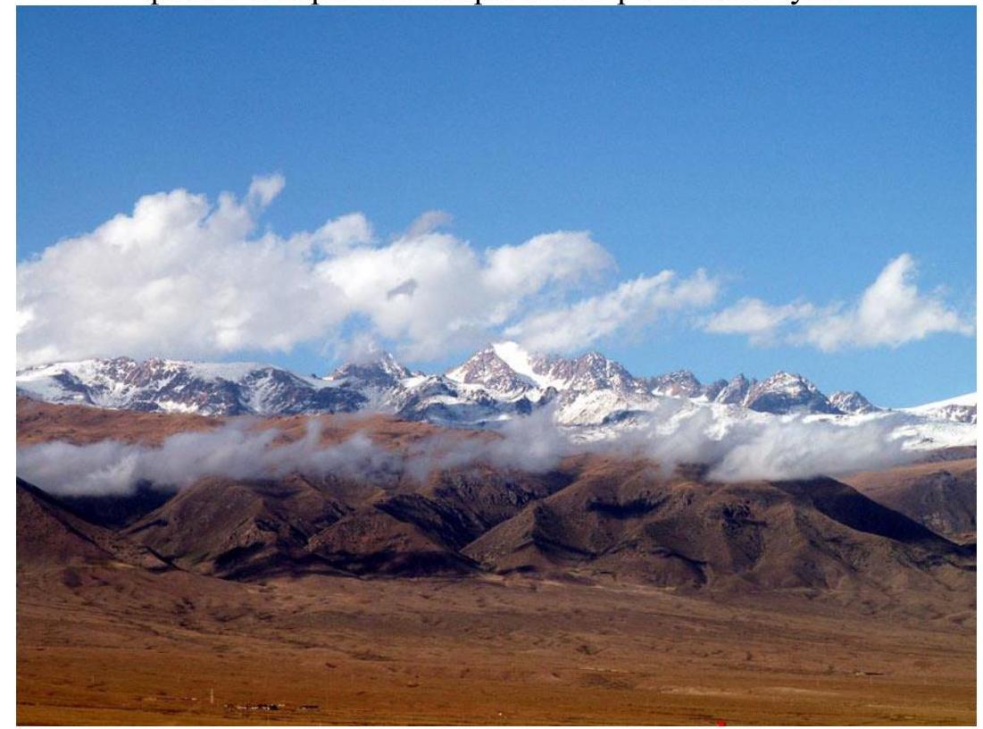
General view of the Chok-Tal massif from the south, Kungey Ala-Too ridge, photo from the northern shore of Lake Issyk-Kul.
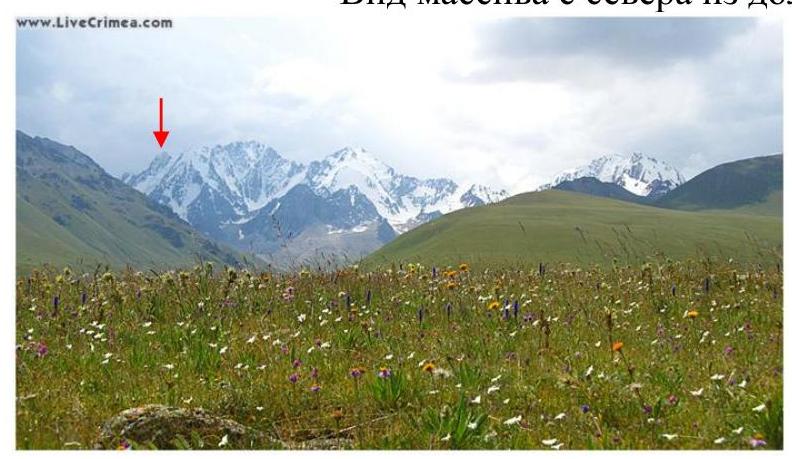
View of the massif from the north from the Dzhindysu valley.
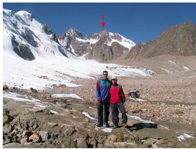
View of the Spartakiad peak from the northeast from the S. Choktal valley.
General photo of the Chok-Tal massif from the Yu. Choktal valley.

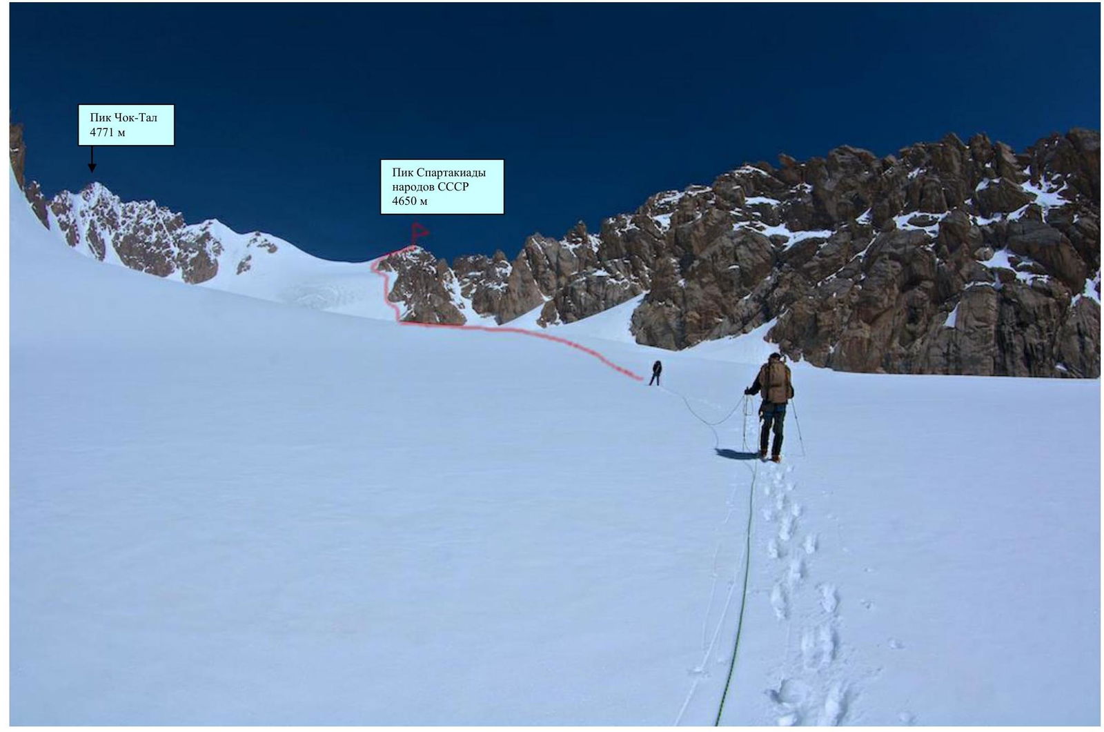
General photo of the summit from the Choktal glacier cirque.
Brief description of the ascent area
The Choktal massif stretches in a latitudinal direction for 7-8 km and consists of a series of peaks separated by deep saddles. The first western peak, or Kobyrga, is 4593 m; the second western peak is the double-headed Peak of Kyrgyzstan 4600 m with northern and southern summits. The second eastern peak, also double, consists of the Peak of the Siberian Academy of Sciences (northern) and the Peak of N. N. Paltov (southern) 4720 m; finally, the First eastern peak, or Choktal proper, is 4771 m; followed by the Peak of Spartakiad of Peoples of the USSR 4650 m.
Thus, there are seven peaks distinguished in the watershed ridge, and several more peaks in the lateral spurs:
- Kobyrga - 4593 m.
- Peak of Kyrgyzstan - 4600 m (northern and southern summits).
- Peak of the Siberian Academy of Sciences - height not specified.
- Peak of N. N. Paltov - 4720 m.
- Choktal - 4771 m.
- Peak of Spartakiad of Peoples of the USSR - 4650 m.
- One peak - unnamed and without exact height.
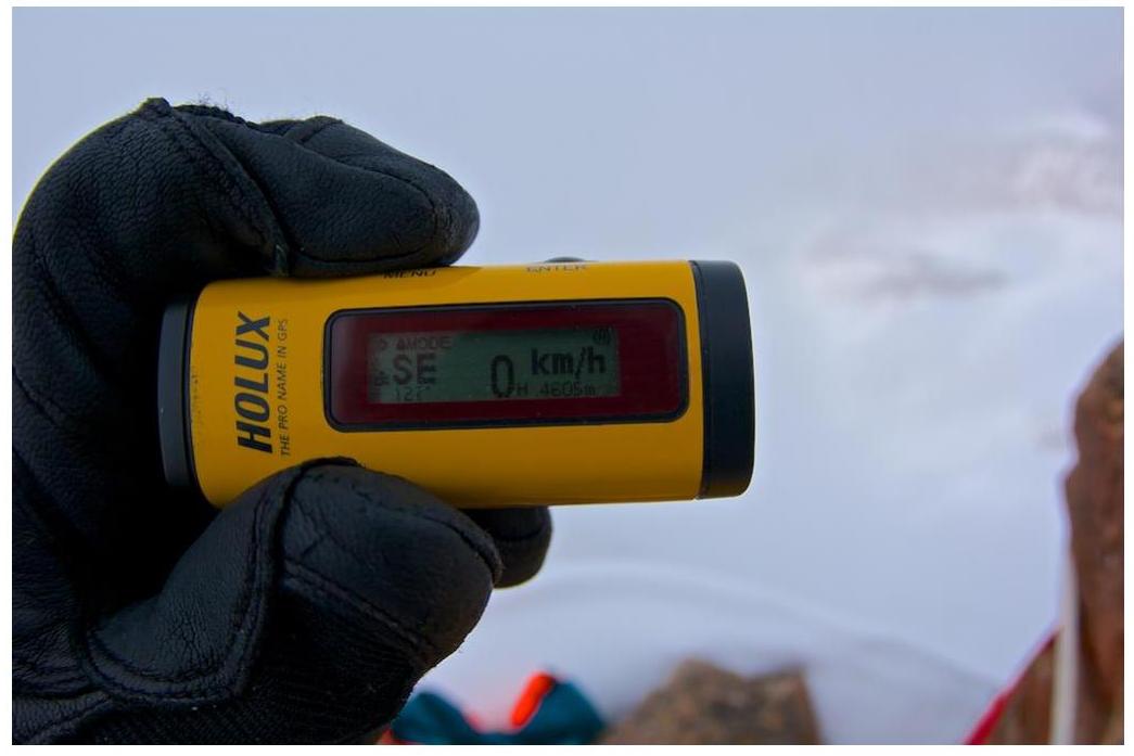
All height measurements were made before 1961. Therefore, high errors are likely in the final height readings of all peaks except the main Choktal. Our GPS showed a height 45 m lower - 4605 m.
Numerous lateral spurs divide the valley glaciers of Voytsekhovsky, Bryzgalov, Poyarkov, and Shnitnikov, belonging to the Dzhindysu river basin, first explored by N. N. Paltov in 1927, and the glaciers:
- Gryushe,
- Krasavets,
- Choktal,
- Rogaty,
- Ozerny,
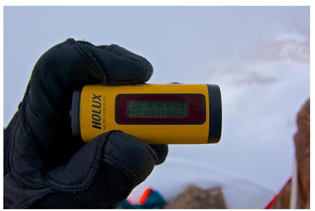
feeding the Yu. Choktal river on the southern side. Further on the photo are the coordinates of the summit!
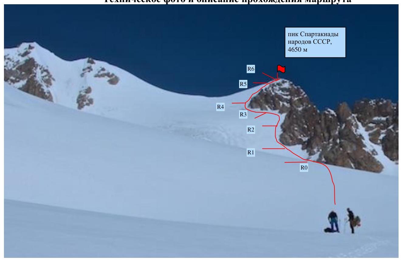
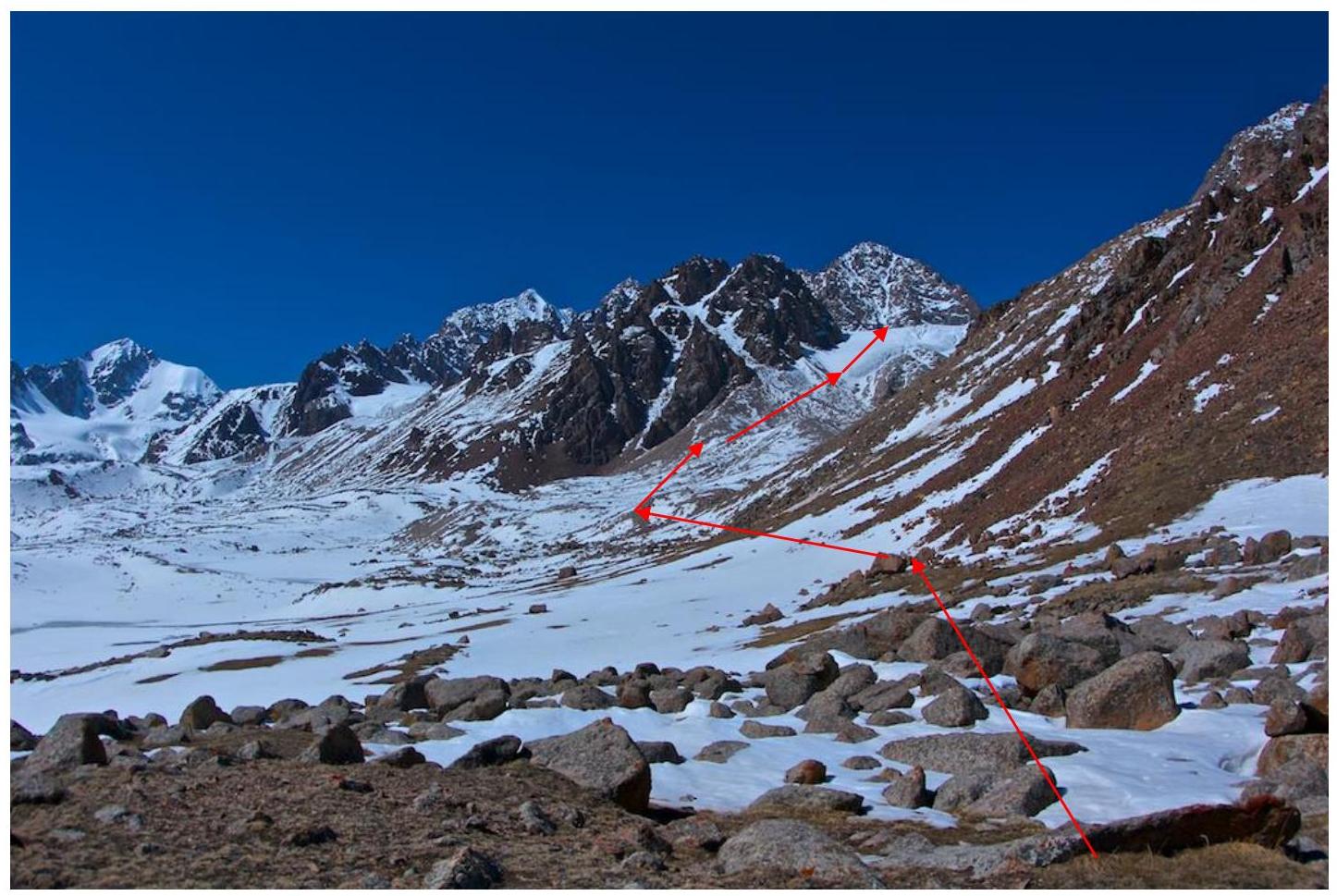
Technical photo and description of the route passage
The route is generally snow-ice 3B cat. diff. with a length of 650 m. The time taken to complete the route is 7-8 hours.
The assault camp was set up on May 2, 1927, on the moraine of Yu. Choktal, 3500 m. Departure to the summit on May 4 at 6:00, by a group of three people, moving up Choktal glacier. Choktal glacier has 3 main steps along its entire length with a slope of 20-25°. On the ascent of the 3rd step - crevasses. Belaying, rope team - mandatory! We were under the route by 12:00.
Ascent:
-
Section R0: first 100 m along a snowy slope 35-40° to rock bastions.
-
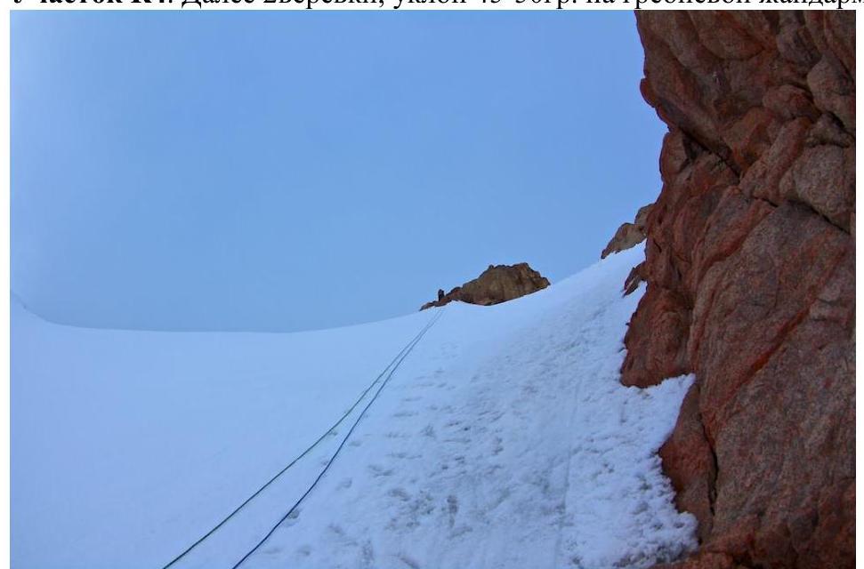
Section R1: then along the rocks 3-5 ropes, ice axes, stations on stationary loops, slope steepness increases to 45-50°.
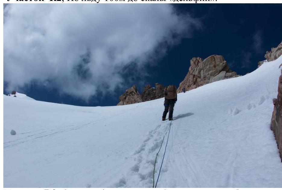
- Section R2: 100 m along ice to the "Dolphin" rock.
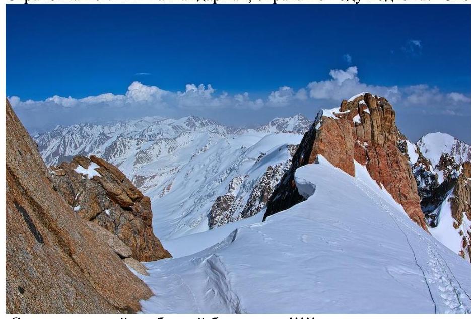
- Section R3: from "Dolphin" a passage of 2 ropes along bastions of the main ridge. Slope 20°. Belaying with loops on rock formations, snow cornices on the northern wall to the right of the ascent.
- To the left - a huge ridge bergschrund!
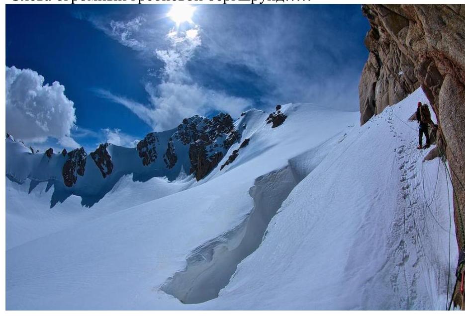
- Section R4: then 2 ropes, slope 45-50° to a ridge rock formation. Ice axes, loops.
- Section R5: from it 1 rope along the main ridge.
- Section R6: then the last rope to the summit ridge.
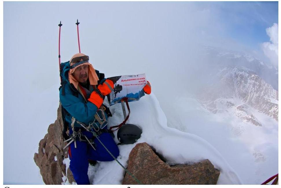 SUMMIT at 17:36 on May 4, 2014.
Descent along the ascent route took 3 hours.
Preparation for the ascent
For a 3B cat. diff. route, all team members were well-prepared. Before the ascent, each participant had experience in ascents of 1B and 2A categories of complexity and mountain hikes: Elbrus, Kazbek, Tepli, Belukha, Western Sayan, Sablya peak.
Work was done in the club on natural relief features (snow and rock). Safety techniques in the mountains were studied and mastered, and rescue training was conducted. The team of first ascenders participated in training rock and snow-ice sessions in winter and summer conditions. They mastered movement on snowy and icy slopes, creation of artificial belay points, and use of ice equipment.
Tactical actions of the group
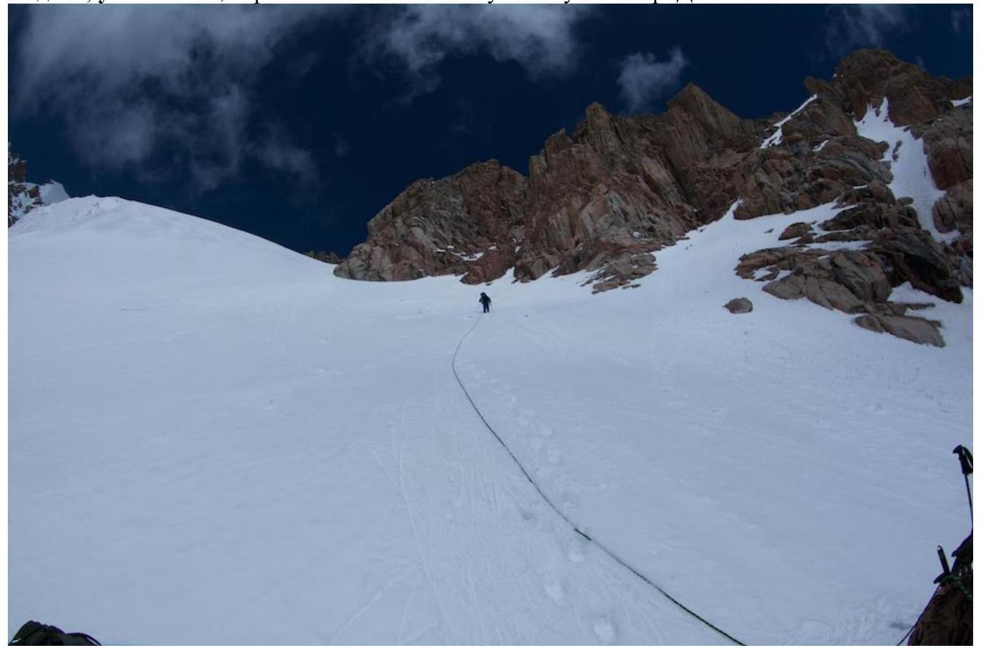
From the assault tent under the route, the group moved along the stony slopes of the moraine. Techniques of movement on scree were practiced on previous routes. At the beginning of the section, when transitioning from the moraine to the glacier, the group put on personal equipment for moving in a rope team on Choktal glacier to the start of the route.
For movement on the glacier and route, the following were used:
- crampons,
- ice axe,
- personal harness.
For faster passage of the route, two 8 mm, 50 m ropes and stationary loops and ice screws were used.
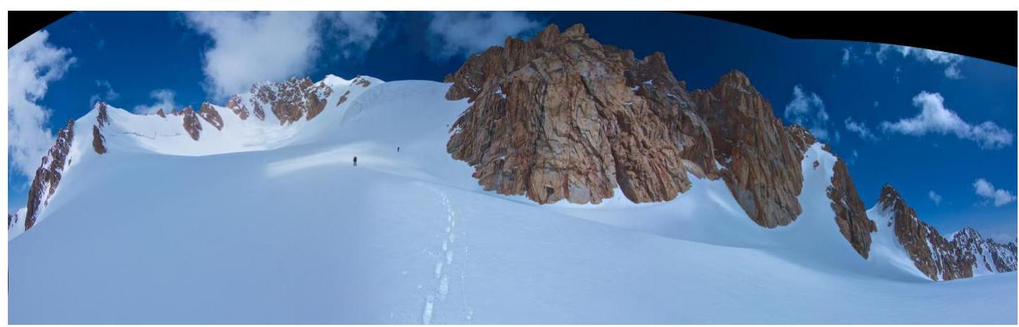
Movement along the moraine to Choktal glacier.
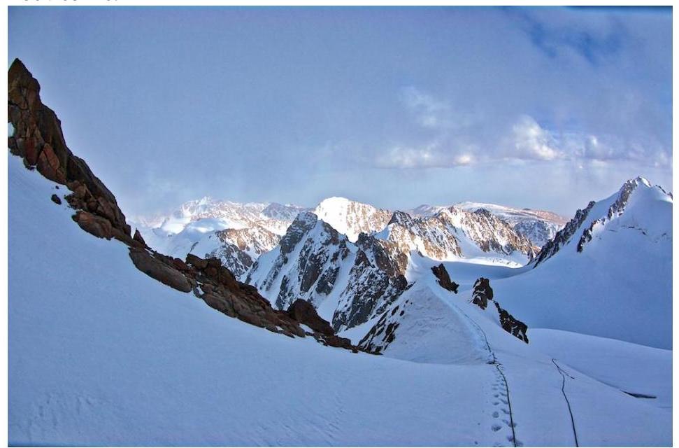
View (panorama) of the cirque with Choktal glacier on the route.
Route in UIAA symbols
Peak Spartakiad of Peoples of the USSR, 4650 m
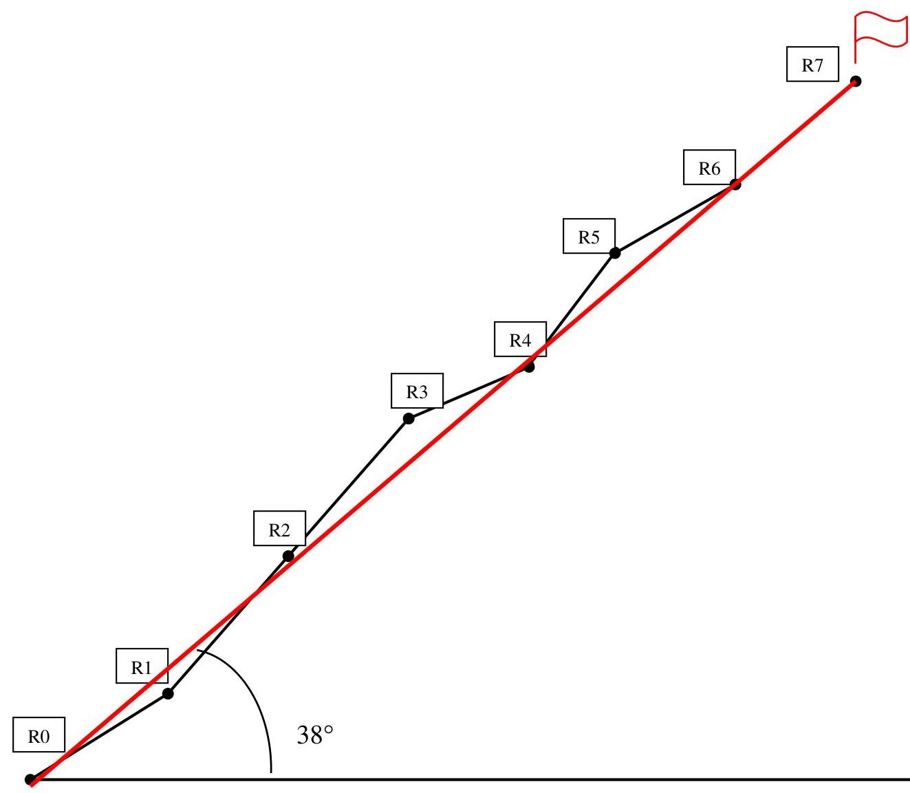
| Rock pitons | Ice pitons | Stationary loops | Route in UIAA symbols | Section | Length, m | Steepness | Cat. diff. | Date/time |
|---|---|---|---|---|---|---|---|---|
| R7 | May 4, 2014 17:36 | |||||||
| 0 | 1 | 2 | R6 | 50 | 35 | 3 | ||
| 0 | 2 | 1 | R5 | 50 | 25 | 3 | ||
| 0 | 3 | 1 | R4 | 100 | 50 | 3 | ||
| 0 | 8 | 2 | R3 | 100 | 25 | 3 | ||
| 0 | 0 | 6 | R2 | 100 | 50 | 3 | ||
| 0 | 8 | 4 | R1 | 150 | 50 | 3 | ||
| 0 | 2 | 1 | R0 | 100 | 35 | 2 | May 4, 2014 12:10 |
Chronometry of the entire route passed
Route profile
Route passage graph
| Hours | Total 22 h |
|---|---|
| 4 | |
| 3 | |
| 2 | |
| 1 | |
| Day | 2nd day |
| Date | May 5, 2014 |
| 24 | |
| 23 | |
| 22 | |
| 21 | |
| 20 | |
| 19 | Descent to base camp |
| 18 | Summit 17:36 |
| 17 | |
| 16 | |
| 15 | |
| 14 | |
| 13 | Movement on route 12:10 |
| 12 | |
| 11 | |
| 10 | |
| 9 | |
| 8 | |
| 7 | |
| 6 | Movement on moraine and glacier |
| 5 | |
| 4 | |
| 3 | |
| 2 | |
| 1 | |
| 0 | |
| Day | 1st day |
| Date | May 4, 2014 |
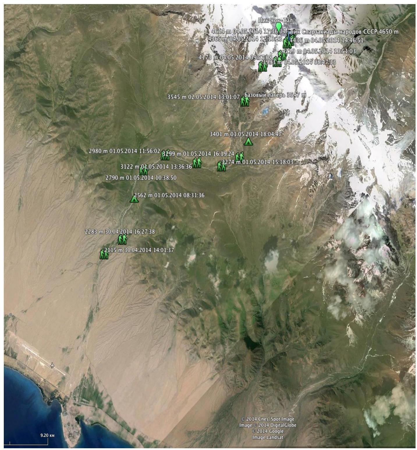
Map of the Kungey Ala-Too ridge area and approach to the Choktal massif

Comments
Sign in to leave a comment