
Passport
- Category — technical
- Tian Shan, western Kokshaal-Too
- Peak Chernogolovka via the center of the S wall (4825 m)
- Proposed category 4B, first ascent
- Elevation gain — 1425 m. Distance — 2000 m. Distance of category 5 sections — 50 m. Average steepness of the main part of the route — 50°
- Pitons hammered: rock 11, chocks 7, ice screws 4
- Climbing hours 14 and 1 day.
- Overnight stays: none.
- Captain: Boyko V.V., Master of Sports. Participants: Efimov V.B., Master of Sports, Lebedev M.V., Candidate for Master of Sports, Lebedeva E.V., Candidate for Master of Sports, Shmokhin I.A., 1st sports category
- Coach: Monaenkov E.I.
- Departure from base camp — August 11, 1998. Start of the route — August 12, 1998. Summit — August 12, 1998. Return to base camp — August 12, 1998.
- Organization: alpinism club "Chernogolovka".
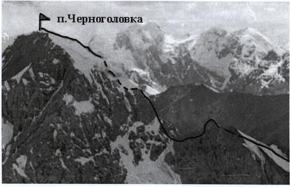
View of Peak Chernogolovka from the slopes of Peak Gornykh Vodyteléy.
Route Description
Peak Chernogolovka rises on the left (orographic) side of the gorge directly above the traditional base camp location. From below, the route to it along the northern ridge appears uncomplicated and is visually assessed as 1B–2A. However, this observation does not reveal a gap in the ridge (the lower section of the ridge appears to merge with the pre-summit ridge), which significantly alters the route's complexity. This gap and the northern wall that opens beyond it:
- greatly complicate the route
- dictate a somewhat unusual tactic for its passage.
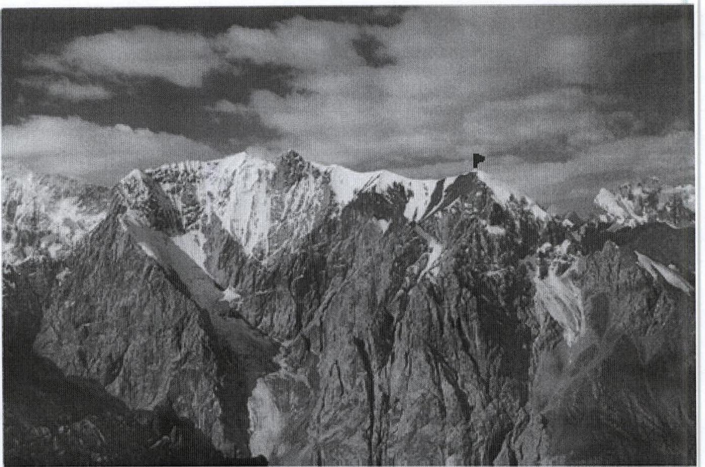
General view of the Peak Chernogolovka massif. The gap terminates towards the northern wall with steep rock walls with a total length of about 120 m, so it is convenient to take an extra 120 m of rope for hanging the gap and using these hung ropes for ascent during the return.
Route Description by Sections
Section R0–R1: gentle (about 20°) initially grassy, then scree slope from the base camp to a small glacier on the slope.
Section R1–R2: ice 10 m, 50°, category 3. Section R2–R3: ice 30 m, 30°, category 2. Section R3–R4: ice 40 m, 20°, category 1 (traverse).
Monaenkov's bivouac sites — convenient areas for overnight stay in case the group performs the described simple approach in the second half of the day.
Section R4–R5: scree 100 m, 20–30°, II.
Section R5–R6: rock 60 m, 30–40°, III, ice "carrot" for rappelling.
Section R6–R7: rappel 40 m, 90°.
Section R7–R8: rappel 40 m, 80°.
Section R8–R9: horizontal ledge 40 m, III.
Section R9–R10: rappel 20 m, 90°.
Section R10–R11: horizontal scree ledge 100 m, I–II — a connecting ridge.
Section R11–R12: wall 60 m, beginning 70°, IV–V, end 60°, III–IV, scree ledges.
Section R12–R13: ledge 15 m, 40°, II–III.
Section R13–R14: scree ledges 80 m, 60°, IV.
Section R14–R15: chimney filled with ice, in its middle part a transition to the right, onto the wall, and further ascent up the wall, to the end of the wall, 50 m, 80°, V.
Section R15–R16: easy rock 60–70 m, 40–50°, II–III.
Section R16–R17: snowy-icy summit cap.
When moving on section R14–R15, one should be cautious of falling ice from the upper part of the chimney. It is advisable to set up a station in a sheltered location. A simple descent option was not explored, so descent is recommended via the ascent route.
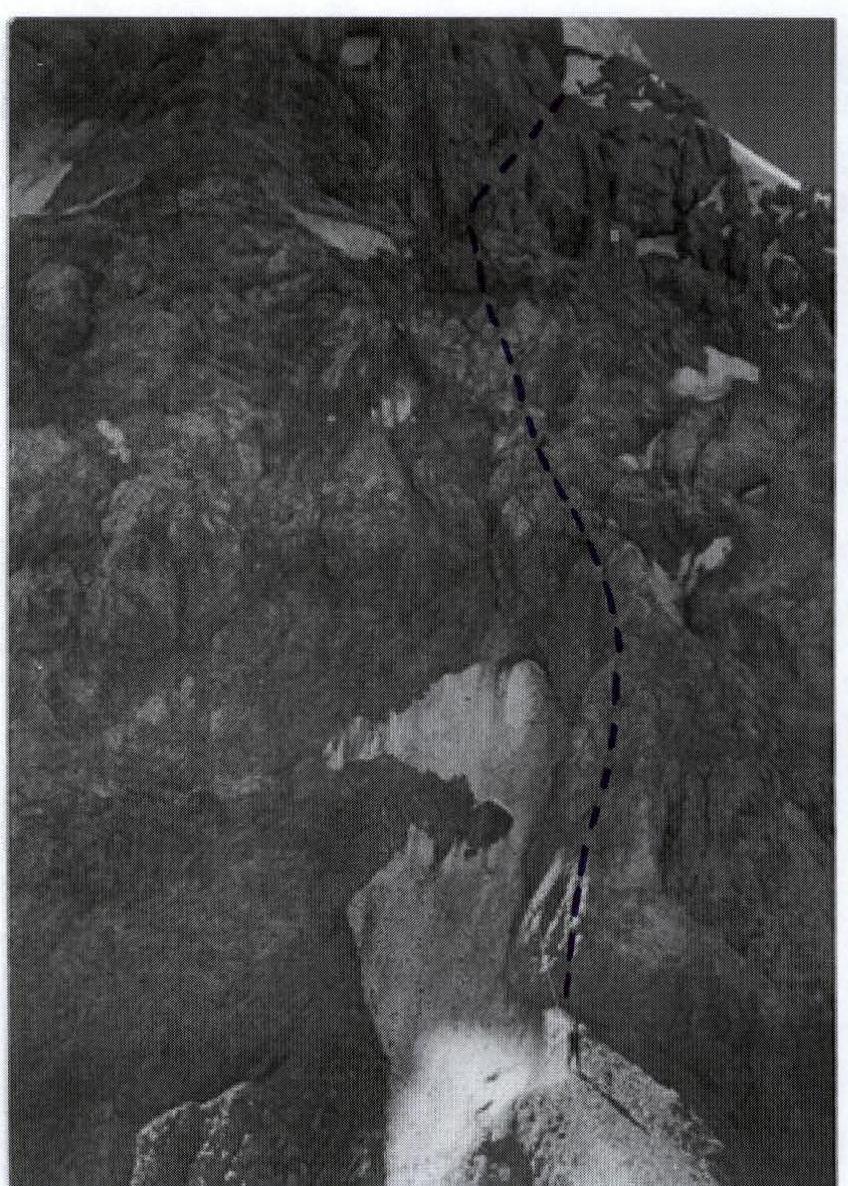
The connecting ridge behind the gap, sections R10–R14.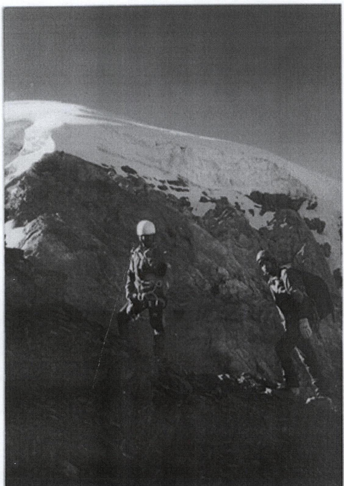
Approach to the gap. In the background is the northern wall of Peak Chernogolovka.
Comments
Sign in to leave a comment