Ascent Log
- Ascent type — rock climbing
- Ascent area — Central Tien Shan, Western Kokshaal-Tau range
- Peak — 4758 m (Pik Pozharnikh Geroyev Chernobylia via the north edge)
- Proposed — 4B category of difficulty, first ascent
- Elevation gain — 858 m
Section lengths:
- 3rd category of difficulty — 280 m
- 4th category of difficulty — 355 m
Average slope:
- Main part of the route — 40°
- Entire route — 35°
- Pitons driven:
- Rock pitons — 19
- Chocks — 13
Left on the route:
- Rock pitons — 2
- Chocks — none
- Team's travel time — 15 hours, days — 1
- Overnight stay — on the lateral moraine below the route
- Leader: Monayenkov Yevgeny Ivanovich — Master of Sports
Team members:
- Opoytsev Nikolay Anatolyevich — Candidate for Master of Sports
- Lavrushchev Nikolay Alekseyevich — Candidate for Master of Sports
- Pankov Vladimir Petrovich — 1st sports category
- Coach: Monayenkov Yevgeny Ivanovich — 142101, Moscow region, Podolsk, 44-A Pleshcheyevskaya st., apt. 17
- Departure to the route: July 31, 1998; summit — August 1, 1998; return to base camp — August 2, 1998
- Alpine Federation of Moscow region:
103050, Moscow, 22-B Tverskaya st., tel. 299-97-67
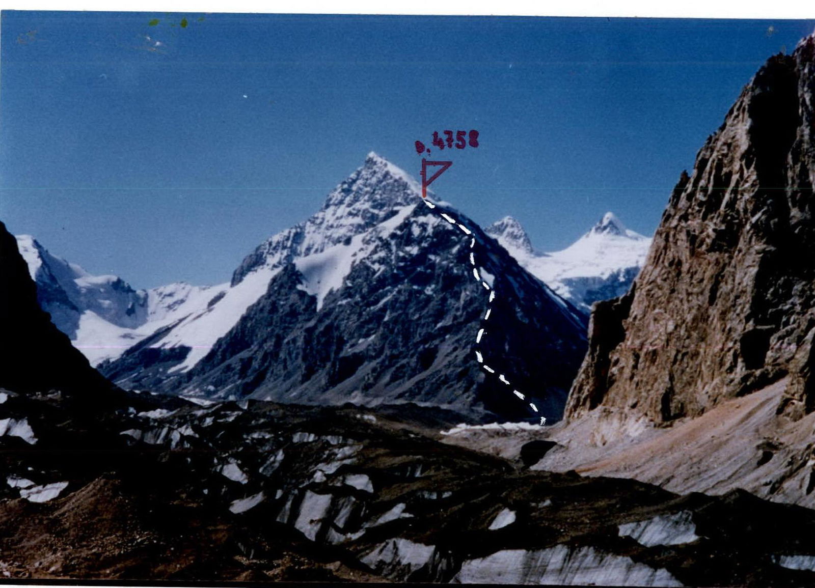
Team's route to peak 4758 m (Pik Pozharnikh Geroyev Chernobylia). Photo taken on approach on July 31, 1998.
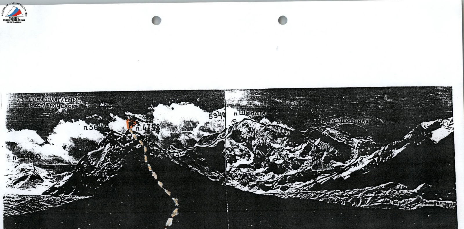
Photopanorama of the ascent area, team's route to peak 4758 m (Pik Pozharnikh Geroyev Chernobylia)
Team's Tactical Actions
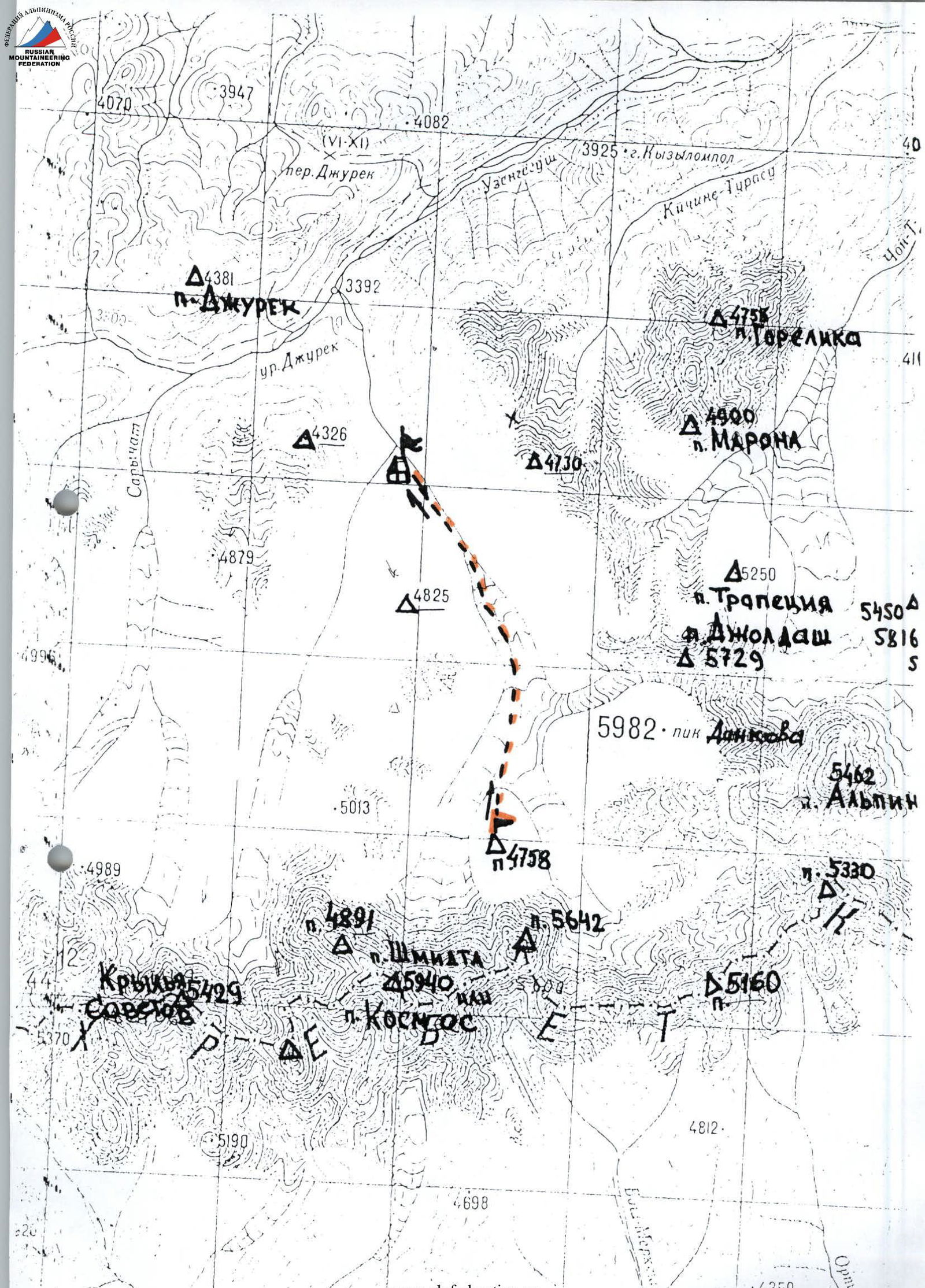
On July 31, the team departed from the base camp at the "green glade" at 10:30 to begin the approach. From the camp, the trail leads towards the Dzhuren gorge — about 1 hour to the start of the glacier. Then, we ascended via medium and large scree to the middle of the glacier. Staying on its right side, we moved towards the chosen unnamed peak 4758 m, located in the center of the Dzhuren gorge. Just below the start of the route via the North ridge, we set up an overnight stay in an excellent cirque with a lake at 17:30.
On August 1, at 8:00, we began from the bivouac in the cirque. The plan was to complete the intended route in one day, including the descent. This plan was fulfilled.
Upon observing the route's condition, it was noted that the ridge was heavily deteriorated. An early departure from the bivouac site was not planned to avoid accidental rockfall in the darkness while passing through the couloir.
The route was led alternately by Ye. Monayenkov and N. Lavrushchev, as the route is quite lengthy and demands significant physical and psychological effort. The team moved in pairs along the route, with simultaneous and alternating movement, and used ropes in certain sections. Belaying on the ridge was done:
- through rock features,
- slings,
- as well as rock pitons and chocks.
The team's physical preparation was even, facilitated by regular joint training sessions.
Throughout the entire path, there was stable radio communication with the base camp and the second team ascending a different peak. The rescue team was on standby at the base camp in case of an emergency.
During the ascent, a strict drinking regimen was observed due to the lack of water on the rocky ridge. Team members had hot meals in the morning before starting the route and had pocket food with hot tea from individual flasks throughout the day. The food consumption per person was 500 g.
There were no falls or injuries during the ascent. According to the team members and the coaching council, the route taken is logical and safe. It can be recommended for teams ascending peak 4758 m for the first time.
The descent path from the summit via scree shelves is quite safe and proceeds almost all the way down to the glacier. It is recommended as the primary descent option when attempting new routes on peak 4758 m.
Route Diagram in Symbols

Route Description by Sections
August 1, 1998
Section R0–R1
Departure from the overnight stay at 8:00. Move towards the North ridge, bypassing its lower part on the right. On the ridge, to the left, a rocky couloir is visible, narrowing at the top, which leads to a rocky ridge heading towards the summit. Simultaneous movement across fine scree.
Section R1–R2
Before entering the couloir, there is a large rocky outcrop that needs to be bypassed on the left.
On the right side of the couloir:
- movement across deteriorated rocks
- piton belay
- exit to a rocky ledge on the ridge
A station location where the entire group can be accommodated.
Section R2–R3
Straight ahead — a long, deteriorated ridge.
Move along the ridge simultaneously to an inclined ledge covered with small stones.
Belay:
- through rock features
- pitons
- chocks
Section R3–R4
The route then proceeds up a non-steep 10 m rock wall to the left — upwards, exiting onto a deteriorated ridge with piton belay. Two ropes of simultaneous movement along the ridge lead to the base of a wide internal corner.
Section R4–R5
The internal corner is quite steep. The path encounters:
- sections of frozen snow;
- "live" rocks frozen in place;
- piton belay.
At the top of the internal corner, exit to the right — upwards, beneath a deteriorated rock wall.
Section R5–R6
Bypass the deteriorated rock wall on the right via easier rocks, exiting onto a small flat area at the start of a narrow chimney.
Section R6–R7
Climbing the chimney is of medium to above medium difficulty with piton belay. Preferably on its left part, which ends on an inclined ledge.
Section R7–R8
From the inclined ledge, across deteriorated rocks, approach beneath a smooth 7 m rock wall, which needs to be bypassed on the left. The rocks are fairly solid with good cracks for chocks. Belay.
Section R8–R9
After bypassing the wall, the route proceeds along a wide earthy ridge with fine scree towards the summit. Simultaneous movement. At the top part of the ridge, a small rock wall leads via its right part to the summit of peak 4758 m at 18:30.
At 19:00, we began the descent. Initially following the ascent path, then sharply turning left — downwards via scree shelves until descending to the glacier. At 21:00, we were back at the tent.