
Passport
- Altitude class.
- Central Tian-Shan, Kokshaal-Too ridge.
- Pobeda (Main) via Dikiy Pass over Pobeda (3) by 3rd category.
- 6A category of complexity.
- Elevation difference: 3039 m, distance — 10090 m.
The average steepness of the main part of the route (Western ridge from Dikiy Pass to 6700 m) – 44° (5230 m – 6700 m), the whole route – 19° (4400 m – 7439 m).
- Previously hammered-in pitons: 15 rock, 8 ice, 1 snow (not removed).
Hammered-in pitons: rock – 0, ice – 0, snow – 0.
- Team's walking hours: 26 hours, 5 days.
- Overnight stops: 1st — 5800 m, lying in a cave. 2nd — 6400 m, lying in a tent. 3rd — 6918 m, lying in a tent. 4th — 7000 m, lying in a tent.
- Participants: Borisov Sergey Viktorovich — International Master of Sports. Zhilin Nikolay Fedorovich — Master of Sports.
- Senior coach: Mikhailov Alexander Alexandrovich — Master of Sports, Honored Coach of Russia. Coach: Selivanov Andrey Fedorovich — Candidate for Master of Sports.
- Departure to the route: August 18, 1999. Summit: August 22, 1999. Return: August 22, 1999.
- Organization: Tyumen Regional Sports Committee.
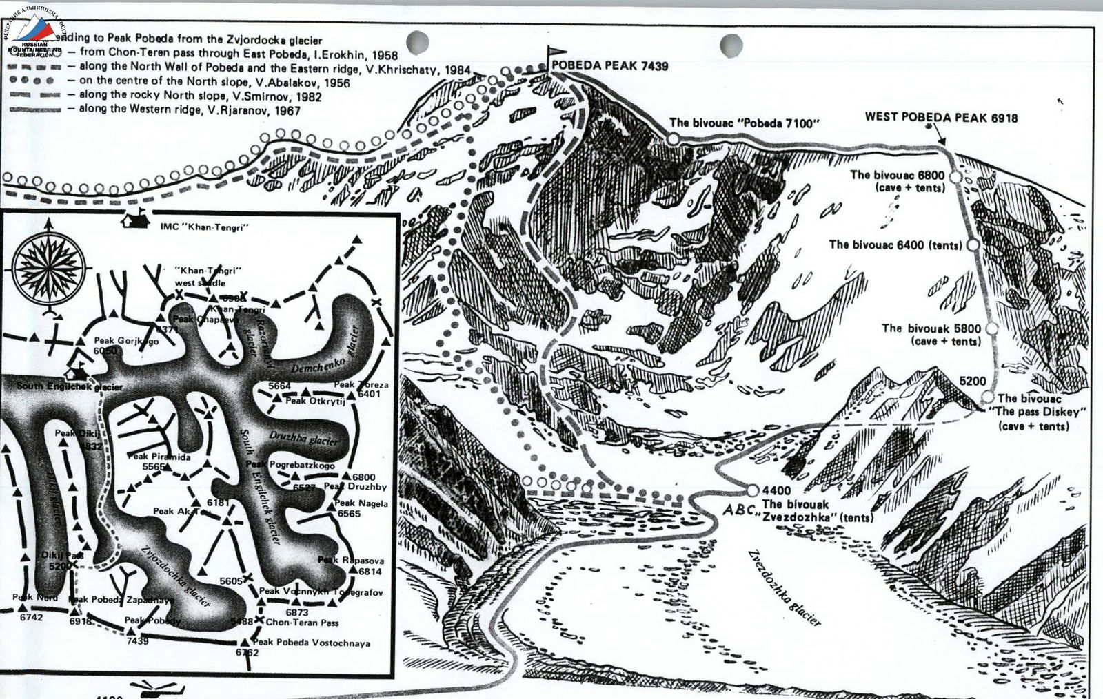
Base camp "South Engilchek" 4100 m
Pobeda (Main)

Photo 1. General view of Pobeda (7439 m).
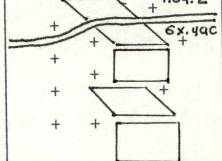
| pitons | ROUTE SCHEME in UIAA symbols M 1:2000 | No. of participants | cat. of complexity | length (m) | steepness (°) | ||
|---|---|---|---|---|---|---|---|
| rock | ice | snow | |||||
| 1 | 2 | 3 | 4 | 5 | 6 | 7 | 8 |
| - | - | - | + + + + + + + + + + + + | 5 | 2A | 50 | 10 |
| - | + | + | + + + + + + | 4 | 5B | 50 | 70 |
| - | - | - | + + + + + + | 3 | 2B | 100 | 10 |
| - | - | - |  | 2 | 5B | 150 | 70 |
| - | - | - | 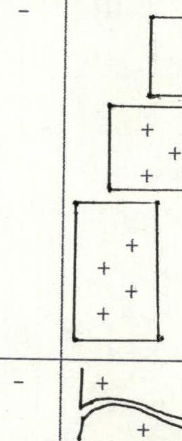 | 1 | 3A | 150 | 45 |
8a
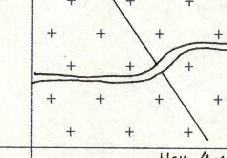
| pitons | ROUTE SCHEME in UIAA symbols M 1:2000 | No. of participants | cat. of complexity | length (m) | steepness (°) | ||
|---|---|---|---|---|---|---|---|
| rock | ice | snow | |||||
| 1 | 2 | 3 | 4 | 5 | 6 | 7 | 8 |
| - | - | - |  | 10 | 2B | 200 | 10 |
| - | - | - |  | 9 | 3B | 100 | 45 |
| - | - | - |  | 8 | 2A | 500 | 10 |
| - | - | - |  | 7 | 3A | 800 | 20 |
| + | + | + |  | 6 | 5A | 50 | 70 |
8b
| pitons | ROUTE SCHEME in UIAA symbols M 1:2000 | No. of participants | cat. of complexity | length (m) | steepness (°) | ||
|---|---|---|---|---|---|---|---|
| rock | ice | snow | |||||
| 1 | 2 | 3 | 4 | 5 | 6 | 7 | 8 |
| - | - | - |  | 14 | 3B | 100 | 35 |
| - | - | - |  | 13 | 4B | 350 | 54 |
| - | - | - |  | 12 | 3B | 50 | 40 |
| - | - | - |  | 11 | 3B | 900 | 40 |
8c
| pitons | ROUTE SCHEME in UIAA symbols M 1:2000 | No. of participants | cat. of complexity | length (m) | steepness (°) | ||
|---|---|---|---|---|---|---|---|
| rock | ice | snow | |||||
| 1 | 2 | 3 | 4 | 5 | 6 | 7 | 8 |
| 2 | - | - |  | 18 | 5A | 50 | 60 |
| 3 | - | - |  | 17 | 4B | 300 | 50 |
| - | - | - |  | 16 | 4A | 150 | 25 |
| - | - | - |  | 15 | 5A | 250 | 50 |
8d
| pitons | ROUTE SCHEME in UIAA symbols M 1:2000 | No. of participants | cat. of complexity | length (m) | steepness (°) | ||
|---|---|---|---|---|---|---|---|
| rock | ice | snow | |||||
| 1 | 2 | 3 | 4 | 5 | 6 | 7 | 8 |
| Pobeda (3) 6918 m | |||||||
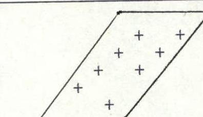
| - | - | - | ++ ++ ++ +++ +++ +++ +++ | 20 | 4A | 200 | 20 |
| - | - | - | ++ + + + + | 19 | 3B | 280 | 30 |
8e
| pitons | ROUTE SCHEME in UIAA symbols M 1:2000 | No. of participants | cat. of complexity | length (m) | steepness (°) | ||
|---|---|---|---|---|---|---|---|
| rock | ice | snow | |||||
| 1 | 2 | 3 | 4 | 5 | 6 | 7 | 8 |
| Pobeda (Main) 7439 m | |||||||
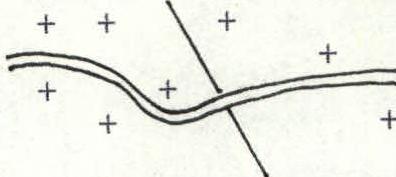
| - | - | - | +5 × 0,4 × | 24 | 5A | 1160 | 30 |
 | 23 | 4A | 750 | 7 | |||
| - | - | - | +4. At night 4 × 400 m. | 22 | 4A | 400 | 4 |
| - | - | - | +4+2+ | 21 | 3B | 3000 | 2 |
Route description by sections
Section R0–R1. Firn slope.
Section R1–R2. Icefall. A series of three ice walls approximately 50 m each. Ropes were hung during route preparation.
Section R2–R3. Traverse under seracs to the right.
Section R3–R4. Snow-ice wall. Ropes.
Section R4–R5. Snow slope.
Section R5–R6. Snow-ice wall. Ropes.
Section R6–R7. Heavily snowed ice slope with closed crevasses.
Section R7–R8. Snow plateau.
Section R8–R9. Steep snow slope leading to Dikiy Pass.
Section R9–R10. Gentle snow ridge leading to the start of the Western ridge, which is the main part of the route.
Section R10–R11. Wide snow ridge with three steep ascents. At the end of the section (5800 m) — traditional overnight stops in snow caves.
Section R11–R12. Snow section leading to the start of the rocky part of the Western ridge of the peak.
Section R12–R13. Snow-covered wide rocky ridge. Piton belay at certain sections.
Section R13–R14. Snow-ice ridge.
Section R14–R15. Snow-covered wide rocky ridge. Piton belay at certain sections.
Section R15–R16. Traverse along a gentle rocky ridge to the right towards a large couloir.
Section R16–R17. The steepness of the ridge increases again. At certain sections, remaining loops and rope sections can be found.
Sections R17–R18. The steepest rocky section of the ridge. At the end of the section — overnight stops.
Section R18–R19. Wide snow-ice ridge with rare rocky outcrops.
Section R19–R20. Summit snow-ice dome.
Sections R21–R24. Snow-ice ridge of varying steepness leading from the Western peak to the Main peak.
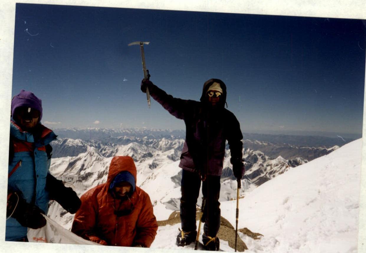
Photo 3. Borisov at the summit. Photo by Zhilin.
Comments
Sign in to leave a comment