1.1 General View of Pobeda
Sheet 1. Passport
- Class - High-altitude
- Central Tian-Shan, Engilchek valley
- Peak Pobeda via the West Ridge
- 5B category of difficulty
- Elevation gain 3039 m, distance 5.5 km
- Number of previously driven pitons: 20
- Team's climbing hours: 24 hours Total: 32, Days: 5
- Overnight stays: 4
- Team leader: Puchinin Andrey Albertovich, participant Kreizel Danil
- Coach: Biryukov Vladimir Nikolaevich
- Departure to the route August 12, 1997 Return August 16, 1997
- Organization: Federation of mountaineering and rock climbing of the Kyrgyz Republic
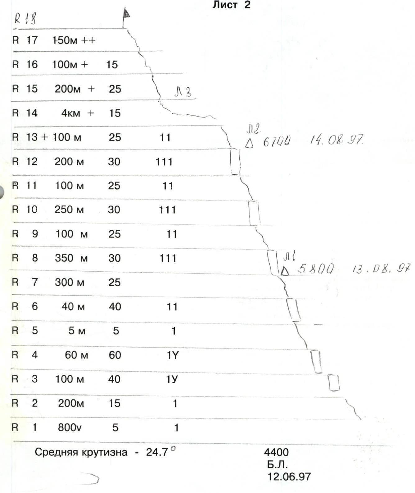
Sheet 2
R18
R17 150 m ++
R16 100 m + 15
R15 200 m + 25
R14 4 km + 15
R13 100 m 25 11
△ 6700 August 14, 1997
R12 200 m 30 111
R11 100 m 25 11
R10 250 m 30 111
R9 100 m 25 11
R8 350 m 30 111
△ 5800 August 13, 1997
R7 300 m 25
R6 40 m 40 11
R5 5 m 5 1
R4 60 m 60 1Y
R3 100 m 40 1Y
R2 200 m 15 1
R1 800 m 5 1
Average slope 24.7°
4400
B.L.
June 12, 1997
1.2. Profile of the wall on the right
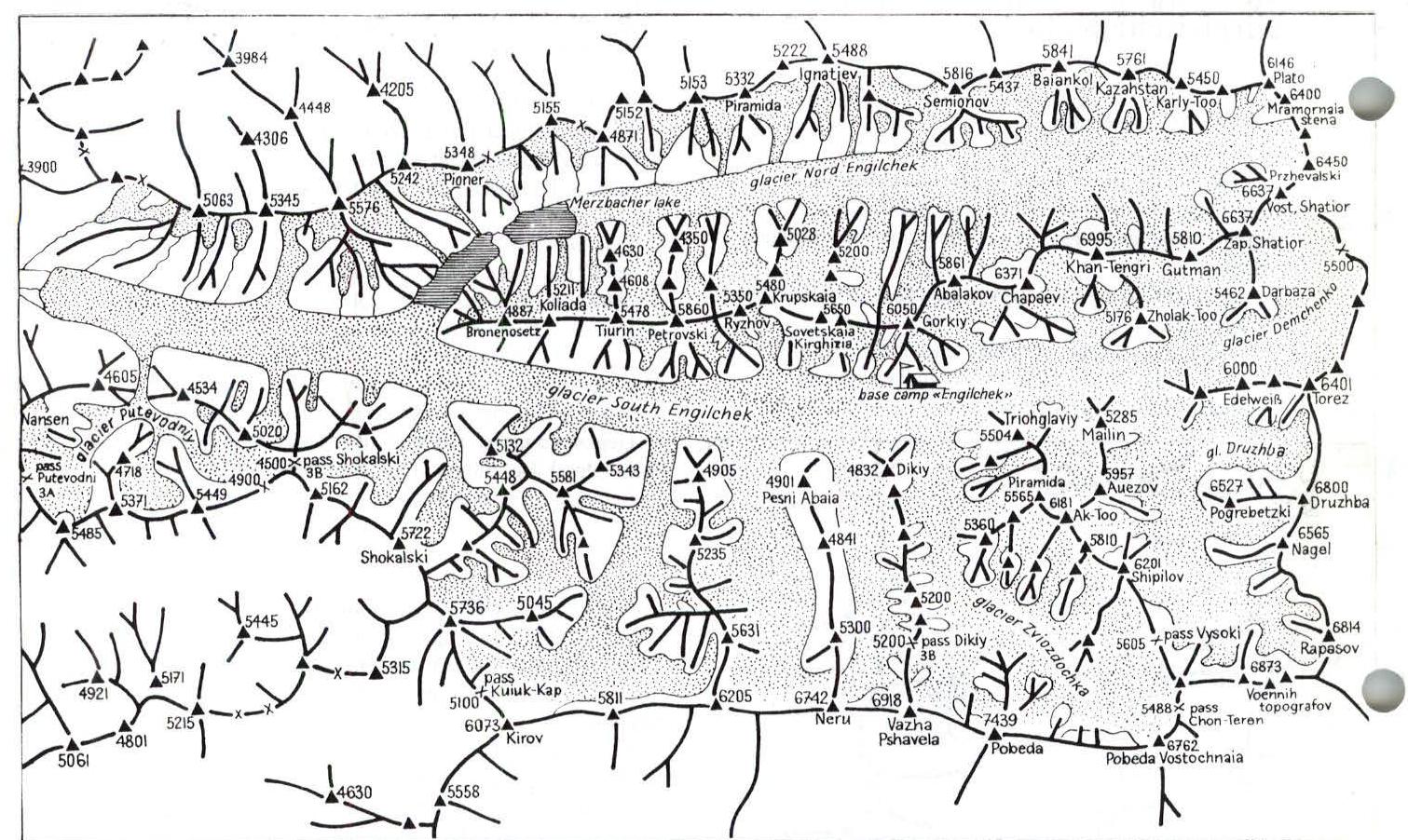
1.3 Map of the area
Sheet 3
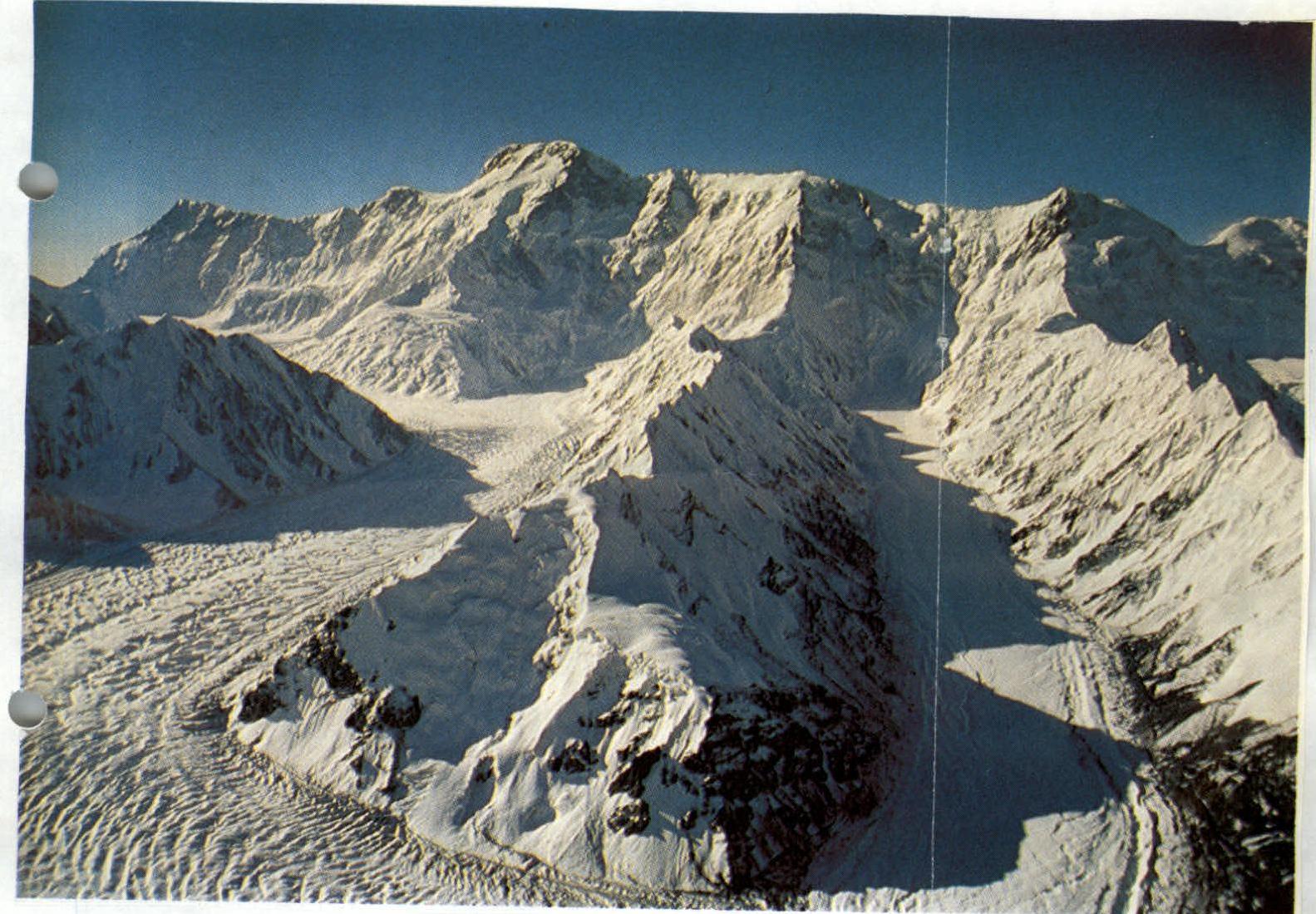
1.4. Photopanorama of the area
Sheet 5. Route description by sections
The section from B.L. to camp 1 was traversed on a glacier in teams. R2 Snow slope R3 Icefall. Snow. Organization of fixed ropes R4 Icefall. Ice. Organization of fixed ropes R5 Easy slope. Snow. R6 Steep slope. Snow. R7 Easy slope. Snow. Firn. R8 Combined section. Rocks - loose, sedimentary rock. Organization of fixed ropes. R9 Easy slope. Snow. R10 —"— R8 R11 —"— R9 R12 — " — R8 R13 Easy slope. Firn. R14 Easy ridge R15 Combined slope. Rocks. Snow. Organization of fixed ropes. R16 Snow ridge R17 Steep snow ridge.